
Set against the stunning backdrop of Norway’s Vesterålen Archipelago, the Dronningruta—or Queen’s Route—offers an exhilarating blend of rugged mountain terrain and scenic coastal paths.
Drawing from our extensive hiking experience across Norway and years spent living in the country, we understand what makes each trail unique.
This 15-kilometre loop between the historic fishing villages of Nyksund and Stø isn’t just a path through nature; it’s a journey through history, enhanced by panoramic views that stretch across the Atlantic.
Whether you’re a seasoned hiker looking for a challenging day’s trek or a nature lover eager to capture stunning landscapes, our hiking guide for Dronningruta is packed with useful information.
Yes, we’ve done the sweating, had the burning legs, scaled monster mountains, and loved it all.
Here, we share our practical advice and local knowledge for this unforgettable hike.
⛰️ Dronningruta Hike Essentials: Key Information
- Total Length: 15 kilometres, combining a 10-kilometre mountain route and a 5-kilometre coastal path.
- Difficulty: Rated as ‘Red’ (demanding) by the Norwegian Hiking Association.
- Location: Dronningruta is found on the northern part of the island of Langøya in the Vesterålen archipelago, Northern Norway.
- Elevation Gain: 448 meters, reaching the high Fingghameia plateau.
- Best Season for Hiking: Accessible from May to September, offering the best weather and trail conditions.
- Reason to Climb: A less well-known and more remote hiking trail. Renowned for beautiful views and rugged trails.
- Safety Features: Portions of the trail are equipped with hand ropes for additional safety in steep sections.
- Navigation Aids: The trail is well marked with red ‘T’s on the rocks, ensuring clear pathfinding.
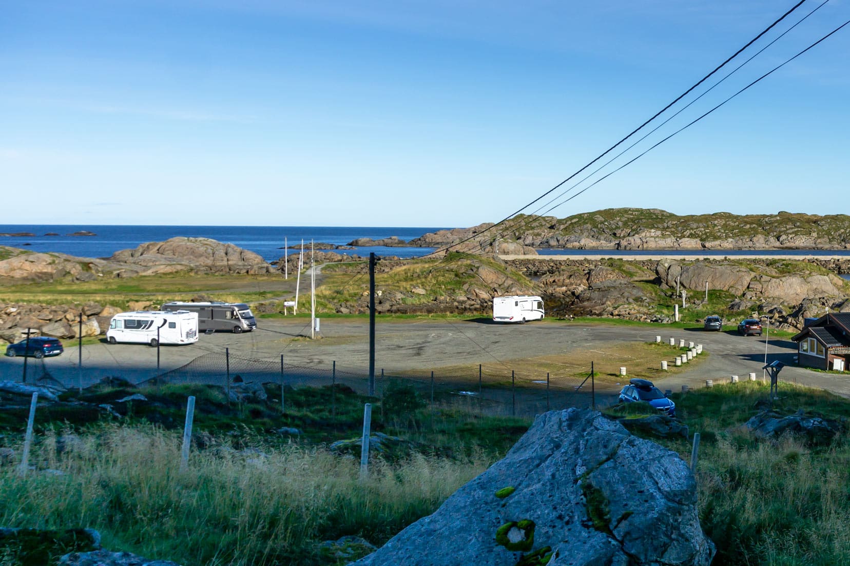
- Parking and Accessibility: Ample parking is available at Nyksund and Stø, with options for motorhome parking.
- What to Bring: Essential items include water, sunscreen, a hat, sturdy hiking shoes, and possibly a light snack. Don’t forget your camera for the views and extra clothing layers for weather changes.
- Emergency Phone Numbers: Police: 112; Ambulance: 113.
What’s Included in this Hike of Dronningruta Post?
To help you plan your hike, we have included the following:
Map: Dronningruta Hike
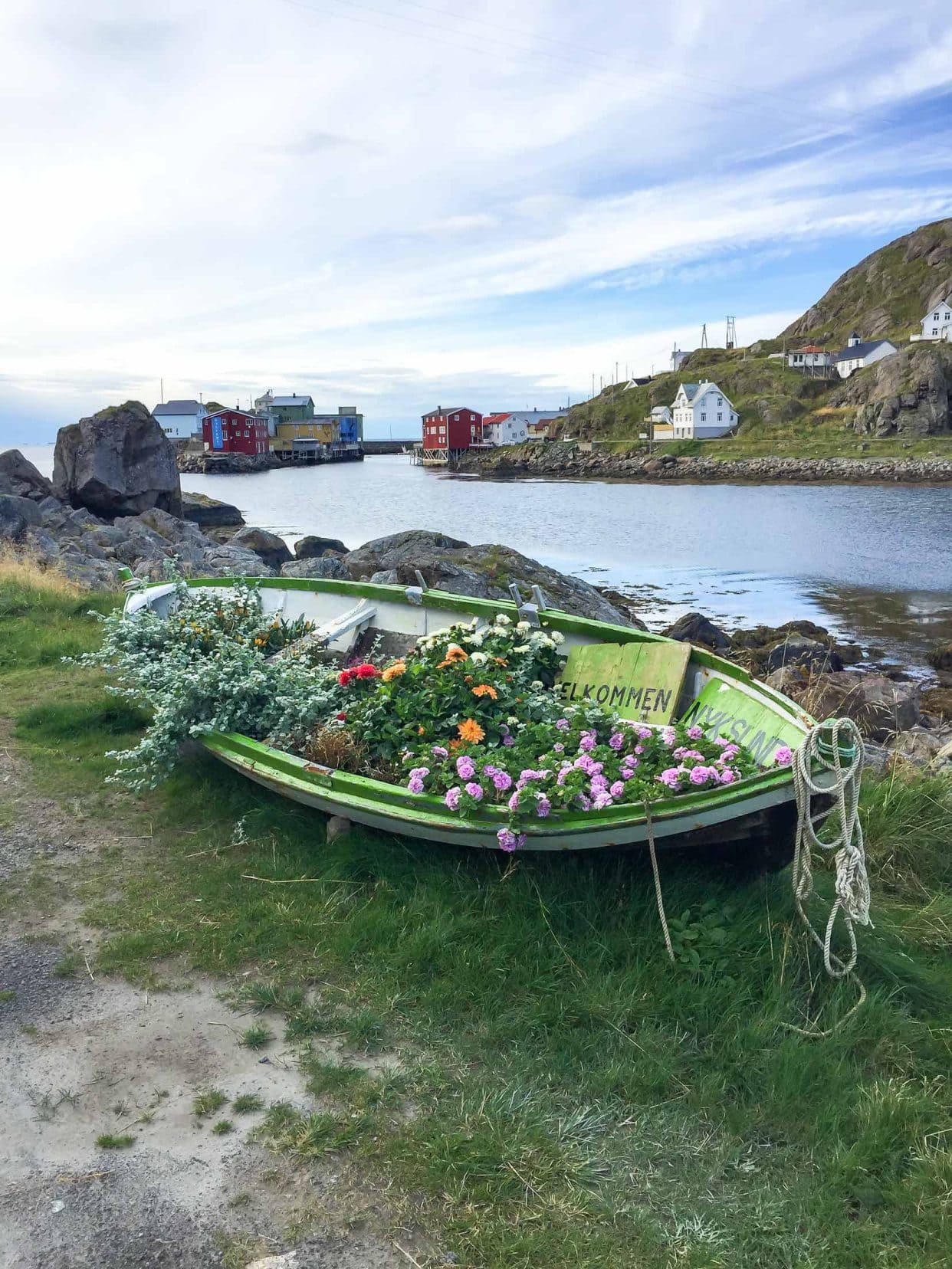
History of Nyksund
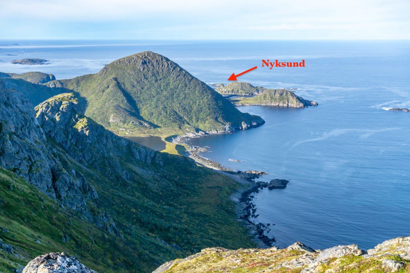
On the Vesterålen Archipelago, located just north of the Lofoten archipelago in Northern Norway, lies the famed Dronningruta or The Queen’s Route.
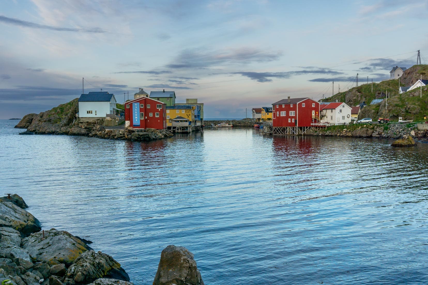
This looped 15-kilometre mountain hike follows a route between the fishing villages of the once-abandoned village of Nyksund and the village of Stø.
In the early days, between 1875 and 1960, Nyksund’s core population of 100 swelled by several hundred, drawn by the winter fishing.
However, the shallow harbour struggled to accommodate the larger modern-day vessels, so the fishing hub was moved away to Myre, 13km to the south.
Not long after, the school in Nyksund closed, and finally, in 1970, Nyksund was totally abandoned. It wasn’t until the 1980s that this ghost town awakened with new life through an international youth project.
This revival continues today. Nyksund has a permanent population, and many residents operate local businesses. Its ghost town acclaim is no longer.
If you’re a fan of Norwegian history, don’t miss a visit to Norway’s medieval wooden stave churches. These unique structures, with their intricate carvings, offer a glimpse into the country’s medieval past.
Planning a Trip to Norway?
- 🚗 Hiring a car? We recommend getting a quote from DiscoverCars
- 🚐 Hiring a campervan? We recommend Motorhome Republic
- ⛑ Arranged your travel insurance? Compare quotes from World Nomads & Safetywing
- 🪪 Order your International Driver’s Licence online here
- 🏩 Booked your accommodation? We use Booking.com to find the best deals
- 🐾 Is someone pet-sitting for you? 🐾 We use and love TrustedHousesitters
- (Get 25% off at checkout for new memberships with our discount code: LIFEJOURNEY25)
Naming of the Dronningruta Hike
Queen Sonya of Norway completed this trek in 1994, and in honour of this, the trail was named Dronningruta, or ‘Queen’s Route’.
The Queen is an avid hiker, having completed many of the beautiful Norwegian trails.
Another particularly memorable trek that the Queen and I completed (okay, we didn’t do it together) is Dronningstien or ‘Queen’s Trail’ Hardangerfjord (near our Preikestolen hike). But let’s get back to Dronningruta.

Preparing for the Dronningruta Hike: Essentials Check
- 💦 Bring plenty of drinking water: Water can be bought in Nyksund and Stø however, there are natural water catchments along the route which should ideally be filtered before drinking.
- 🥾 Proper hiking kit: It is strongly recommended that you wear comfortable hiking shoes or boots. Walking poles may help. Carry waterproof and cold-weather clothing in a backpack, as sometimes two hands are required to navigate the terrain.
- 🌦️ Check the forecasted weather: Always verify the weather conditions before hiking.
- 💬 Inform someone of your plans: If travelling alone, inform someone of your intended route and expected return time.
- 🗺️ Use an offline map: Although the hike is well-marked, it’s handy to refer to an offline map such as that offered in Maps.me or OsmAndMaps. It’s free to use the app and to download the area map which shows the walking trails for Dronningruta.
- 🧑🦯 Prefer a guided hike? This is a service offered at Holmen Brygge Accommodation, Nyksund.
- ⛴️ Water taxi option: During summer, a water taxi operates from Stø to Nyksund, halving the hike distance.
The Dronningruta Hike
Starting the Hike: Nyksund
We stayed at Holmen Brygge accommodation in Nyksund, using it as our base while exploring the area. The starting point for this looped hike is approximately 500m from Nyksund, off the only road that leads to the town.
The hike can just as easily start from Stø.
The Dronningruta hike is rated as red (challenging) by the Norwegian Hiking Association, so you need to be relatively fit. Expect the hike to take between 5 and 8 hours.
I started with the mountain route (red) and completed the circular hiking loop in 5 hours, including stops for photos and the search for geocaches.
Mountain Route to Stø
The first goal of the initial gentle ascent is to reach the junction point. Once there, different route options can be chosen.
- 🔴 red hiking sign indicating a demanding hike following the mountainous route to Stø. This is the route I chose.
- 🟢 green hiking route, indicating an easy hike, descending to follow the coastline to Stø.
- 🔵 blue hiking sign, indicating a medium difficulty hike leading to Sørkulen Peak.

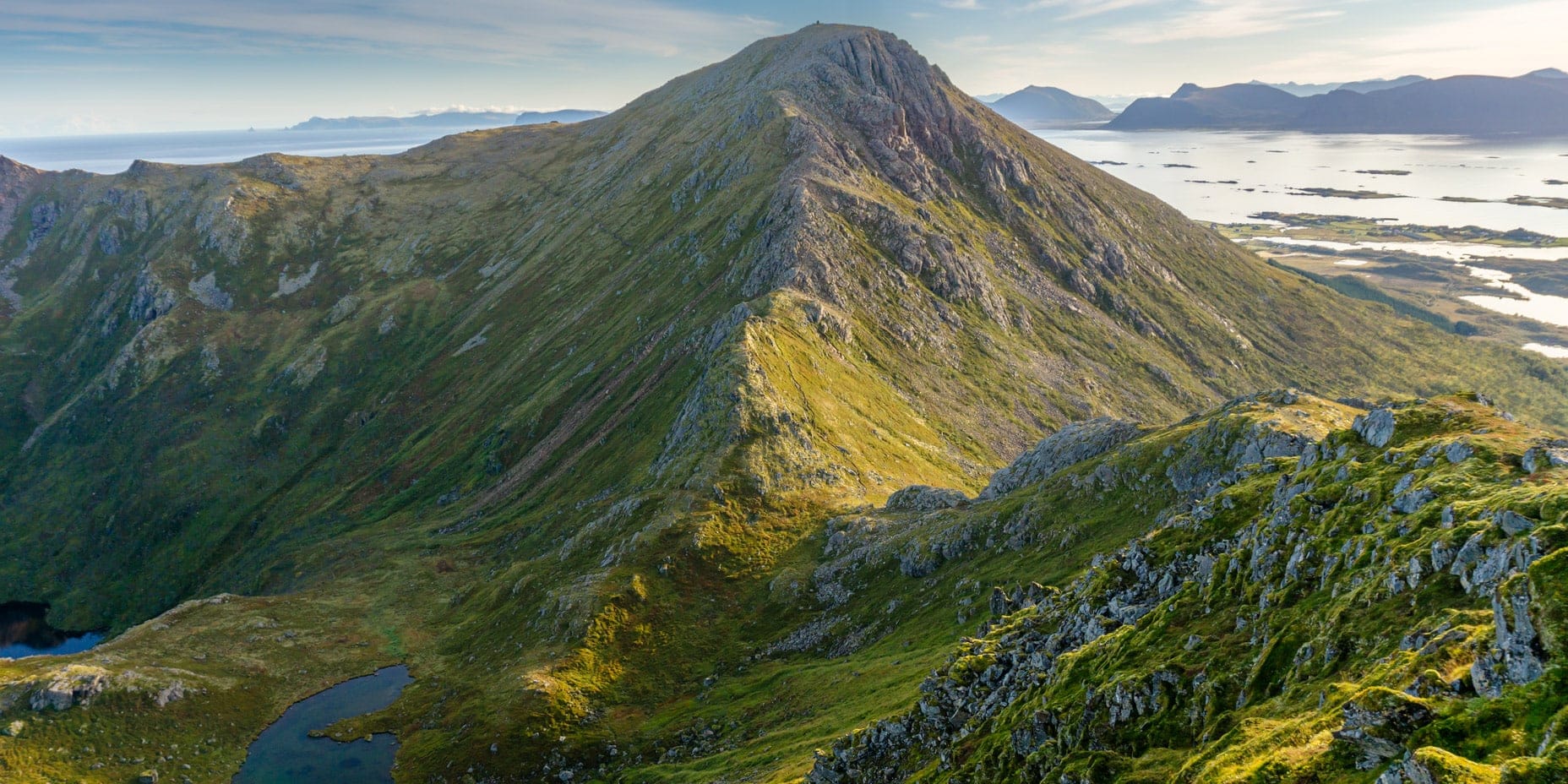
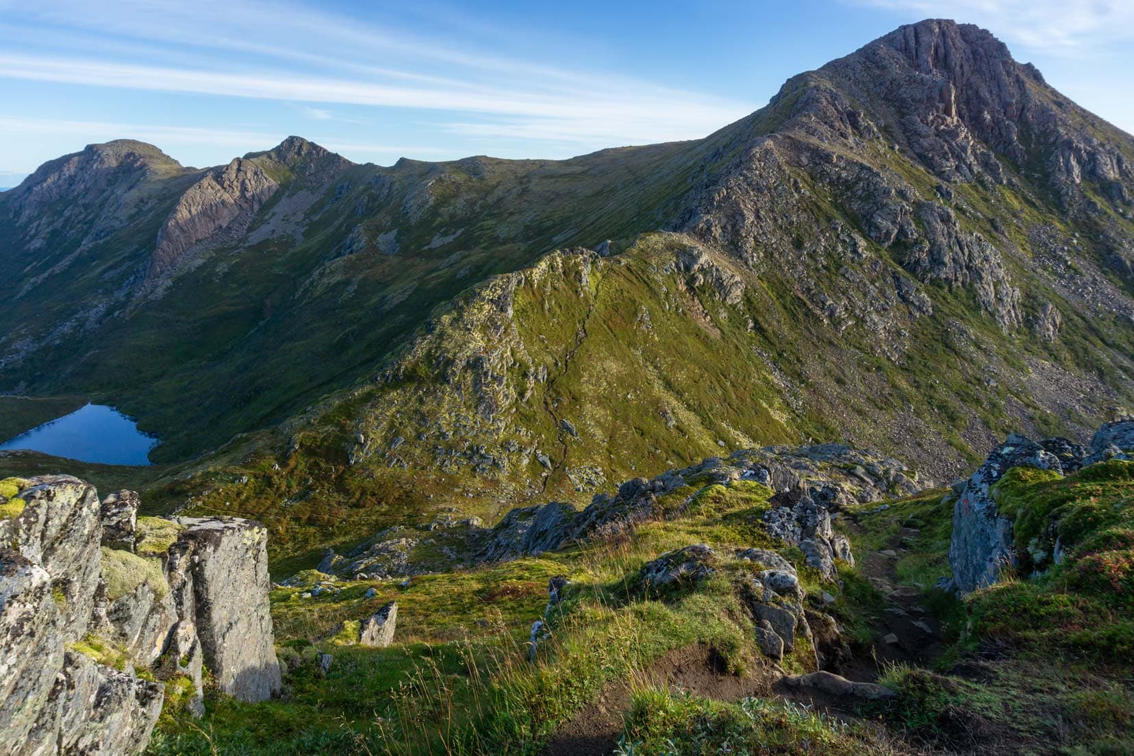
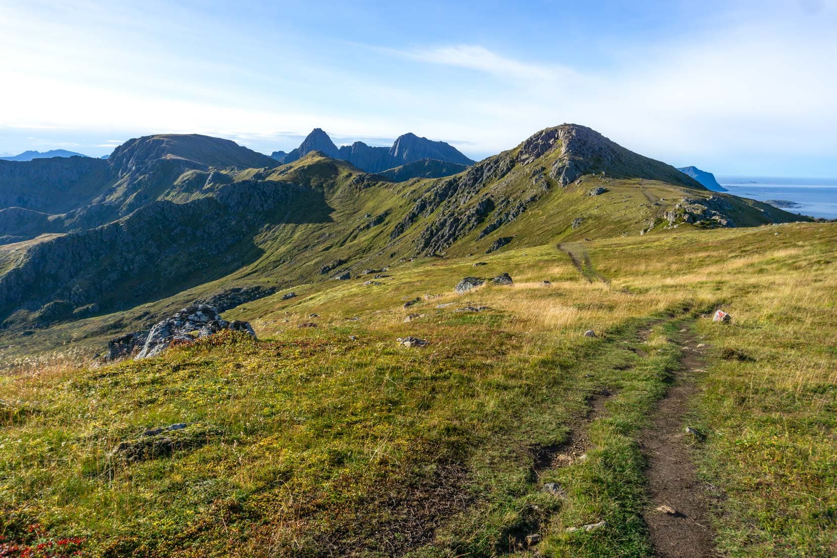
From this junction, the spine of the mountain is followed until reaching Finngamheia Peak at 448 metres above sea level. This hike section has the most difficult terrain and poses the most potential for injury.

However, this has been recognised with parts of the trail installed with rope handrails.
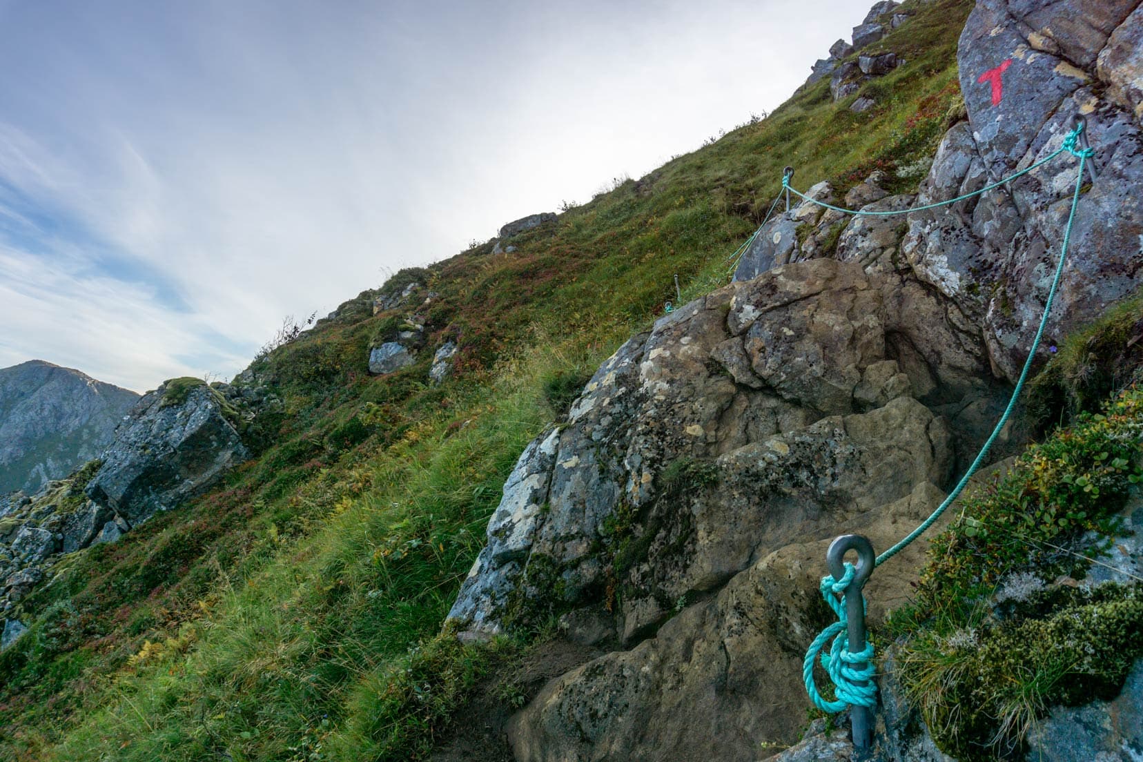
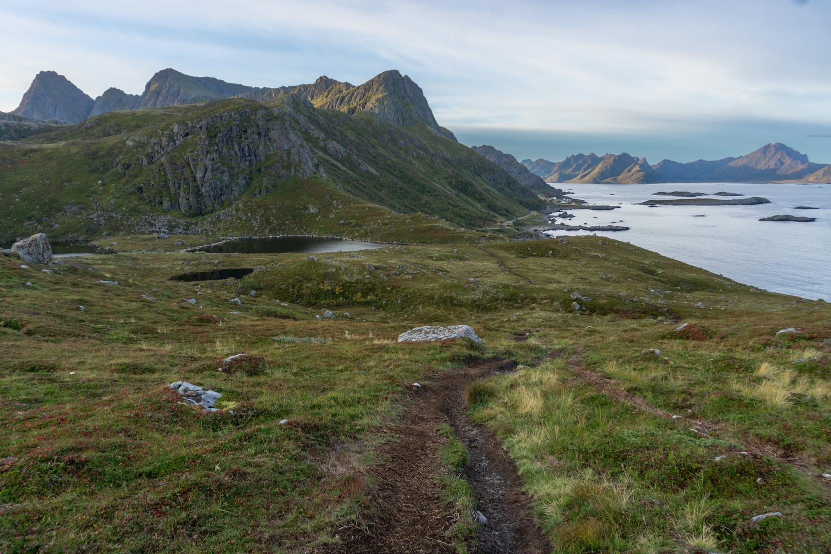
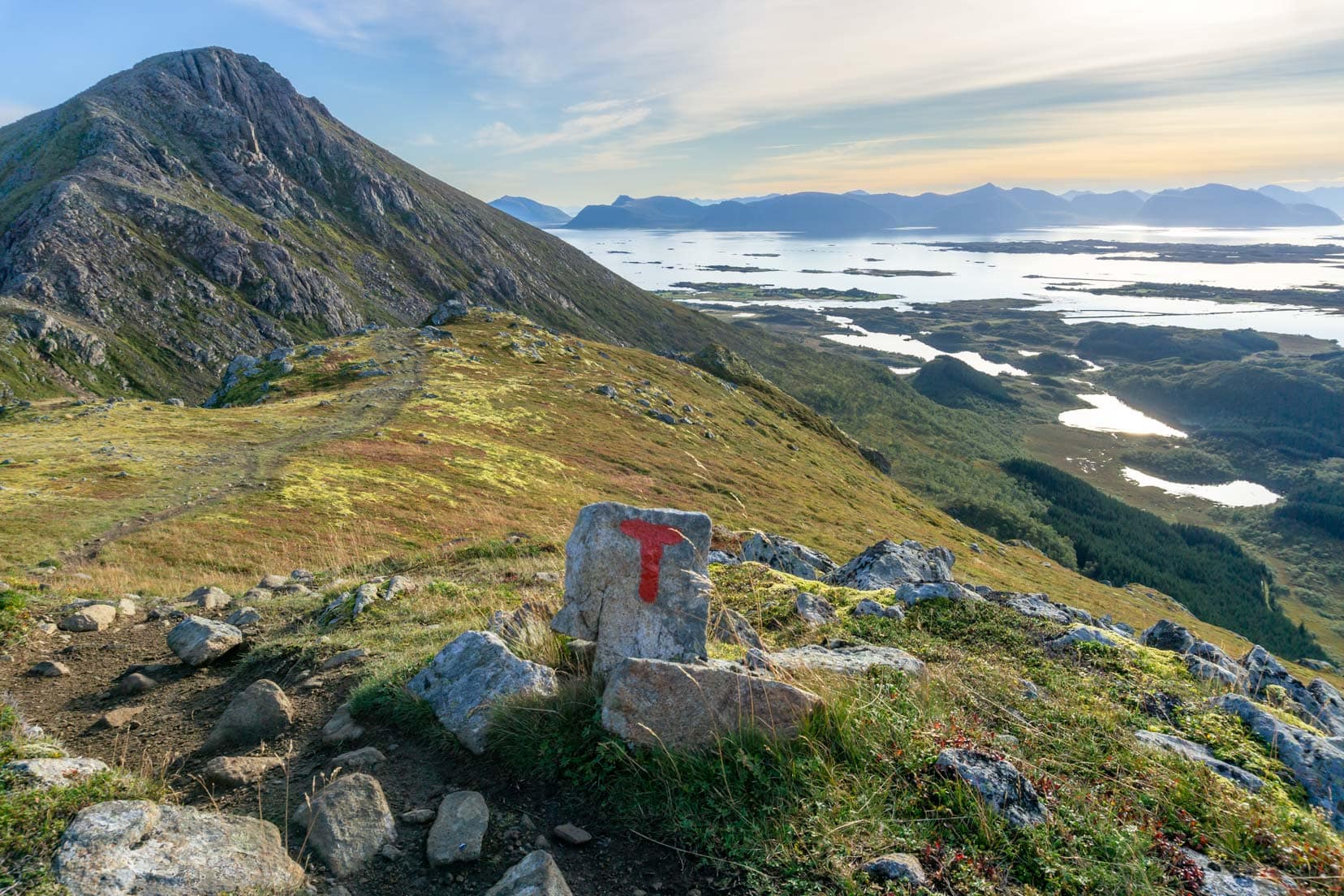
As per the Norwegian Mountain Code, the trail is marked by a red-painted ‘T’ on rocks. Although it’s head-down and careful during this part of the trail, don’t miss the great views back to Nyksund.
The path tracks the western side of the mountain, Sørkulen. It offers amazing views of the nearby islands and the Atlantic Ocean. The trail is now relatively flat and obstacle-free.
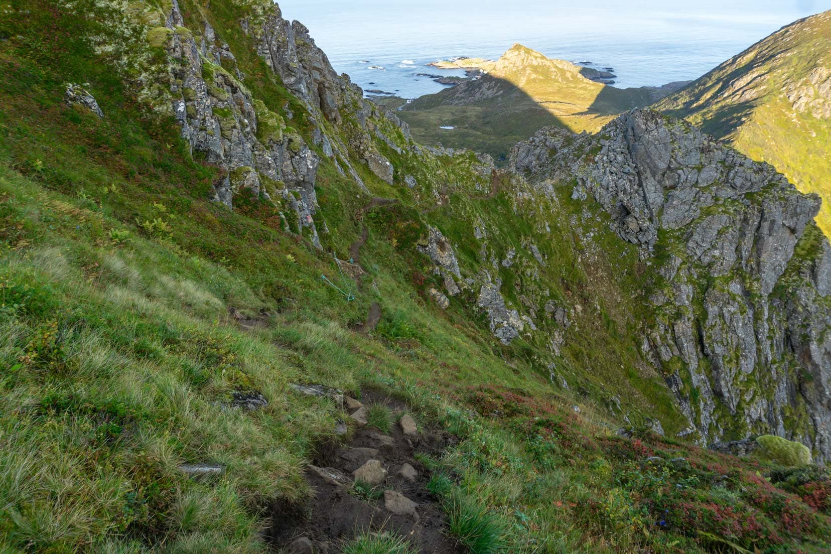
The contorted spine of Fingghameia soon appears. From here, the sweeping views extend to the east over Andøya and west over the steep mountain drop-offs to the sea.


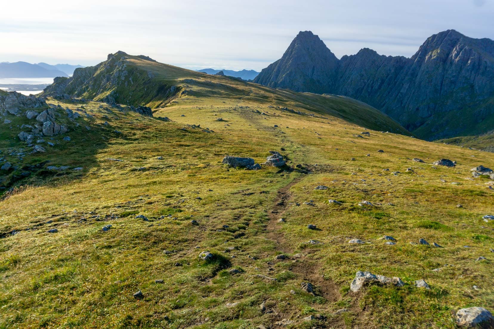
The trail skirts around the peak of Fingghameia and then rises out onto a plateau. Again, the views east and west are magnificent and no wonder as this is the highest section of the hike.
The trail undulates over relatively flat ground. The steep ridges rise ahead on the trail, hiding what is over that next rise. You start to wonder what’s in front.
However, there are no more steep inclines to be concerned about. It’s all about enjoying the fresh air and the stupendous views.
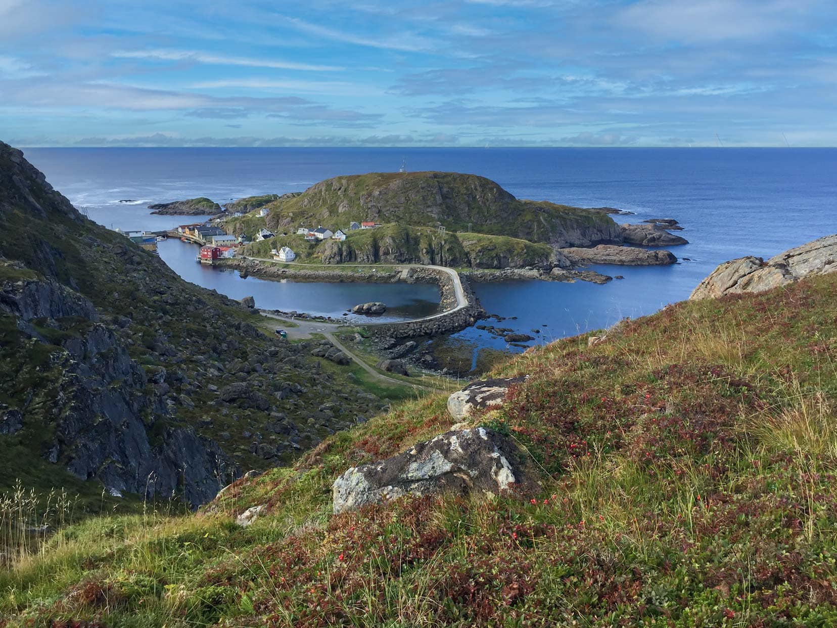
Descending into Stø
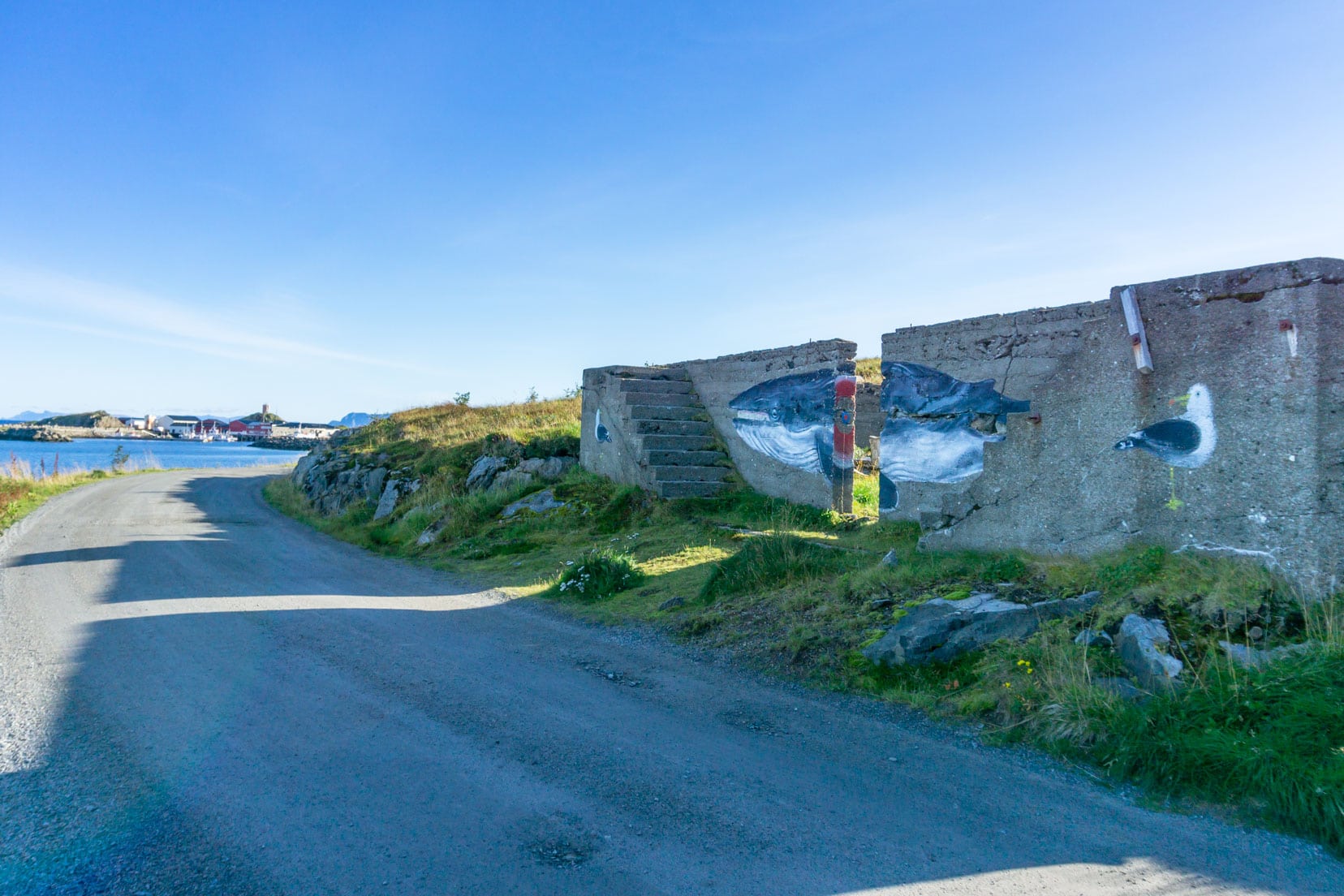
Quite suddenly, the mountain trail starts to descend, and the little fishing village of Stø comes into view. Although the village seems close enough, it’s another hour of steady downhill walking, passing a radar station, to reach a carpark, a short distance from Stø.
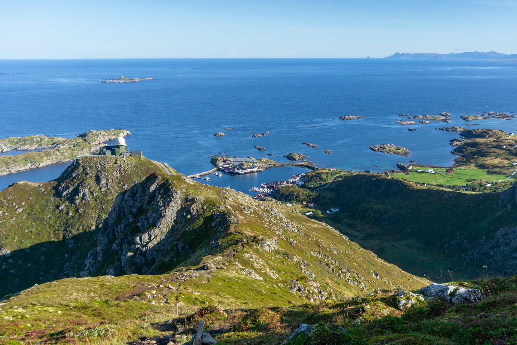
From the carpark, you can detour into Stø; however, it means you would have to backtrack to rejoin the trail. I didn’t, choosing to push on.
Some interesting artwork and driftwood arrangements are just off the road and close to the Bobilcamp campsite.
Enjoy quirky artwork?
Utsira Island’s street art is calling you. This remote island is famous for its vibrant depictions and creative installations scattered throughout the landscape.
It’s a good place to pause, re-group and replenish. The halfway point was reached.
I didn’t stop for long. I continued my trek to the west, hugging the coastline to begin the return leg of Dronningruta.
Coastal Route back to Nyksund
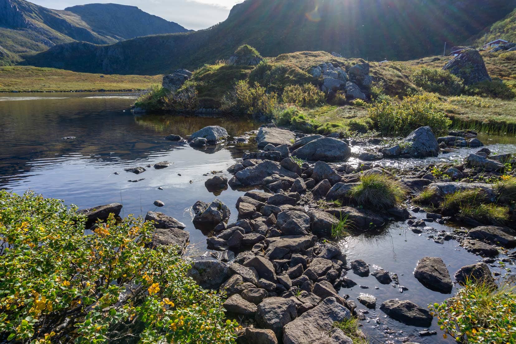
The Dronningruta trail was tracking along the mountain’s base, hugging the shoreline and drawing closer to Nyksund. For the next few kilometres, the trail is relatively flat, with the only challenges coming from small sections of boggy ground.
However, well-placed timber planks help the crossing of these water-logged areas.
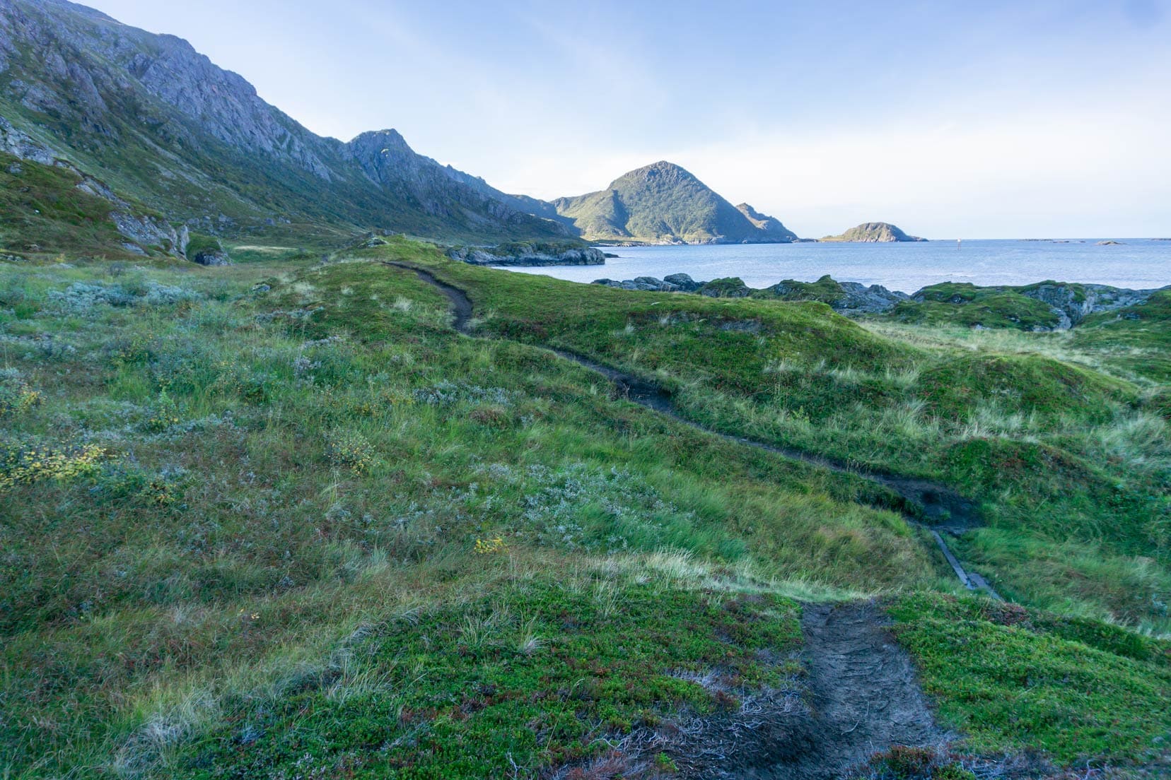
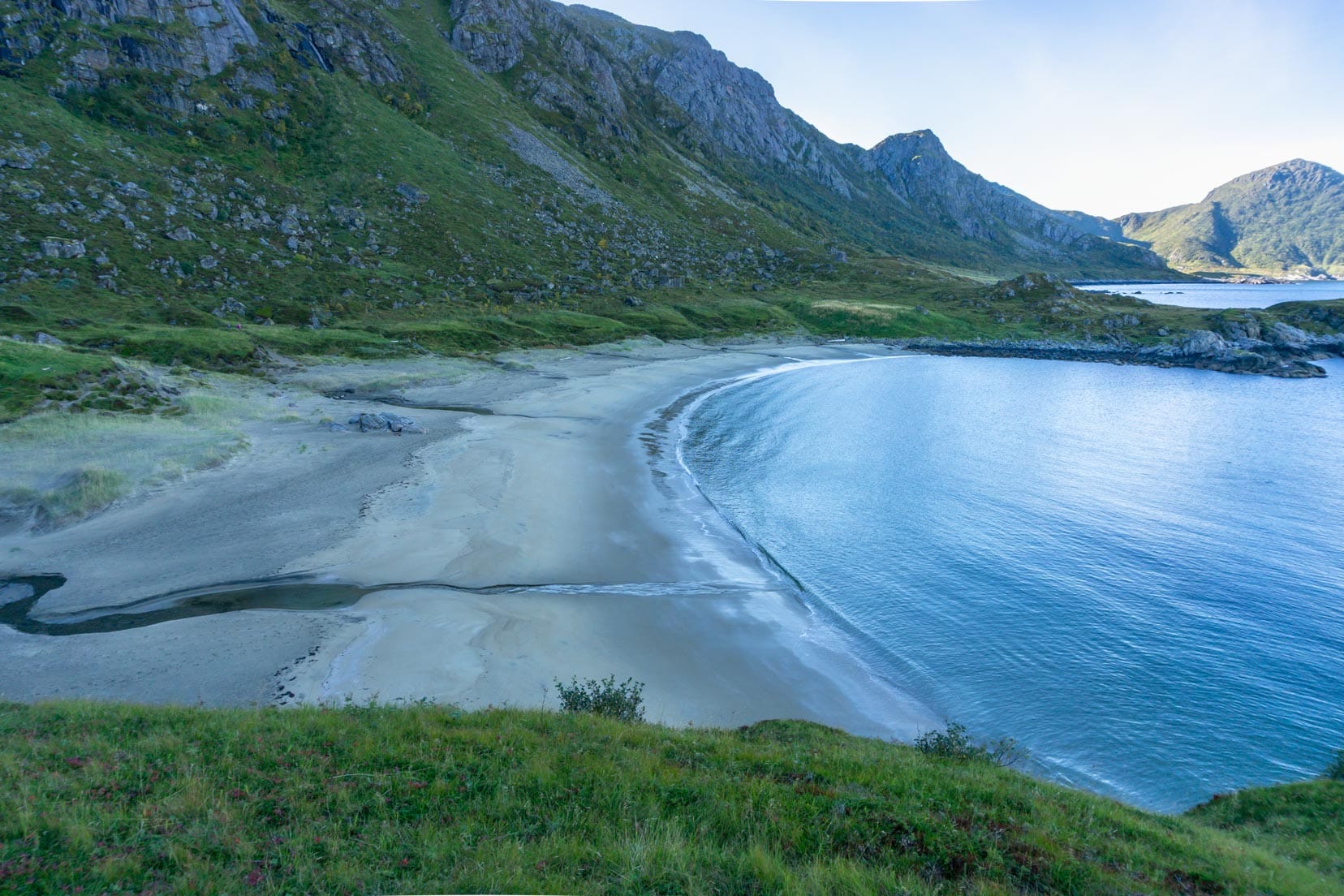
The coastline scenery changes with each passing cove, each having its own unique style. One cove, named Skipssand, features a particularly inviting sandy beach.
Halfway along this coastal stretch is Enge, the site of an old settlement thought to date back to the Viking age. There are no relics here but a modern shelter with a fire pit, offering the weary hiker the opportunity to rest and escape the weather.

At the end of the coastal path, a couple of streams require careful negotiation using stepping stones. The coastal stretch culminates at the steep side of a mountain.
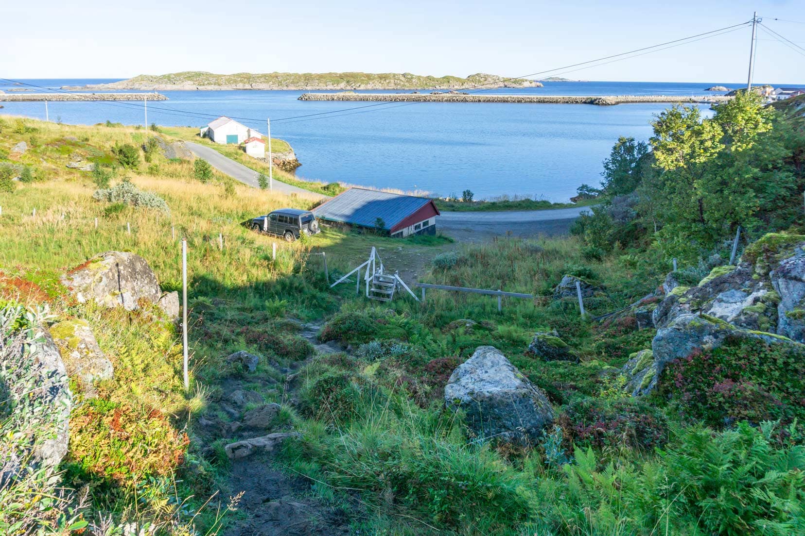
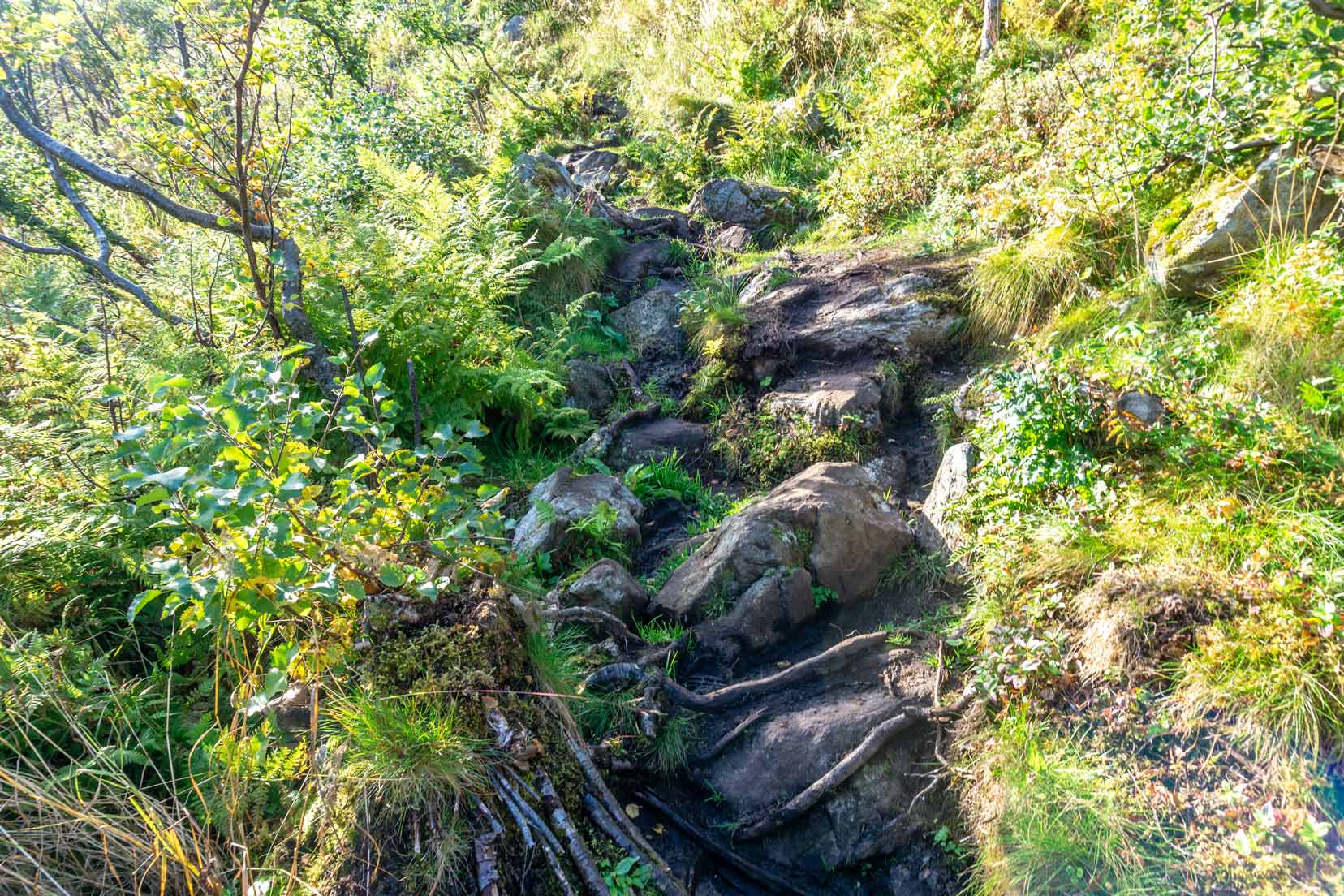
The final part of the trail starts by weaving past some houses before the steep ascent begins.
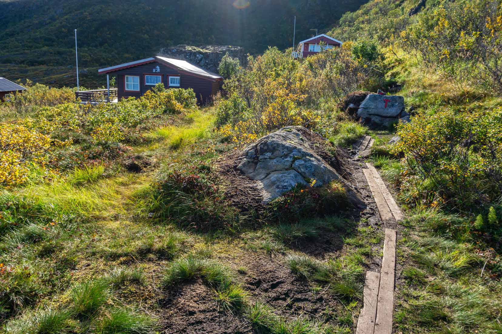
An all-out assault is unleashed. The rocky, slippery path is hell-bent on hampering progress; however, the challenge has been accepted.
If other parts of Dronningruta are remembered for their beauty, this final part is unforgettable for its torment on the legs.
I do jest. It’s not hardship, it’s part of making great memories.
Cresting the mountain and passing the junction sign again brings Nyksund into view. A bit of downhill to go.
Finally, at the finish, 5 hours of exhilarating, exhausting and unforgettable fun had ended.
Dronningruta was now immortalised along with the other hikes I’ve completed: Preikestolen, Kjeragbolten and Dronningstien.
Tips for First-Time Hikers of Dronningruta
Start Early
I recommend beginning your hike before sunrise to catch stunning sunrise and landscape photos. This also lets you enjoy the tranquillity of the trail without any crowds.
Route Suggestions
For an easier route of Dronningruta, consider starting at Stø and hiking clockwise up the mountain while your legs are fresh. This direction has less uphill sections.
Exploring Nyksund
If you want to visit Nyksund, follow the trail to the car park and walk a few hundred metres into Nyksund.
For the Adventurous
If you’re up for a challenge, follow my anti-clockwise route starting from Nyksund. This route involves a more intense hiking experience than hiking clockwise. The time to beat is 5 hours … just saying. 🙂
Personal Reflections
The Dronningruta hike was one of my most challenging hikes, not the longest I’ve done in Norway, but definitely memorable. It was a hike of wonder, exhaustion, sweat and exhilaration.
You’ll understand when you finish.

What Made This Dronningruta Hike Different From Others?
Each one of our hikes in Norway has given us a different experience.
With Preikestolen and Kjeragbolten, it was the heart-stopping fear at the closeness of a thousand-plus metre drop. Meanwhile, Dronningstien, Bondusdalen, Ryten, and Himakana offered stunning, ever-changing vistas.
Kongevegen and Utsira, with their gentle winding paths, beckoned us to explore what was around the next corner. Torghatten, the hole in the rock, impressed with its unique magnificence.
And finally, Dronningruta.
This hike sits apart from the rest, and rightly so. Its unique ability to evoke a profound sense of solitude and insignificance amidst stunning natural magnificence makes it a truly revitalizing experience.

Hiking Levels of Difficulty in Norway
- Easy (Green): Novice hikers, no experience necessary
- Medium (Blue): Intermediate with some hiking experience, average fitness level
- Demanding (Red): Experienced hikers, high fitness level, well-equipped with good hiking boots, basic navigation skills (map and compass)
- Expert (Black): Longer and more technical hikes, experienced hikers, high fitness level, well-equipped with good hiking boots, advanced navigation skills (map and compass)
What to Do in the Nyksund and Stø Area
Activities and Attractions
- 🐋 Arctic whale tours: Experience the thrill of seeing whales up close with guided tours from Stø.
- Nordland sculptures: Explore the unique outdoor sculptures that depict the artist’s interpretation of nature and culture.
- Geocaching: Join a global treasure hunt and discover hidden caches around Nyksund and Stø in hidden spots.
Accommodation and Dining
Nyksund
- Where to stay: Options include Holmen Brygge accommodation, which offers comfortable lodging with beautiful views. However, there are other options with good reviews. If you’re camping or motorhoming, Nyksund Bobilcamp is the place.
- Where to eat: We can personally vouch for the local restaurant Ekspedisjonen Nyksund. Restaurant Langhuset is also an option.
- Closest supermarket and fuel stop: The nearest supermarket and fuel stop are located in Myre, about 13 kilometres from Nyksund.
Stø
- Where to stay: Nyksund offers the best accommodation options. If you’re camping or motorhoming, Stø Bobilcamp is the place.
- Where to eat: Valen Restaurant within the Bobilcamp campsite is a handy choice for dining.
- Closest supermarket and fuel stop: The nearest supermarket and fuel stop are also in Myre, 13 kilometres away.
Dronningruta Hike …That’s a Wrap
Planning your Dronningruta hike can be an exciting adventure, and I hope this guide provides all the information you need. The hike offers stunning landscapes, a sense of solitude, and a unique connection with nature.
Completing this hike was one of the most rewarding experiences for me, and I’m sure it will be for you, too. If you enjoy fabulous scenery, then road-tripping the Lofoten Islands sounds like it’s for you.
I’d love to hear about your hike, so please drop me a message with your thoughts and any tips you discovered along the way. Safe hiking!
On the Vesterålen Archipelago, located just north of the Lofoten archipelago in Northern Norway, lies the famed Dronningruta or The Queen’s Route. This looped 15-kilometre mountain hike follows a route between the fishing villages of the once-abandoned village of Nyksund and the village of Stø.
Why not Pin and Save it for later
Planning Your Travels?
These are the travel resources we recommend and use when planning our trips.
- 🚘 Car Hire: We use DiscoverCars.com
- Motorhome/Campervan Rental: We highly recommend the Motorhome Republic
- 🪪 Order your International Driver’s Licence online here
- 🛏 Book Accommodation: We use Booking.com to find accommodation that suits our budget
- 🐶 Pet Sitting/Pet Sitters: Check Out TrustedHousesitters here (Use our Discount code: LIFEJOURNEY25 for 25% off. )
- Activities and Experiences: Get Your Guide and Viator
- Travel Insurance: Safetywing or World Nomads
- 🥾 Travel Gear and Accessories: Check out our top picks here — Lifejourney4two page on Amazon
For a more thorough list, visit our Travel Resources page here.