
Ready to experience one of Norway’s famous panoramic hikes? Then Dronningstien is for you.
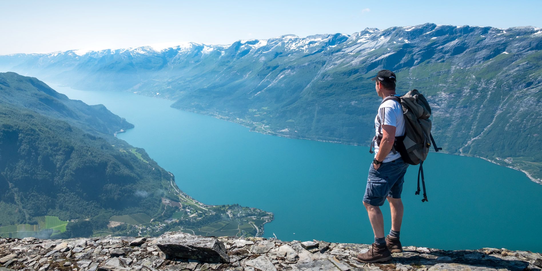
Known as The Queen’s Trail, this tough 16km hike crosses the Hardangervidda Plateau with sweeping views of the spectacular Hardangerfjord. You’ll need your stamina, though; Dronningstien has an altitude gain of 800m.
Having lived in Norway for some years in the historical village of Skudeshavn, 200km further south, Dronningstien was high on our list of iconic Norwegian hikes to conquer.
Full of anticipation, we set out to tackle this gruelling route, also a favourite of Queen Sonja of Norway.
⛰️ Dronningstien Hike in a Nutshell
- Hike Route: The route runs between Kinsarvik (starting at Rôte) and Lofthus in the Hardanger region, Hordaland, Norway. Rôte, the official start/end point, is a 2.5km walk from Kinsarvik.
- Trail Markings: Blue ‘D’ (D for Dronning or Queen) marks the route between Rôte, across the Hardangervidda mountain plateau, and the Monk Stairs’ top. From here, the Red ‘T’ marks the route from the Monk Stairs down to Lofthus.
- Distance: 16km hike between Kinsarvik and Lofthus.
- Time Required: Approximately 8-9 hours.
- Elevation Gain: 900 metres.
- Difficulty: Demanding.
- Terrain: Includes rocky paths and boggy areas at the Kinsarvik end.
- Equipment/Clothing: Waterproof hiking boots, plenty of water and snacks, walking sticks (useful for descent), and clothing layers (as the weather can change quickly).
- Best Season: June to October, depending on snow conditions.
- Starting Point: Kinsarvik or Lofthus.
Map: Dronningstien Hike with Attractions and More
How to Use This Map: Hike Trail, Parking, Transport and Attractions
- To use this interactive map effectively, click the square icon in the upper right corner to expand.
- A key will appear on the left, guiding you through various locations.
- Clicking on any site reveals detailed information about that spot.
- Purple markers 🟣 show points of interest
- Red markers 🔴 show accommodation
- Black ⚫️ markers showing parking
- Yellow 🟡 markers show the ferry stops
- Green 🟢 markers show bus stops
Hiking Dronningstien – Start the Hike from Lofthus or Kinsarvik?
This hike can be started from either Lofthus or Kinsarvik, with most starting from Kinsarvik. We started from Lofthus while staying at Hardanger Hostel B&B in Lofthus.
The points below are reversed if starting from Lofthus.
Hiking from Kinsarvik to Lofthus (reverse the below if starting the hike from Lofthus):
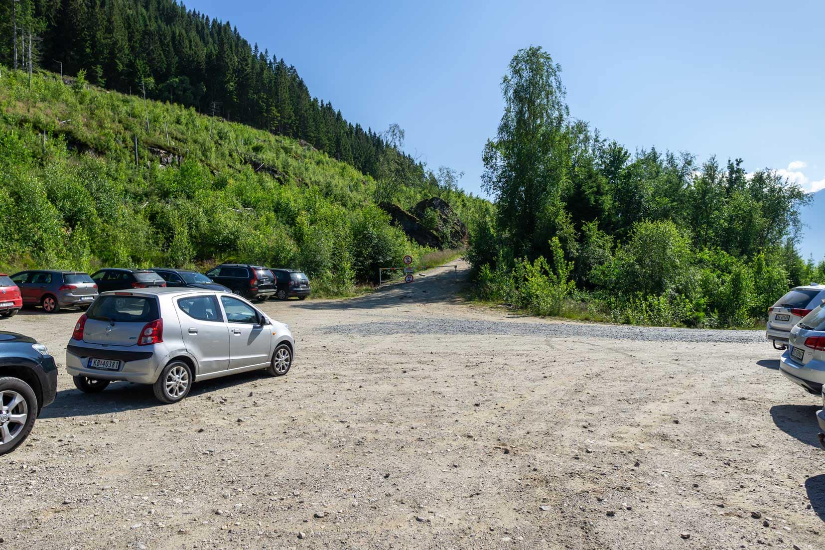
- Park in Kinsarvik at the old ferry parking or near Kinsarvik town hall. Limited parking at Rôte.
- Walk from the Esso gas station to Rôte for the start of the Dronningstien hike. Approximately: 2.5 km
- Hike from Rôte to the start of the Dronningstien plateau. Approximately: 3km
- Hike Dronningstien plateau to the Monkesteppen. Approximately: 6.0 km
- Hike Monkesteppen to Lofthus. Approximately: 4.5km
- Catch the bus from Lofthus to Kinsarvik. The bus stop is near Lofthus’s Bunnpris supermarket and the large parking area, which hikers will use if they start the hike from Lofthus.
Plan Your Trip To Lofthus or Kinsarvik – Transport to Dronningstien
By Car
- Kinsarvik Start: Park opposite the Esso gas station in the old ferry parking or near Kinsarvik town hall.
- Røte Start: From Route 13 near the Esso gas station, follow the road to Røte Carpark. The parking fee is NOK 200.
- Lofthus Start: Free parking is available at the car park by the Bunnpris Grocery Store at the harbour.
By Bus
- Travel to Lofthus or Kinsarvik: Use the Skyss Reise Bus network to plan your journey to various locations in Norway.
- Between Lofthus and Kinsarvik: Bus 990 runs daily. Travel time is 15-20 minutes. For more planning, download the Skyss Reise app.
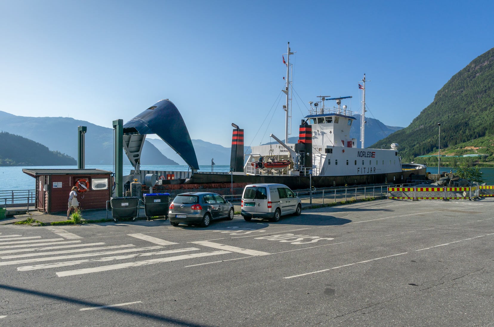
By Ferry
- Route 2095: Operates between Utne and Kinsarvik. Check times and purchase tickets from Norled.No.
- Free Travel: The Kinsarvik – Utne ferry route is free per the free Norled ferry routes information.
By Shuttlebus
- Routes: The shuttle bus runs from Lofthus to Kinsarvik to Røte.
- Stops include:
- Ullensvang Church parking
- Lofthus Center near Bunnpris Supermarket
- Hotel Ullensvang
- Lofthus Camping
- Shuttlebus Season: From the end of May to October 15th.
- More Information: Shuttlebus Website.
Planning a Trip to Norway?
- 🚗 Hiring a car? We recommend getting a quote from DiscoverCars
- 🚐 Hiring a campervan? We recommend Motorhome Republic
- ⛑ Arranged your travel insurance? Compare quotes from World Nomads & Safetywing
- 🪪 Order your International Driver’s Licence online here
- 🏩 Booked your accommodation? We use Booking.com to find the best deals
- 🐾 Is someone pet-sitting for you? 🐾 We use and love TrustedHousesitters
- (Get 25% off at checkout for new memberships with our discount code: LIFEJOURNEY25)
Why is the Dronninstien Hike Famous?
There are a few good reasons why Dronningstien is such a famous hike:
- Trail Origin and Name: Queen Sonja officially opened the trail in 2013 with the hike named after her. It is said to be one of her favourite hikes in Norway. ‘Dronning’ in Norwegian means queen. The official name for Dronningstien is HM Queen Sonja’s Panoramic Hiking Trail.
- Scenic Views: During the hike, there are magnificent views of Hardangervidda National Park, Folgefonna glacier within Folgefonna National Park, and the serene 38 km-long fjord called Sørfjorden.
- Hike Difficulty: The difficulty of the hike, which is rated as ‘challenging’
- Hike Length and Duration: The hike is 14km long and takes a few hours to complete.
Dronningstien certainly deserves to be included among the most scenic and beautiful hikes in Norway, alongside Preikestolen and Kjeragbolten.
Video: Dronningstien Hike Inspiration
Immerse yourself in just a minute of breathtaking scenery along the Dronningstien, HM Queen Sonja’s favourite hiking trail.
This video teaser offers a glimpse into the panoramic views of Hardangervidda National Park, the majestic Folgefonna glacier, and the tranquil Sørfjorden. Perfect for those planning their hike or dreaming of Norway’s natural beauty!
Our Trek of Dronningstien: Journeying Above the Clouds
We were eager to start our ascent, anticipating what awaited us on the Dronningstien trail.
Starting the Day: Lofthus Morning Prep
We overnighted at the Hardanger Hostel B&B and, after a carb-rich breakfast, drove a mere three minutes to the Lofthus carpark to start the hike. We re-checked our gear, ensuring ample water, snacks, and extra clothing for any unpredictable mountain weather.
We parked in Lofthus instead of leaving our car at the Hardanger Hostel parking to avoid the extra 2.5km walk later in the day when we returned to Lofthus via the bus, which stopped at the carpark.
The Ascent Begins: Through Orchards to Ancient Steps
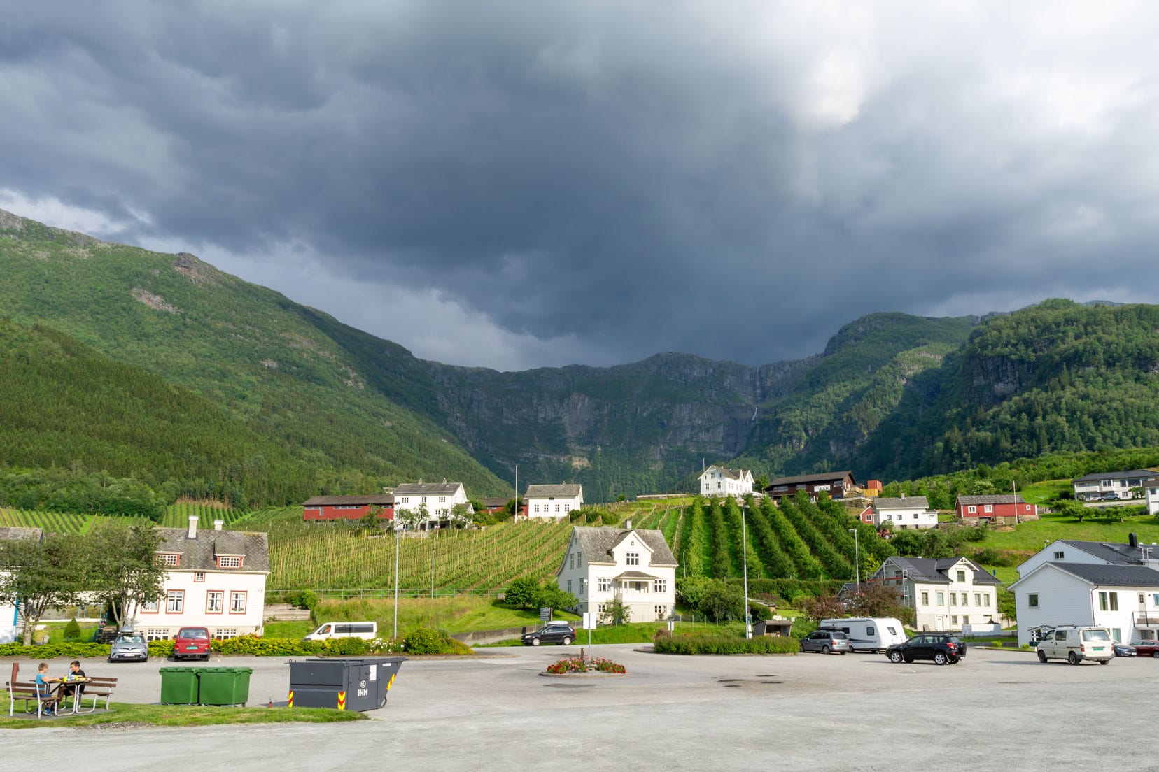
The start of the uphill hike led us through Lofthus, where we followed signs indicating the Dronningstien hike. We passed behind the luxury Hotel Ullensvang and continued on a paved road through lush orchards of cherry and apple trees.
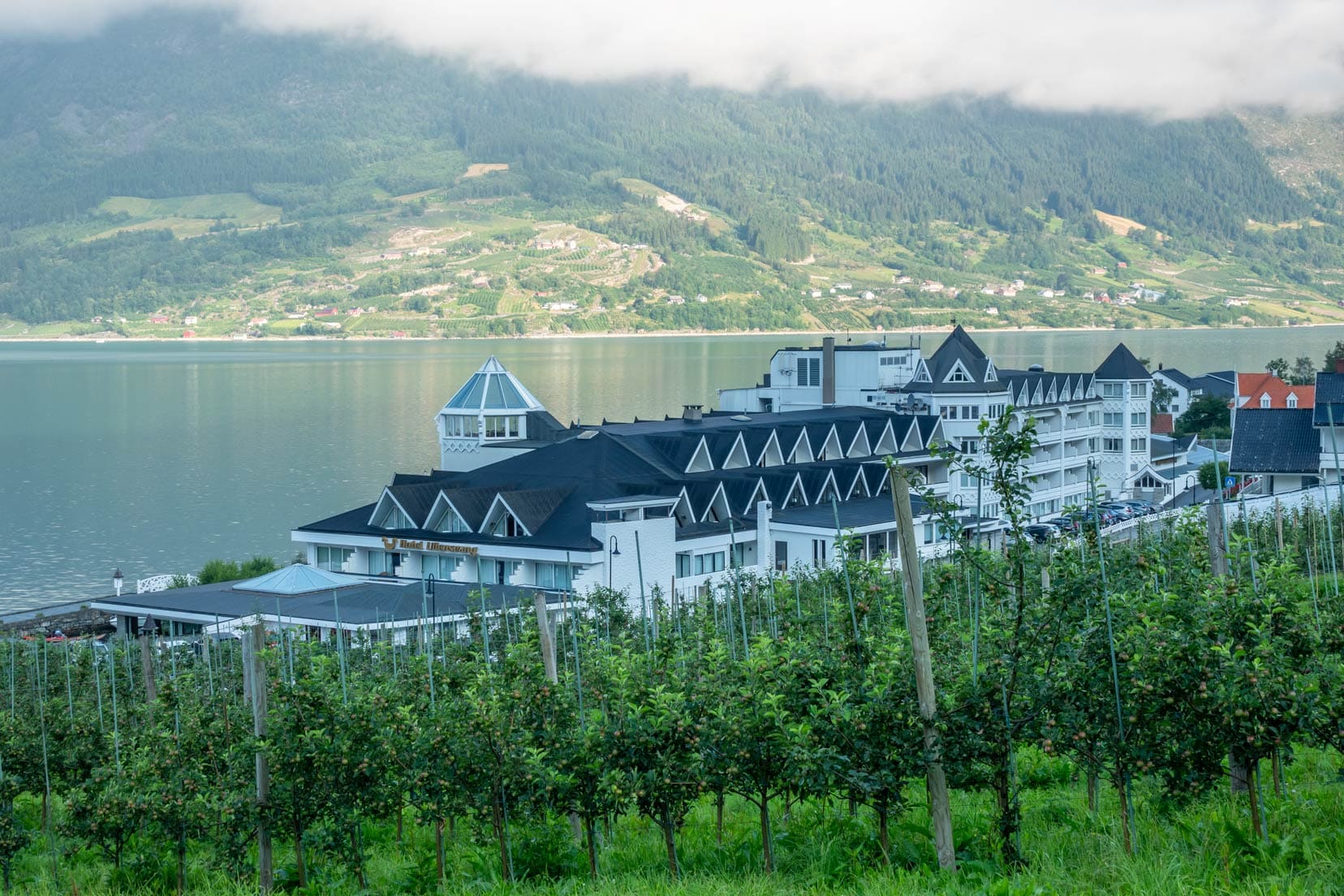
It wasn’t long before we had great views of Ullensvang Church, Sørfjorden and the distant Folgefonna glacier over the fruit trees.
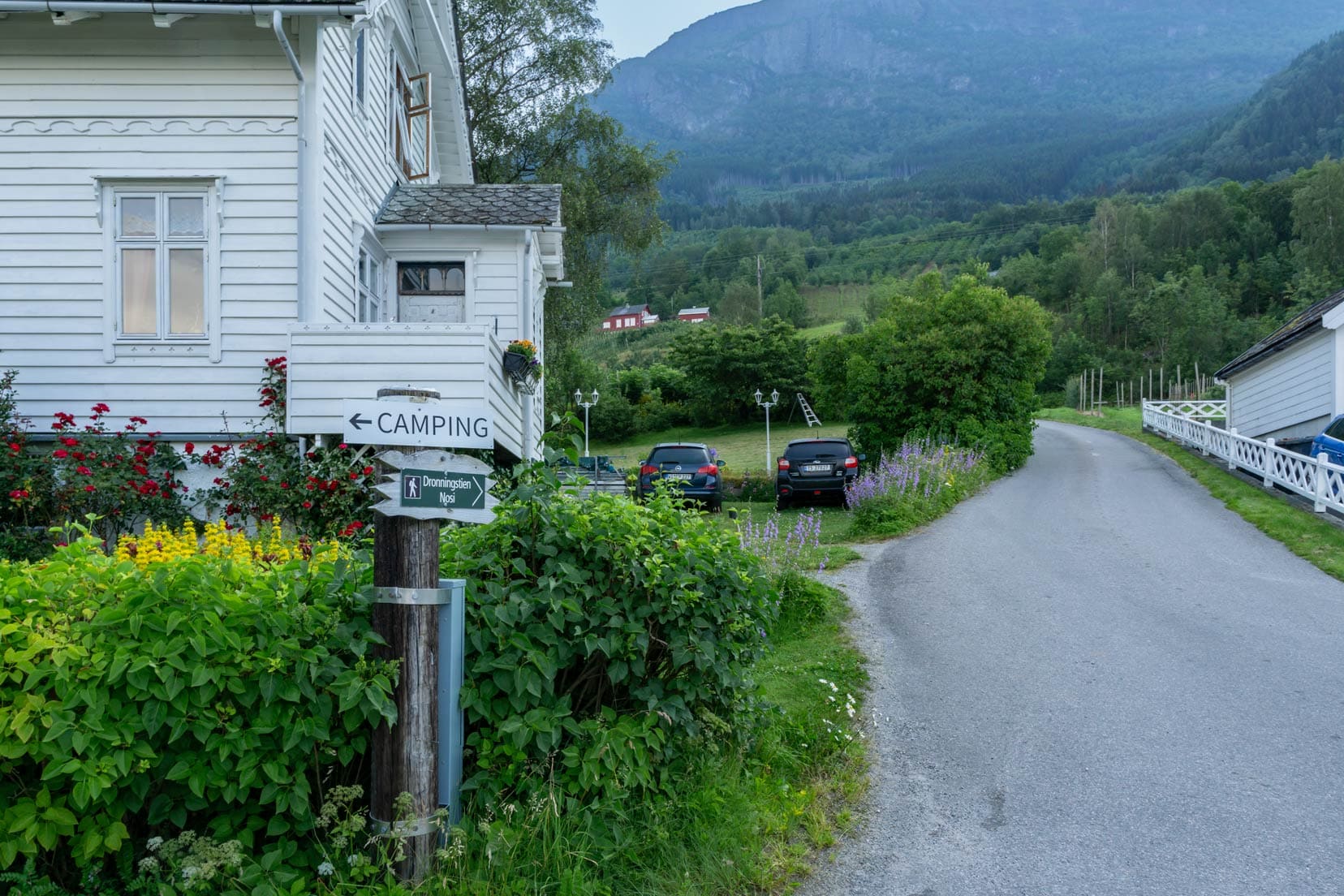
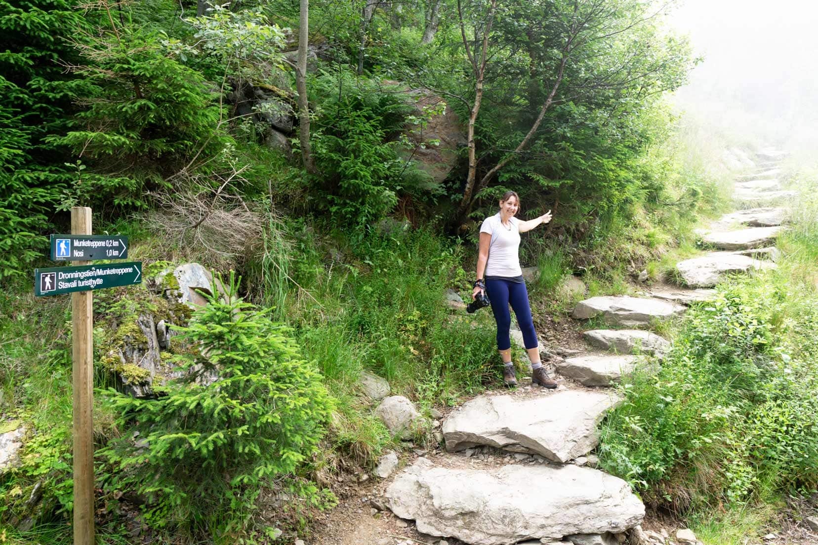
We continued onto a gravel road, passing a chain barrier and a sign indicating Munketreppene (monk steps) and Nosi (viewpoint with the name nose, because it looks this from below).
The real ascent began as we approached the historic 616 Monk Steps (from 600 to 800 metres above sea level), built by monks between the 12th and 16th centuries to improve the existing path. These are Norway’s oldest stone stairs.
Along these ancient stones were wildflowers of pinks, yellows, and blues and a symphony of birdsong that cheered us on, distracting from our fatigue. Each step was a mixture of effort and awe as we ascended higher, closing the distance to the Hardangervidda plateau.
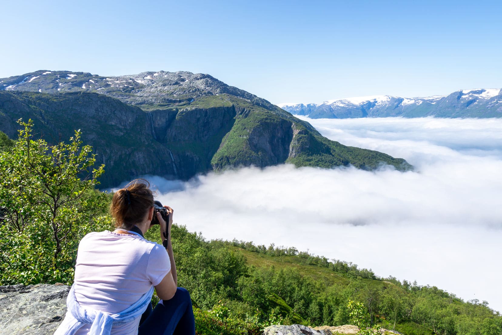
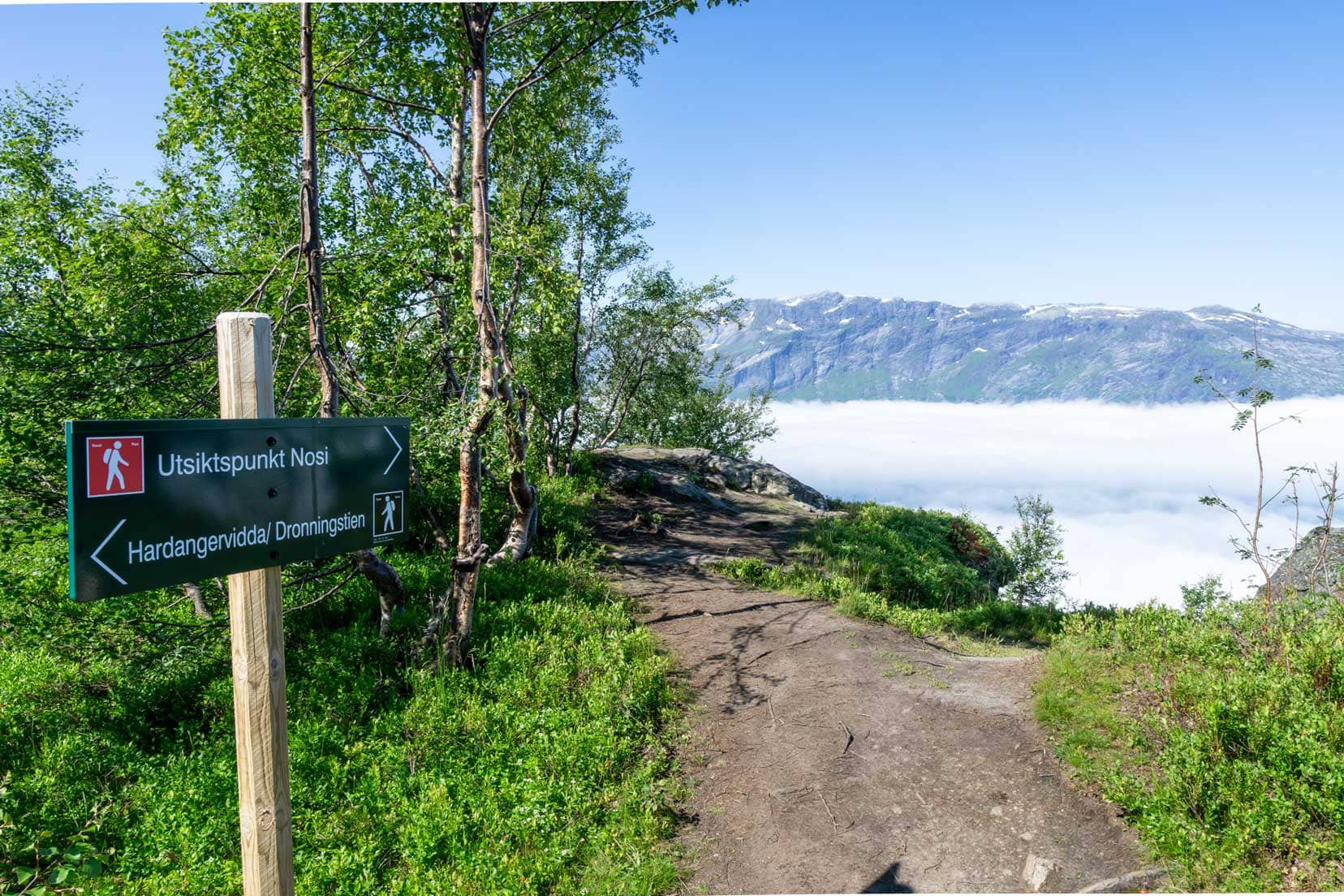
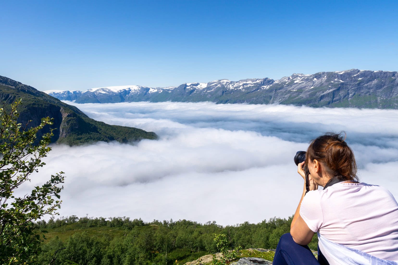
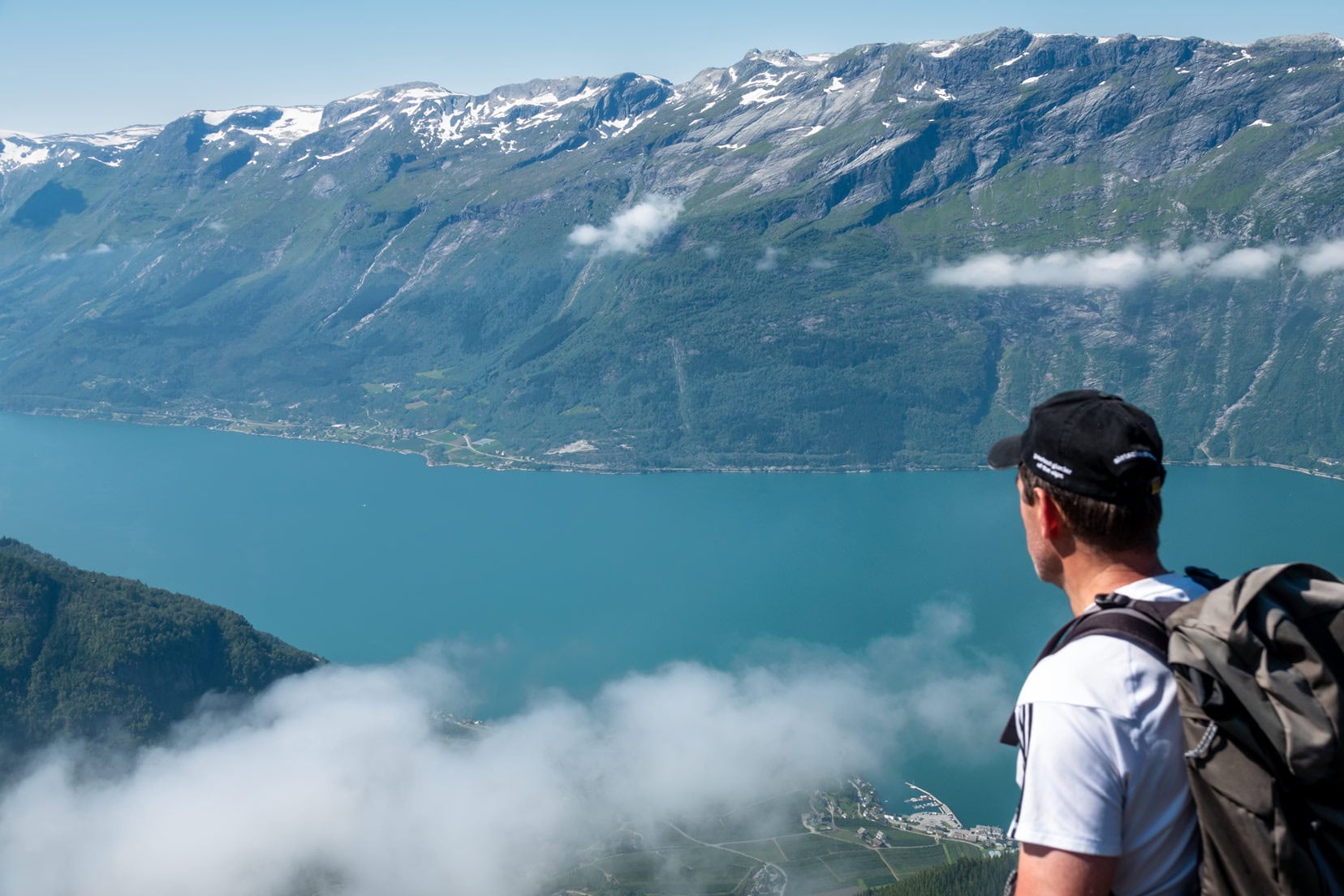
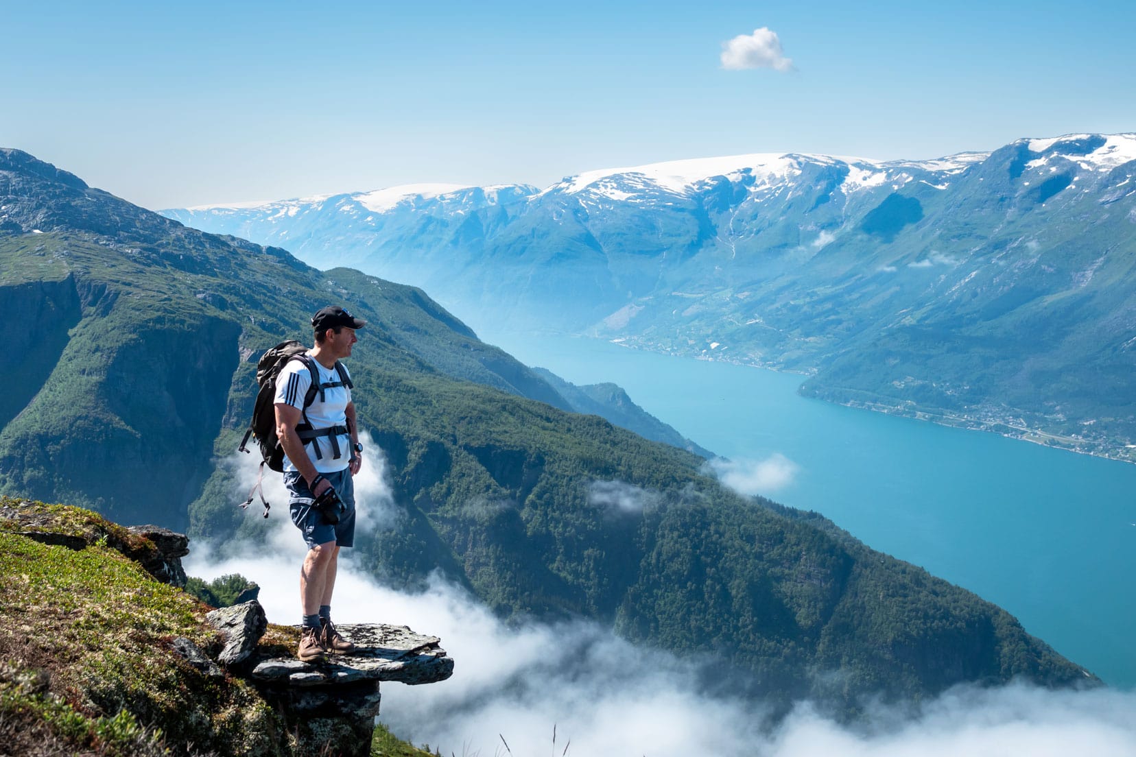
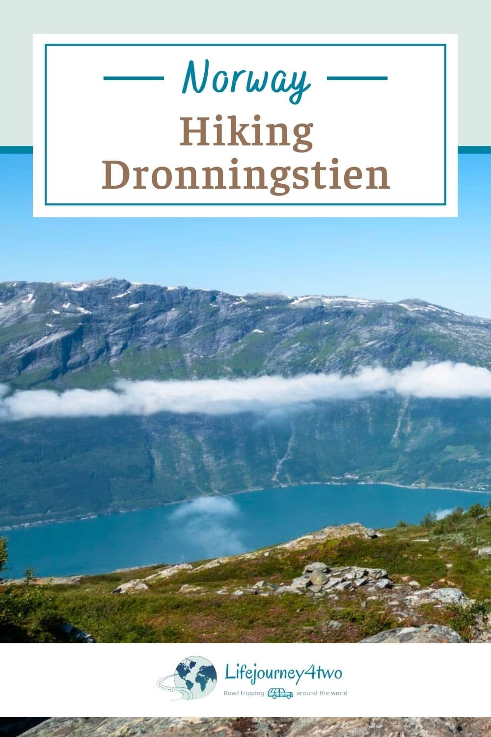
Reaching Nosi viewpoint, we stopped to drink and enjoy the view, knowing we were within a couple of hundred metres from the top. We had made it above the cloud cover.
Below us, a thick blanket of clouds obscured the ground, transforming the landscape into a white sea stretching up and down the fjord.
Above the Clouds: Reaching New Heights
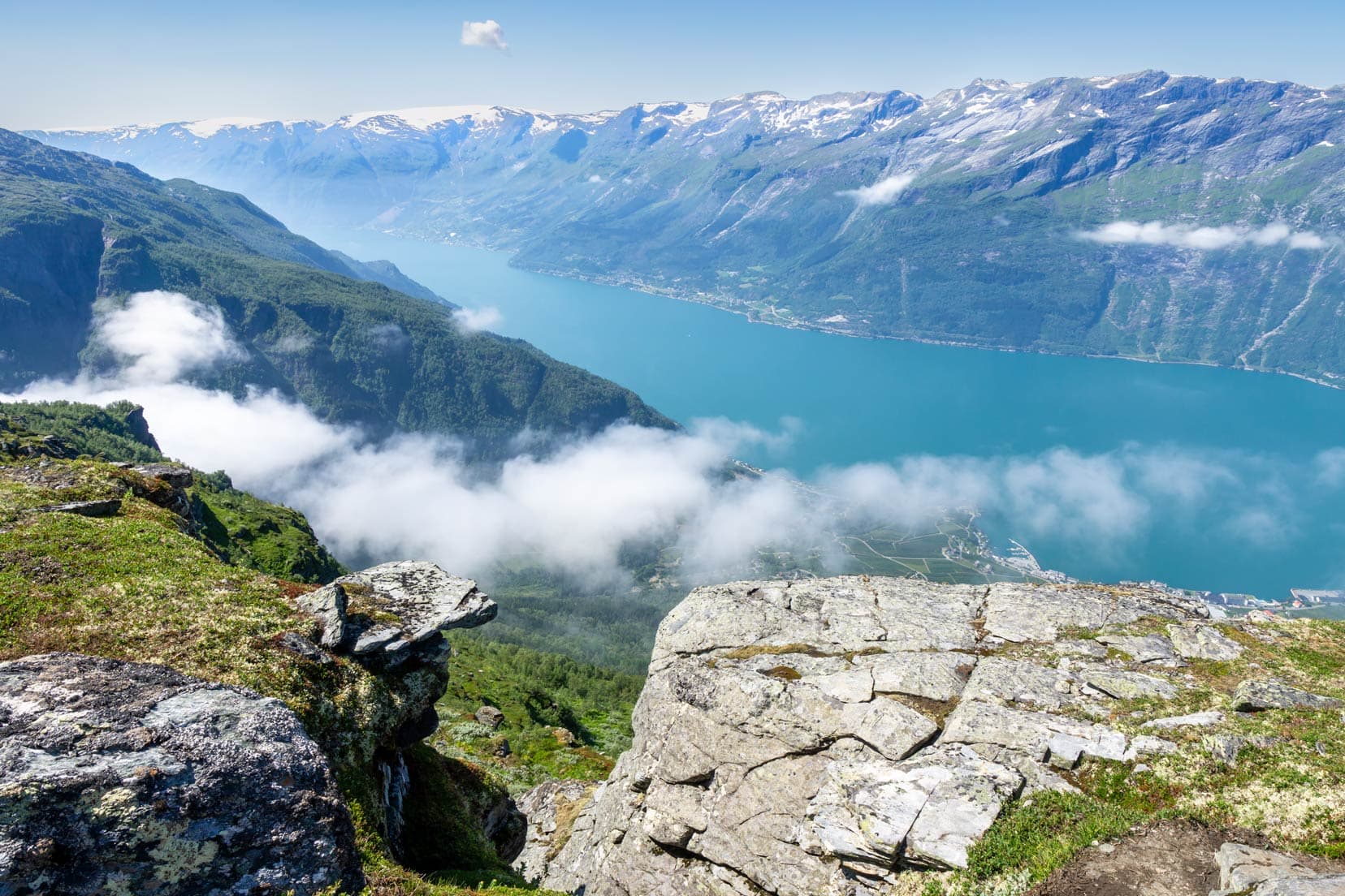
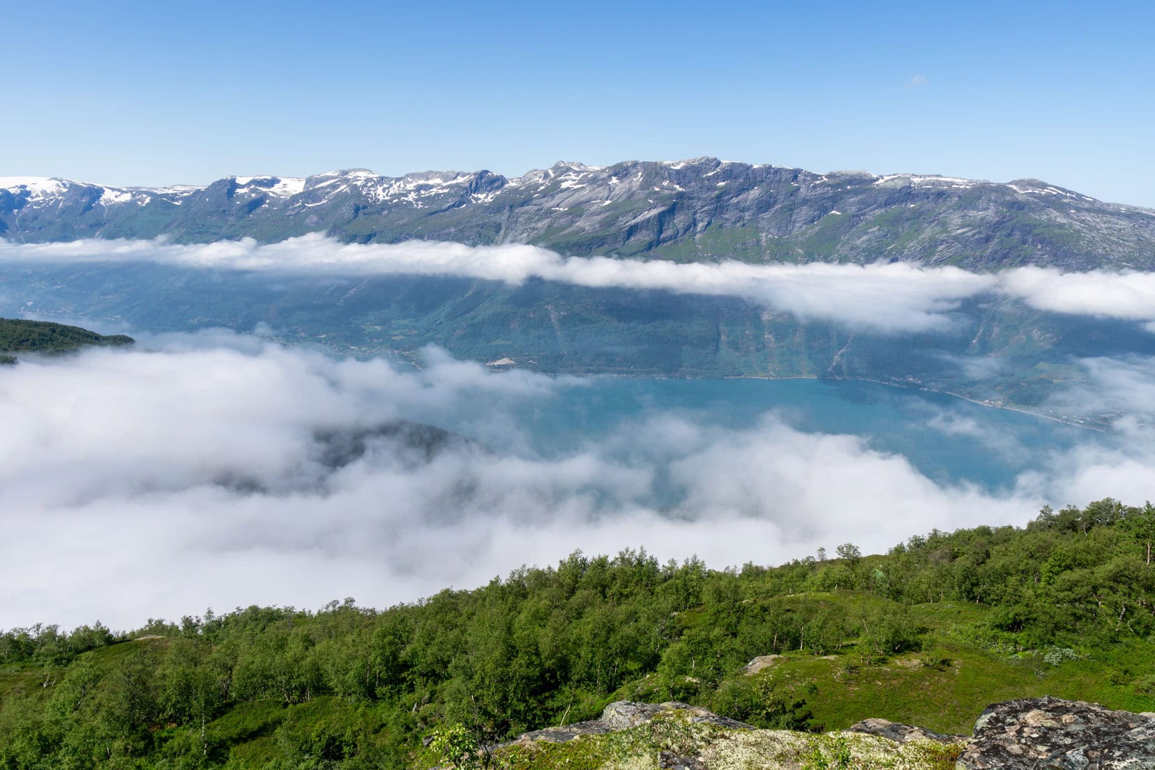
As we reached the summit, the expanse of Sørfjorden unfolded before us in all its majestic glory. It was a moment of accomplishment.
We took another break, capturing photos and simply soaking in the beauty and vastness. The cloud base was slowly beginning to disperse, revealing the vibrant blues and greens of the fjord waters below.
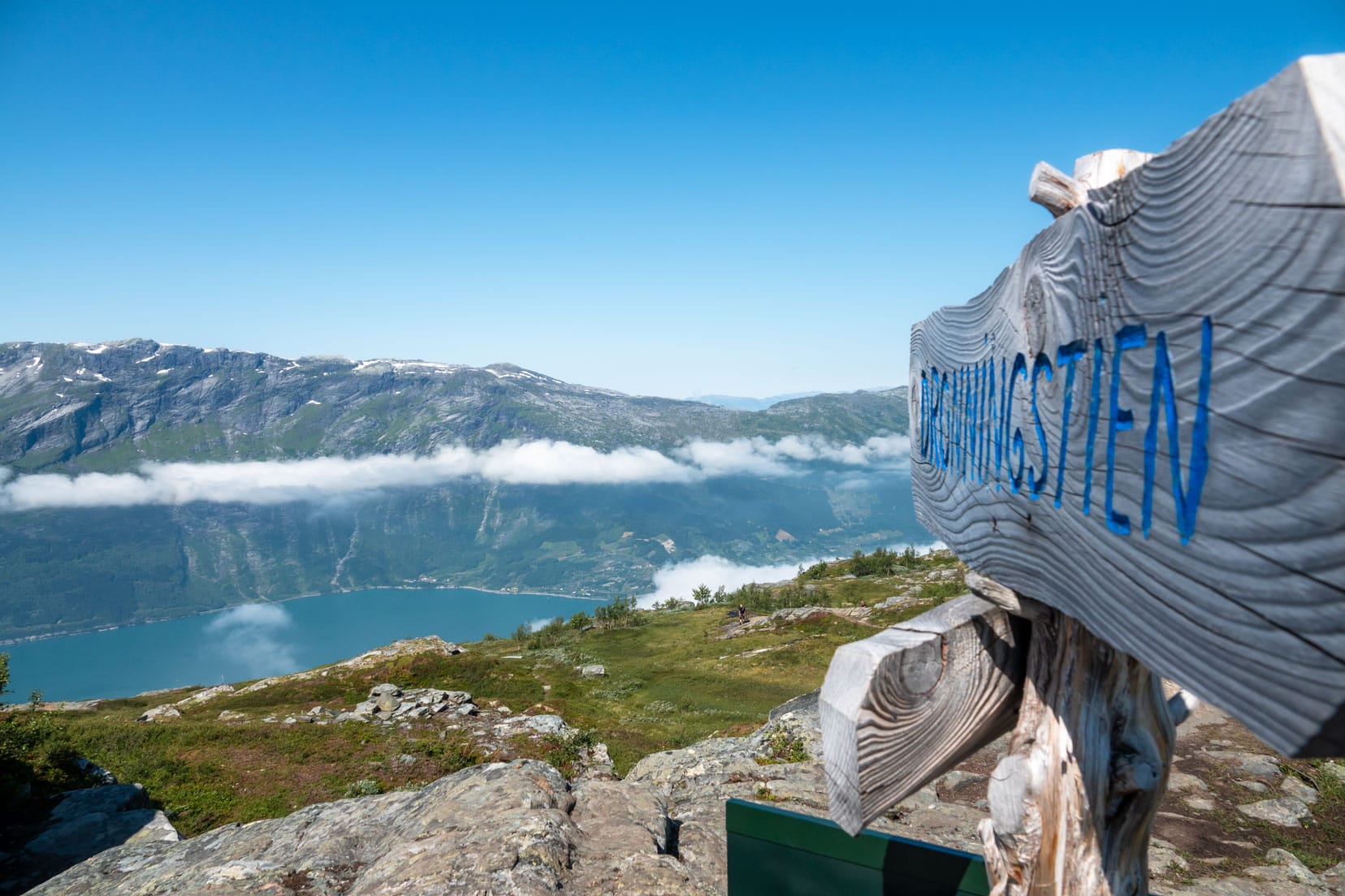
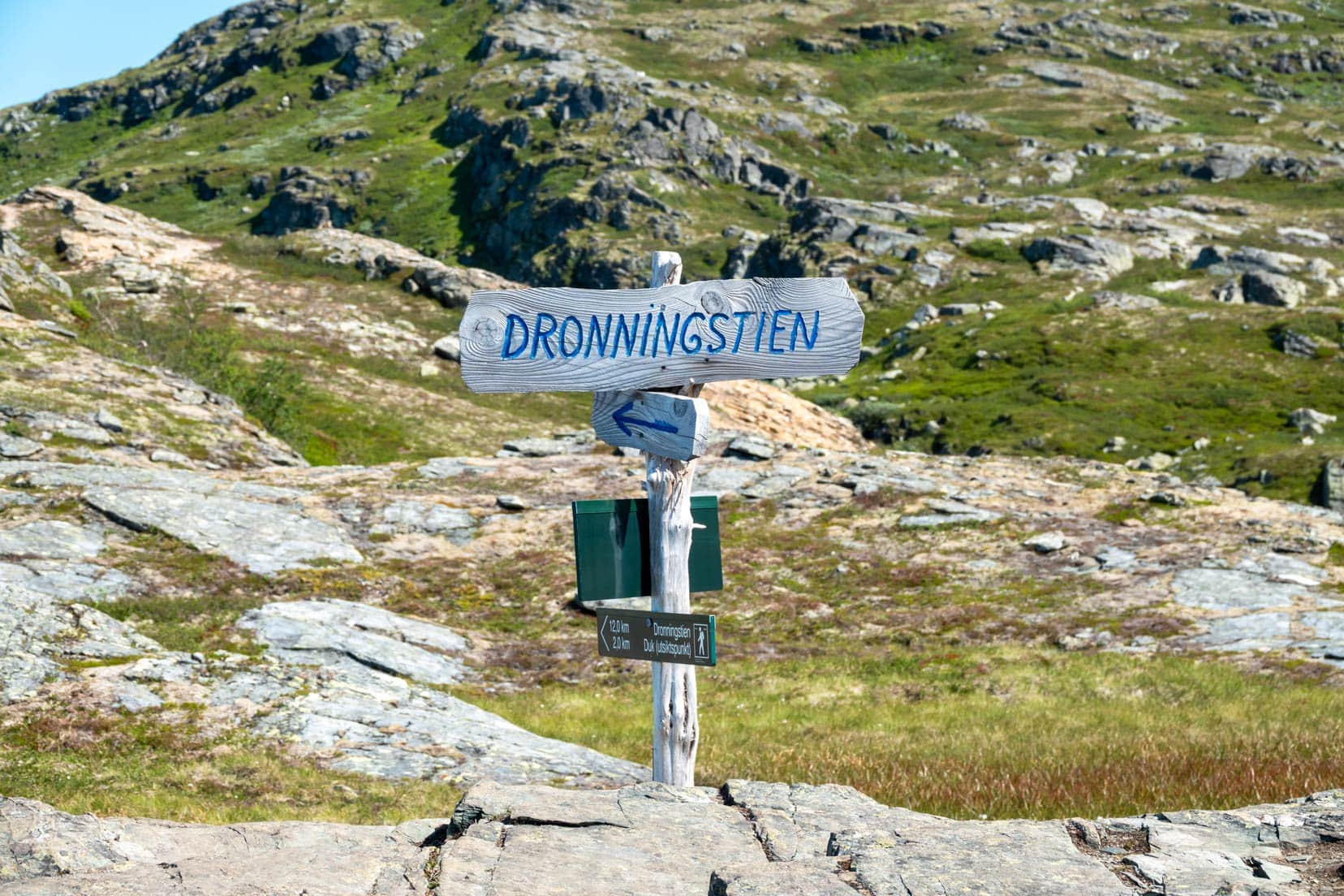
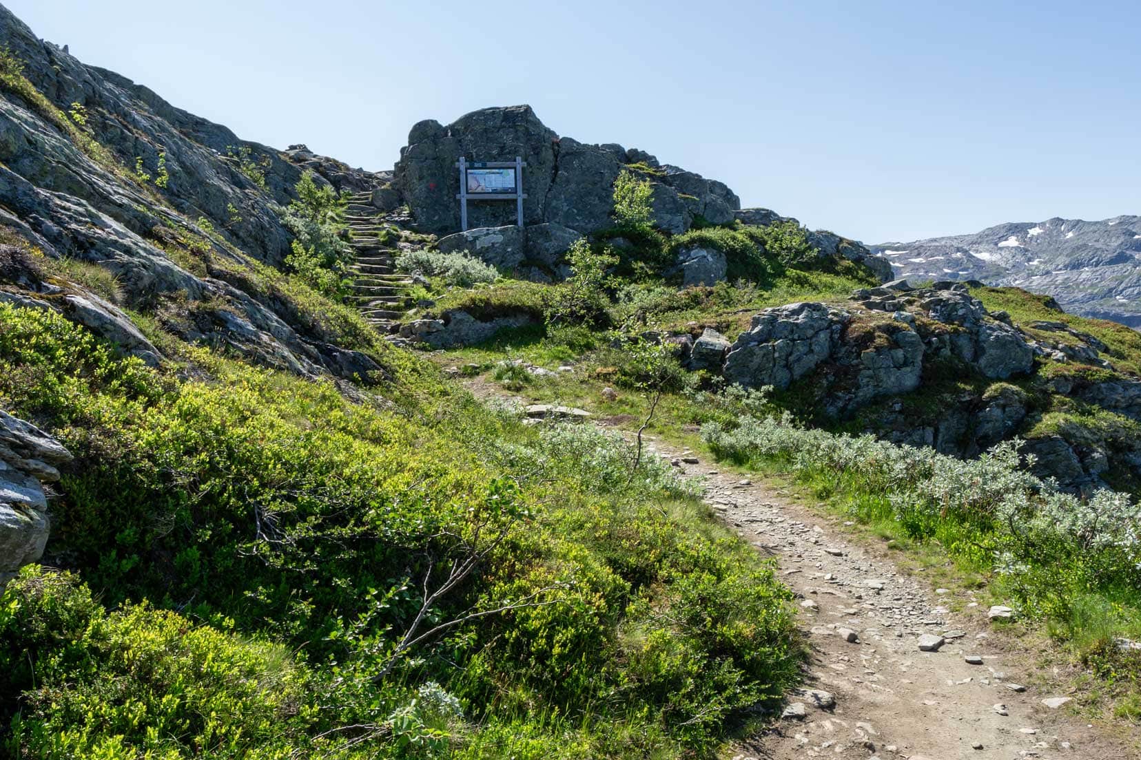
Looking around us, the immediate plateau landscape was dotted with small lakes and streams. A posted information board confirmed that we had reached the Rjukande summit. A blue sign marked ‘Dronningstien’ pointed out the hiking path, inviting us to explore further. After a good drink, we pushed on.
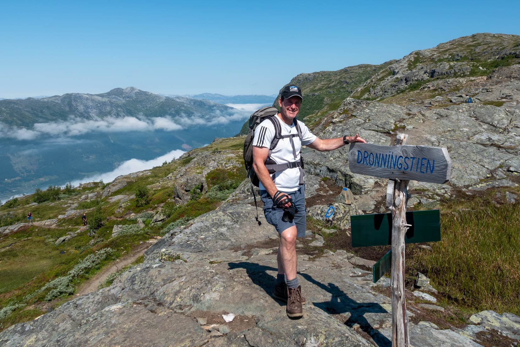
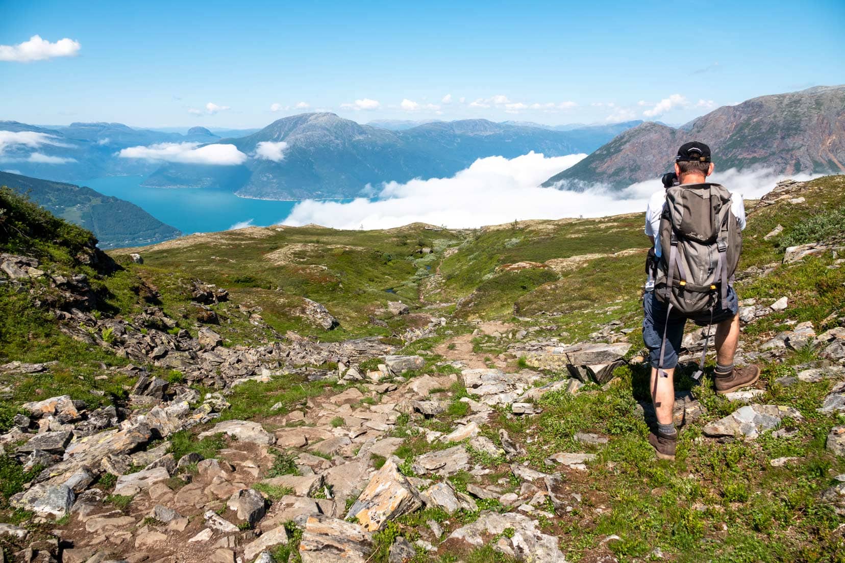
The hiking trail hugs the plateau edge, providing spectacular views of the Folgefonna National Park. Sporadic progress was made; ambling from one blue ‘D’ marker to the next.
The views were mesmerising, and we spent a lot of time gazing in wonder at the grandeur of the landscape in appreciation of what we were witnessing.
The photography opportunities were plentiful. The cloud base had all but disappeared at this stage.
If you’re a bit rusty with the camera, then consider reading more on these photography tips and techniques.
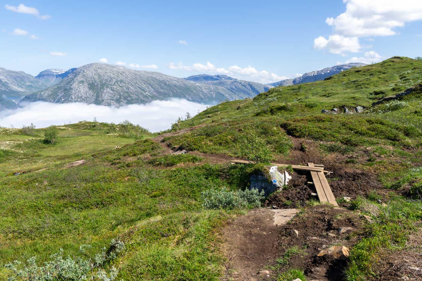
The hike ahead is pretty much all flat, with only a few areas that needed negotiating around rocks and through the wet. It’s all about the view and enjoying the wide open spaces.
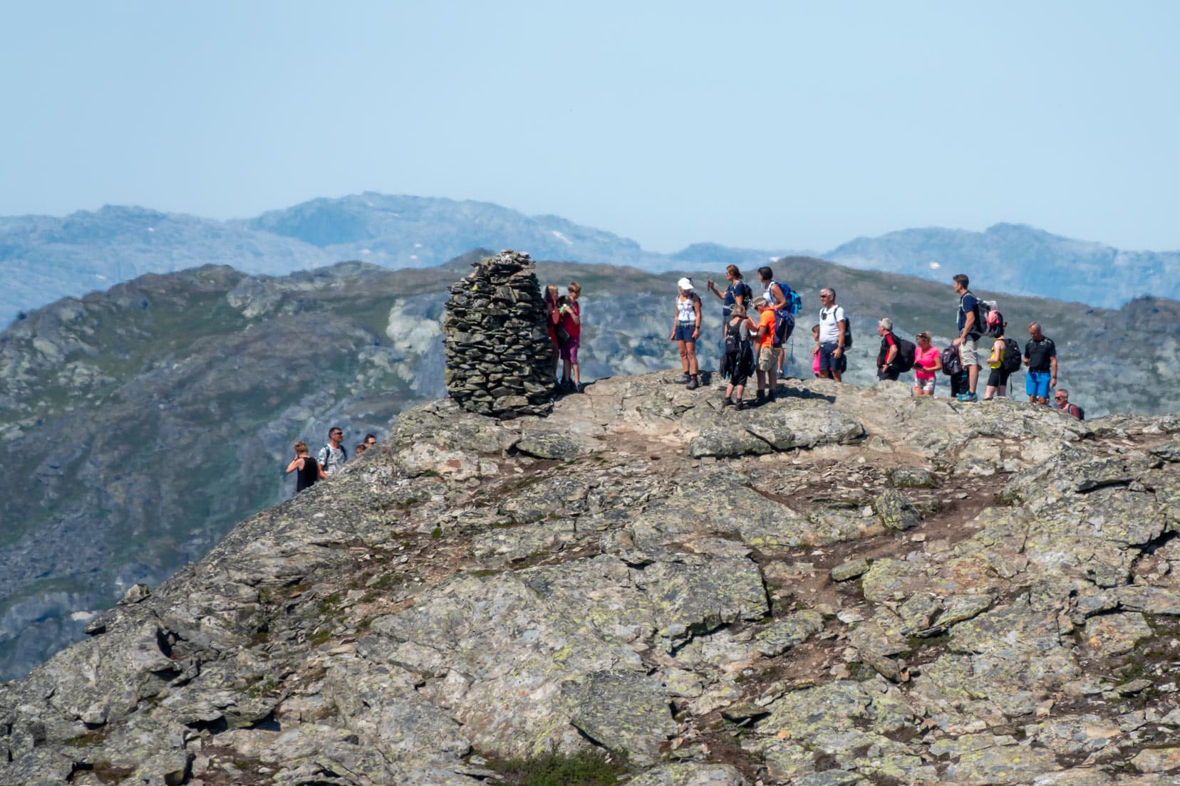
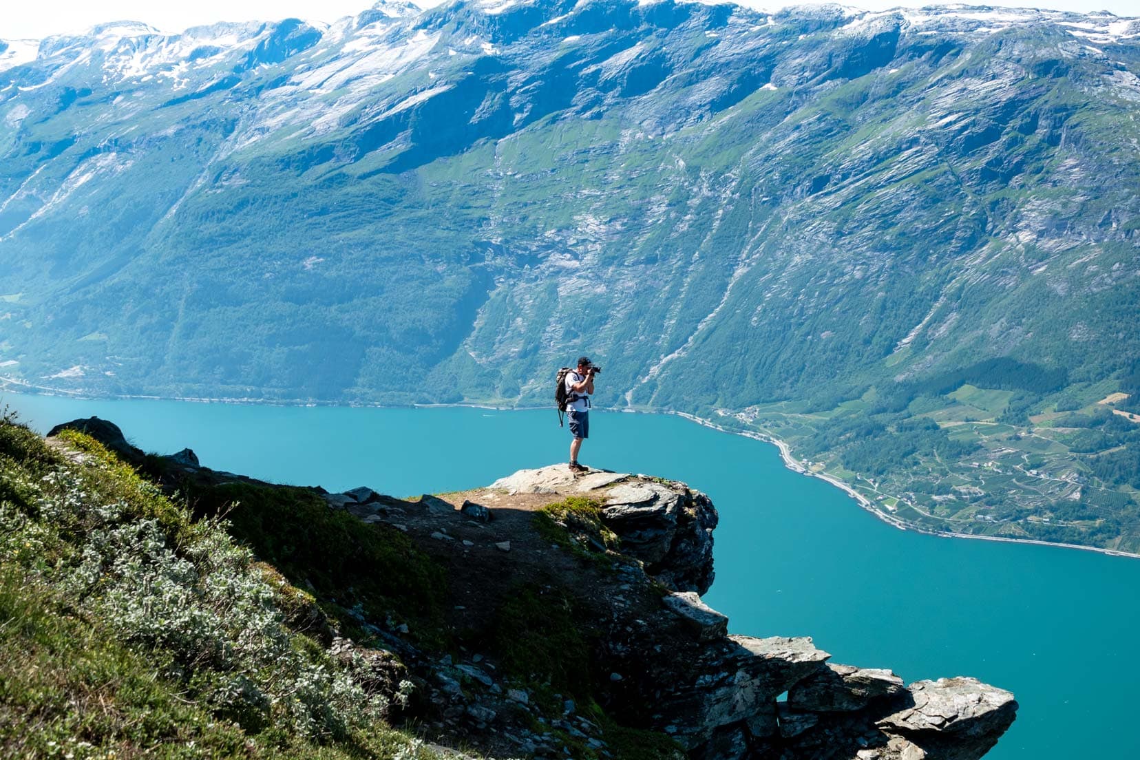
Along the hike, there are a few rock ledges that offer great photo opportunities. We passed a rock cairn that seemed to be a popular place for people to take photos.
This rock ledge (marked on the map) is an outstanding spot for photos. Other hikers were waiting their turn to capture this view, so we couldn’t stay long.
I’ll let our photos do some talking. You’ll get the picture.
The plateau section of the hike is about 5km long. In the last kilometre of the plateau hike (the Kinsarvik end), you can see the junction of Sørfjord and its parent, Hardangerfjord, the second-longest fjord in Norway, stretching 179 km.
The Descent: Navigating the Terrain Back
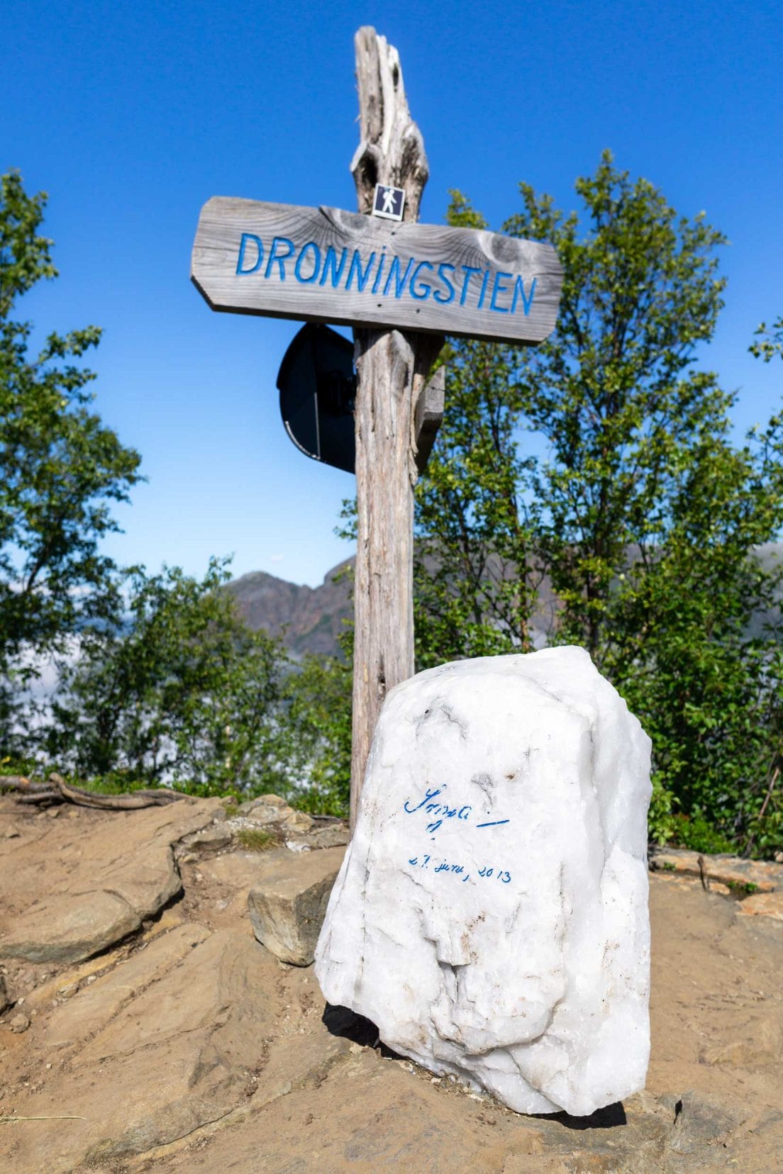
Around the point where the track began to descend towards Kinsarvik, we spied a marker with a white rock engraved with Queen Sonja’s signature, dated 2013.
The track conditions were beginning to change. The path was now strewn with loose rocks that shifted underfoot, demanding careful attention with each step. Sections of the trail had become waterlogged, creating boggy areas that could easily trap an unwary hiker’s boot.
Fortunately, wooden boards were strategically placed across the muddiest and most unstable parts of the trail. Still, it was slow going.
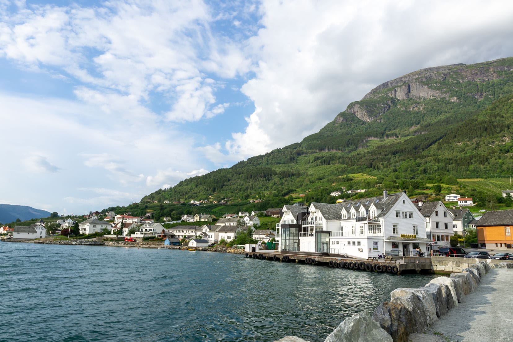
The descent became steeper, and we descended through tall trees and past the Rôte parking area. The track continued through tall grass and finally onto a road we followed into Kinsarvik.
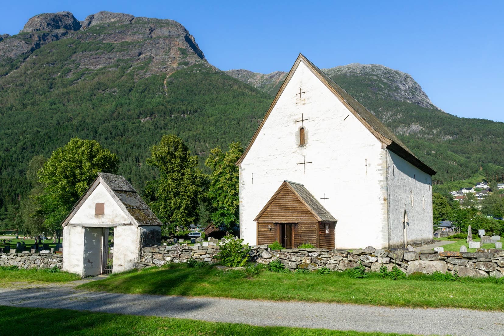
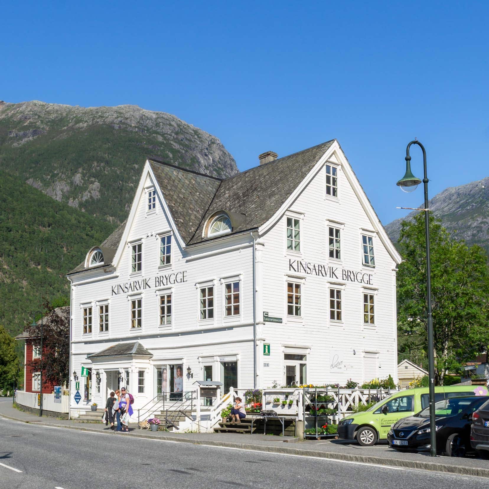
Kinsarvik’s old 12th-century stone and its interior mosaics are of interest. They are free to enter. Opposite is the attractive white-timbered Kinsarvik Brygge, which acts as the town’s tourist office.
The Dronningstien hike was complete, and the 8 hours of hiking were now behind us. We were tired but elated with a day well spent.
Reflecting on the Hike
The Dronningstien hike, with its diverse terrains and breathtaking vistas, offers something for everyone. From the seasoned trekker to the enthusiastic beginner, this trail allows everyone to create their unique experience.
The key to truly enjoying this hike is pacing yourself according to your comfort level. Take time to pause, breathe, and fully absorb the surrounding beauty. Each step on this trail is an opportunity to connect with nature.

Where to Stay When Hiking Dronningstien
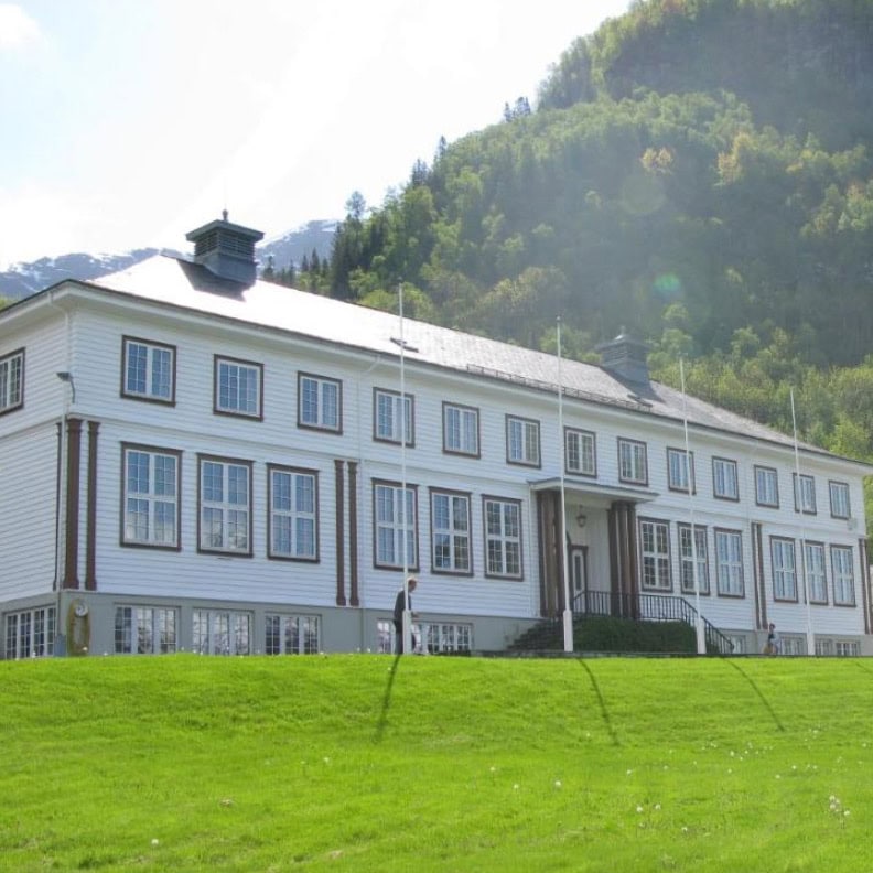
We stayed at Lofthus, on the eastern shore of Sørfjorden, at the Hardanger Hostel B&B. Breakfast was included in the price. Or, for a more upmarket option, Hotel Ullensvang is rated as fabulous.
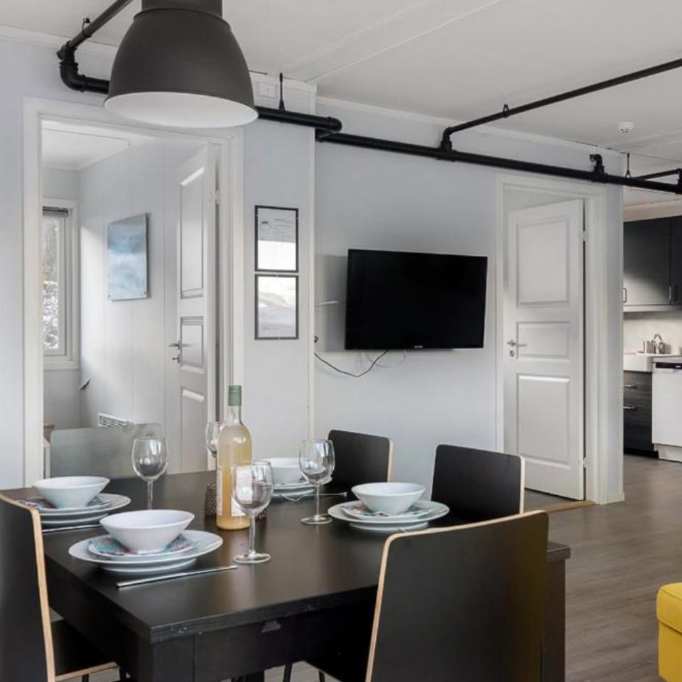
Lofthus Accommodation Option
Kinsarvik Accommodation Option
Dronningstien Hike…That’s a Wrap
As we wrapped up our journey on the Dronningstien trail, it was clear that this hike offers more than just a physical challenge—it is a full sensory experience, blending history with the natural beauty of Norway’s landscapes. Whether you’re starting from Kinsarvik or Lofthus, the route provides diverse terrains and breathtaking views that are worth every step.
For those planning to tackle this trail, remember to prepare appropriately, pace yourself, and take time to enjoy the stunning landscapes you’ll pass through. This hike is about reaching the summit and appreciating the journey itself.
Along with Preikestolen and Kjeragbolten, Dronningstien was now one of our top three Norwegian hikes. Since you’re close to Folgefonna National Park, you might consider the Bondhusvatnet hike which is rated as easy and has beautiful landscapes.
Safe travels and happy hiking!
Do you have an all-time favourite hike? Why? I’d love to know about it; drop a comment below.
Pin and Save for Later
Planning Your Travels?
These are the travel resources we recommend and use when planning our trips.
- 🚘 Car Hire: We use DiscoverCars.com
- Motorhome/Campervan Rental: We highly recommend the Motorhome Republic
- 🪪 Order your International Driver’s Licence online here
- 🛏 Book Accommodation: We use Booking.com to find accommodation that suits our budget
- 🐶 Pet Sitting/Pet Sitters: Check Out TrustedHousesitters here (Use our Discount code: LIFEJOURNEY25 for 25% off. )
- Activities and Experiences: Get Your Guide and Viator
- Travel Insurance: Safetywing or World Nomads
- 🥾 Travel Gear and Accessories: Check out our top picks here — Lifejourney4two page on Amazon
For a more thorough list, visit our Travel Resources page here.
Hy,
Your description about DRONNINGSTIEN HIKE is very well, also the pictures amazing, step by step guide telling a lot. Thanks for sharing amazing pictures as well as a description.
Thanks so much. We’re so glad that you enjoyed the post:)