
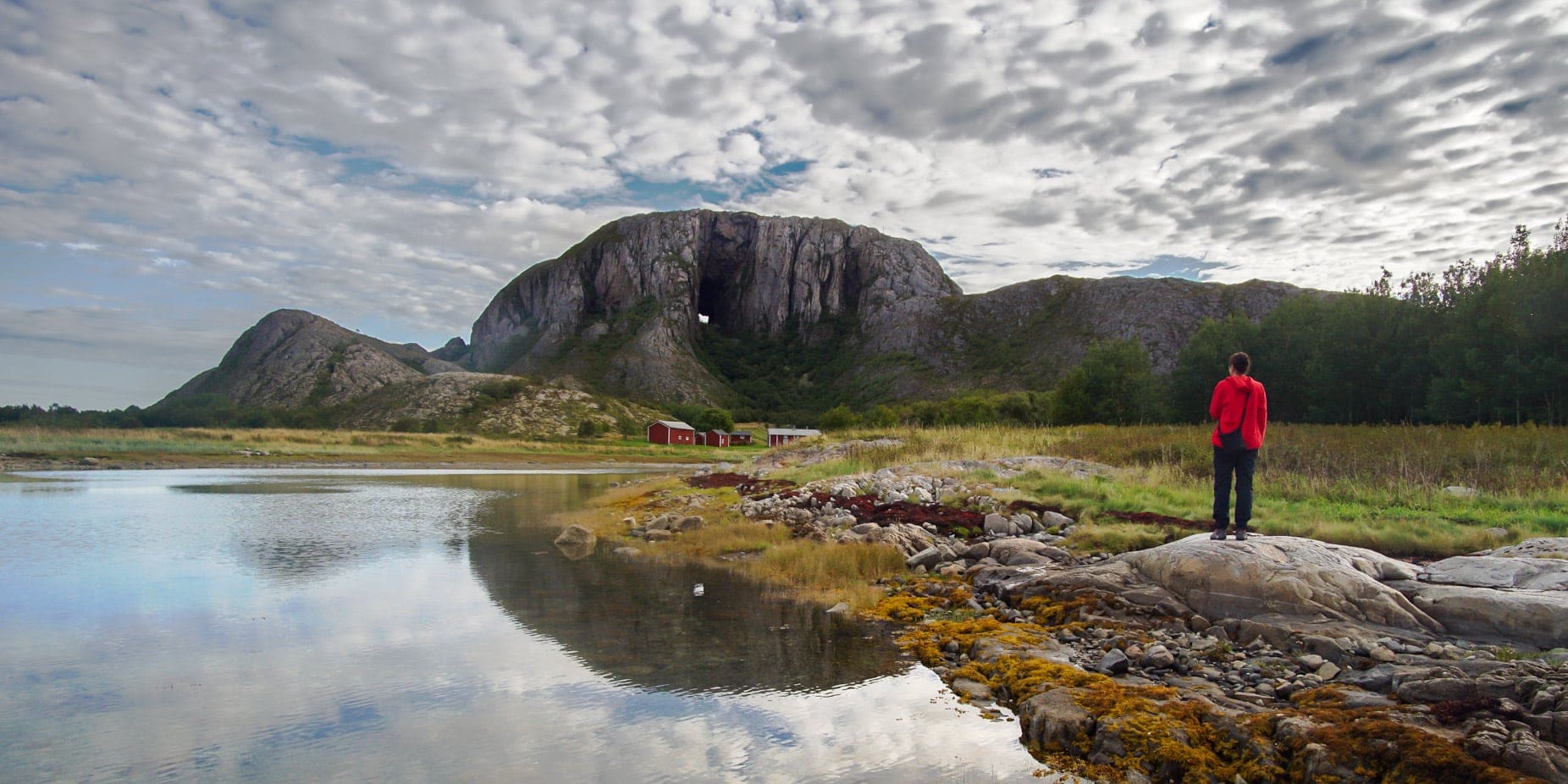
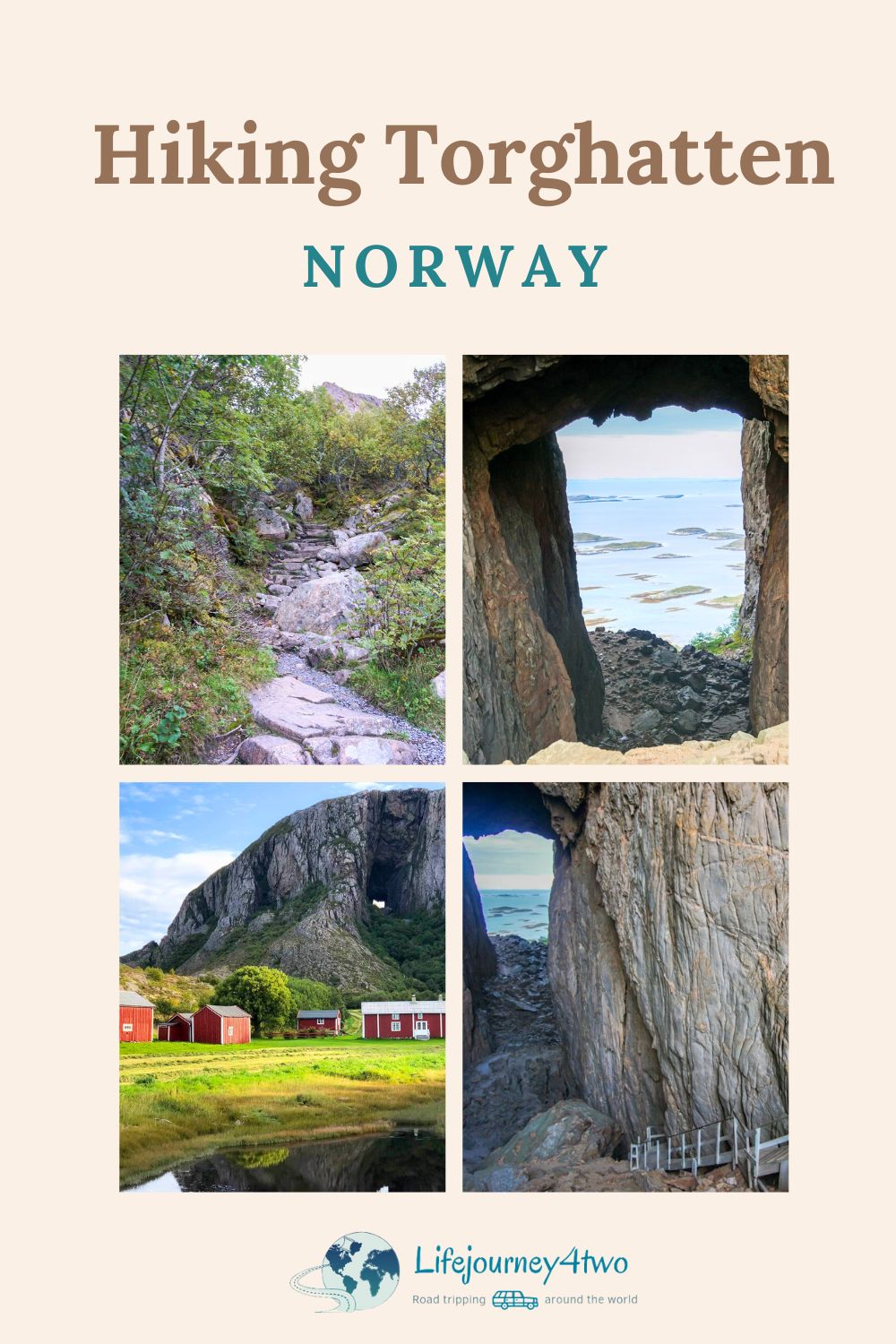
Torghatten, known as Norway’s ‘Hole in the Mountain,’ is more than just a stunning natural wonder; it’s a gateway to a past much older than the Vikings. This Torghatten hike is not your standard trek.
During our Trondheim to Bodo road trip, we took a detour to embark on the Torghatten hike and see this unique geological feature firsthand.
Torghatten is not only visually stunning; it offers a hike through a natural tunnel that is one-of-a-kind in Norway.
Whether you love to hike Norway’s mountains, are interested in mythology, or looking for stunning views, Torghatten has something special for everyone. With its easy accessibility and various paths, it is an easy place to explore and enjoy.
Read on to discover the legend of this extraordinary location while we share all the practical tips you need to visit one of Norway’s most unforgettable natural wonders.
⛰️ Torghatten Hike in a Nutshell
- Difficulty: Easy. A paved pathway leads from the carpark to the cave entrance, where a wooden stairwell descends to the cave floor, where the paved path continues.
- Elevation Gain: 100m from the carpark to the hole entrance, followed by a 250m descent to the coastline.
- Cave Dimensions: 166 m long, 10–28 m wide and 28–75 m high.
- Distance: The trail is a 2.7km loop.
- Trail Head: 50m from the carpark.
- Location: Torget Island, Brønnøy Municipality of Nordland County, west coast of central Norway.
- Reason to Climb: Norway’s unique ‘hole in a mountain’.
- Best Time to Visit: April to October.
- What to Bring: Hiking footwear, water, layered clothing, camera.
- Accommodation: Corner Hotell Bronnoysund
What’s Included in this Post?
Map: Torghatten and Surrounds
How to Use This Map
- To use this interactive map effectively, click the square icon in the upper right corner to expand.
- A key will appear on the left, guiding you through various locations.
- Clicking on any site reveals detailed information about that spot.
- Camping stops are marked with a green circle (🟢).
- Torghatten cave openings are marked with a blue circle (🔵).
- Trailhead is marked with a black circle (⚫️).
- Parking is marked with a red circle (🔴).
- Airport is marked with a yellow circle (🟡).
- The memorial plaque of the plane crash is a brown cross.
The Legend of Torghatten
And so the story goes …
When the troll Hestmannen saw the beautiful maiden Lekamøya, he decided to steal her away at night. Hestmannen mounted his horse and rode in pursuit of the one he wanted, but Lekamøya fled, thwarting his attempt.
All the while, the troll-king of Sømna, her father, watched from afar.
As night turned to morning, the disappointed and rejected Hestmannen determined that no one should have her, notched an arrow to his bow, aimed it at the desperate Lekamøya and let it fly.

However, the troll-king of Sømna flung his hat in the arrow’s path, causing it to be holed, but it was enough to save Lekamøya from certain death. The hat fell to the ground, and at that moment, the sun pierced the horizon, turning everything to stone.
And so, the Torghatten or ‘hole in the mountain’ legend was borne. Literally translated, Torghatten means ‘square hat’.
The Other Story of Torghatten
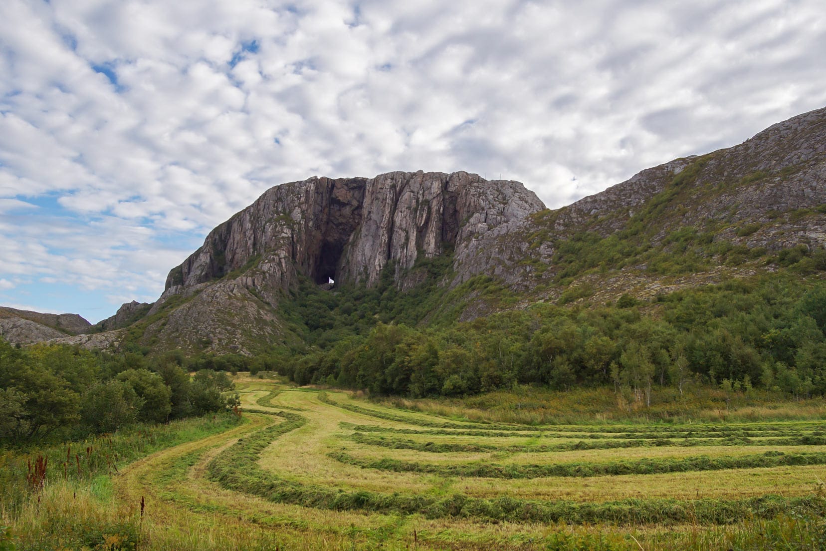
Torghatten, or the ‘hole in the mountain,’ is older than the Vikings themselves—actually, much, much older. We are talking 470 million years ago.
During the Ice Age, the weathering of two sea caves on either side of this granite mountain caused them to finally meet. The hole you see today is immense: 160 metres long (525 ft), 20 metres wide (66 ft), and 35 metres high (115 ft).
Science debunks the myth; however, the Norse trolls’ legend is enthralling.
Nature has been responsible for creating other wonders in Norway that you need to add to your bucket list: Preikestolen, Kjeragbolten and the ethereal Northern Lights.

Planning a Trip to Norway?
- 🚗 Hiring a car? We recommend getting a quote from DiscoverCars
- 🚐 Hiring a campervan? We recommend Motorhome Republic
- ⛑ Arranged your travel insurance? Compare quotes from World Nomads & Safetywing
- 🪪 Order your International Driver’s Licence online here
- 🏩 Booked your accommodation? We use Booking.com to find the best deals
- 🐾 Is someone pet-sitting for you? 🐾 We use and love TrustedHousesitters
- (Get 25% off at checkout for new memberships with our discount code: LIFEJOURNEY25)
Video: Torghatten Hike (Sneak Peek)
Torghatten Hiking Options: Three Distinct Routes
Each route offers its own unique challenges and scenic views, providing options for every level of hiking enthusiast. Whether you’re looking for a quick trek or a demanding adventure, Torghatten has a trail that fits your needs.

Route 1: Hike from Car Park to and through the Hole (Return)
- Difficulty: Easy (Blue): Suitable for hikers with an average fitness level.
- Duration: Approximately 1.5 hours
- Elevation Gain: 100 meters.
Route 2: Hike from Car Park to and through the Hole and Around the Mountain
- Difficulty: Easy (Blue): Suitable for hikers with an average fitness level.
- Duration: About 3.0 hours.
- Elevation Gain: 100 meters.
Route 3: Hike from the Car Park to and through the Hole, Around the Mountain, Climb Torghatten Peak, and Return to the Car Park
- Difficulty: Demanding (Red): Suitable for experienced hikers with a good fitness level.
- Duration: Approximately 5.0 hours.
- Elevation Gain: 350 meters.
Our Hiking Experience at Torghatten
Hike to the Hole in the Mountain: Route 1
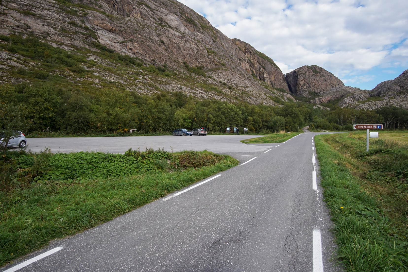
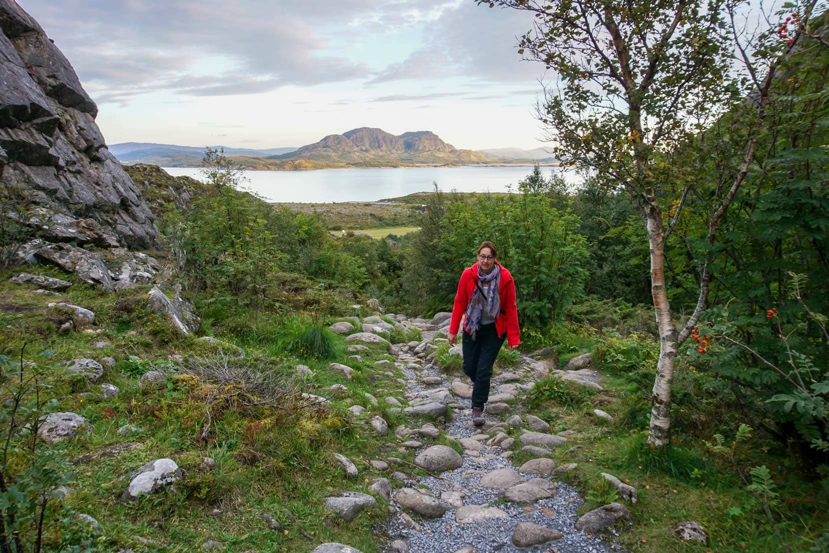
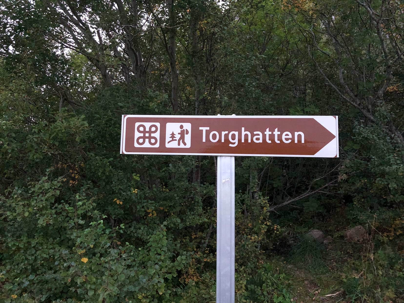
From the expansive carpark, the trailhead is just a 50m walk. Here, you start your Torghatten hike.
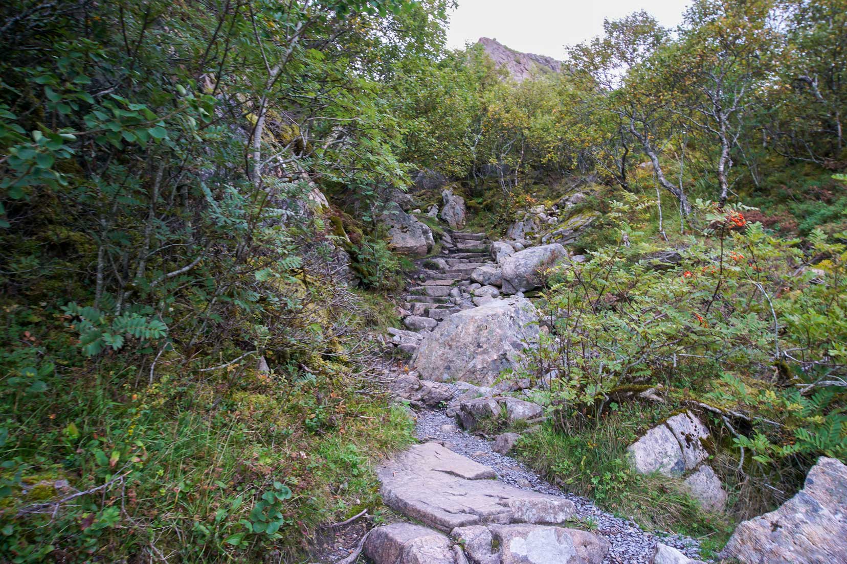
The walk begins by meandering past rocks and bushes, offering a truly picturesque setting. As the trail starts to ascend, rock steps facilitate the climb.
Potholes of Torghatten
On this part of the walk, you can see different layers of pebbles indicating old shorelines that used to exist when the sea level was much higher.

Amongst these pebble shorelines are potholes. These potholes were formed by rivers carrying rock and gravel that, over time, ground out an ever-larger hole due to the swirling effect.
Hole in Torghattan
A last set of rock stairs to climb and you are upon the cave entrance.
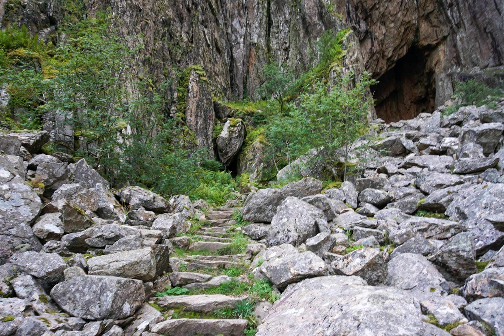
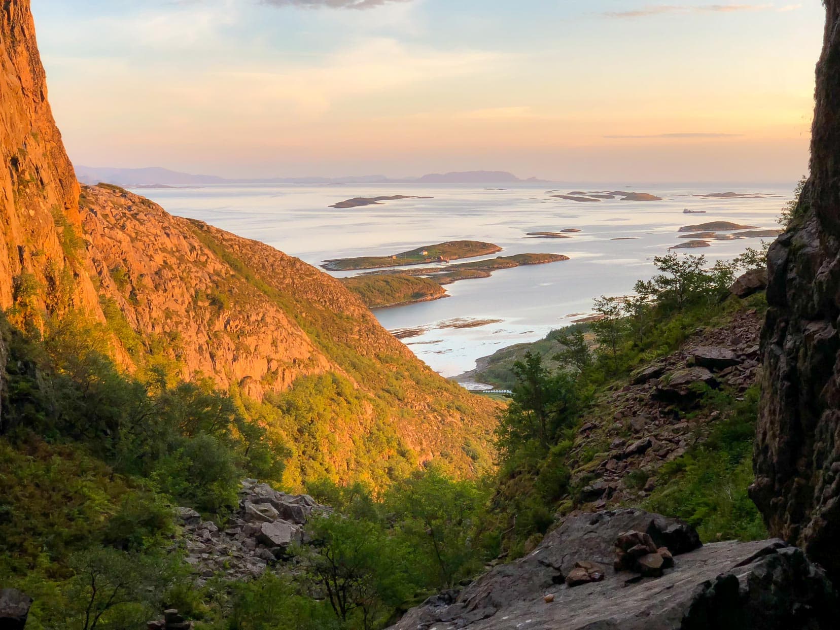
You can clearly see that this opening is sitting higher and is the smaller of the two. From this vantage point, the view extends all the way through the hole to the islands beyond.
Looking down, the 166-metre-long cave, with big rocks jumbled and piled up on the cave floor, was akin to a giant’s playground. It was cavernous, with cave widths of 10 to 28m and a 28 to 75m high ceiling.
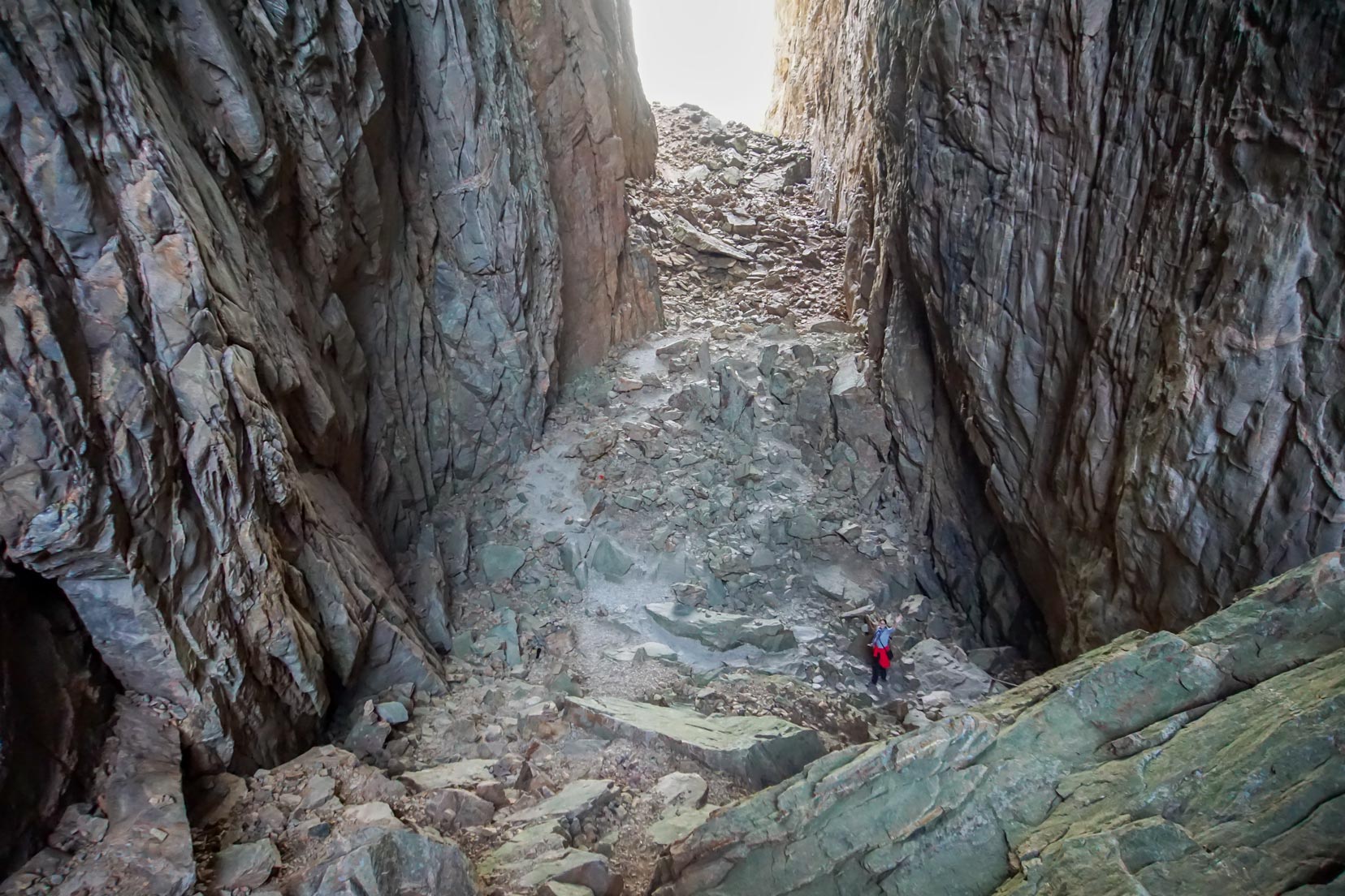
Clambering down to the cave floor is unnecessary, as a well-placed solid wooden stairwell has been built against the cavern wall. We estimate that there are about 120 steps from top to bottom.

At the lowest step on the platform, a natural stone path offers a safe route through the rocks that litter the cave floor. This is the lowest section of the cave.
The cavern floor rises quite steeply from here to the second (western end) cave opening.

Before you depart the cave, I’ll mention that Torghatten is quite the mecca for geocaches. There are a few to be found, and we added our name to quite a few.
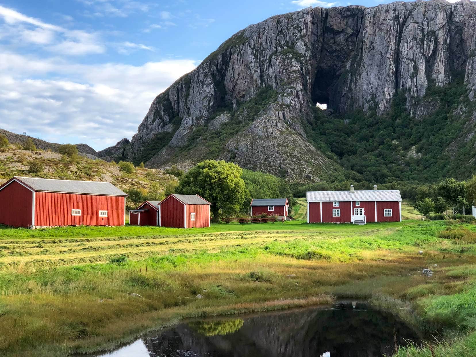
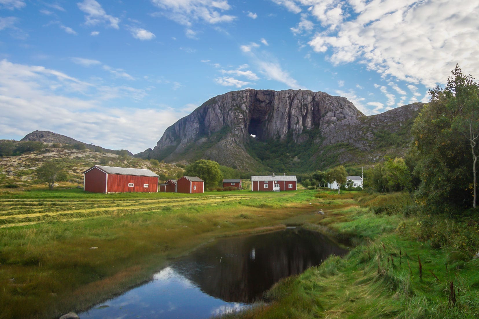
Gazing out the western side of Torghatten’s hole in the mountain reveals a beautiful postcard landscape. The isolated red farmhouses stand amid the green summer fields, with hundreds of small islands dotting nature’s canvas.

Signatures of Kings
After our visit to Torghatten, I discovered something fascinating: King Oscar’s signature from his 1873 visit is still visible on the southwest wall at the western end of the hole. Additionally, on the left side of the north entrance, you’ll find the signatures of King Olav V and King Harald V, both from their 1963 visits.
This is the turnaround point if you choose to complete Route 1. Backtrack back to the carpark.

Hiking Around Torghatten Mountain: Route 2
Following the path down the hill towards the sea is highly recommended for the views back to Torghatten. On this descent, you have great views of the hole in the mountain.
Passing the red farmhouses, leave the gravel path and walk parallel to a stream on a trail that winds through a small grove. After roughly 10 minutes, you reach the open shoreline.

It’s here, in my opinion, that you’ll find the best views of Torghatten. You can see right through the hole in the mountain.
If you’re short on ideas then these road trip photography ideas then here are some that will get you going.

Hike to the Car Park Plus Optional Hike to Torghatten Peak: Route 3
Returning to the path, it is all flat ground, so easygoing. If you’ve already found the geocaches, then there’s plenty of fun on this return walk.

Hike to Torghatten Peak
Partway along this return walk is a red arrow sign indicating the direction of the hike up to Torghatten Peak, rated as a demanding climb. The ascent of 1.6km to the mountain has a couple of steep ridges along the way, but handrails are in place to assist with the climb.
The views at the top of the surrounding landscape are said to be fantastic. Unfortunately, we didn’t complete this climb.
Returning to the sign, it’s a short walk to the carpark.

Torghatten Plane Crash of 1988
On the evening of May 6, 1988, enveloped in low fog, a Widerøe flight tragically struck the western mountainside of Torghatten. The accident claimed the lives of all 36 individuals onboard.
This crash marked Norway’s most severe aviation disaster in 16 years. A memorial plaque now rests on Torghatten’s western mountainside, offering a place for silence, contemplation, and the laying of flowers.
Travel Guide: How To Get to Torghatten
Embarking on your journey to Torghatten starts with choosing the best mode of transport that fits your travel style and budget. Here’s how you can reach Norway’s iconic ‘Hole in the Mountain’ whether by air, land, or sea.
Fly/Drive Combo
Brønnøysund boasts a regional airport connecting to major Norwegian cities such as Oslo, Trondheim, Bodø, and Bergen.
Car rental services are readily available at the airport for those looking to explore further.
🚘 If you are looking to hire a car then we recommend DiscoverCars.
- They are winners of the World’s Best Car Rental Booking Website
- They have a Price Match Guarantee.
- 4.5 Rating on Trustpilot
- Free Cancellation
Driving With Your Car
Driving on the main route E6, the turnoff to Brønnøysund/Torghatten is 7.5 km south of Strendene or 27 km north of Majavatn.
It’s a further 97 km drive to Brønnøysund and another 15 km to Torghatten.
Ferry
Norway’s coastal ferry service operates 11 vessels—seven by Hurtigruten and four by Havila Shipping.
This service makes stops at 34 ports along the coast from Bergen to Kirkenes, with Brønnøysund being one of the key stops. The hole in the mountain can be seen during the entry into Brønnøysund.

Top Tips for Hiking in Norway
- Appropriate Footwear: Always wear sturdy, waterproof hiking boots.
- Suitable Clothing: Opt for wind and waterproof layers, as the weather in the Norwegian mountains can change swiftly. Be prepared for all conditions.
- Hydration: Carry enough water to prevent dehydration throughout your hike.
- Nutrition: Pack sufficient snacks and food to maintain your energy levels.
- Emergency Numbers: Save these Norwegian emergency numbers:
- Fire: #110
- Police: #112
- Ambulance: #113
- Physical Preparedness: Ensure you are physically fit for the hike’s difficulty level.
- Safety Communication: If hiking alone, inform someone of your route and expected return time.
- Weather App: Download the free ‘Yr’ app for up-to-date weather information.
- Offline Maps: Use the free ‘Maps.me’ app for navigation without needing mobile data.
- Know Your Limits: There’s no shame in returning if the hike becomes too challenging.
Trail Difficulty Levels: Hiking in Norway
Norway categorizes its hiking trails based on difficulty levels to help hikers select routes that suit their experience and fitness levels:
- Easy (Green): Suitable for novice hikers; no previous experience required.
- Medium (Blue): For intermediate hikers with some experience; it requires an average fitness level.
- Demanding (Red): Designed for experienced hikers with a high fitness level, essential gear includes good hiking boots and basic navigation skills with a map and compass.
- Expert (Black): Intended for very experienced hikers undertaking longer, more technical routes; requires a high fitness level and is well-prepared with hiking boots, navigation skills, and essential hiking gear.
Where to Stay Near Torghatten
Finding the perfect place to stay near Torghatten enhances your visit, whether you prefer the comfort of a hotel or the adventure of camping on a road trip adventure. Here are our top picks for both options:
Hotel Accommodation
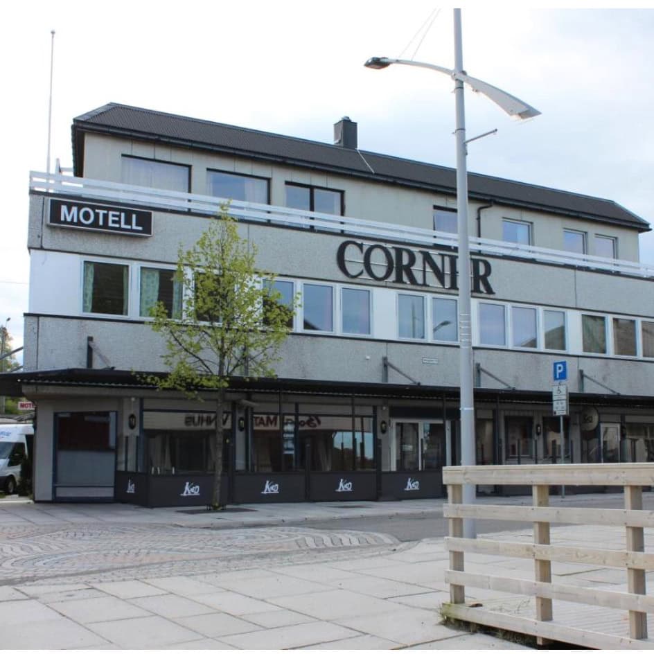
For ease, we overnighted in Brønnøysund at the Corner Hotell. It was a fantastic stay, value for money and can highly recommend the fabulous breakfast and free wifi.
Camping Near Torghatten
For those looking to camp near Torghatten, we’ve mapped out the three closest campgrounds to ensure you have convenient options:
- Mosheim Camping Anna Jensen: Located at Mosheim 43, 8908 Brønnøysund, Norway. For reservations or inquiries, call +47 75 02 20 12.
- Skogmo Family Camping: Situated at Skomo 64, 8908 Brønnøysund, Norway. Contact them at +47 90 95 75 21.
- Kjellsand Camping: Found in Kjellsand, 8908 Brønnøysund, Norway. This site offers a quintessential camping experience and is open only from 01 to 31 July.
These sites provide excellent facilities and are perfectly positioned for exploring Torghatten and the surrounding area.
Frequently Asked Questions
What is the meaning of Torghatten?
Torghatten means square hat. When you see the Torghatten <ountain from a distance, you can make out the brim and crown of a hat.
How do you get to Torghatten?
There are many different options. Drive to Torghatten if you already have a car, fly/drive combo by flying to Brønnøysund, then hire a car or by a ferry that visits many destinations on Norway’s coastline.
Where to Next in Norway?
If going north, you may be on your way to see the sights of the beautiful Lofoten Islands, which will not disappoint. It has a magic all its own.
Should you travel south, a Trondheim to Bergen road trip offers much to see and plenty of things to do in Stavanger. Either of these cities makes a great base to venture forth on other great hikes in Norway.
Torghatten Hike … That’s a Wrap
There’s no doubt that seeing and walking through mighty Torghatten, the ‘hole in the mountain,’ was a wonderful and unique experience in Norway. It is a wonderful subject to photograph.
The hike is easily and quickly accessed from the carpark and can be thoroughly enjoyed as it does not require great fitness levels. With its different hiking routes, this ensures that everyone is kept happy.
While Norway is renowned for its fjords, waterfalls, and quaint towns, Torghatten stands alone. It needs to be on everyone’s tourist radar.
We highly recommend adding a visit to Torghatten to any Northern Norway itinerary.
Have you cast your eyes on Torghatten? Are there any rivals to Torghatten?
Planning Your Travels?
These are the travel resources we recommend and use when planning our trips.
- 🚘 Car Hire: We use DiscoverCars.com
- Motorhome/Campervan Rental: We highly recommend the Motorhome Republic
- 🪪 Order your International Driver’s Licence online here
- 🛏 Book Accommodation: We use Booking.com to find accommodation that suits our budget
- 🐶 Pet Sitting/Pet Sitters: Check Out TrustedHousesitters here (Use our Discount code: LIFEJOURNEY25 for 25% off. )
- Activities and Experiences: Get Your Guide and Viator
- Travel Insurance: Safetywing or World Nomads
- 🥾 Travel Gear and Accessories: Check out our top picks here — Lifejourney4two page on Amazon
For a more thorough list, visit our Travel Resources page here.