
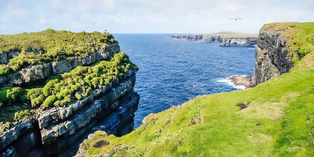
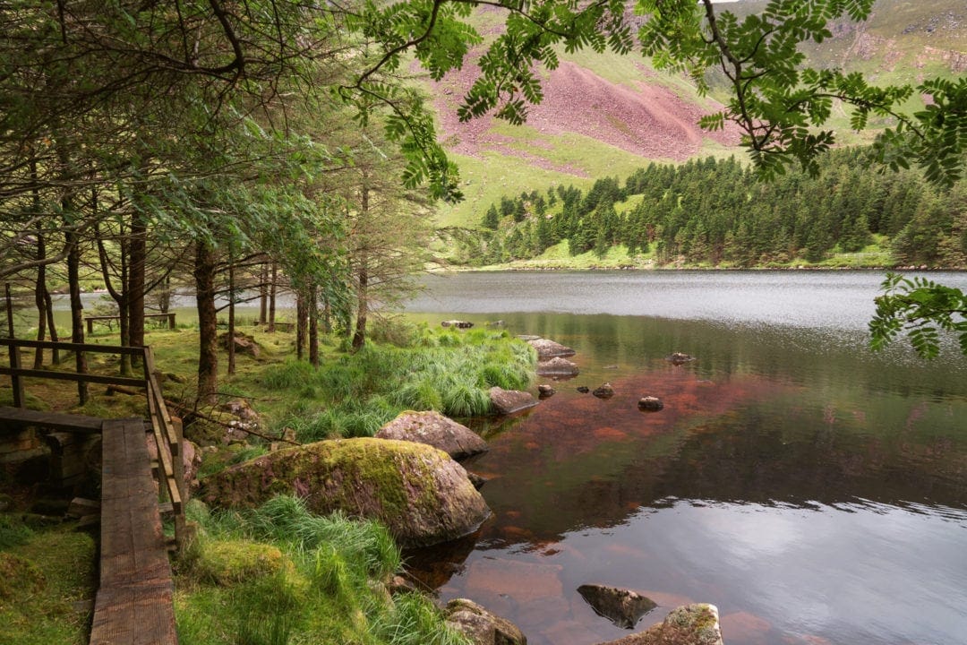
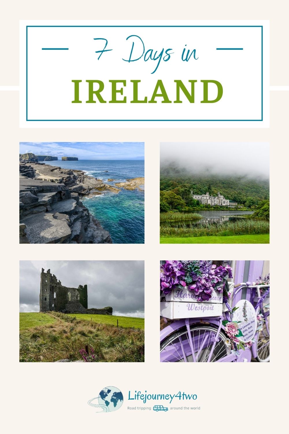
Our 7-day Ireland road trip itinerary from Dublin was an exploration of what makes this country truly special.
Arriving in Dublin, we were greeted by green hills and soft rain—scenes reminiscent of my youth growing up in the south of England but with a distinctly Irish twist.
For Lars, hailing from Australia with its sun-drenched landscapes, the transition to Ireland’s lush greenery, narrow winding lanes, and the lure of a perfect pint of Guinness marked a series of delightful firsts.
To streamline your road trip planning, we’ve organized our destinations into clear themes, allowing you to tailor your trip to your interests.
We share our seven-day road trip itinerary, a mix of popular spots and hidden gems that showcase the best of Ireland.
Follow in our footsteps or blaze your own trail—either way, our insights aim to show that visiting Ireland goes beyond just checking off a destination. It explores its enchanting landscapes, rich history, and vibrant culture.
🚗 Suggested 7-Day Ireland Road Trip Itinerary From Dublin
Ready to explore Ireland but not sure where to start?
Here’s our 7-day road trip itinerary, which will take you through some of the Emerald Isle’s most breathtaking landscapes, rich history, and vibrant culture.
Whether you follow this plan or use it as inspiration to create your own, we’ve got you covered for an unforgettable Irish adventure.
Use the links to jump to any of the places covered, or just keep browsing.
Day 1: Dublin to Rock of Cashel – 166 km (2 hours)
- Explore Dublin: Kick off your trip in Ireland’s lively capital.
- Rock of Cashel: Marvel at this stunning ensemble of medieval architecture set against the Irish landscape.
- Stay in Cashel: 🛌 Cashel Modern Apartment| ⭐️ 9.9/10 | Exceptional Reviews | check availability
Day 2: Rock of Cashel to Portmagee via the Ring of Kerry – 277 km (3hr 50)
- Kenmare: Visit this delightful town known for its historical graveyard.
- Ring of Kerry: Experience the iconic scenic drive with its beautiful beaches and views.
- Valentia Island & Bray Head: Enjoy breathtaking views.
- Portmagee: Your gateway to the mystical Skellig Islands.
- Stay in Portmagee: Seagull Cottage B&B | ⭐️ 9.3/10 | Superb Reviews | check availability here
Day 3: Portmagee to Dingle – 160 km (3 hours)
- Finish the Ring of Kerry: Finish the scenic drive.
- Historic Forts: Explore Leacanabuile and Cahergal Ringed Forts and Ballycarbery Castle.
- Slea Head Drive: Explore Coumeenoole Bay and Dunmore Head.
- Stay in Dingle: The Old Irish Farmhouse | ⭐️ 9.2/10 | Superb Reviews | check availabilty
Day 4: Dingle to Kilkee via Conor Pass Road – 150 km (3.5 hours)
- Conor Pass: Drive through dramatic landscapes.
- Lough Adoon: A hidden gem worth visiting.
- Glanteenassig Forest Park: Enjoy the tranquillity of nature.
- Loop Head Peninsula: Visit its Lighthouse and scenic cliffs.
- Stay in Kilkee: Blue Tit Lodge B&B | ⭐️ 9.2/10 | Superb Reviews | check availibility (We gave this place 10/10)
Day 5: Kilkee to Galway via Cliffs of Moher – 210 km (3 hours 40)
- Kilkee Cliff Walk: Start your day with stunning views.
- Cliffs of Moher: Visit this iconic natural wonder.
- The Burren: Explore the unique lunar landscape.
- Stay in Galway: Country Haven | ⭐️ 9.8/10 | Exceptional Reviews | check availability here
Day 6: Galway to Clifden – 78 km (1 hour 10)
- Explore Galway: Experience the city’s vibrant atmosphere.
- Clifden Sky Road Loop: Offers unparalleled scenic views.
- Stay in Clifden: Ben View Guesthouse B&B | ⭐️ 9.5 /10 | Exceptional Reviews | check availability
Day 7: Clifden to Westport – 97 km (2 hours)
- Kylemore Abbey: Don’t miss this historic and spiritual site.
- Croagh Patrick: Enjoy the views and the spiritual journey.
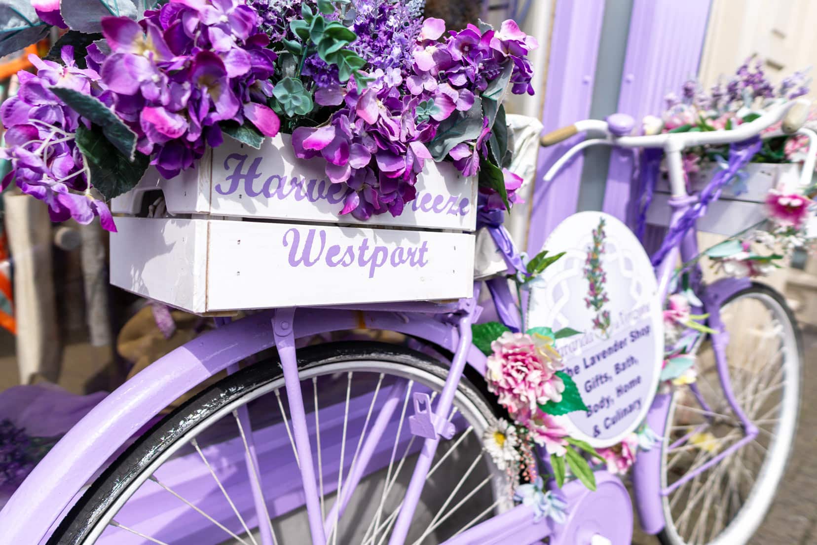
- Westport: Relax in this lovely town.
- Stay in Westport: Westport Heights B&B | ⭐️ 9/10 | Superb reviews| check availability here
On Your Way Back to Dublin:
- Visit Sean’s Bar in Athlone, Ireland’s oldest pub, for a fitting end to your Irish road trip adventure.
This plan combines Ireland’s best, from its rich history and natural beauty to its modern culture.
Feel free to tweak it to suit your interests and pace, ensuring your Irish adventure is everything you’ve dreamed of and more.
Planning your own Irish road trip adventure? Start here with our comprehensive guide on planning a road trip for a seamless experience.
7-Day Ireland Road Trip Overview
Here’s our detailed 7-day Ireland Itinerary route from Dublin to give you a rough idea of the suggested loop.
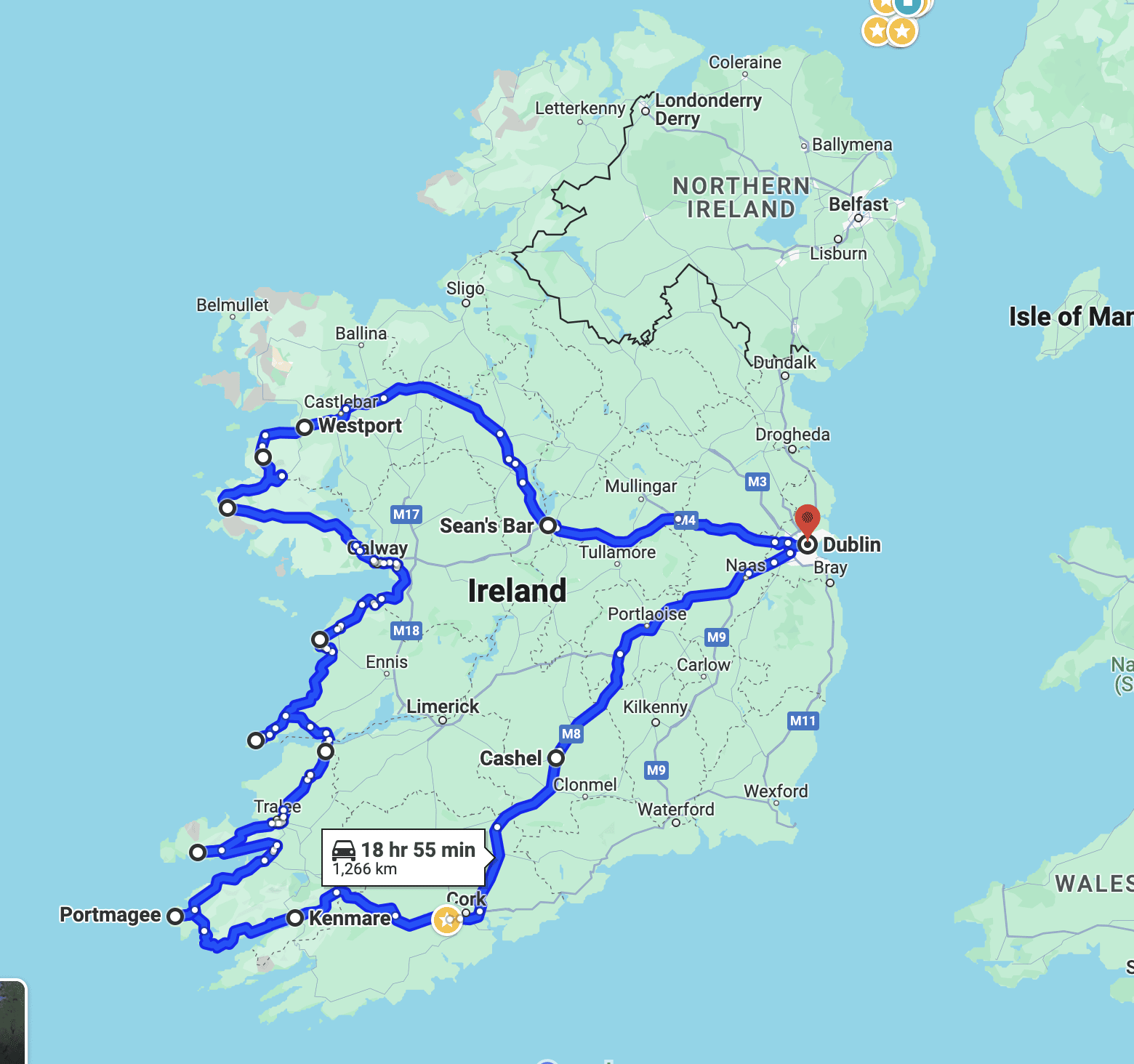
Map Showing The Stops and Highlights of Our Week in Ireland
This map pinpoints all our stops and highlights, making it easier to follow the scenic paths and plan your daily explorations.
This visual aid will help you plot your route and ensure you don’t miss any of Ireland’s stunning landscapes and historic sites.
Map of Attractions in Ireland By Category
This interactive map includes Ireland’s attractions sorted by category with easy-to-follow colour coding.
Unlike our road trip map, this one helps you find places based on what you love—be it historical sites, nature spots, or cultural highlights.
It’s straightforward: each category has its own colour, making your planning process smoother. Every pin is a gateway to discovery from the wild Ring of Kerry to the historic Rock of Cashel.
This map is perfect for tailoring your adventure to your interests, ensuring you hit all your must-sees in one go.
Planning a Trip to Ireland?
- 🚗 Hiring a car? We recommend getting a quote from DiscoverCars
- 🚐 Hiring a campervan? We recommend Motorhome Republic
- ⛑ Arranged your travel insurance? Compare quotes from World Nomads & Safetywing
- 🪪 Order your International Driver’s Licence online here
- 🏩 Booked your accommodation? We use Booking.com to find the best deals
- 🐾 Is someone pet-sitting for you? 🐾 We use and love TrustedHousesitters
- (Get 25% off at checkout for new memberships with our discount code: LIFEJOURNEY25)
Take a Quick Look: Ireland in 2.5 Minutes
Check out our short video to glimpse Ireland’s diverse beauty and what the country offers.
From the rugged coastlines of the Wild Atlantic Way to the lively streets of Galway, get a feel for Ireland’s vibrant character and scenic sights.
Verdant landscapes, historical landmarks, and cultural vibrancy await you around every corner.
Keep reading as we guide you through Ireland’s sites and share stories that bring the places to life.
🍀 Quick Guide to Our Itinerary Destinations
It’s not just the scenic landscapes that make Ireland special; the rich tapestry of history, the welcoming people, and those unforgettable moments make it truly unique.
Here’s a brief overview of the best spots, from historic castles to wild coastlines—a dream for any photographer. Capturing Ireland’s beauty through the lens is a big part of the adventure. Explore our road trip photography tips to bring home stunning visual memories
By the end, we hope Ireland will be added to your travel list if it isn’t already.
Let’s get straight into all the places listed on the above itinerary that may take your fancy.
Historical Sites & Cultural Treasures
Ireland’s history is rich and complex; each site offers a glimpse into its past. From the majestic Rock of Cashel to Sean’s Bar, the oldest pub in Ireland, these places are keystones of Irish heritage
- Rock of Cashel: A breathtaking collection of medieval structures against the Irish skyline.
- Kenmare: A charming town rich in history.
- Leacanabuile and Cahergal Ringed Forts: Examples of ancient stone fortifications.
- Ballycarbery Castle: Evocative ruins filled with history.
- Kylemore Abbey: A marvel of Victorian architecture and Benedictine perseverance.
- Sean’s Bar: A pub steeped in history, offering more than just a pint.
- Galway: A city that perfectly blends traditional roots with modern vibrancy
- Westport: Noted for its lively, picturesque streets as much as its accolades
- Clifden: Celebrated for its traditional Irish music and scenic landscapes.
Wildlife & Nature Spots
Nature lovers and photographers, here’s what you can’t miss:
- Ring of Kerry: Iconic drive showcasing Ireland’s stunning landscapes.
- Loop Head Peninsula and Kilkee Cliff Walk: Known for its lighthouse views and bird watching.
- Cliffs of Moher: Breathtaking views and a birdwatcher’s paradise.
Scenic Gems
Ireland’s beauty goes beyond the green hills:
- Conor Pass: Drive through wild and rugged landscapes.
- Lough Adoon: Peaceful lake surrounded by natural beauty.
- Glanteenassig Forest Park: A tranquil retreat within a lush forest.
- Slea Head Drive: Stunning Atlantic views and rich history.
- The Burren: Explore the unique lunar-like karst landscape.
- Croagh Patrick: Combine spiritual history with scenic hikes.
As we set off on our Irish adventure, we were reminded of the power of road trips to create lasting memories, much like those captured in our inspirational road trip quotes.
A Useful Planning Tool for Your Ireland Road Trip
Grab this FREE road trip Travel planner to help you make planning your Ireland road trip the best they can be.
Exploring Ireland: Our Itinerary from Dublin
Our seven-day Irish Road Trip began in Dublin but quickly took us through the heart of Ireland to the west coast, from breathtaking landscapes and rugged coastlines to lively cultural scenes. We’re excited to share the places that made our trip unforgettable.
Are you drawn to postcard-perfect views, charming towns, the lively buzz of an Irish pub, or off-the-beaten-path discoveries?
Then, come along with us as we capture Ireland in all its glory. See our recommended travel photography gear for your travels.
Day 1: Dublin to Rock of Cashel – 166 km (2 hours)
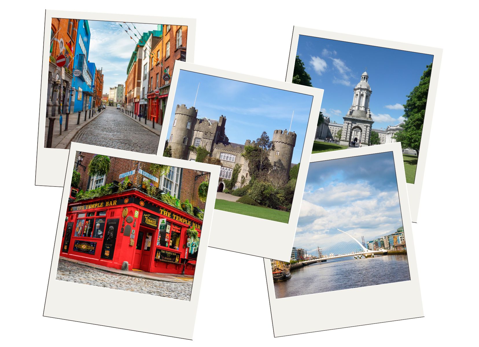
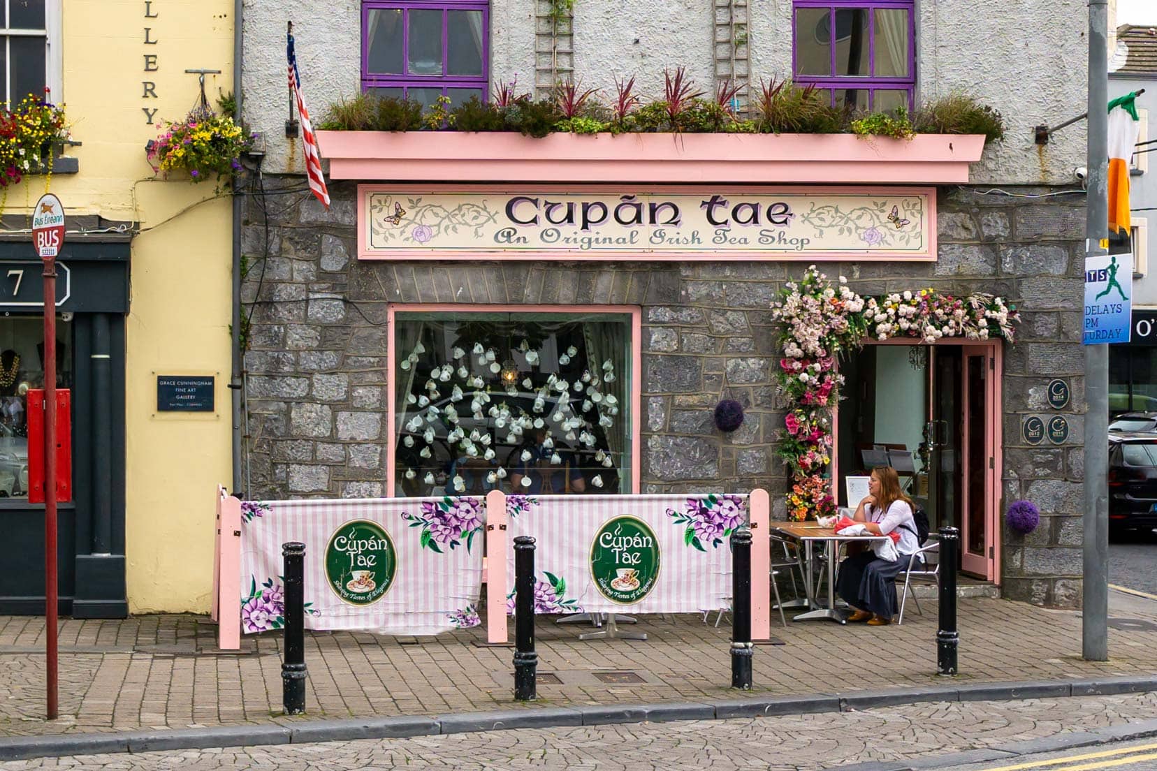
1. Explore Dublin: Ireland’s Captivating Capital
Begin your Irish journey in Dublin, a city brimming with history, culture, and a bustling modern vibe. Dublin is not just Ireland’s political and cultural heart but also a testament to its enduring charm and resilience. In fact, the European Commission has named it the European Smart Tourism Capital for 2024.
From the historic streets of Temple Bar to the serenity of St Stephen’s Green, Dublin offers a unique blend of traditional Irish culture and contemporary charm. Explore iconic landmarks such as Trinity College, where the Book of Kells is housed, and the storied Dublin Castle, among others.
As you walk through the city, the rich literary history and welcoming pubs provide a deep sense of place, with every street corner offering a new story. Dublin is a city that truly captures the essence of Ireland’s historical grandeur alongside its contemporary pulse.
Visitor Tips for Exploring Dublin
- Best Time to Visit: Spring and early autumn offer pleasant weather and thinner crowds.
- Transport: Dublin is best explored on foot, but public transport is excellent for reaching outlying attractions.
- City Views: Climb to the top of the Guinness Storehouse for panoramic city views and a pint.
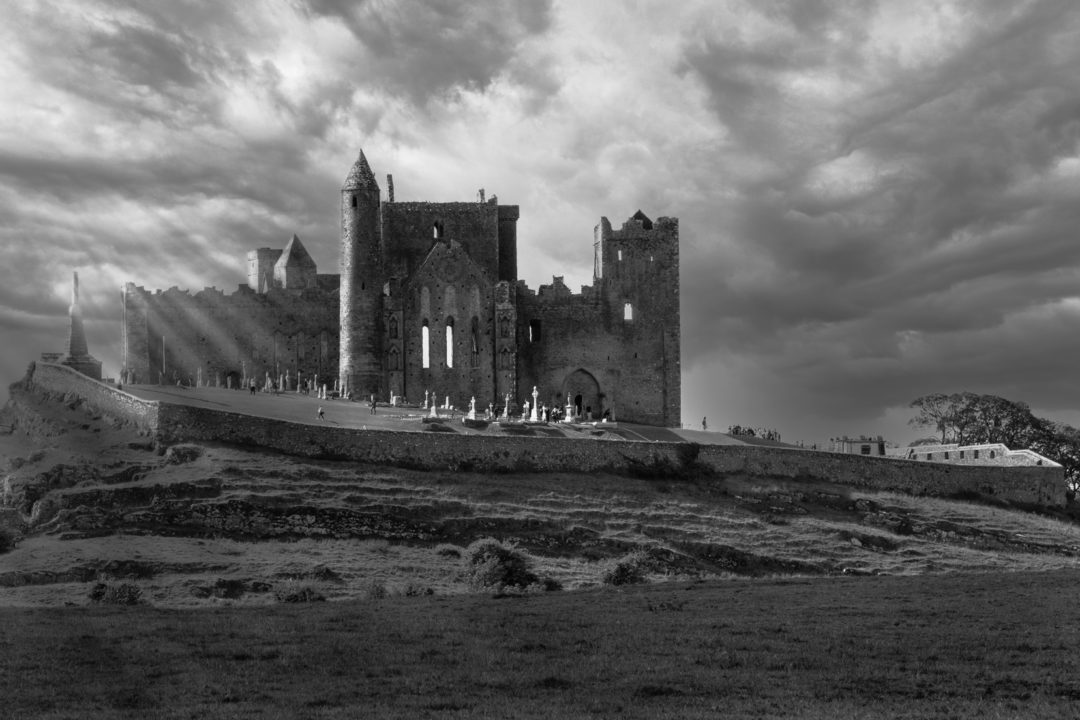
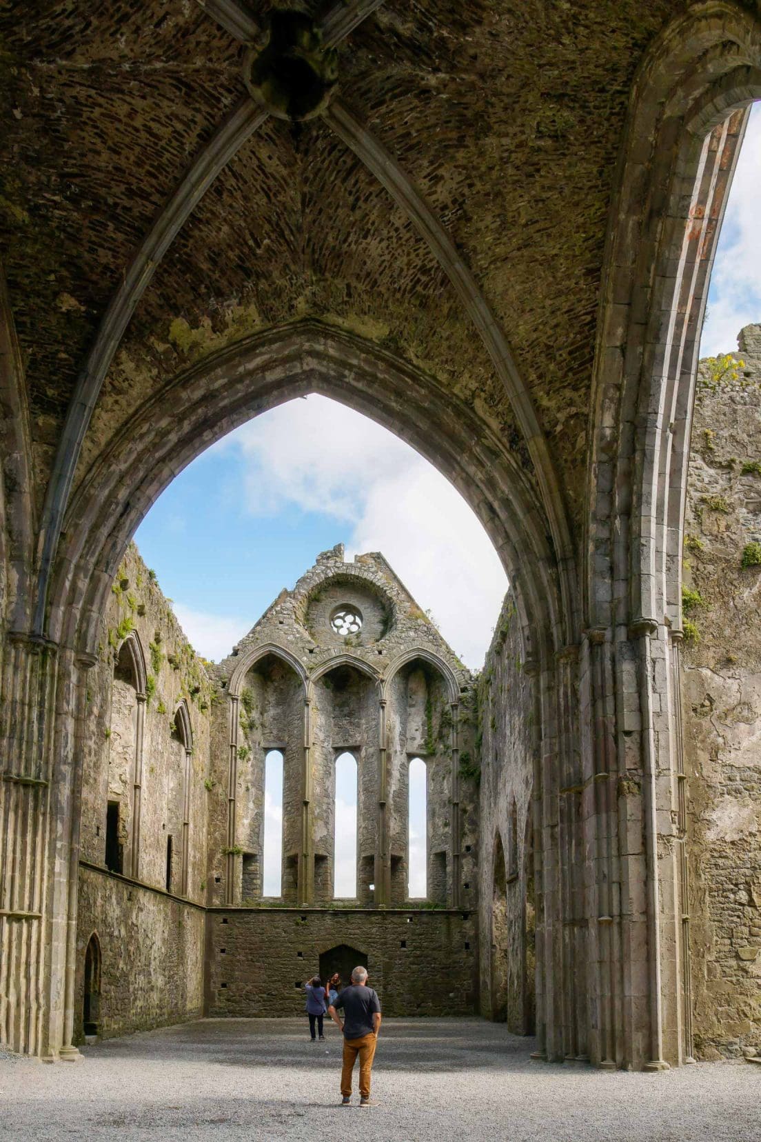
2. The Rock of Cashel: A Gateway to Ireland’s Past
The Rock of Cashel is a perfect starting point after the hustle and bustle of Dublin. It is a testament to Ireland’s rich history and natural beauty.
The Rock of Cashel, or Carraig Phádraig in Gaelic, isn’t only a tourist attraction but a crucial piece of Irish heritage.
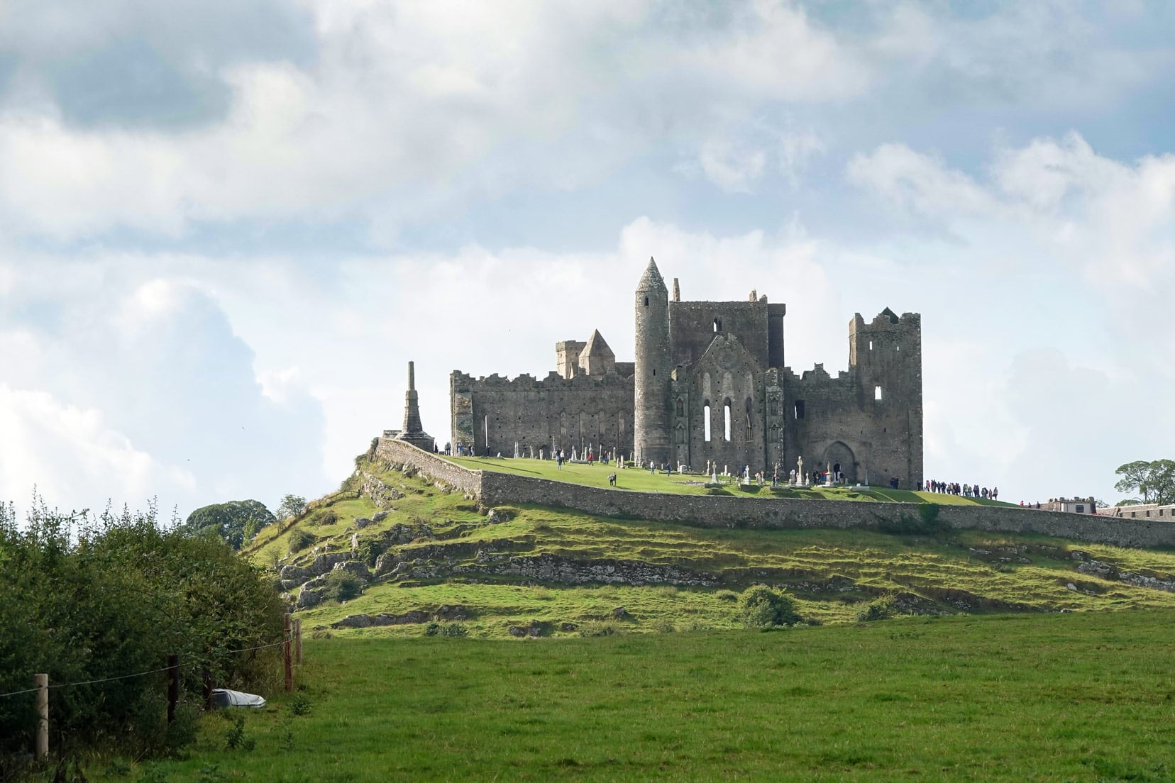
Perched on a limestone hill, this group of medieval buildings offers great countryside views and illustrates Ireland’s blend of history and nature.
Various spots on the drive into Cashel offer perfect views for photos and appreciation of the cathedral ruins.
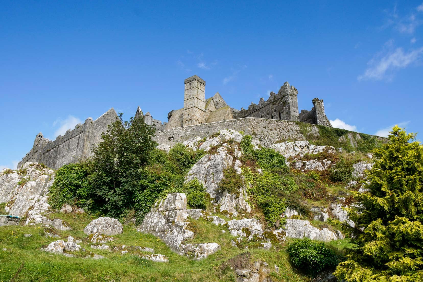
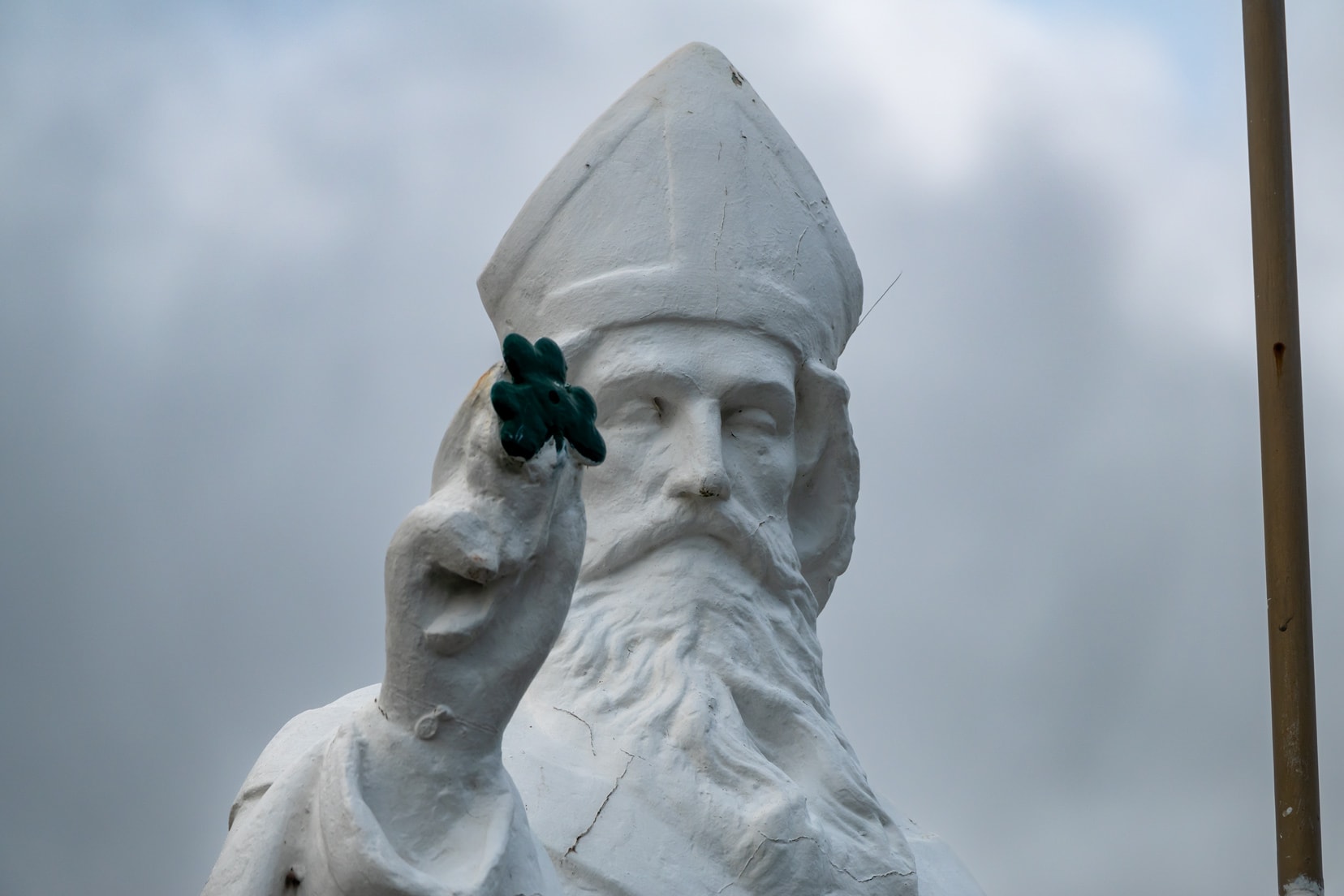
Clear signage and parking lead you to this historic site, where you can learn about its past, including St. Patrick’s conversion of King Aenghus to Christianity.
We wandered around for about an hour here.
So, what makes the Rock of Cashel a must-visit? It encapsulates Ireland’s appeal: tangible history, endless views, and a portal to another era.
It’s these types of experiences that make a trip to Ireland truly worthwhile.
Visitor Tips for The Rock of Cashel
- Best Time to Visit: Aim for early morning or late afternoon to avoid crowds and enjoy the best light.
- Photo Ops: The roads to Cashel offer great views of the Rock.
- Walking Shoes: Opt for comfortable shoes suitable for exploring uneven ground.
- Parking Info: There’s paid parking near the entrance, with town signage directing you.
- Tickets and Tours: Open almost daily, entry fees apply (€8/adult in 2024). For Cormac’s Chapel tours, purchase tickets on-site due to limited space. More details here.
- Take Your Time: An hour is generally sufficient, but those deeply interested in history or photography may wish to stay longer.

🛌 Stay in Cashel
O’Briens Family run Lodge | ⭐️ 9.5/10 | Exceptional Reviews | check availability
Day 2: Rock of Cashel to Portmagee via the Ring of Kerry – 277 km (3hr 50)
Kenmare
Venturing through the scenic Caha Pass, we arrived in Kenmare, a place instantly made memorable by Molly Gallivan’s extraordinary story. In County Kerry, the landscapes and the stories behind them enrich every visit.

Molly Gallivan’s Cottage and Traditional Farm tells the tale of a 19th-century widow who brewed illicit poitín and ran an illegal pub to support her family.
Today, her homestead is a living museum celebrating her entrepreneurial spirit and traditional Irish life.
You can explore a cottage, farm, and visitor centre offering crafts and stories, along with Molly’s Old Tea Shop, which is open daily from mid–March to mid–November.
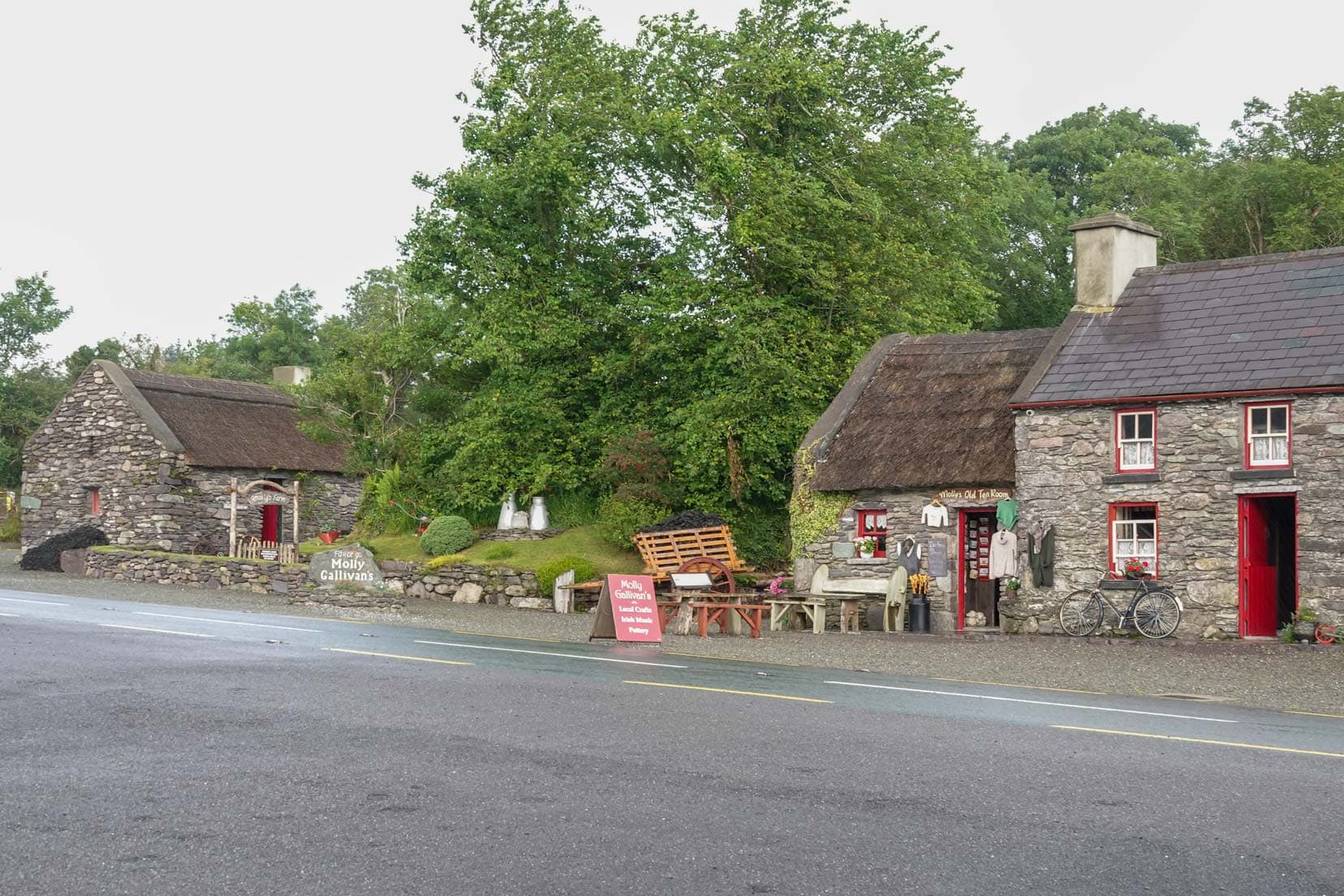
A short distance from Molly Gallivan’s, Kenmare is hailed as the “Jewel on the Ring of Kerry.”
The Kenmare Old Cemetery offers a poignant glimpse into the town’s history, with graves dating back to the Great Potato Famine.

Nearby, St. Finnian’s Holy Well, believed to have healing properties, provides a peaceful retreat.

Kenmare Bay, close to St. Finnian’s, offers serene views and a chance to spot seals lounging around the bay.

Visitor Tips for Kenmare & Molly Gallivan’s
- Explore on Foot: Kenmare’s small size is perfect for walking, showcasing its vibrant atmosphere.
- Molly Gallivan’s Experience: Open from mid-March to mid-November.
- Kenmare’s Culinary Scene: Try the local cuisine at Kenmare’s acclaimed restaurants.
- Market Day in Kenmare: Wednesdays feature local produce and crafts.
Explore the Ring of Kerry
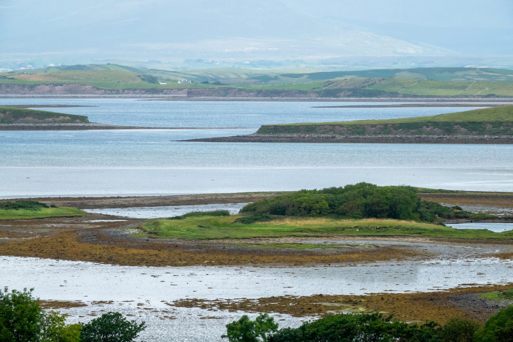
Navigating 189 kilometres of Ireland’s awe-inspiring landscapes, the Ring of Kerry unfurled before us.
Driving the Ring of Kerry
It doesn’t matter which direction you drive the Ring of Kerry, though tour buses must follow an anti-clockwise direction.
We chose clockwise to suit our itinerary best and to avoid potential delays from tour buses, a strategy that worked well during our late August visit.
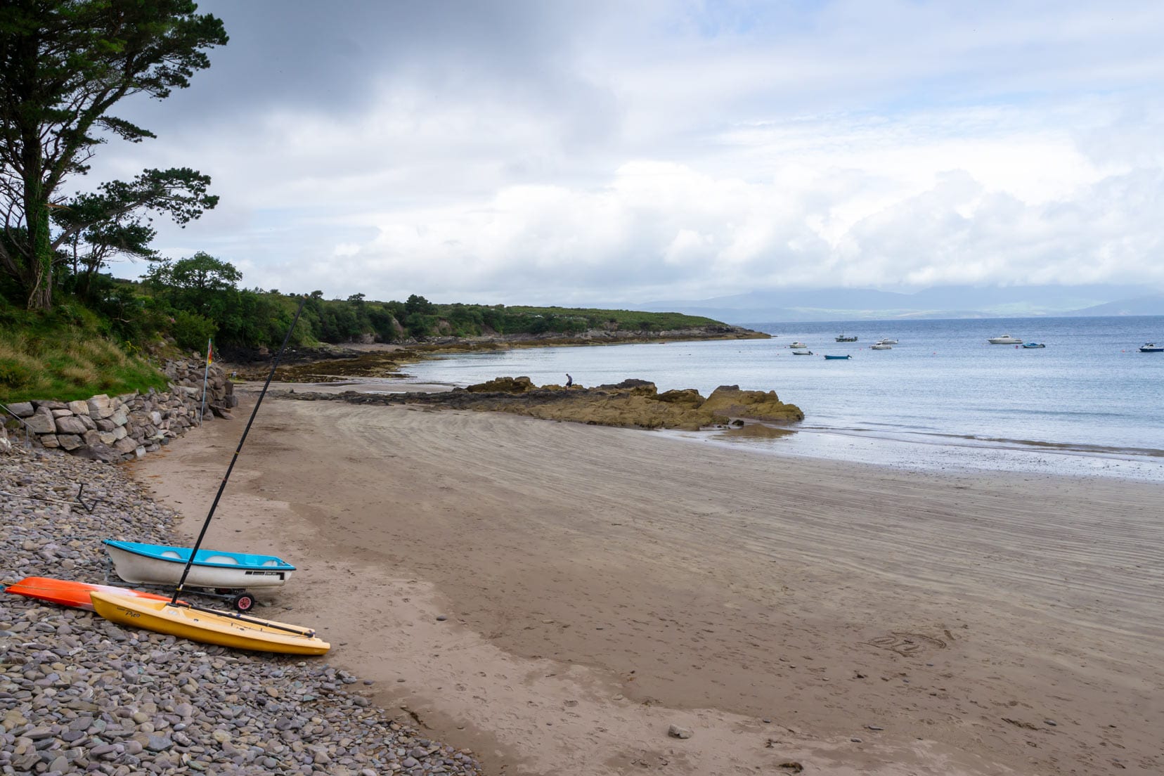
Derrynane Beach
Derrynane Beach offered a memorable stop with its sweeping views, even as the sea mist gave our photos a dreamy quality.
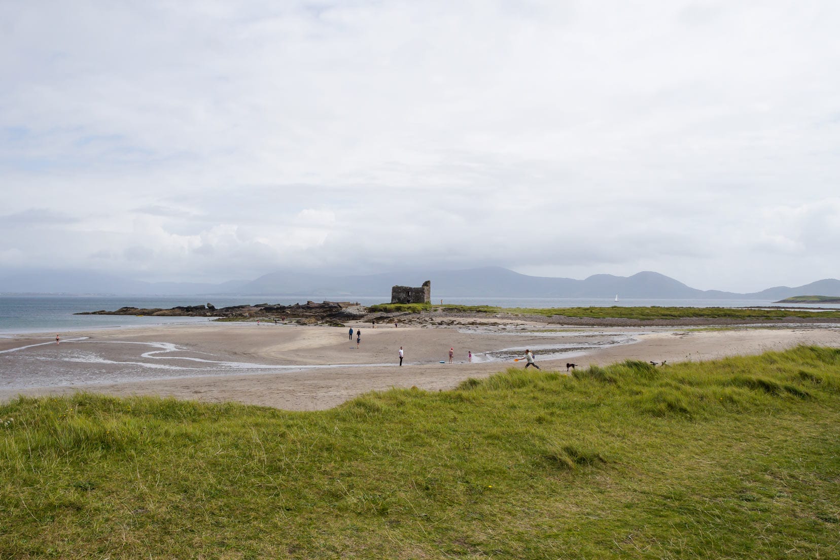
Ballingskelligs Beach and Castle
Next on our journey, Ballingskelligs Beach greeted us with its soft sands and the historic silhouette of its 16th-century castle.

The castle, paired with the beach, created a picturesque scene, highlighting the unique charm of Ireland’s coast.
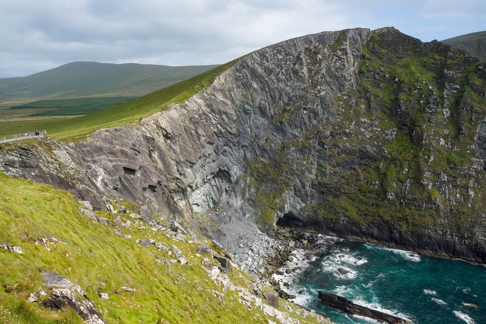
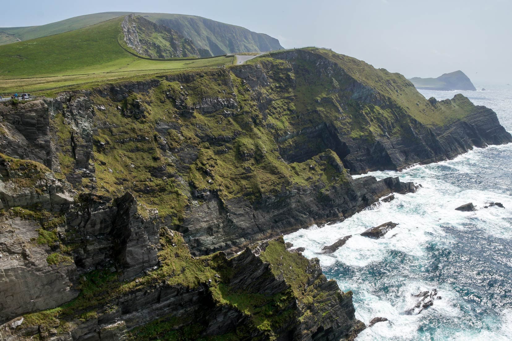
Kerry Cliffs
Driving north for about 30 minutes brought us to Kerry Cliffs, Kerry’s highest cliffs. On a clear day, they offer rugged views over Skellig Rocks and Puffin Island.
The entrance fee is a small price for the awe-inspiring sights from these towering cliffs.

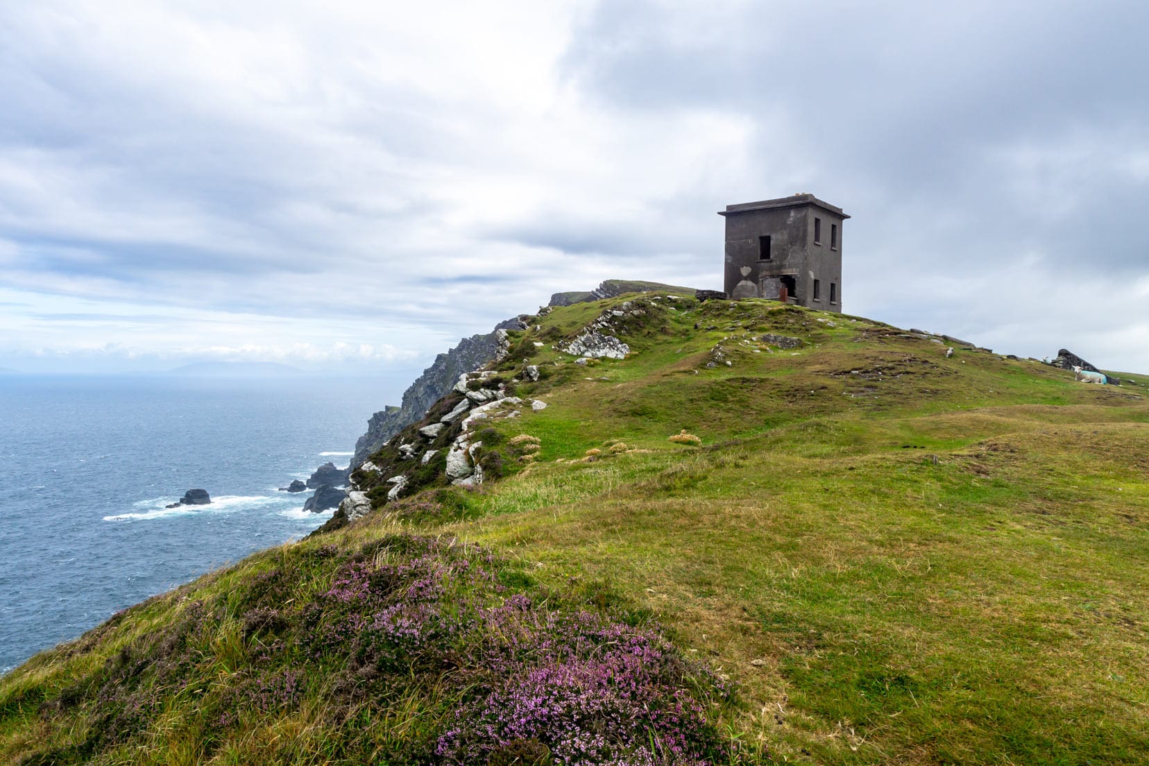
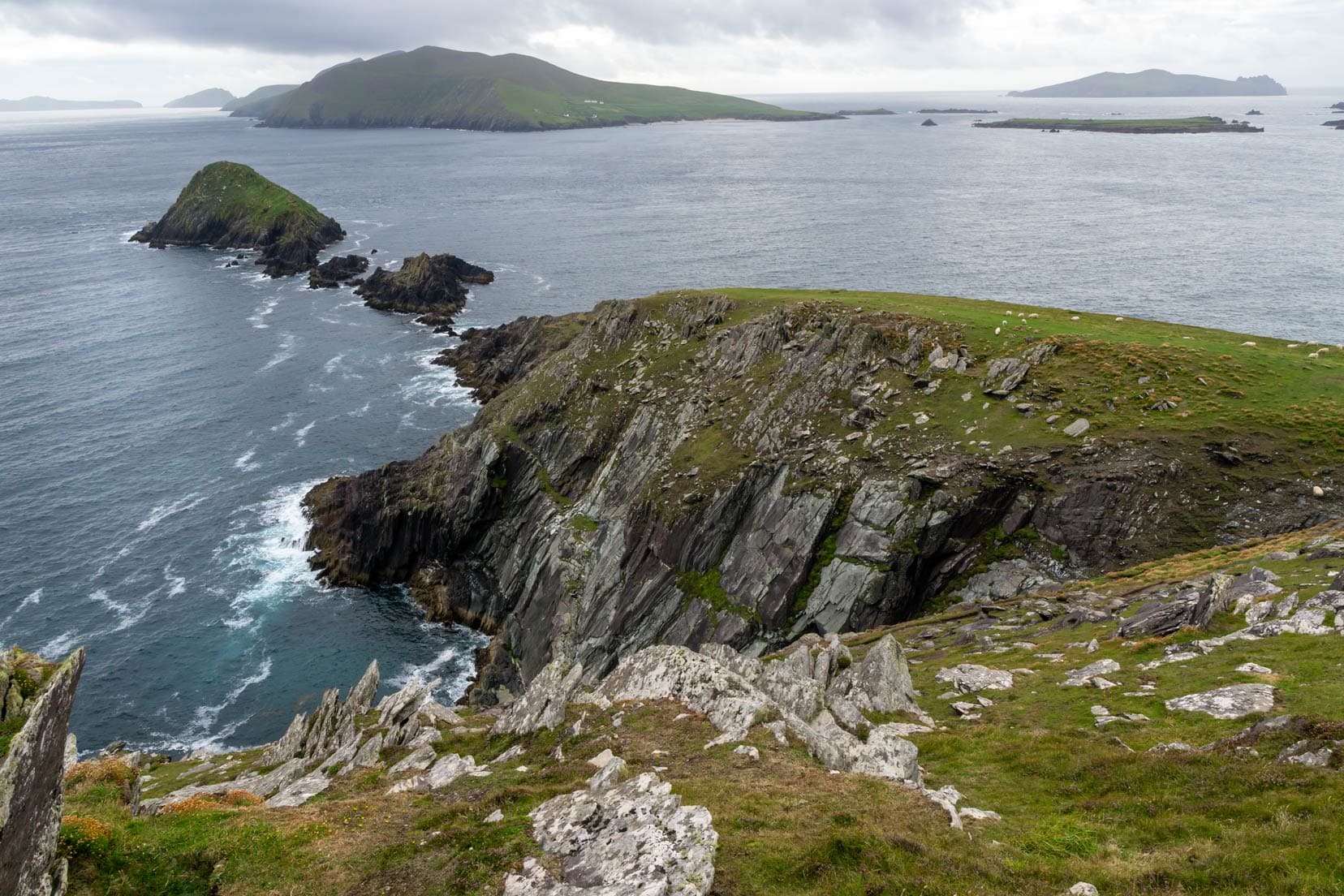
Bray Head, Valentia Island
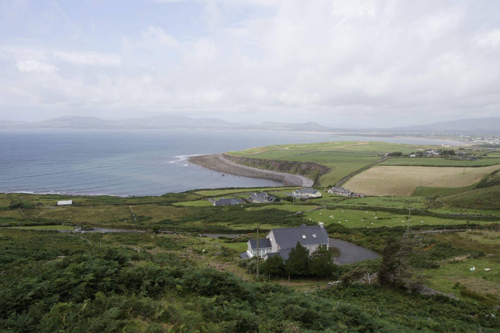
While staying overnight in Portmagee, Valentia Island beckoned us for a hike up Bray Head.
The effort was rewarded with views of the Skellig islands and a close-up of the ruins of Bray Head Signal Tower, a remnant from the Napoleonic era.
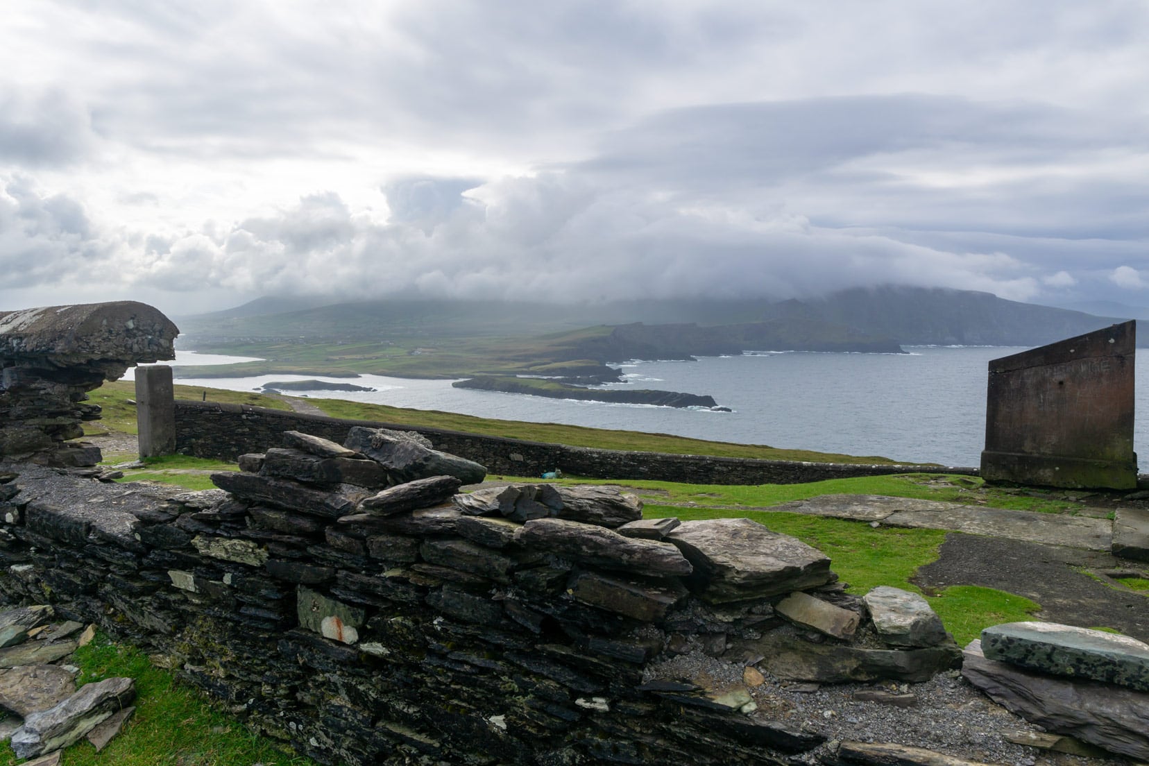
Just off the coast and easily seen from Bray Head is Skellig Michael, a UNESCO World Heritage site famed for its 6th-century monastic settlement and unique beehive huts.
Skellig Michael, a haven for diverse bird colonies, including puffins, terns, and gulls, offers a glimpse into a world where history and natural beauty converge.

To learn more, consider joining the Ultimate Skellig Coast Tour. This three-hour adventure is perfect for anyone over 10.
The journey promises a deep dive into the rich tapestry of ancient history and natural wonders along the Skellig Islands.
🐧 Skellig Michael : The Ultimate Skellig Coast Cruise Tour | ⭐️ 5/5 Star Reviews | ⏳ 3 hours | 👉 check availability here
Stay in Portmagee
Seagull Cottage B&B | ⭐️ 9.3/10 | Superb Reviews | check availability here
Day 3: Portmagee to Dingle – 160 km (3 hours)
Killarney National Park
Killarney, a renowned highlight on the Ring of Kerry, beckons travellers with its myriad attractions, even though it wasn’t a stop on our route.
Known for the expansive Killarney National Park, the historical allure of Muckross House, and the serene Lakes of Killarney, the town stands as a sanctuary for those passionate about nature and history.
Venturing into Killarney and immersing yourself in its diverse treasures could enrich your Irish journey with memorable experiences.
Visitor Tips for the Ring of Kerry
- Driving Direction: While the route can be driven in any direction, driving clockwise might help you avoid the larger tour buses, making for a more leisurely trip.
- Best Time to Visit: To enjoy the Ring without the crowds, consider visiting during spring or autumn shoulder seasons.
- Stops Along the Way: Don’t rush. The beauty of the Ring of Kerry is in its diversity. Derrynane Beach, Ballingskelligs Beach and Castle, and the Kerry Cliffs are great stops.
- Photography: Bring your camera and be ready for frequent stops. The landscapes are picturesque, and you’ll want to capture the panoramic views and historical sites.
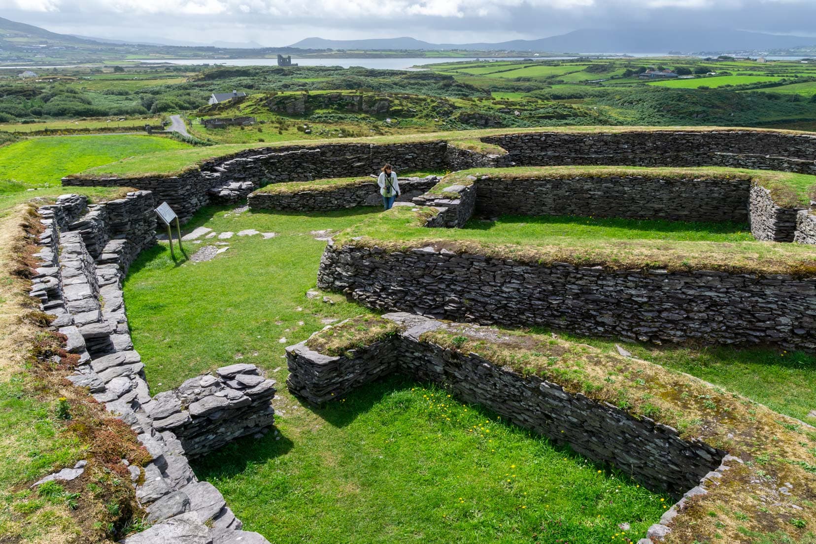
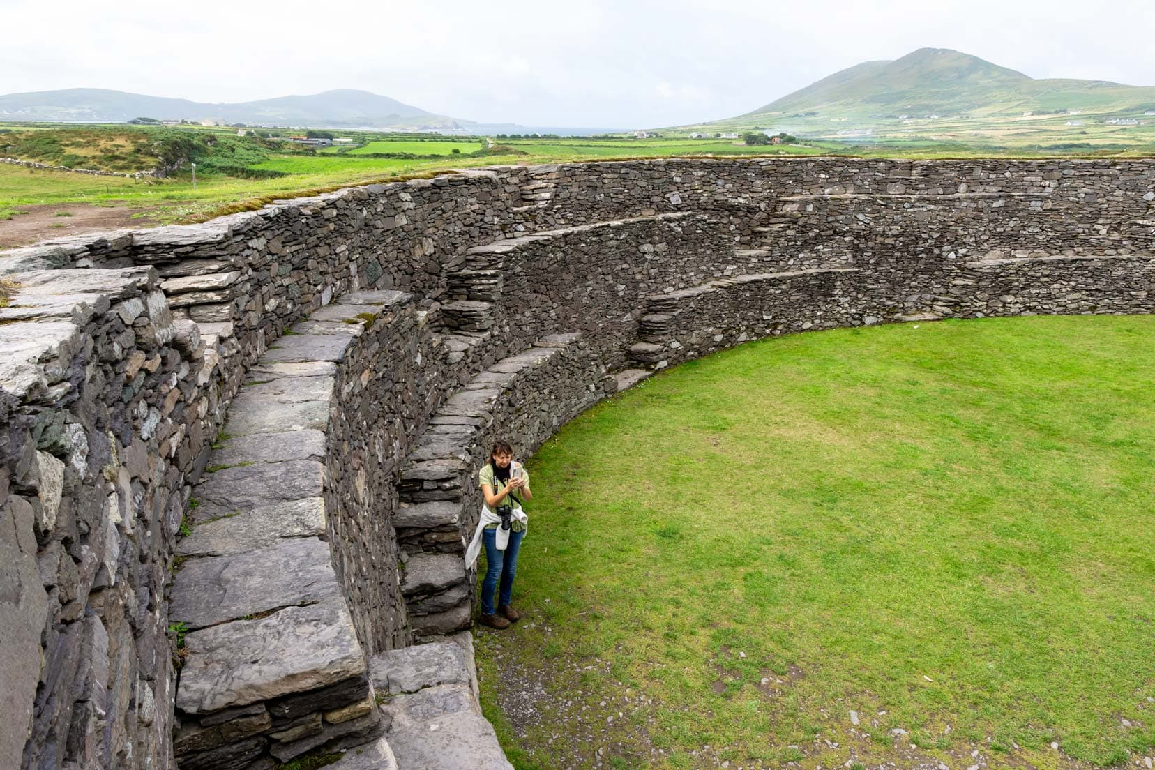
Leacanabuile and Cahergal Ringed Forts
Leacanabuile and Cahergal, ancient ringed forts close to Cahersiveen, serve as windows into Ireland’s 9th-century history.
These forts gave us insights into early Irish settlers’ communal and defensive strategies.

Leacanabuile stands out with its clochán-style buildings, indicative of community living, while Cahergal impresses with robust stone walls.
I love walking around old settlements like these, and I wonder who else has touched the very stone I can touch today.
Visitor Tips for Leacanabuile and Cahergal Ringed Forts
- Accessibility: Free entry and a short walk from the main road to both forts, with available parking.
- Best Time for Visits: Visit early or late afternoon for optimal photography lighting and fewer crowds.
- Photography: These forts, set against Ireland’s green landscapes, offer fantastic photo opportunities.
- Guides and Information: Information boards provide historical context, enhancing self-guided tours.
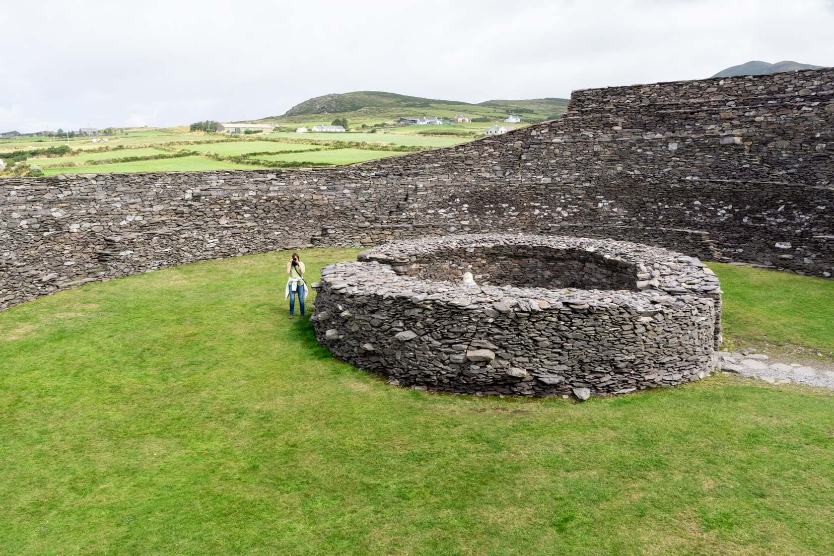
Exploring these forts offers a tangible connection to Ireland’s early days, highlighting their significance in your Irish travel itinerary.
Ballycarbery Castle
After wandering around the ringed forts, we caught sight of the 15th-century Ballycarbery Castle ruins.
From afar, its haunting beauty loomed large against Kerry’s lush landscape backdrop. This crumbling castle once served as a stronghold for the McCarthy clan.

Regrettably, a “no entry” sign at the fence curbed our curiosity, limiting us to the castle’s outskirts.
Yet, this didn’t dampen our spirits; the castle’s exterior alone made for an incredible photo opportunity, capturing the essence of Ireland’s medieval past.
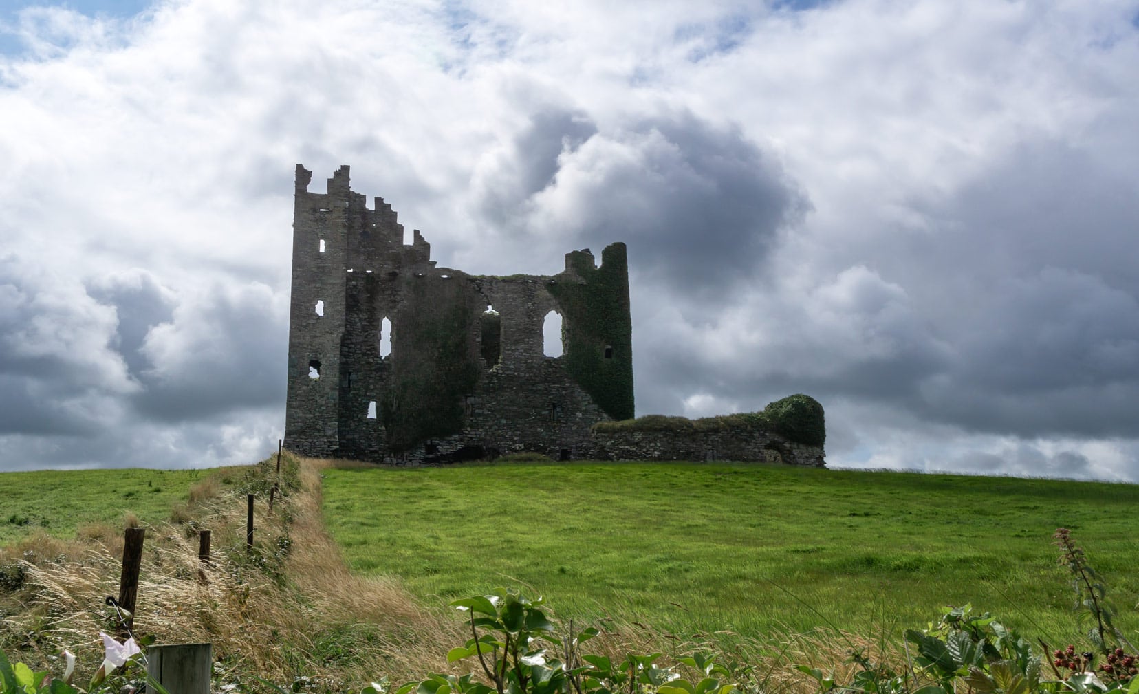
Visitor Tips for Ballycarbery Castle
- Best Viewing Points: For the best photographs, we found that the path leading up from the road on the castle’s northwest side offers an excellent vantage point.
- Photography Advice: Visit early in the morning or late in the afternoon to capture the castle in the best light. The shadows and light can add a dramatic effect to your shots.
- Exploring Nearby: Just a short drive away, visit Leacanabuile and Cahergal Ringed Forts to enrich your journey through Ireland’s past.
- Parking Tips: There’s a small parking area close to the castle.
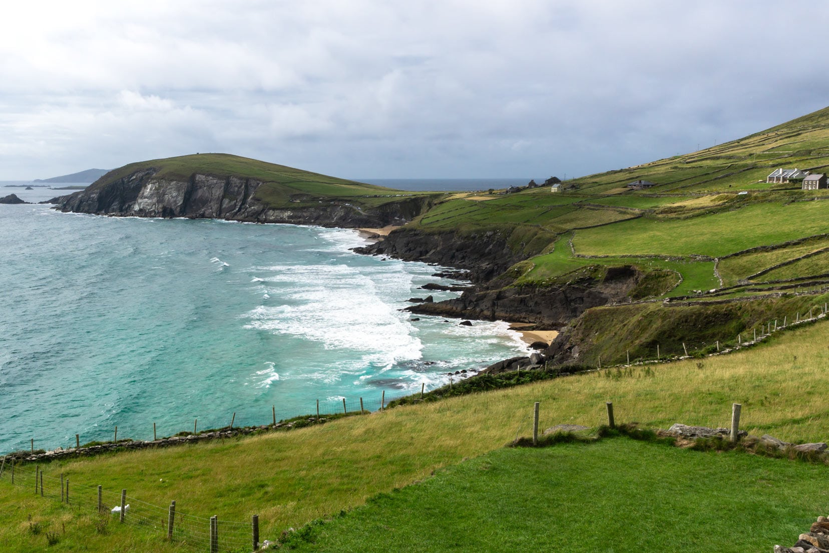
Slea Head Drive, Dingle Peninsula: A Journey Through Time
The Slea Head Drive on the Dingle Peninsula took us on a captivating loop from Dingle to Feohanagh. Stretching over 41 kilometres, this scenic route revealed more of the untamed beauty of Ireland’s landscapes.
The remains of stone cottages along the way shared tales of a bygone era and invited us to pause and reflect on their history.
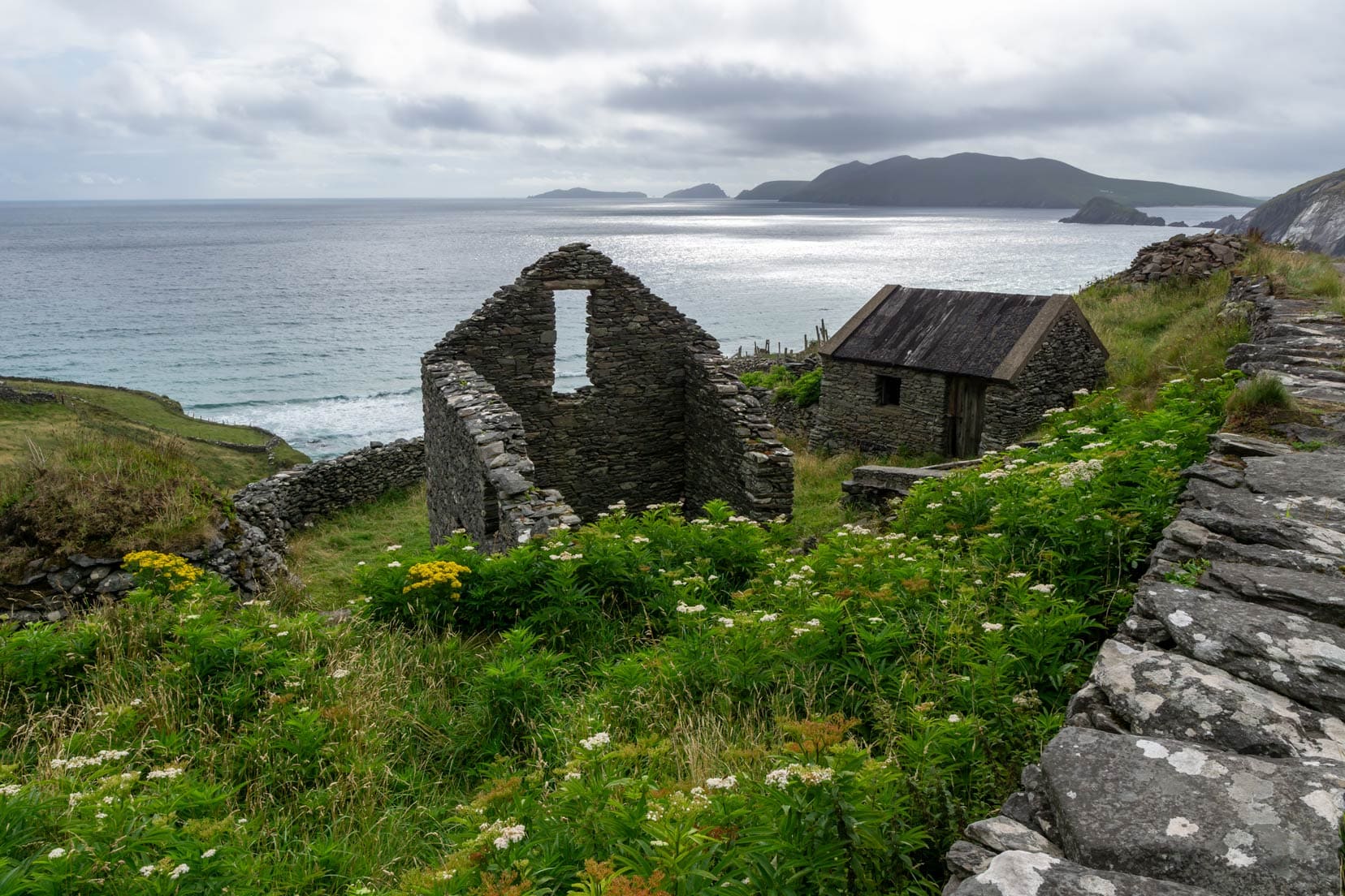
If finding a spot to capture the views seems tricky, don’t worry. A designated lookout point, further along, offers views of Coumeenoole Bay.
When you reach the Bay, it’s time to stretch those legs with a one-kilometre hike up a steep hill, rewarding you with panoramic views across the bay.
Dunmore Head: Where Fantasy Meets Reality
Reaching Dunmore Head was a standout moment on our drive. It is famous not just for its breathtaking scenery but also as a filming location for ‘Star Wars—The Last Jedi.’
Visitor Tips for Slea Head Drive and Dunmore Head
- Timing Your Drive: Early morning or late afternoon offers the best light for photos and a better chance of avoiding the crowds.
- Exploration on Foot: Don’t miss the hike up to Dunmore Head. The effort is rewarded with some of the most spectacular views in Ireland.
- Film Buff Bonus: Star Wars fans, you’re walking on sacred ground. Embrace the cinematic history that’s been immortalized here.
Stay in Dingle
🛌 The Old Irish Farmhouse | ⭐️ 9.2/10 | Superb Reviews | check availabilty
Day 4: Dingle to Kilkee via Conor Pass Road – 150 km (3.5 hours)
Conor Pass: A Drive Through Ireland’s Majestic Heights
Conor Pass, a high mountain pass in County Kerry, gave us great views across the valley.
This was day four of our Ireland road trip, heading north from Dingle.
The Conor Pass is a 12-kilometre stretch winding past steep drops with the kind of sweeping views that make Ireland’s picturesque landscape so renowned.
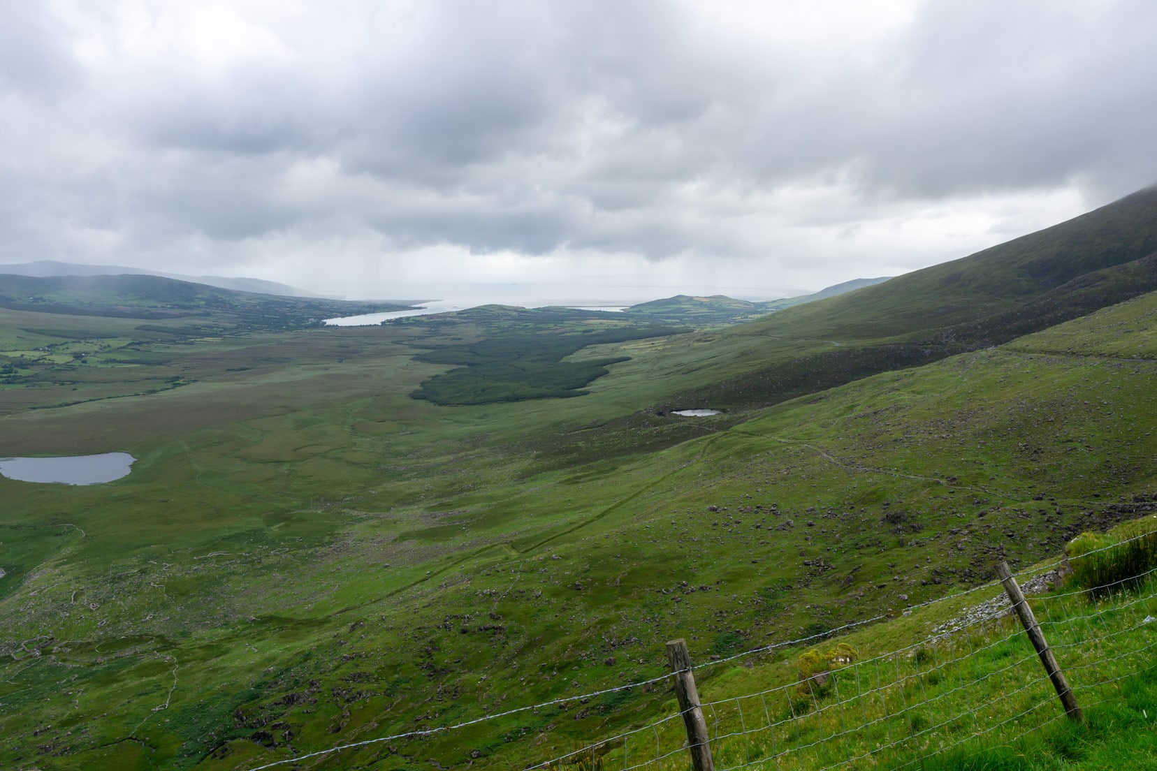
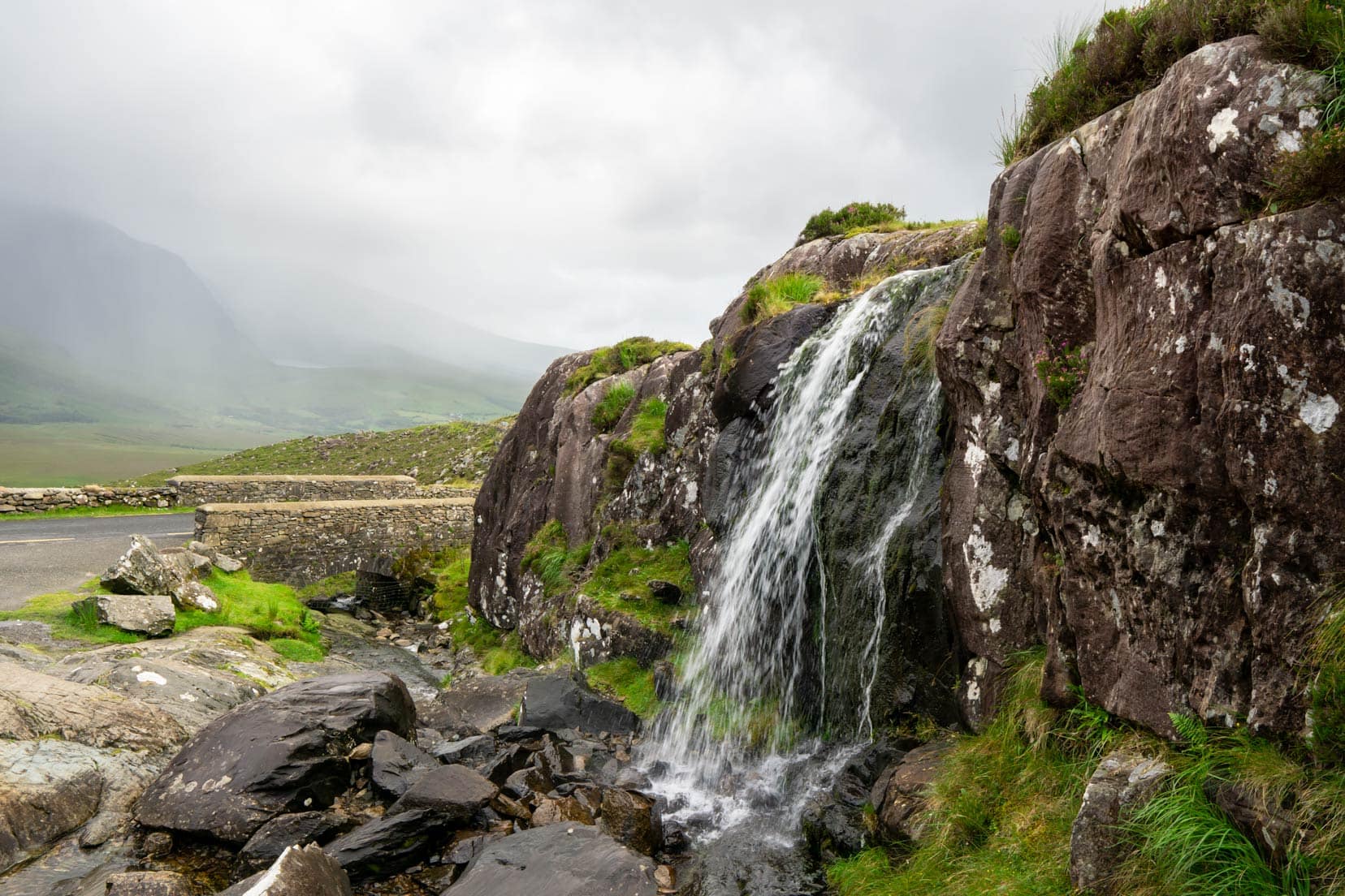
Continue approximately 1.5 kilometres north past the Conor Pass summit and look for a pullover.
From the carpark, you can see a cheery little waterfall. If it’s not too slippery, you can walk to Lough Doon, a secluded lake above the road’s level.
Unfortunately, due to recent rain, the trek proved too slippery, so we decided to tackle that one on a return trip.
Visitor Tips for Conor Pass
- Vehicle Restrictions: Note the weight limit: under 2 tonnes. This ensures safe navigation through narrow and winding roads.
- Summit Stop: Don’t rush through; the summit carpark offers breathtaking views of the valleys below. It’s the perfect spot for a photo op or to appreciate Kerry’s beauty.
- Driving Tips: The narrow road has sharp bends and steep drops. Drive slowly and be prepared to pull in to let oncoming traffic pass.
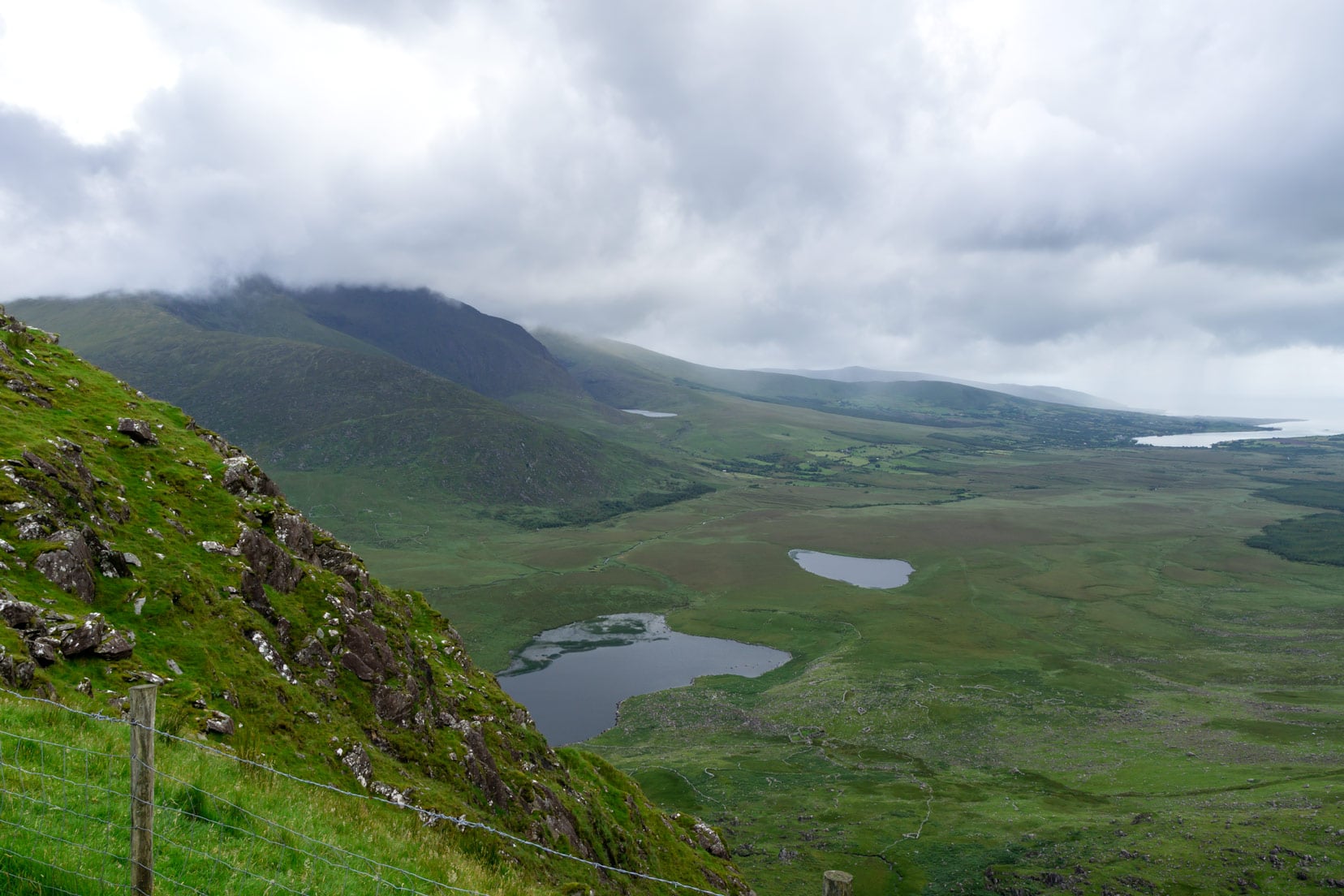
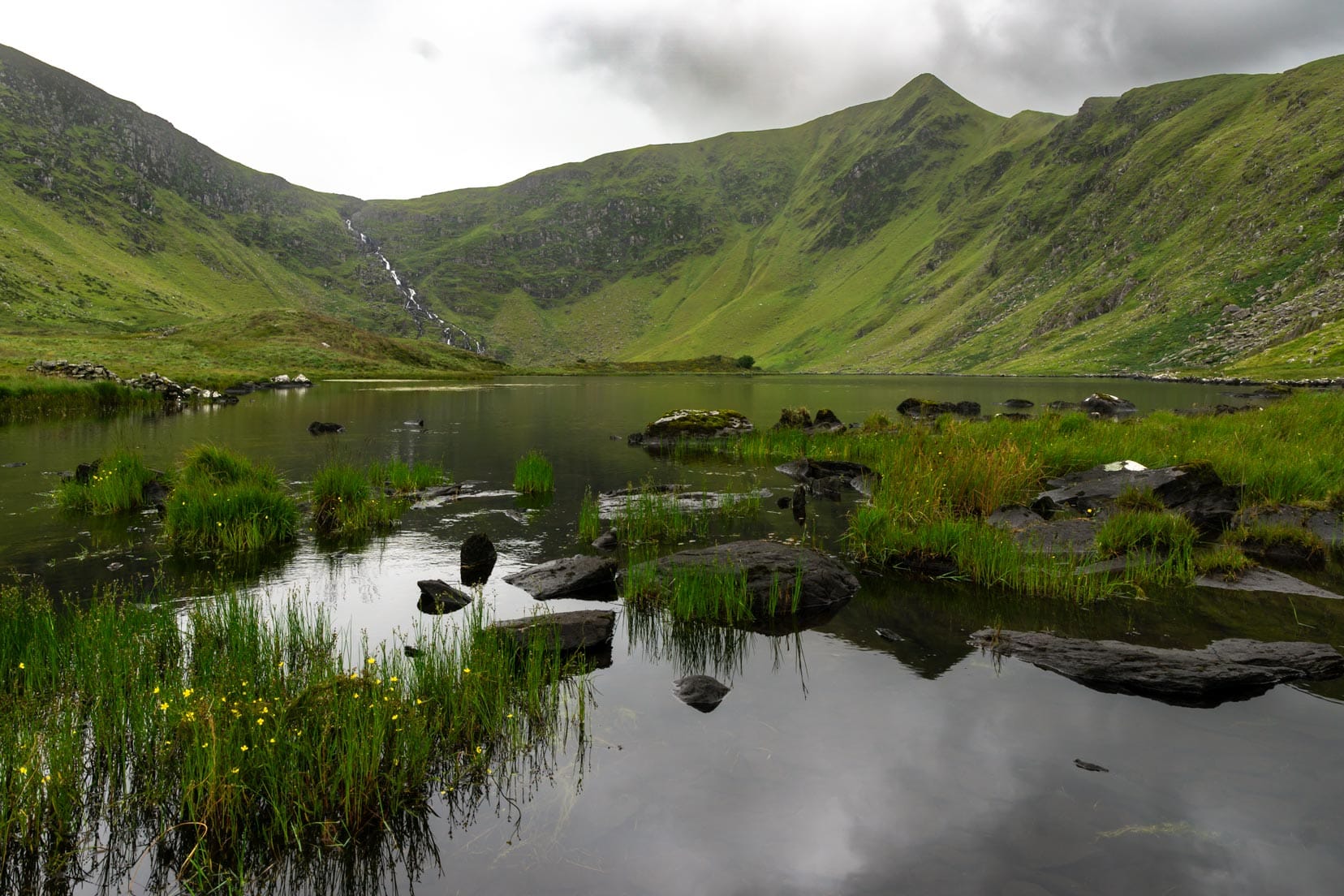
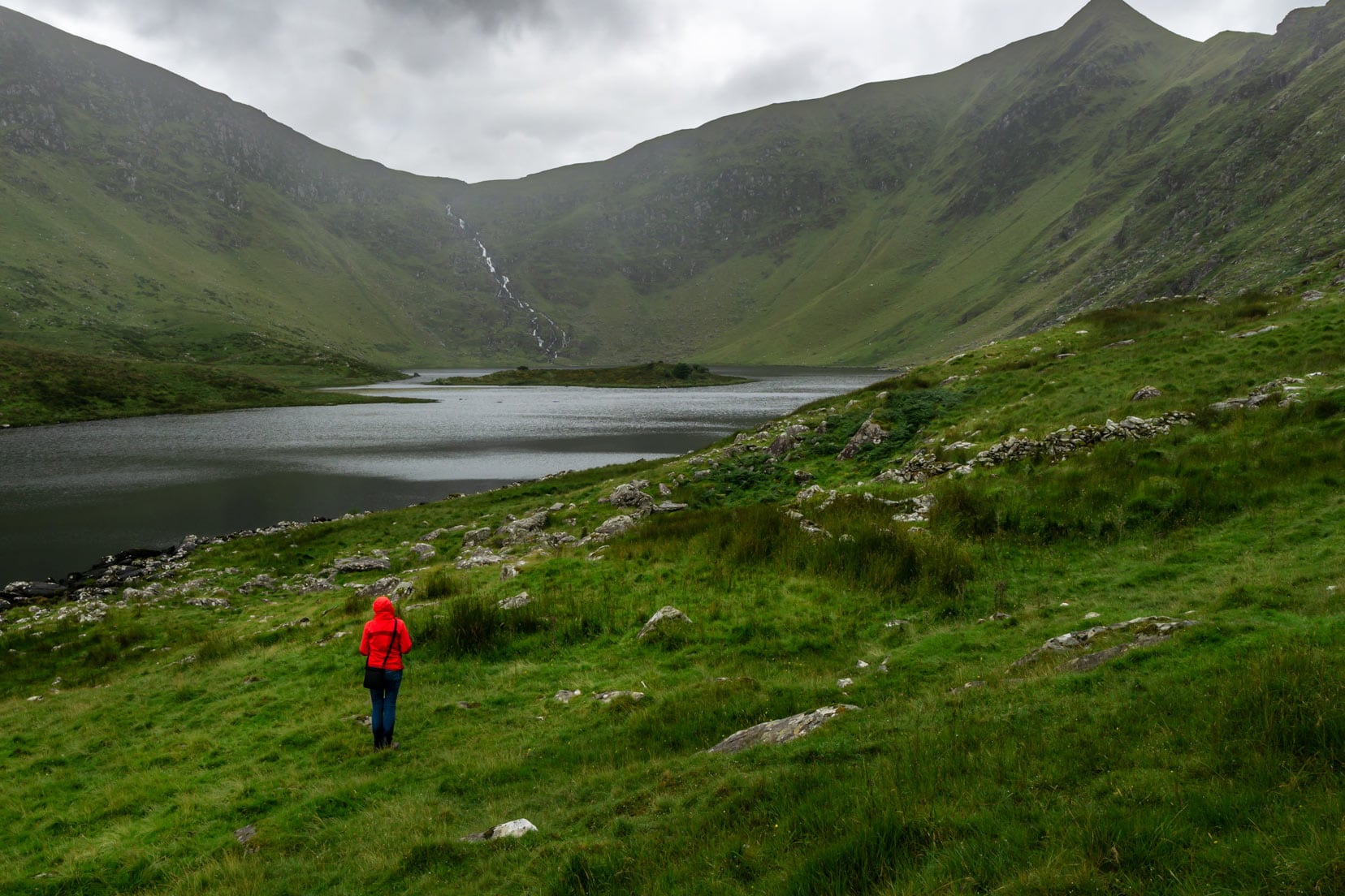
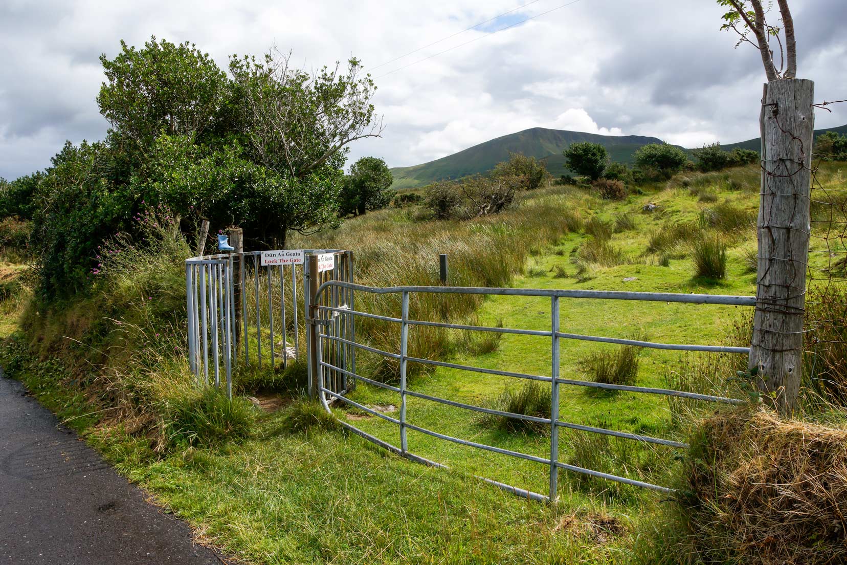
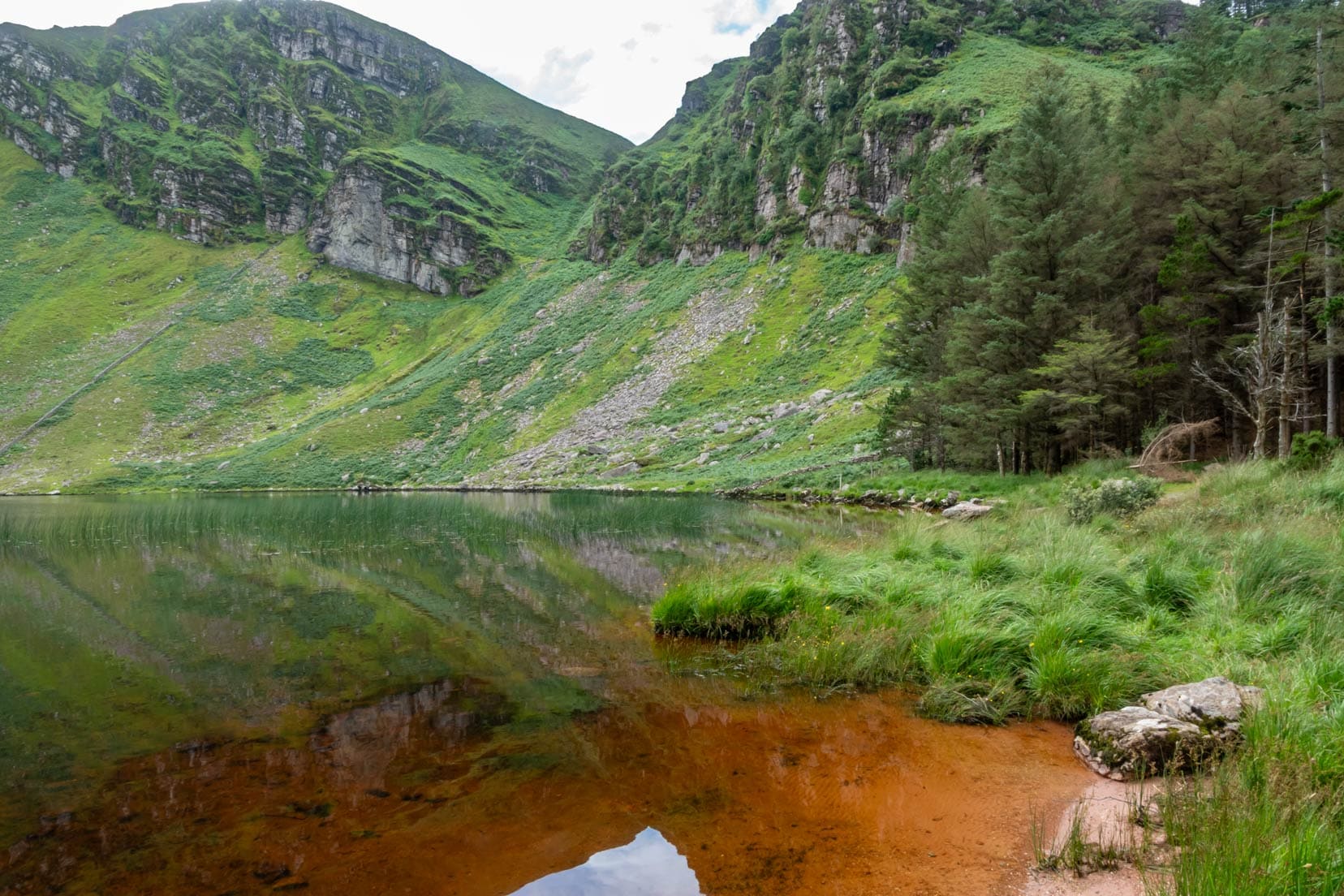
Lough Adoon: A Secluded Gem in Kerry’s Landscape
Leaving Conor Pass, we headed towards Cloghane, intrigued by a local’s tip about the hidden Lough Adoon
Our hike began at a gateway, leading 1.5 kilometres to Lough Adoon’s secluded beauty.
Unlike the similarly named Lough Doon we’d heard about, Lough Adoon was a destination unto itself, a hidden treasure amidst Kerry’s verdant landscape.
The walk to the lake was gorgeous. The path hugged a picturesque stream, offering countless photographic moments.
Approaching the lake, the path turned wild, guiding us through tall grass to the lakeside. It was an exhilarating walk, especially when it started bucketing down.
However, the reward of the tranquil beauty of Lough Adoon, cradled by the nearby mountains, was worth it.
Visitor Tips for Lough Adoon
- Allow Time: We spent around 2.5 hours here, including the walk back. Give yourself enough time to not only reach the lake but to enjoy its peaceful surroundings.
- Photography: The entire walk, especially near the stream, offers picturesque scenes. Whether you’re an avid photographer or love capturing moments on your phone, there’s plenty to inspire.
- Dress Appropriately: Waterproof footwear, waterproof trousers, or rain gear can make your walk more comfortable, especially on wetter days.
- Seek, and You Shall Find: The entrance to the path isn’t immediately obvious. Look out for the gateway shortly after the junction to Cloghane; it’s your gateway to this hidden gem.
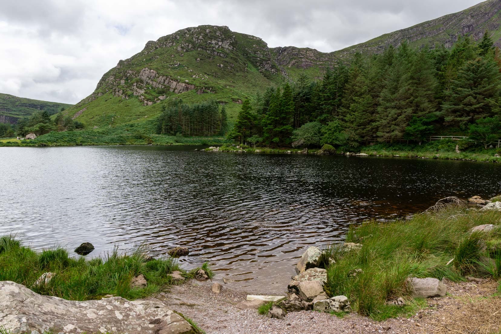
Glanteenassig Forest Park
In the heart of Kerry lies Glanteenassig Forest Park, secluded and away from the usual tourist tracks.
Discovering Lough Slat and Lough Caum
The park is home to two stunning lakes, Lough Slat and Lough Caum, each offering its own unique charm.
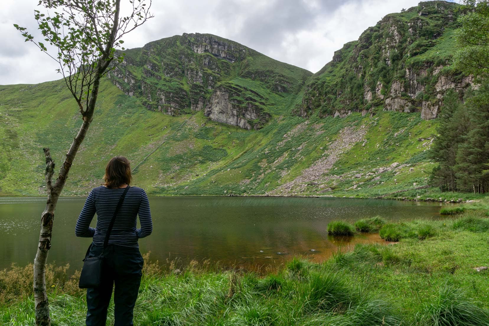
We first headed to Lough Slat, where just a 100m walk from the small carpark brought us face to face with the attractive lake, surrounded by steep, lush hills that reflected beautifully on the lake’s surface.
The peace and multi-coloured beauty of Lough Slat was one of our standout memories from our week in Ireland.
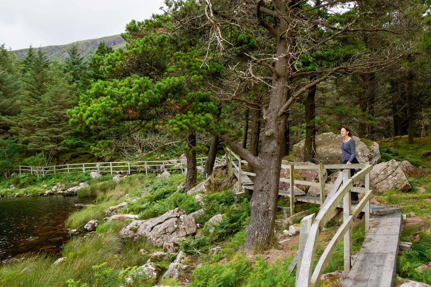
Next up, we drove on towards Lough Caum.
Here, wooden walkways hugged the shoreline, so we could take a refreshing walk around the lake.
The contrast and beauty are a true testament to Ireland’s natural splendour, and dare I say it—yet another reason to visit Ireland!
Visitor Tips for Glanteenassig Forest Park
- Photography Haven: Don’t forget your camera! The park’s landscapes offer countless photo opportunities, from the lakes to the surrounding hills.
- Road Caution: If venturing beyond Lough Caum, be prepared for rougher tracks. We managed in our two-wheel drive, but caution and slow driving are advised.
- Picnic Spots: Pack a picnic to enjoy beside the lakes. There are several spots where you can relax and take in the scenery.
Stay in Kilkee
Blue Tit Lodge B&B | ⭐️ 9.2/10 | Superb Reviews | check availibility (We gave this place 10/10)
Day 5: Kilkee to Galway via Cliffs of Moher – 210 km (3 hours 40)
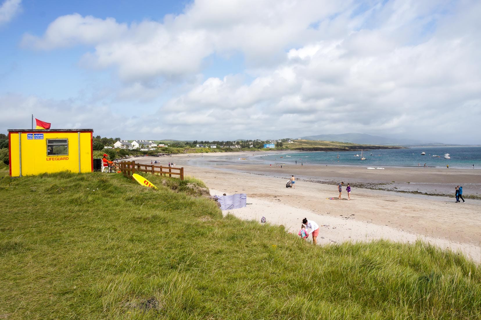
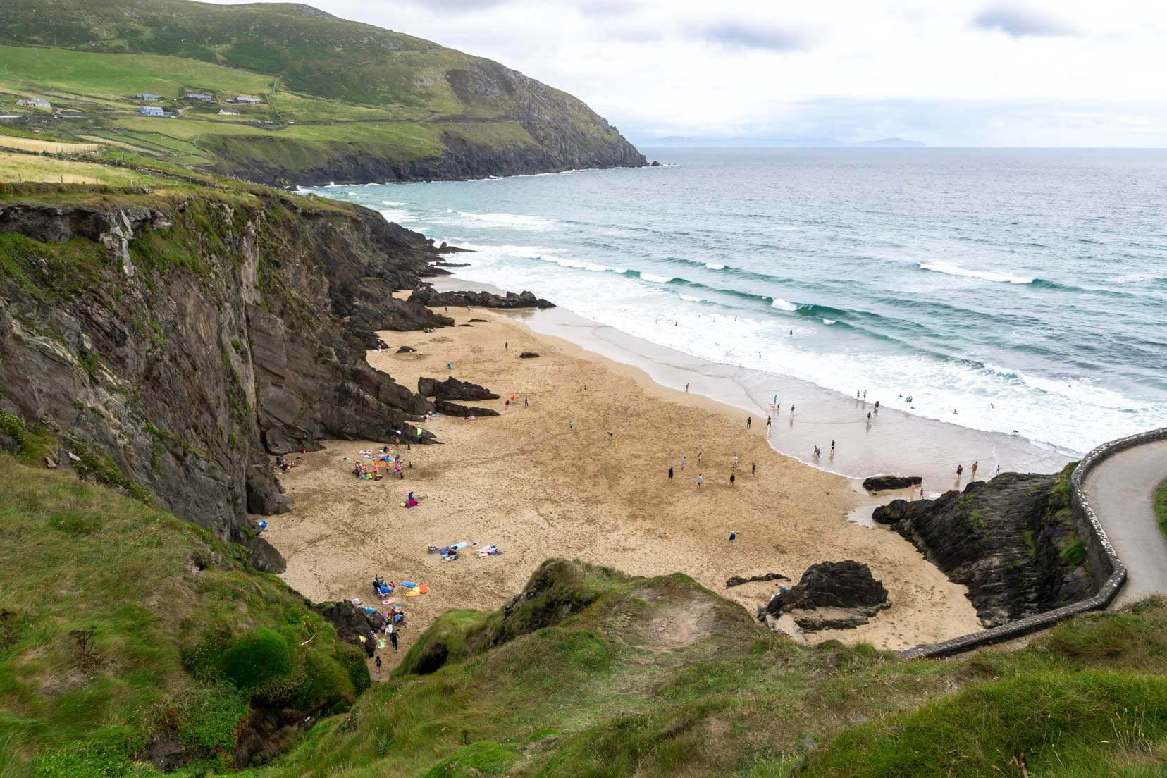
Loop Head Peninsula Drive and Kilkee Cliff Walk
Starting our journey at Loop Head was like entering Ireland’s wild Atlantic heart. The Peninsula Drive and Kilkee Cliff Walk showed us more of Ireland’s raw beauty.
Kilkee Cliff Walk
We started at Kilkee, fueling up with coffee at Diamond Rocks Cafe by the Pollock Holes carpark.
Then we hit the Kilkee Cliff Walk, choosing the 5km loop. There’s also an 8km loop if you’re feeling more energetic.
You won’t miss the Pollock Holes, which are pretty much directly in front of the cafe. These are three natural tidal rock pools popular with swimmers. They get their name from the Pollock (fish) that call this home for six months of the year.
Near the cliff walk, we found fascinating formations like the ‘Amphitheatre’ and the ‘Puffing Hole,’ showcasing nature’s power.
Loop Head Drive
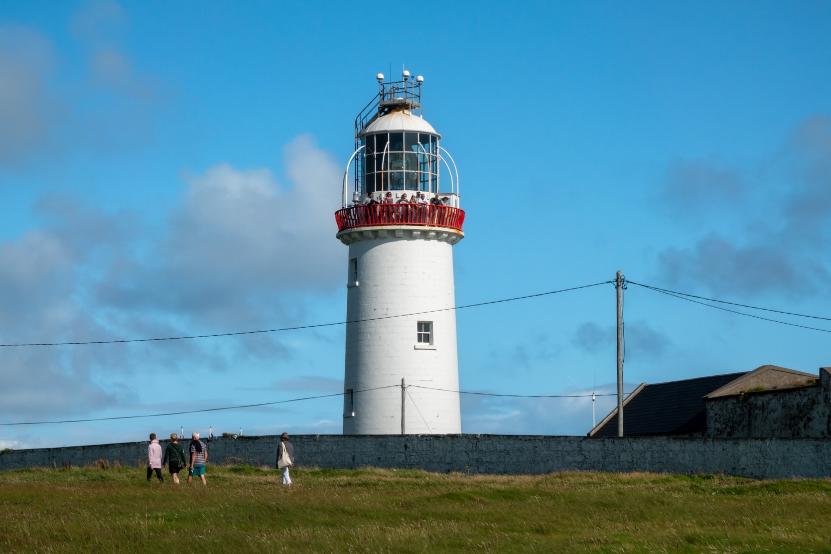
Loop Head Drive took us through stunning Irish landscapes to the Loop Head Lighthouse.
This area, known for its dramatic cliffs and as a filming location for “Star Wars – Return of the Jedi,” did not disappoint.
The lighthouse, operational since 1854, allows visitors to explore its history and enjoy views from its height. For a unique experience, stay overnight in the Loop Head LightKeeper’s cottage.
Nearby, Sampson’s Island and the legend of Cú Chulainn’s Leap bring to life the myths of Ireland.
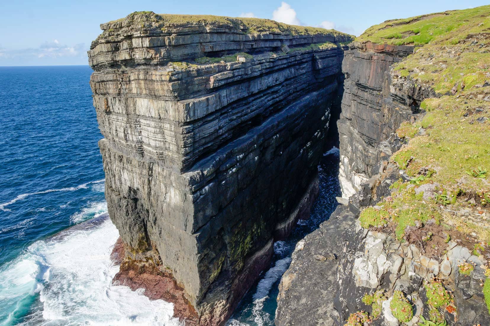
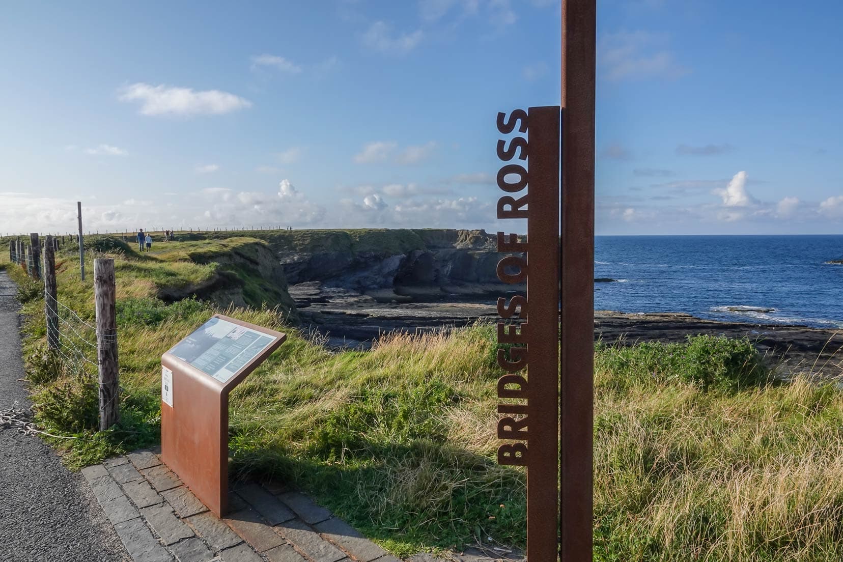
A short drive away, the Bridges of Ross, highlight natural rock arches sculpted by the sea – though only one remains.
Visitor Tips for the Loop Head Peninsula Drive and Kilkee Walk
- Visit Timing: Aim for spring or summer to take advantage of the mild weather and long days, ideal for enjoying the stunning views and wildlife.
- Lighthouse Tour: Plan a visit to Loop Head Lighthouse. Check its opening times as they change with the seasons. There’s a small fee, but the panoramic views of the Atlantic are worth it.
- Overnight Stay: For a special experience, consider booking a stay at the Loop Head Lightkeeper’s House. Book early to secure your spot in this peaceful retreat.
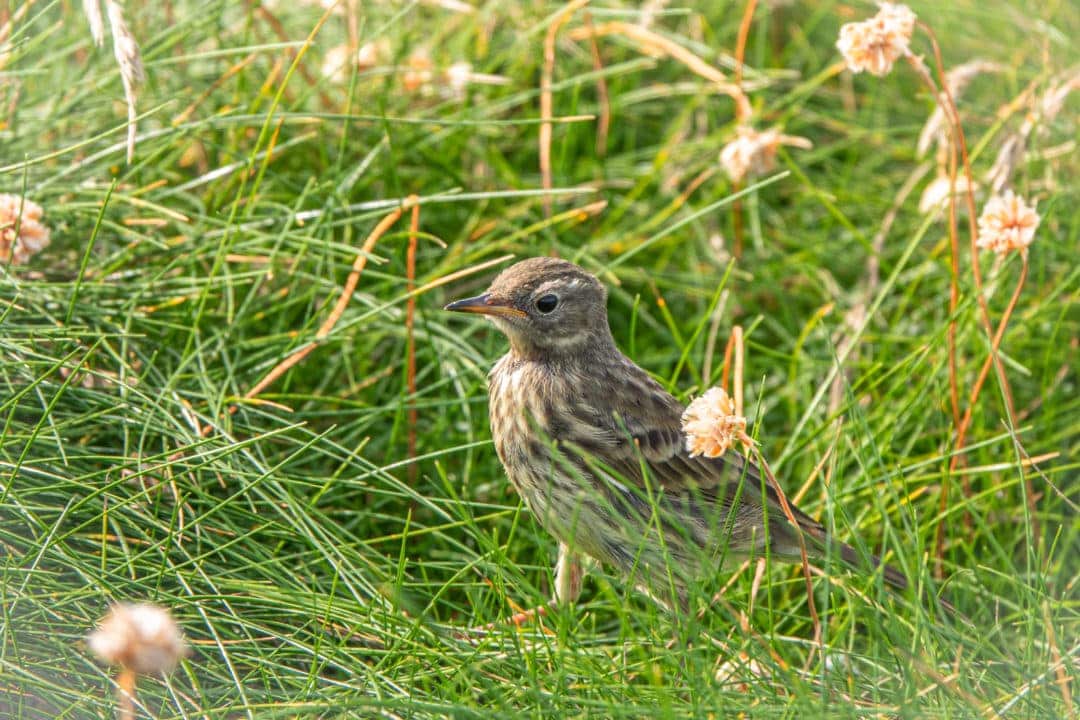
- Birdwatching: Bring binoculars for birdwatching at Sampson’s Island. It’s a prime spot for seeing seabirds.
- Geocaching: Loop Head is excellent for geocaching. Enjoy the hunt but be mindful of the environment.
- ‘Eire’ Markings: Look for WWII ‘Eire’ markings, a fascinating part of history and a unique photo spot.
- A Quieter Alternative: The cliffs along Loop Head offer spectacular views similar to the Cliffs of Moher but are less crowded and free to visit, making it an excellent choice for peacefully exploring Ireland’s dramatic coastlines.
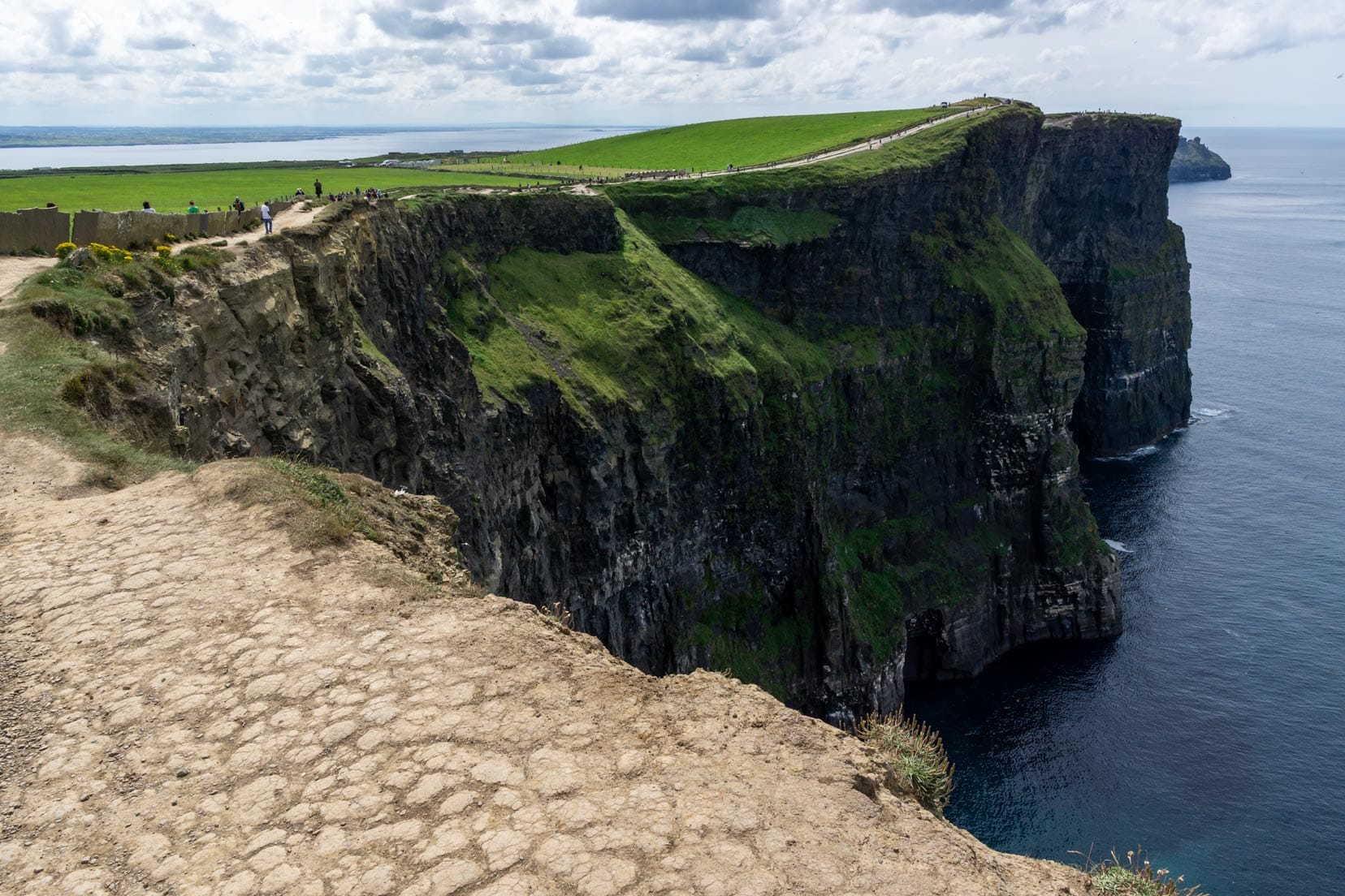
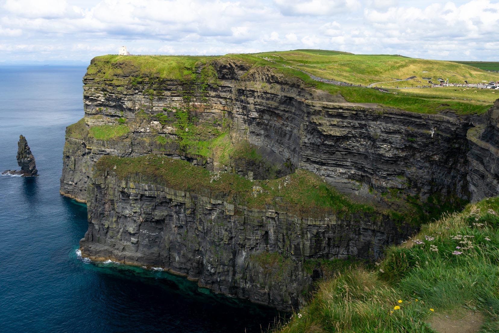
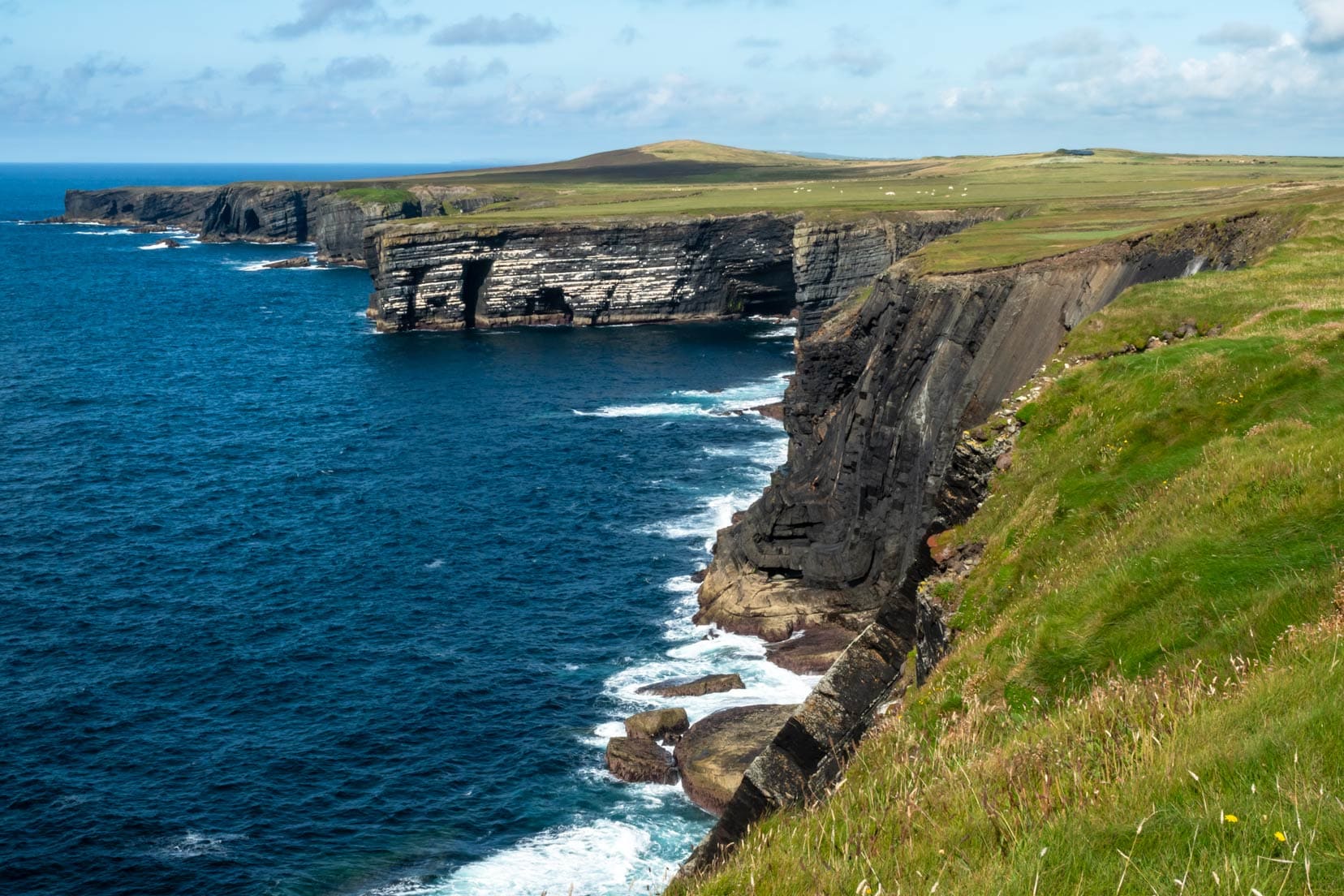
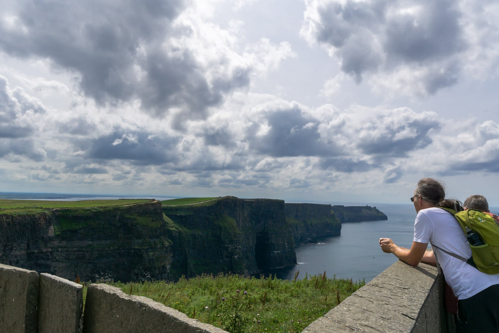
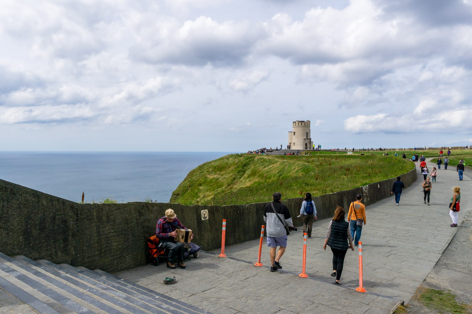
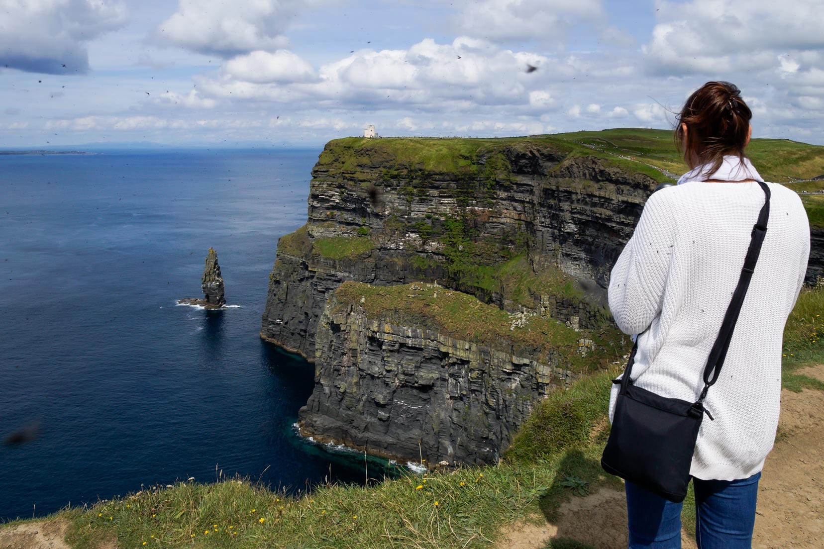
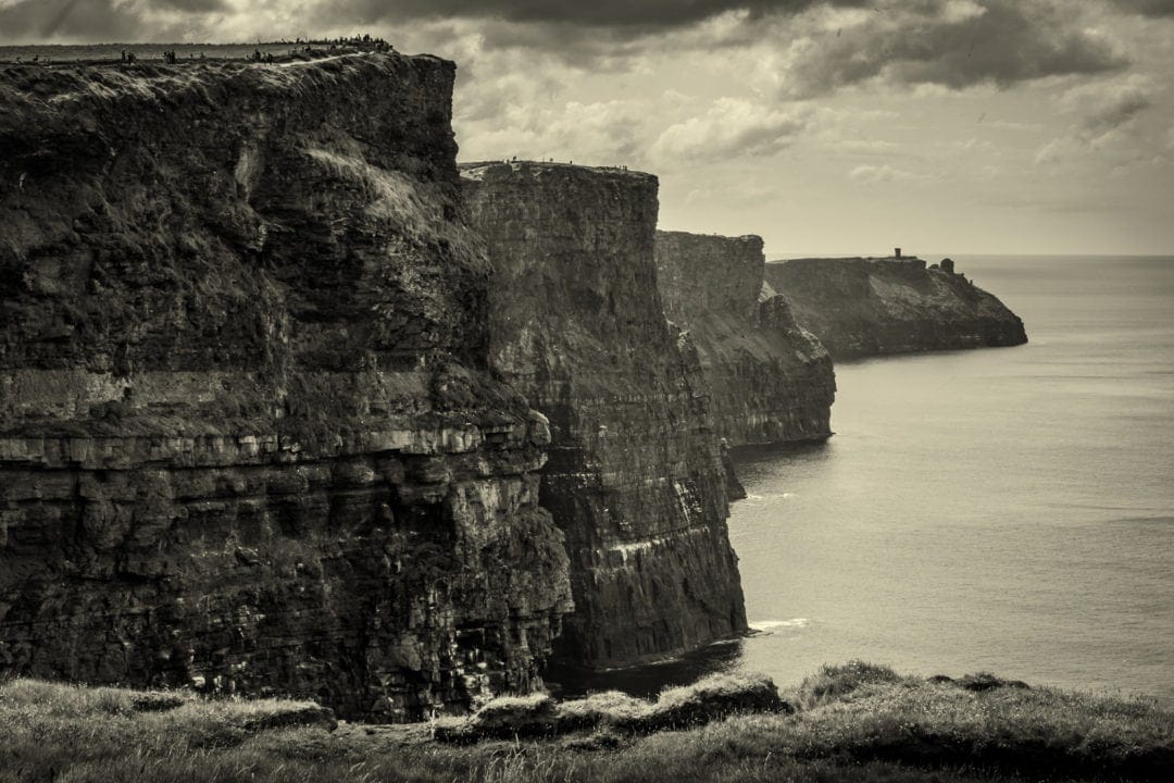
Cliffs of Moher: Ireland’s Towering Marvel
Our 7-day journey led us to the Cliffs of Moher, Ireland’s iconic natural wonder. These cliffs, a visitor magnet, showcase Ireland’s coastal charm.
Essential Insights on the Cliffs of Moher
- Visitor Magnet: Up to a million people a year come to marvel at these cliffs, making them Ireland’s top natural tourist spot.
- Height at its Peak: Reaching 214m, the cliffs offer an imposing view.
- Puffin Season: From April to mid-July, you’re in with the chance to spot puffins.
- Amenities Galore: Complete with a tourist centre, eateries, and plenty of places for souvenirs, it’s well-equipped for visitors.
The Cliffs were the busiest place we visited and cost 12 euros per adult during peak hours. Later, we found that online ticket purchases and off-peak visits cut costs significantly.
The cliffs themselves were swarming with tourists, and though it was peak season in August, the views, while impressive, didn’t quite live up to the hype for us.
It’s one of those places you have to see for yourself to judge. A not-so-pleasant surprise was the biting flies, a rare nuisance according to locals but a significant one during our visit.
Visitor Tips for the Cliffs of Moher
- Ticket Savvy: Save by booking your tickets online and visiting outside the 11 am to 4 pm window.
- Insect Repellent: Don’t get caught off guard by biting flies; a good repellent can go a long way.
- Best Views: O’Brien’s Tower, located on the northern end, is the prime spot for sweeping views.
- Seeking Solitude: For a quieter experience, consider the southern access via a local farmer’s land for a small fee. This lesser-known path offers a more solitary cliff walk.
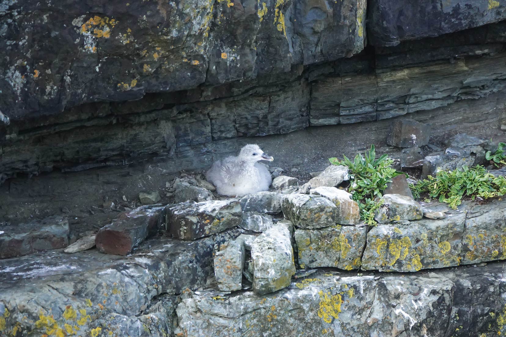
The Cliffs of Moher are not just visually stunning; they’re a vital breeding site for over 30,000 seabirds, hosting species like the Fulmar, Kittiwake, Guillemot, Razorbill, Puffin, and Chough.
Recognized as a Special Protection Area (SPA), this site highlights the importance of enjoying and conserving these natural habitats.
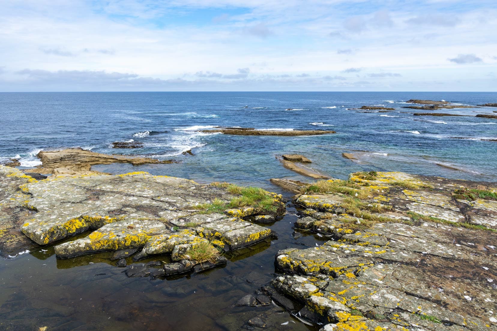
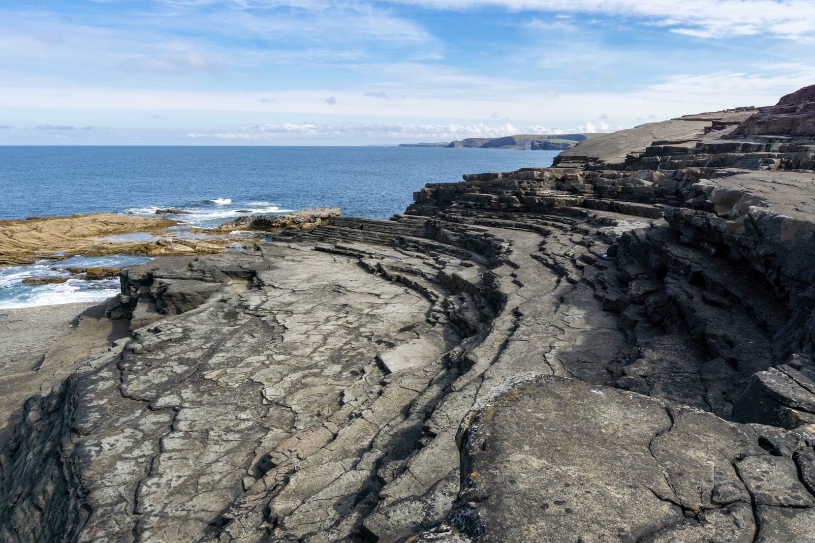
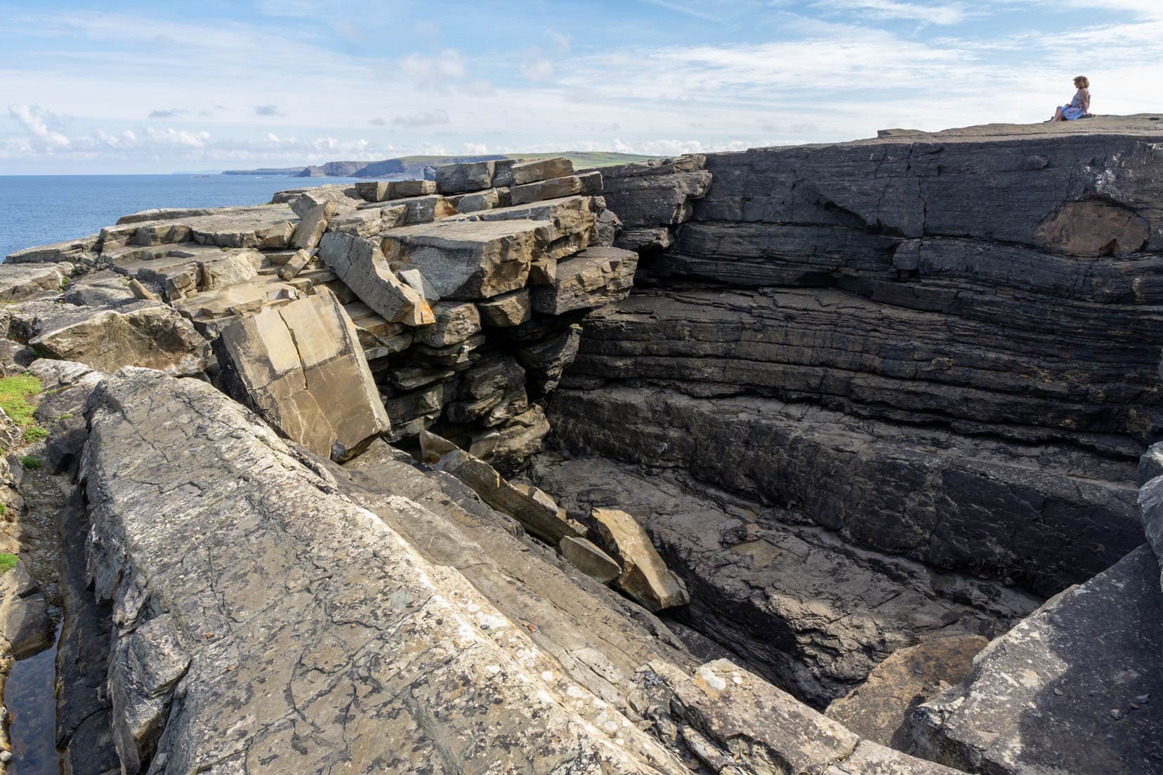
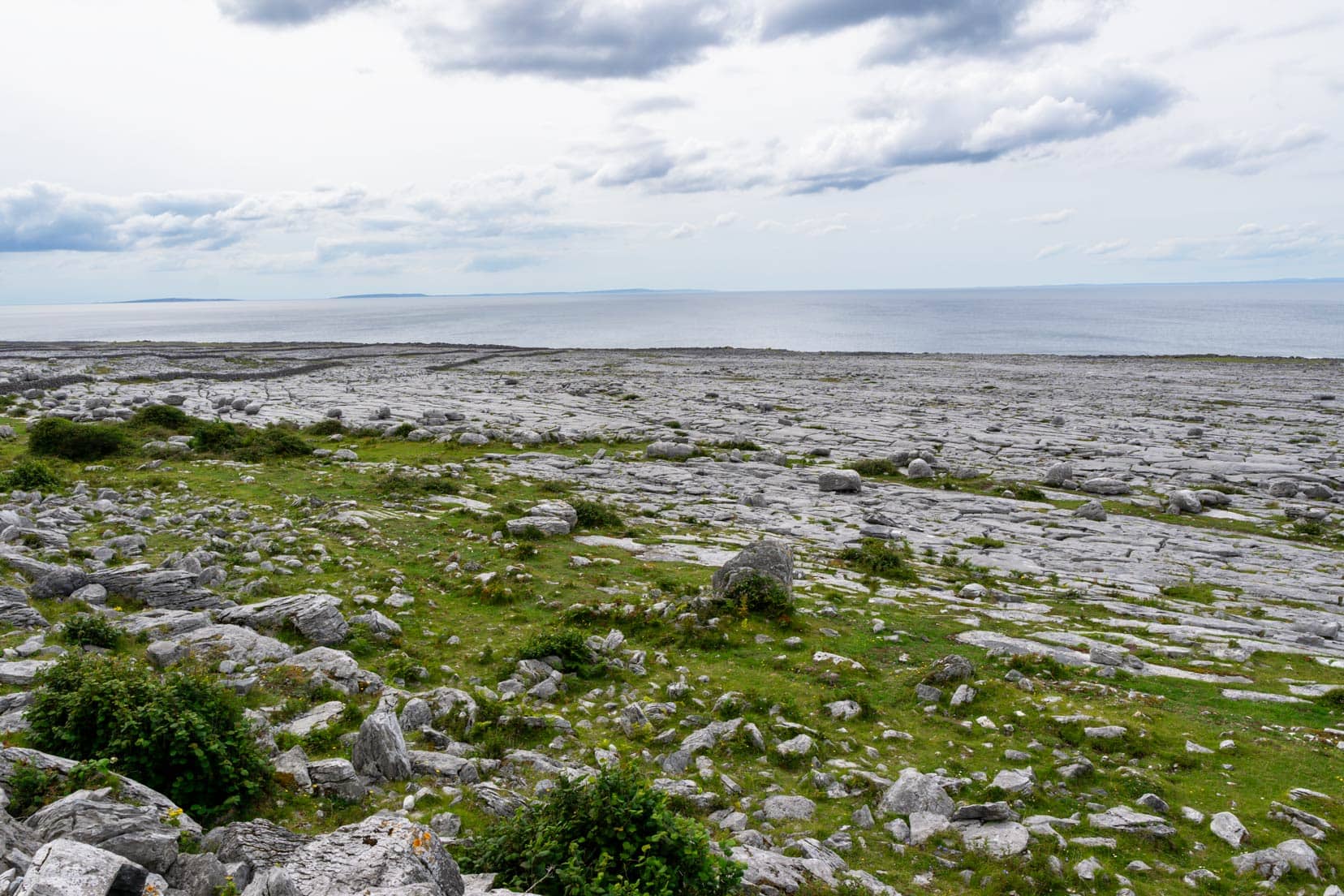
The Burren: A Lunar Landscape on Earth
Travelling through Ireland, we discovered the Burren’s unique landscape, a striking departure from the country’s typical greenery.
This moonlike terrain, marked by extensive limestone pavements shaped over millennia, showcased a dramatically different side of Irish nature.
In County Clare, O’Donohue’s Pub stood out with its vibrant colours, so we just had to pop inside!
We were welcomed by Pat, the owner, and learned of the pub’s 150-year family legacy.
Our lunch of Irish Stew and Guinness, surrounded by tales of old, was a nod to Ireland’s famed hospitality.
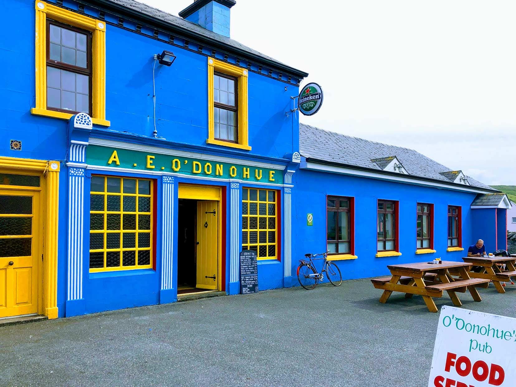
Visitor Tips for The Burren and O’Donohue’s Pub
- Lunar Landscapes: The Burren is a must-see for its unique geological formations. Don’t forget your camera.
- Try the Local Delicacies: The Irish Stew, Irish Coffee, and a pint of Guinness at O’Donohue’s are highly recommended.
From the alien landscapes of The Burren to the hearty welcome in a family-run pub, the experience captured the essence of exploring Ireland—unexpected contrasts, rich history, and unforgettable flavours.
Stay in Galway
Country Haven | ⭐️ 9.8/10 | Exceptional Reviews | check availability here
Day 6: Galway to Clifden – 78 km (1 hour 10)
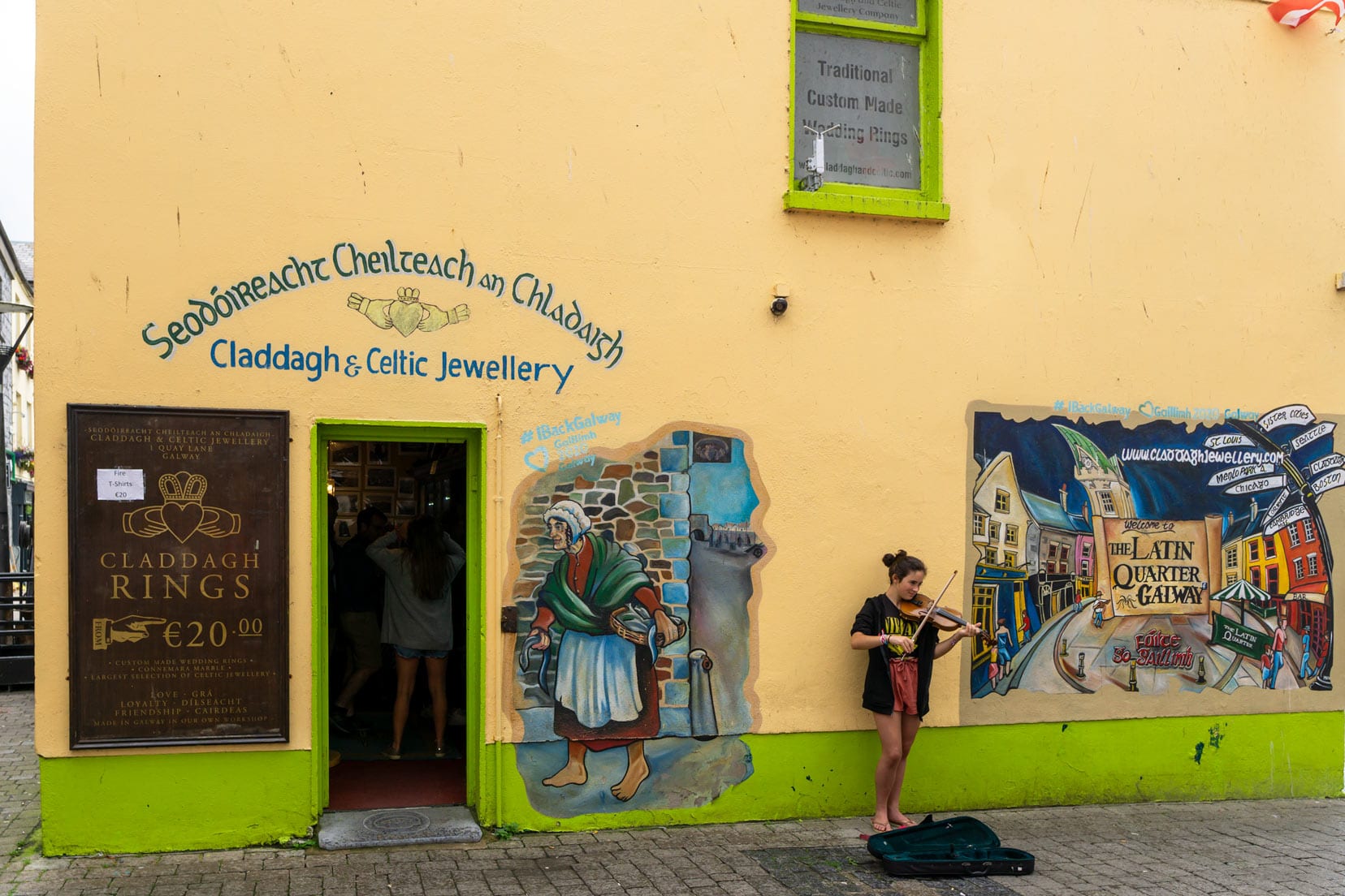
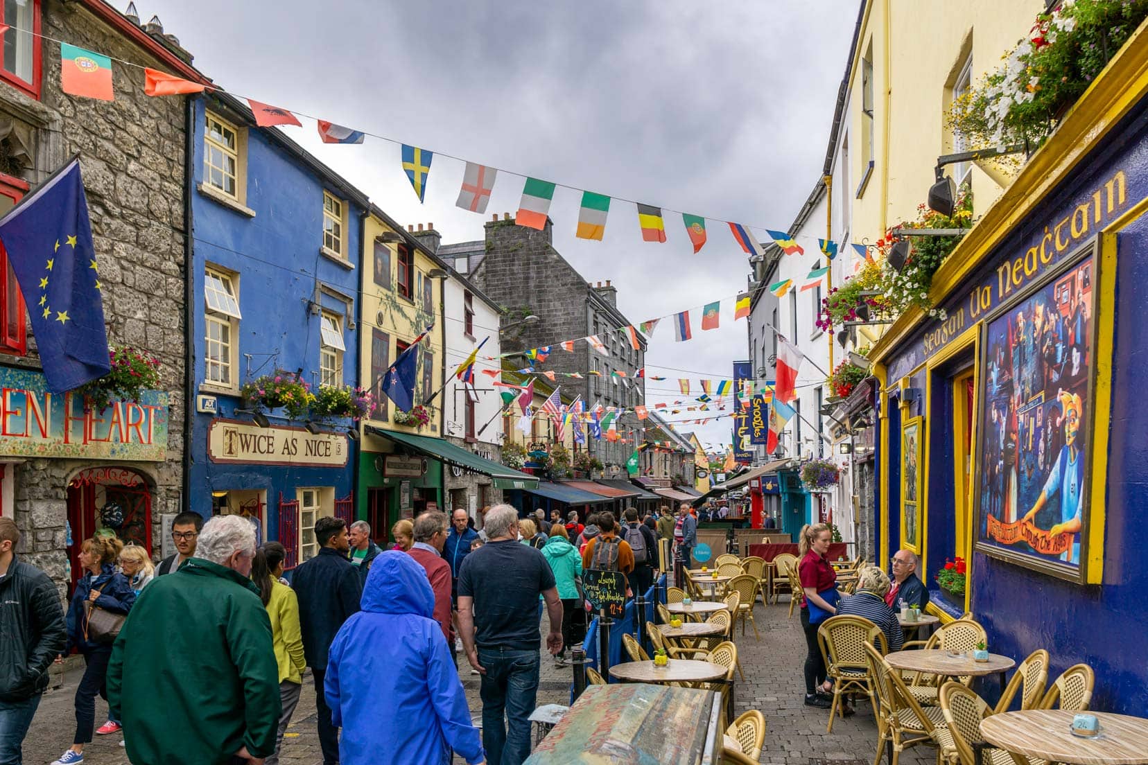
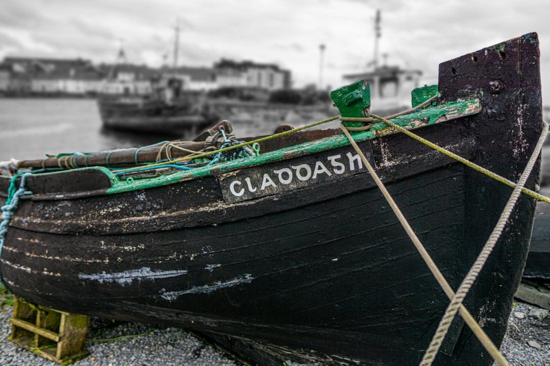
Galway: The Heartbeat of Irish Culture
Galway, known as the ‘Cultural Heart of Ireland,’ offers a unique blend of traditional Irish culture and contemporary vibrancy.
This city, alive with history and bustling streets, captivates visitors with its dynamic atmosphere.
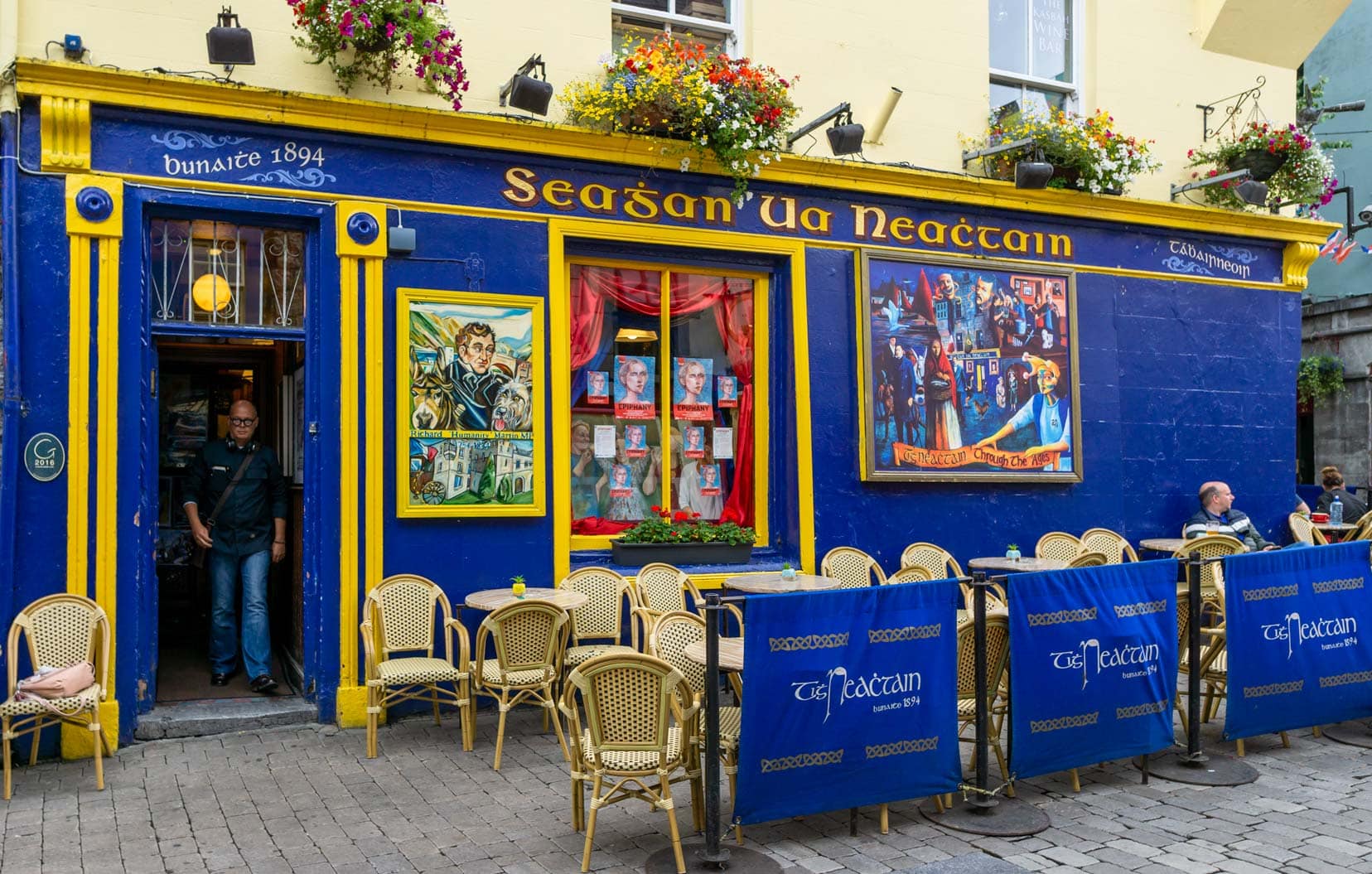
Upon arrival, the lively streets welcomed us with open arms, showcasing Galway’s unique charm through its vivid shop fronts and pulsating pubs.
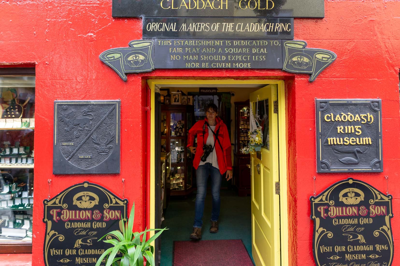
A treasure trove of history, Galway is famed for being the home of the Claddagh Ring since the 1700s, a symbol of love, loyalty, and friendship. This emblematic piece of jewellery reflects the city’s deep-rooted sense of community and heritage.
Strolling down to the waterfront, we encountered the Spanish Arch, a relic from 1584 that stands as a testament to Galway’s medieval past.
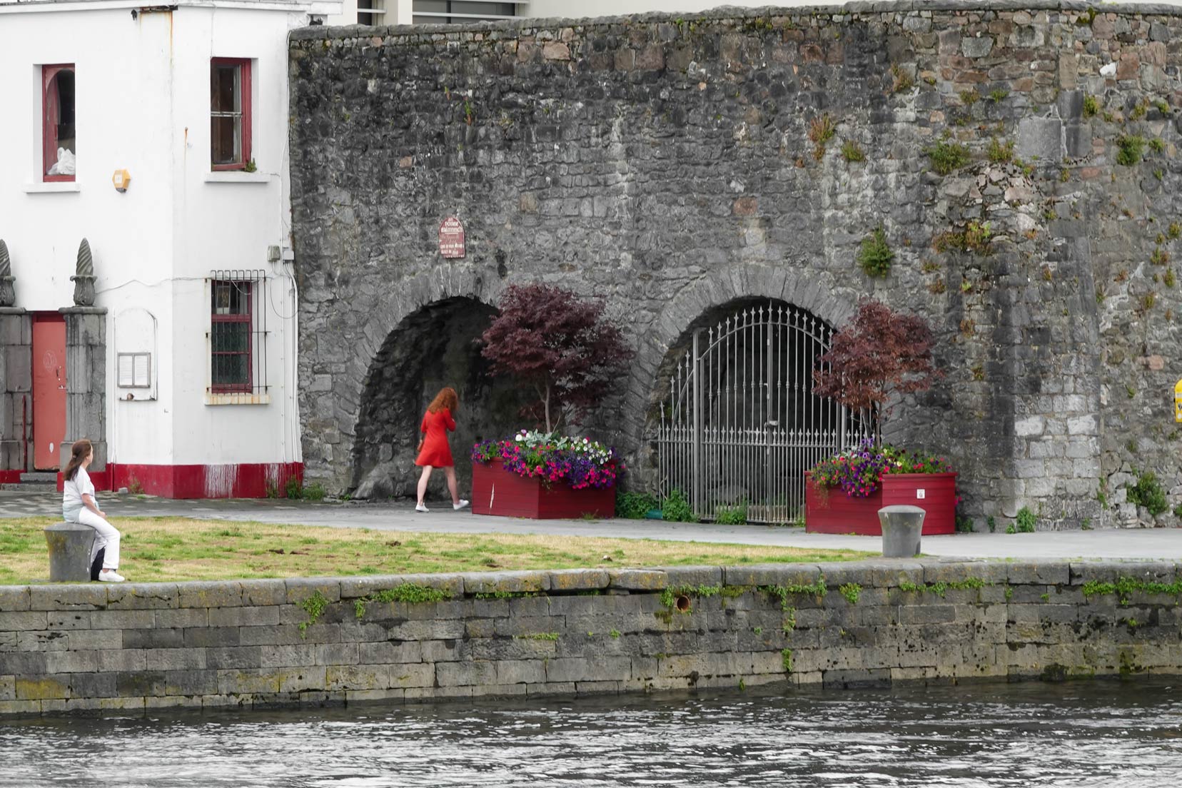
It’s locations like these that stitch the fabric of Galway’s historical narrative, inviting visitors to explore its rich tapestry of stories.
Galway’s allure doesn’t stop at its history; the city vibrates with cultural festivities, street performers, and an undeniable sense of belonging.
It’s a place where every visitor finds a piece of themselves, be it in the melodious tunes of street musicians, the historical whispers of its landmarks, or the warm greetings of its locals.
Visitor Tips for Galway
- Dive into the Culture: Immerse yourself in Galway’s cultural scene with a visit to the Latin Quarter, where street performers, local artisans, and musicians bring the city to life.
- Explore the Claddagh: For those interested in Galway’s famed Claddagh Ring, visit the local shops that craft this symbol of Irish heritage.
- Spanish Arch and Museum: Don’t miss the Spanish Arch, an iconic historical landmark, and the adjacent Galway City Museum, which offers insights into the city’s past.
- Enjoy the Festivals: Galway is renowned for its festivals. Plan your visit around the Galway International Arts Festival (July) or the Galway Food Festival (May) to experience the city’s most vibrant.
Galway left an indelible mark on us. Amidst its bustling streets and vibrant colours, we found a piece of Ireland that perfectly bridges its storied past with a dynamic present.
Clifden
You might wonder, why Clifden?
Our quest for the quintessential Irish pub experience led us straight to Lowry’s Music and Whiskey Bar – and it did not disappoint.
Awarded the ‘Best Traditional Bar in Ireland’ in 2015, 2018, and 2019, it’s easy to see why.

Buzzing with life every evening, it promised an immersive dive into Irish music and culture.
We got there early to grab seats (highly recommend doing the same), and soon bopped and clapped our way through the medleys of traditional Irish Folk music and ballads.
By the time you leave Clifden, you’ll carry a piece of Ireland in your heart and feel just a bit more Irish yourself.
And yes, a pint or two of Guinness definitely added to the experience!
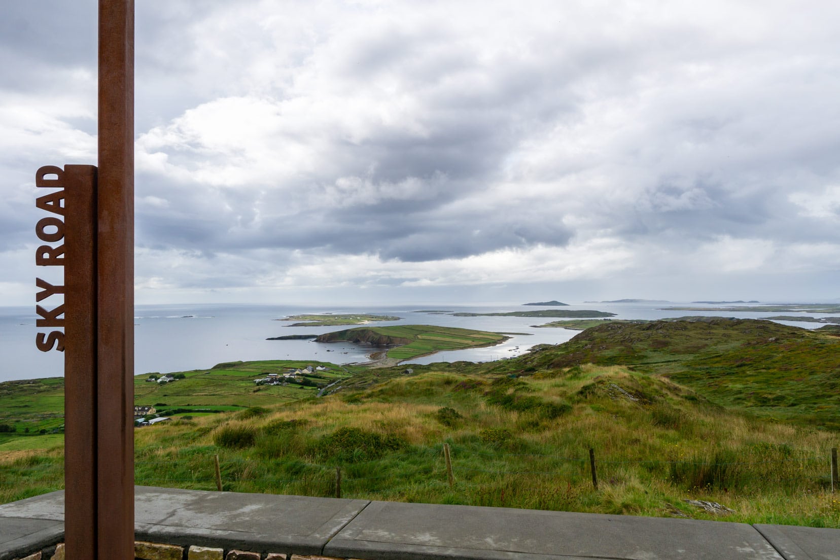
Sky Road Loop
The Sky Road Loop lies right on Clifden’s doorstep. This 16-kilometre loop starts and ends in Clifden and offers fantastic views of the Connemara countryside.
Visitor Tips for Clifden
- Sky Road: The Sky Road loop is a must-do for its breathtaking views of Connemara’s rugged terrain and the vast Atlantic. It’s ideal for both driving and cycling.
- Local Music: Clifden is renowned for its vibrant Irish music scene. Lowry’s Bar offers unforgettable traditional sessions. Arrive early to secure a spot, as it gets crowded.
- Connemara National Park: A short drive from Clifden, the park has walking trails suitable for all levels and showcases the natural beauty of Connemara.
- Clifden Arts Festival: Align your visit with this mid-September event to experience one of Ireland’s leading cultural festivals featuring music, literature, and arts.
- Clifden Castle: Explore the castle ruins for a historical adventure and enjoy the scenic walk offering views of the town and bay.
- Local Cuisine: Clifden’s restaurants excel in fresh, local seafood. Sampling the day’s catch is highly recommended to taste the region’s best flavours.
Stay in Clifden
Ben View Guesthouse B&B | ⭐️ 9.5 /10 | Exceptional Reviews | check availability
Day 7: Clifden to Westport – 97 km (2 hours)
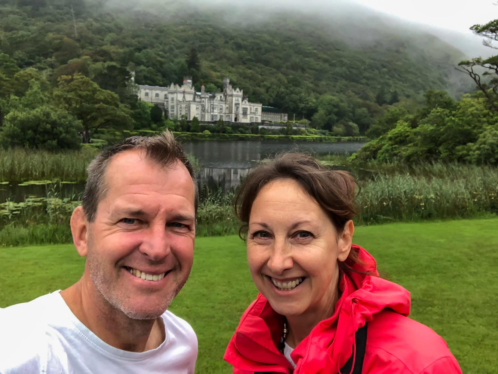
Kylemore Abbey: A Glimpse into a Love Story Amidst the Drizzle
Kylemore Abbey stands out not just for its architectural elegance but for the heartfelt story behind its creation.
Originally built in the 19th century as a romantic gesture by Mitchell Henry for his wife, Margaret, the Abbey has since been adopted by Benedictine nuns and transformed into a place of education and worship.
Learning about the lives that echoed through its halls added layers to our understanding and appreciation of Kylemore.
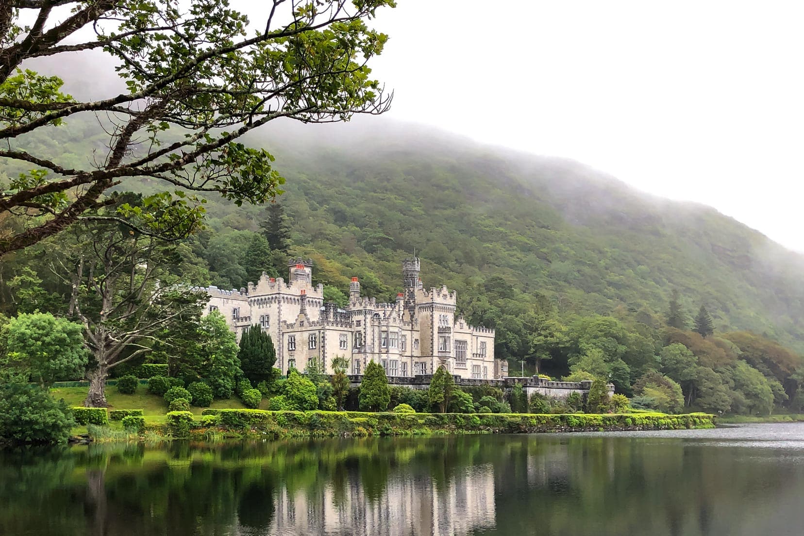
Nestled in the Connemara landscape with its lake and mountains, Kylemore Abbey is as picturesque as it is historical.
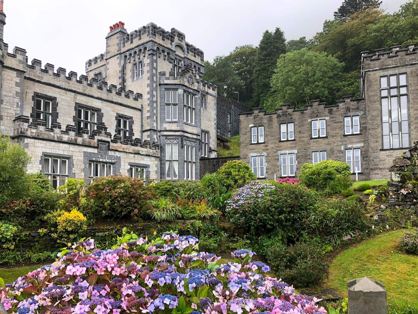
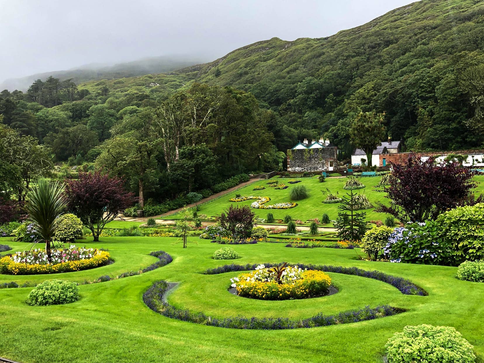
Its Victorian walled garden, restored to its former glory, offers visitors a glimpse into the estate’s self-sufficient past.
Despite the rain, or perhaps because of it, Kylemore felt like a scene from a gothic novel, where every stone and every leaf had a story to whisper.
Tips for Visitors to Kylemore Abbey
- Kylemore Abbey adult ticket: €17.00
- Opening Times: Feb-Oct. Check Kylemore Abbey’s Website for more details.
- Capture the Moment: Don’t miss the Abbey’s reflection from the viewing platform by the car park.
- Take a Cozy Break: The teahouse offers a cozy break with cream teas and snacks. The electric bus to the gardens is a bonus in wet weather.
- Treat Yourself: The gift shop’s homemade fudge is a must-try, a sweet memento of your visit—we can vouch first-hand that it is delicious.
Even with the rain, Kylemore Abbey was a standout moment in our travels, a testament to Ireland’s ability to meld natural beauty with deep, human stories.
These experiences underscore the unique charm of visiting Ireland.
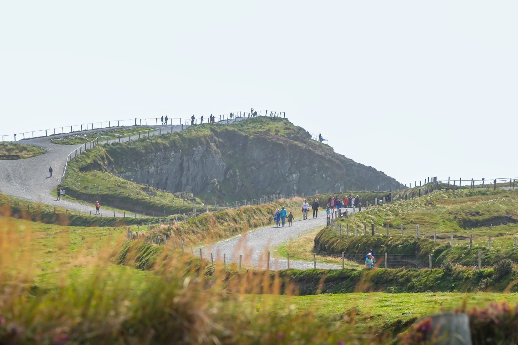
Croagh Patrick
Nearing the end of our Irish road trip, we arrived at the iconic Croagh Patrick.
Locally called the ‘The Reek,’ this mountain is a sacred site, celebrated as Ireland’s holiest mountain.
At a towering height of 764m, the typical climb takes about four hours for someone of average fitness. Yet, our trek was tailored more towards capturing the natural beauty rather than the pilgrimage.
Starting from the base carpark, we began our ascent, targeting the statue of St. Patrick just 250 meters up.
This brief journey, easily done without heavy-duty hiking gear, presented far-reaching views over Clew Bay and its scattered islands.
Sturdy shoes and waterproofs are crucial for those extending their hike. The visitor centre offers climbing sticks for rent and guided tour options for deeper exploration.
Visitor Tips for Croagh Patrick
- Climbing Sticks: Available for rent, they can be a valuable aid for climbing to the summit.
- Statue of St. Patrick: Even if you’re not up for the full hike, the short walk to the statue offers magnificent views and is easily accessible.
- Photography: Don’t forget your camera for the views of Clew Bay and its islands.
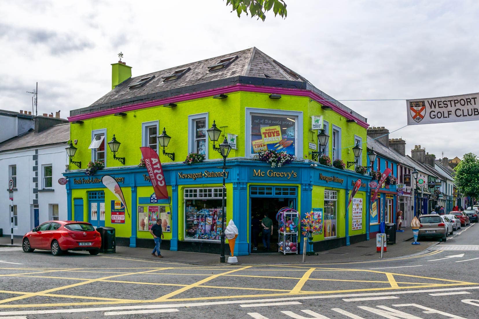
Wander Around Westport
Discovering Westport was like uncovering a hidden gem, renowned as the ‘Best Place to Live in Ireland.’ A heartbeat away from Croagh Patrick, its charm captivated us from the get-go.
Walking its vibrant streets, we felt a distinct buzz; locals were friendly, shops burst with colour, and everything felt vibrant and inviting.
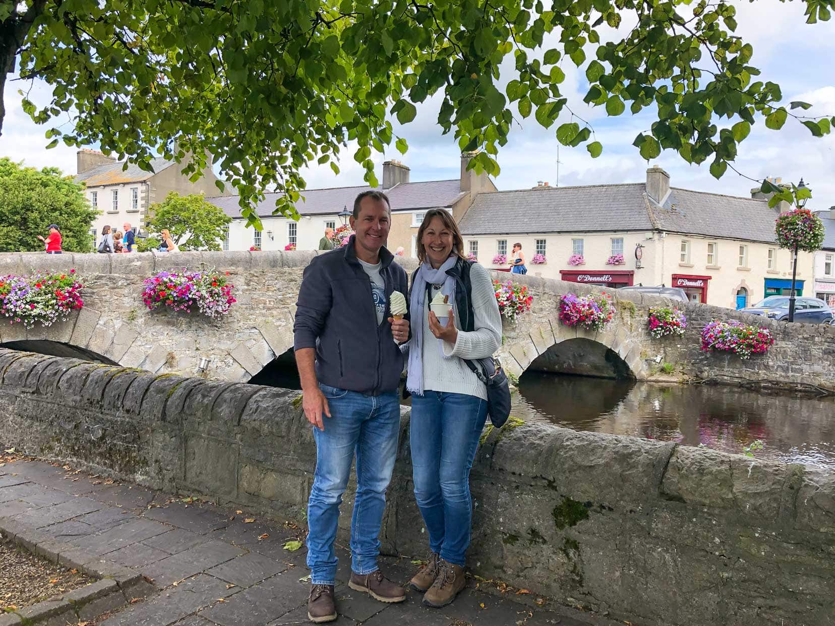
We couldn’t resist grabbing some of Ireland’s best ice cream at McGreevy’s and enjoying it by the Carrowbeg River. Trust us, it’s as delightful as it sounds.
Westport wraps you in its warmth, making it hard to leave.
Visitor Tips for Westport
- Stay Nearby: It’s a place you’ll want to soak in, so find a cozy spot nearby to stay the night.
- McGreevy’s Ice Cream: Do yourself a favour and try the ice cream. It’s an experience in itself, and it was voted Ireland’s best for a reason.
- Explore the Riverside: The Carrowbeg River offers picturesque spots perfect for a leisurely afternoon.
- Photography: Capture the colourful shop fronts and quaint streets; Westport is a photographer’s dream.
🏩 Westport Heights B&B | ⭐️ 9/10 | Superb reviews| check availability here
Stay in Westport
🛌 Westport Heights B&B | ⭐️ 9/10 | Superb reviews| check availability here
On Your Way Back to Dublin
Sean’s Bar in Athlone
Sean’s Bar in Athlone: Stepping into History
Our Irish adventure led us to Athlone, home of Sean’s Bar, renowned as the oldest pub in Ireland—and possibly the world.
Certified by the Guinness Book of Records and dating back to 900AD, stepping into Sean’s Bar felt like walking through a portal to the past.
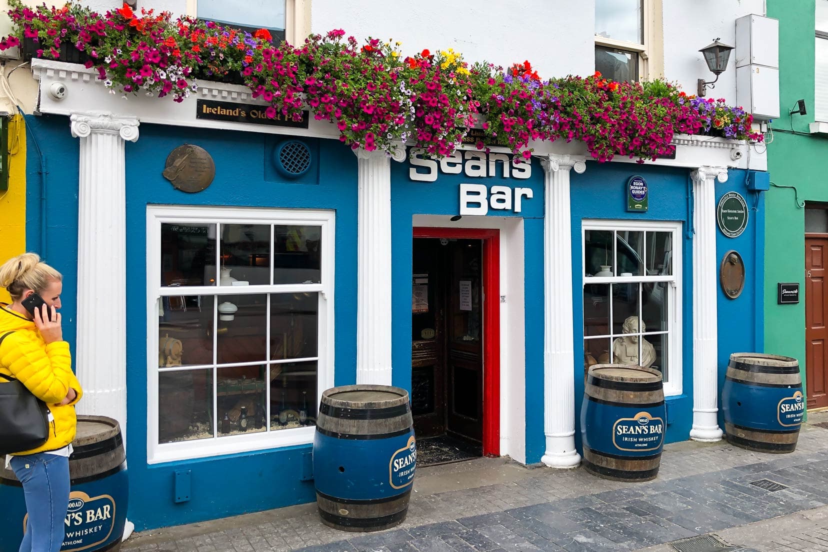
The charm of Sean’s Bar isn’t just in its age.
The sloping floor, designed to let rainwater flow back to the river, and the sawdust, a practical solution for spillages and, humorously, for easier removal of patrons who had one too many, spoke volumes of the practicality and humour in Irish hospitality.
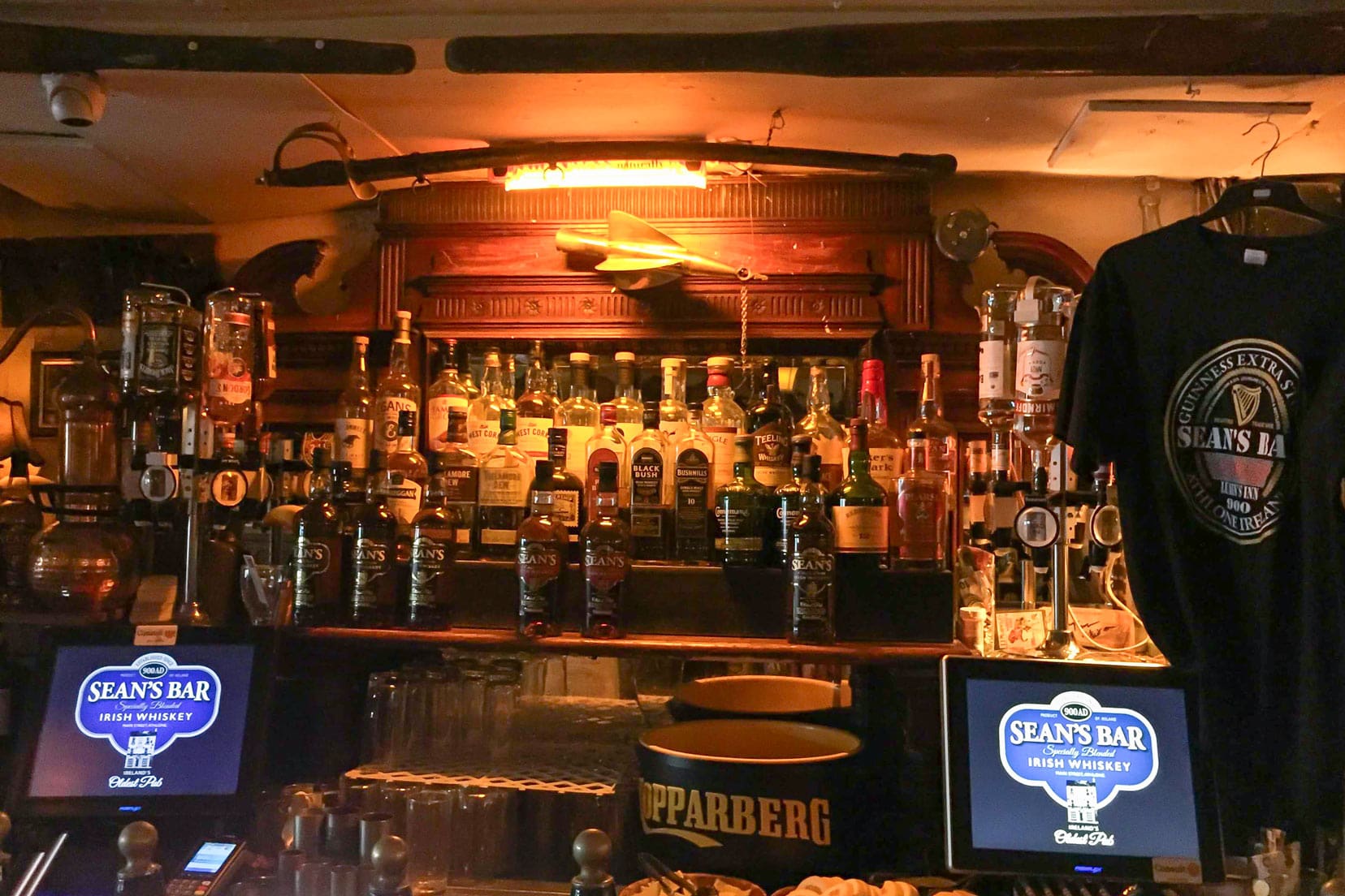
The walls and ceiling of Sean’s Bar are a museum of memorabilia, each telling a part of Ireland’s rich tapestry of tales, laughter, and music.
And the variety of Irish brews? It’s an invitation to taste Ireland in a glass.
Leaving Sean’s Bar, we carried with us the warmth of Irish hospitality and a slice of history—oh and a T-shirt, making our Irish adventure all the more memorable.
It’s places like these that underscore the spirit of Ireland.
Visitor Tips for Sean’s Bar
- Timing Your Visit: While Sean’s Bar is welcoming at any hour, evenings offer a lively atmosphere with possible live music sessions.
- Try the Brews: Don’t miss out on trying a traditional Irish stout or whiskey. Ask the bar staff for recommendations; they match your taste to the perfect drink.
- Chat with the Locals: Sean’s Bar patrons and staff are full of stories. Engaging in conversation is the best way to uncover the hidden gems of Irish culture and history.

Visiting Sean’s Bar wasn’t just a check on our list but a dive into the heart of Irish culture and conviviality. It affirmed, without a doubt, why Ireland is worth every moment.
The Best Way to Explore Ireland
Embarking on our Ireland adventure, we chose to navigate the picturesque landscapes with a trusty car, opting for the homely comforts of B&Bs along our path.
This approach proved perfect for winding through Ireland’s legendary routes, including the Wild Atlantic Way, the Ring of Kerry, and the enchanting Sky Road Loop.
Here’s why a car is your best companion for the Irish journey:
- Flexibility to Explore: A car allows you to pause anywhere that catches your eye, from breathtaking views to intriguing sites.
- Intimate Encounters: It brings Ireland’s warmth and charm up close, from engaging with locals in cozy village pubs to discovering hidden gems.
- Navigating with Ease: A car’s compact nature is ideal for Ireland’s narrow and winding roads, ensuring you can explore every nook and cranny of the countryside and easily access remote locations.
- Iconic Routes: Ireland’s celebrated drives aren’t merely about travelling from A to B; they’re immersive experiences packed with history, stunning beauty, and awe-inspiring landscapes.
🚘 If you are thinking of renting a car in Inverness, check out the best deals available here at DiscoverCars.com
Essential Tips for Your Ireland Adventure
Embarking on an adventure to the Emerald Isle? Here are some insider tips to ensure your journey across Ireland is as smooth and enjoyable as possible:
Embrace Ireland’s Unpredictable Weather
Ireland is famous for offering all four seasons in a single day.
To fully enjoy your explorations, come prepared with layers, waterproof attire, and sturdy footwear.
The west coast, in particular, can receive anywhere from 1,000 to 2,000 millimetres of rain annually—this abundant rainfall is the secret behind Ireland’s vibrant greenery.
Make the Most of Local Tourist Information Centers
Upon arrival, make a beeline for the nearest tourist information centre. These centres are treasure troves of valuable insights, offering maps, brochures, and tailored recommendations. The staff can guide you to the must-see attractions and hidden gems off the beaten path.
Navigate the Roads with Care
The quaint charm of Ireland includes navigating its narrow, winding roads, especially those on scenic routes. Drive carefully and respect local driving etiquette, such as using passing places with courtesy.
Consider Renting a Car
While public transport efficiently connects Ireland’s major cities, the true spirit of the country is best discovered through its countryside. A rental car offers the freedom to explore at your leisure, from quaint villages and secluded beaches to ancient ruins.
We use Discover Cars – Grab a quote here.
Prioritise Safety
Ireland’s cliffs and coastal walks offer stunning views but can pose risks, especially under windy conditions or poor visibility. Keep a safe distance from cliff edges and stick to marked paths to ensure your safety while soaking in the breathtaking scenery.
Immerse Yourself in the Irish Culture
Irish pubs are the heart and soul of the community, offering more than just drinks. They are vibrant hubs of stories, music, and history. They’re a great place to experience traditional Irish music, engage with the locals, and immerse yourself in Ireland’s rich culture.
Utilize Free Resources
For those looking to explore the Wild Atlantic Way, a free e-guidebook covering the entire 2,500-kilometre drive is available here. This invaluable resource can help you plan and enhance your road trip experience.
With these tips, you’re well on your way to experiencing the best Ireland offers. Prepare for an adventure that promises to be as enriching as it is memorable.
Handy Driving Tips for an Ireland Road Trip
Embarking on an Irish road trip? Smoothly navigate the Emerald Isle with these essential tips:
- Stay Left: Driving is on the left in Ireland. It may require some adjustment for those from right-hand driving countries, but you’ll adapt quickly.
- Toll Roads: We avoided Ireland’s toll roads as much as possible and opted for the slower scenic routes – easy to do with a simple GPS setting. For convenience or speed, consider an electronic tag for tolls. Learn more about electronic tags.
- Speed Limits: Observe speed limit signs: 50 km/h in towns, 80-100 km/h on open roads, and up to 120 km/h on motorways.
- Narrow Roads: Prepare for narrow and single-lane country roads. They’re charming but demand patience and courteous driving.
- Drink-Driving Laws: Ireland enforces strict drink-driving regulations. If you plan to indulge, be aware of the limits. Find out more about driving in Ireland here.
These insights aim to make your Irish road trip both enjoyable and safe.
Navigating the roads and the journey as a couple can be as thrilling as challenging. Discover our top road trip tips for couples to make every mile enjoyable.
FAQ for Is Ireland Worth Visiting?
Is Ireland Good for Tourists?
Absolutely! Ireland is a fantastic tourist destination, offering a unique blend of breathtaking landscapes, rich history, vibrant culture, and warm hospitality. Whether you’re into outdoor adventures, exploring historical sites, or enjoying the local music and pub scene, Ireland has something for everyone.
How Many Days in Ireland Is Enough?
While you can get a taste of Ireland in a short visit, a minimum of 7 to 10 days is recommended to appreciate its diversity truly. This allows you to explore a mix of Ireland’s urban charm and rural beauty, including time for some scenic drives like the Wild Atlantic Way or the Ring of Kerry.
What Is So Special About Ireland?
Ireland’s special allure lies in its dramatic landscapes, from the rugged cliffs of Moher to the serene beauty of the Glanteenassig Forest Park. Add to this the historical castles dotting the landscape, the rich musical tradition, and the legendary Irish hospitality, and you’ve got a truly unique destination.
Why Do Tourists Go to Ireland?
Tourists flock to Ireland for various reasons, including its stunning natural beauty, historical and cultural sites, lively cities like Dublin and Galway, and iconic experiences like sipping Guinness in a traditional Irish pub. The chance to connect with ancestral roots also draws many visitors.
Can You Explore Ireland by Road?
Exploring Ireland by road is one of the best ways to see the country. The scenic routes, such as the Wild Atlantic Way and the Ring of Kerry, offer fabulous views and experiences. Car rental is widely available, and driving allows for the flexibility to discover Ireland’s hidden gems at your own pace.
What Should I Not Miss in Ireland?
While there are countless must-see spots, some highlights include the Cliffs of Moher, the Ring of Kerry and Kylemore Abbey. Don’t miss experiencing live traditional music in a pub and visiting at least one of Ireland’s historic castles.
Is Ireland Expensive to Visit?
The cost of visiting Ireland can vary widely depending on your travel style and choices. While Dublin and popular tourist areas can be pricey, there are ways to explore Ireland on a budget, including staying in B&Bs, self-catering accommodations, and enjoying free attractions like national parks and museums.

7-Day Ireland Itinerary … That’s a Wrap
Whether it’s your first trip or you’re returning for more, Ireland’s appeal is undeniable, offering new discoveries at every turn.
Thanks for coming along on our journey across Ireland.
May your journey to Ireland be filled with exploration and discovery, capturing the essence of this unique island.
Feeling inspired?
Extend your adventures with an Outer Hebrides road trip for a Scottish experience that complements the Irish landscape and culture.
Planning Your Travels?
These are the travel resources we recommend and use when planning our trips.
- 🚘 Car Hire: We use DiscoverCars.com
- Motorhome/Campervan Rental: We highly recommend the Motorhome Republic
- 🪪 Order your International Driver’s Licence online here
- 🛏 Book Accommodation: We use Booking.com to find accommodation that suits our budget
- 🐶 Pet Sitting/Pet Sitters: Check Out TrustedHousesitters here (Use our Discount code: LIFEJOURNEY25 for 25% off. )
- Activities and Experiences: Get Your Guide and Viator
- Travel Insurance: Safetywing or World Nomads
- 🥾 Travel Gear and Accessories: Check out our top picks here — Lifejourney4two page on Amazon
For a more thorough list, visit our Travel Resources page here.
Hi, this is wonderful trip. I have been trying to work out a four day trip for my husband and I.
Can I ask if you think this is something we can do in our 50’s.
Dublin to Waterford, Waterford to Cork, Cork to Limerick, Limerick to Kildare, Kildare to Dublin to fly out that morning.
IF we can fit more in just say it. A lot of people have been saying thetas too much and just stay in one place.
This would be our first road trio outside Australia.
Any information or guideness would be wonderful. As you both look like you know a lot better.
Kind regards
Kerri
Hi Kerri,
Don’t worry about age, we’re in our 50’s too and travelling the world. I’m sure you two will be just fine and Ireland is a nice place to be!
I plotted the kilometres between the locations you gave using Google Maps:
Dublin to Waterford = 166k (2 hr drive)
Waterford to Cork = 131k (1 hr 45mins drive)
Cork to Limerick = 117k (1 hr 30mins drive)
Limerick to Kildare = 171k (1hr 30mins drive)
Kildare to Dublin = 55k (45mins drive)
The driving distance and time between each stop is not excessive but it all boils down to what you want to see and do. Is it visits to the small towns? The country walks? The attractions along the route you want to take? Are you travelling in the Irish summertime?
I think that given the kilometres you’ll need to drive between locations, that you will fill your day with getting from A to B and all the things you plan to do and see along the way. If you don’t mind this then I think your itinerary will be ok. Our average driving speed was about 80 klm/hr on the country roads.
Let me know how you get on and I’m happy to help further if you want.
Warm Regards,
Lars
What a great itinerary. Definitely pinning this one for when we go 🙂
Thanks Wendy, we had a great time in Ireland – hope you enjoy your time there x
Interesting! We are seriously considering a road trip in Ireland for next year, taking the RV across on the ferry. This jam-packed itinerary will be really useful. So much to see!
Thanks, Jane – yes, there is definitely lots to see in Ireland:) Look forward to hearing all about your RV trip.