
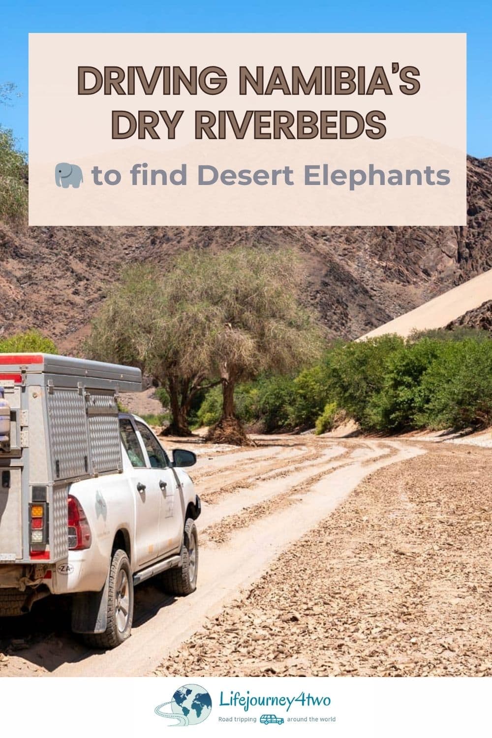
Ever wondered what it’s like driving Namibia’s dry riverbeds, where desert elephants roam? We spent 10 days driving the Ugab, Huab, Hoanib and Hoarisib riverbeds.
This article includes information on our planning, the driving route, our navigation tools, trip challenges and more. I’ve used our GoPro and iPhone footage to create four videos covering each river drive.
So buckle up, and I’ll explain how to navigate Namibia’s dry riverbeds.
You might want to read our article about finding desert elephants in Namibia, where I detail our experiences and where we encountered these incredible animals.
👀 What You’ll Find in this Driving Namibia’s Dry Riverbeds Article
- 🗺️ Interactive Map showing Driving Routes and Points of Interest
- 🏞️ Our Journey Across Namibia’s Iconic Destinations
- 📋 Trip Planning
- 📹 GPS Logging Tools of our Route
- 🚙 Driving the Four Riverbeds
- 🚏 Route Selection and Navigation
- 🤔 What I’d Do Differently
(Click any section above to jump ahead)
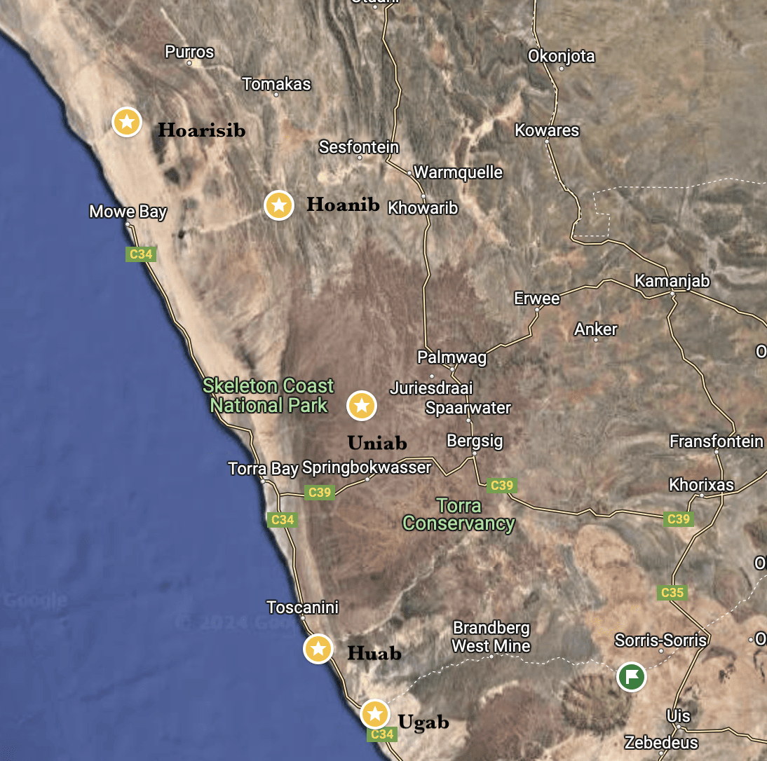
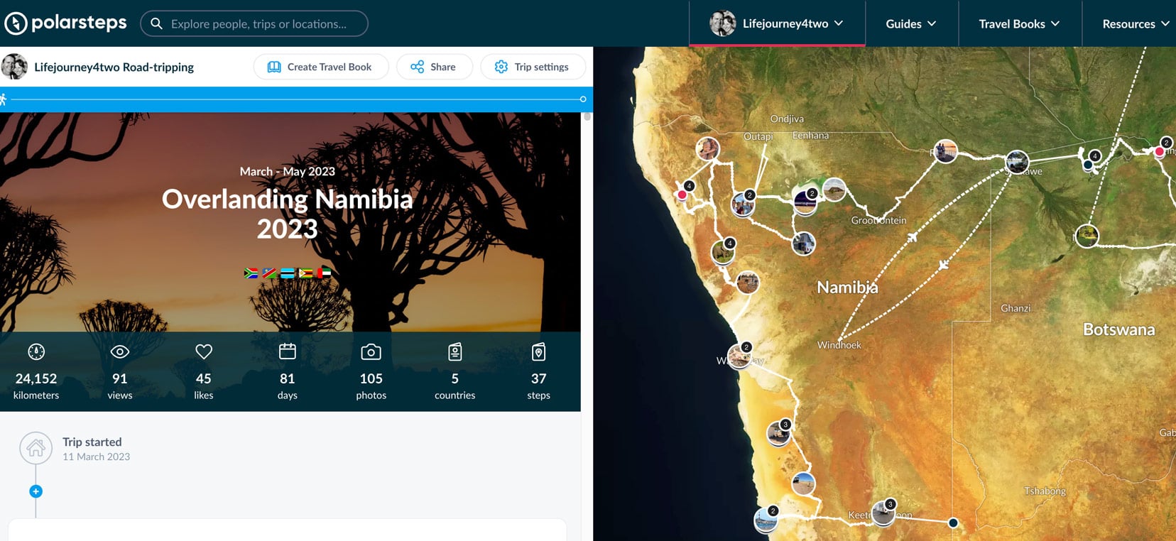
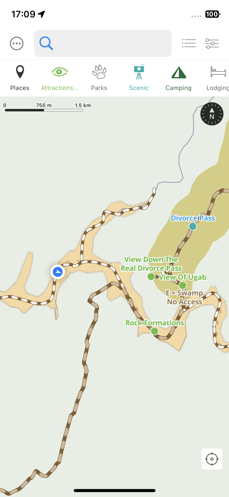
Map: Driving Namibia’s Dry Riverbeds and Our Driving Routes
This interactive map below showing our driving route, combining Polar Steps positions with those from the Tracks4Africa app.
The different coloured map markers represent:
- 🟩 Green: campsite
- 🟦 Blue: route marker
- ⬜️ Grey: attraction
- 🟨 Yellow: our desert elephant sightings
- 🟧 Orange: a driving route that was attempted but did not succeed
Our Journey Across Namibia’s Iconic Destinations
After 3 months in Botswana, we crossed into Namibia and spent two and half months self-driving our South-African registered 4×4 as part of our wider Southern Africa travels. We photographed this country’s breathtaking landscapes, listened to amazing stories and experienced unbelievable wildlife encounters.
We’ve visited some of Namibia’s iconic places, some of which you might already have heard of:
- Kolmanskop, a ghost town, near Lüderitz
- Lüderitz, a town of unique history found on Namibia’s west coast.
- Sandwich Harbour, where the Namib-Nauklaft massive dunes meet the ocean,
- Sossusvlei, a pan in an ancient dune setting with 900-year-old preserved camel thorn trees,
- Quiver Trees and the Giants Playground, near Keetmanshoop, where you can see Namibia’s national tree.
Planning a Trip to Africa?
- 🚗 Hiring a car? We recommend getting a quote from DiscoverCars
- 🚐 Hiring a campervan? We recommend Motorhome Republic
- ⛑ Arranged your travel insurance? Compare quotes from World Nomads & Safetywing
- 🪪 Order your International Driver’s Licence online here
- 🏩 Booked your accommodation? We use Booking.com to find the best deals
- 🐾 Is someone pet-sitting for you? 🐾 We use and love TrustedHousesitters
- (Get 25% off at checkout for new memberships with our discount code: LIFEJOURNEY25)
Trip Planning
Our plan for driving Namibia’s dry riverbeds to search for desert elephants was spontaneous. At the time, we were visiting Sossusvlei and heading north. So yes, little time to formulate a plan. However, we never let that stop us!
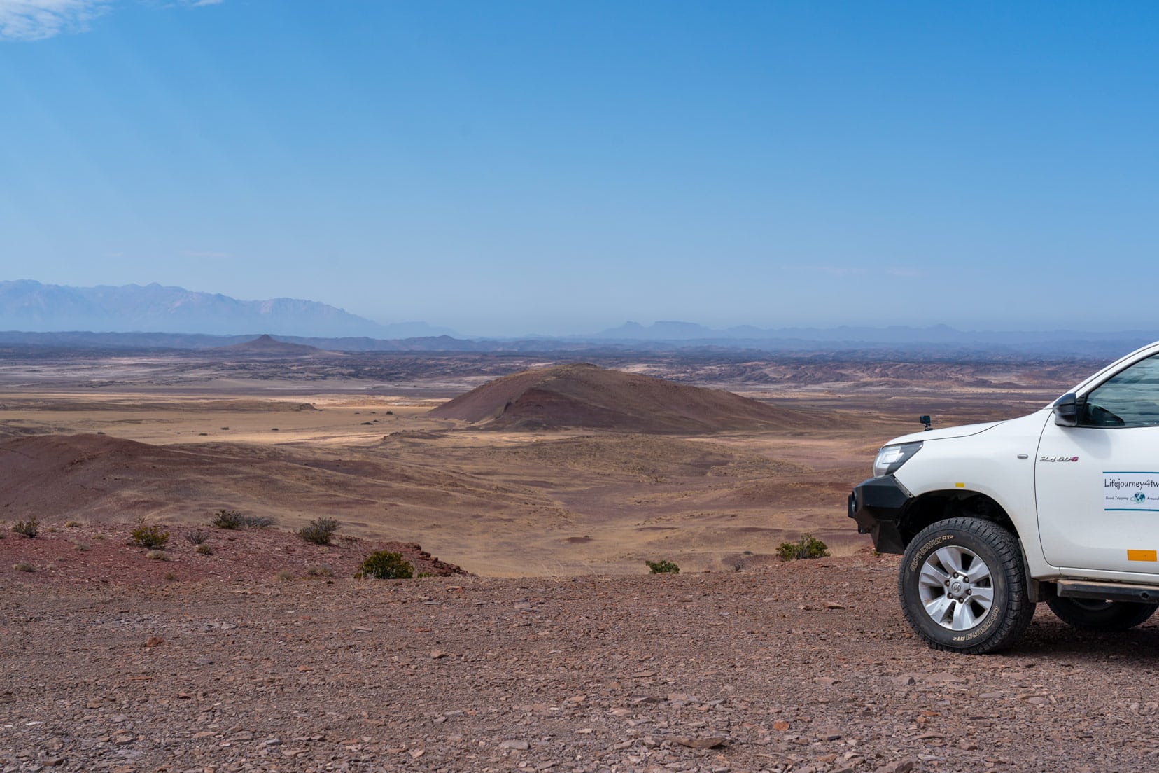
Departing Swakopmund, the options once reaching Henties Bay were to keep driving north along the Skeleton Coast or swing east to Mt Brandberg to start our drive of the riverbeds and the search for the desert elephants.
It wasn’t a hard decision. Eastbound towards Mount Brandberg it was.
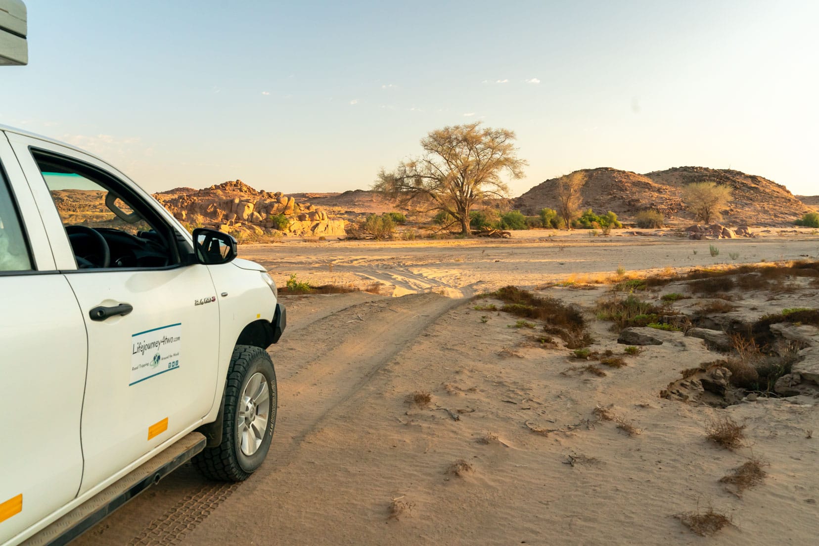
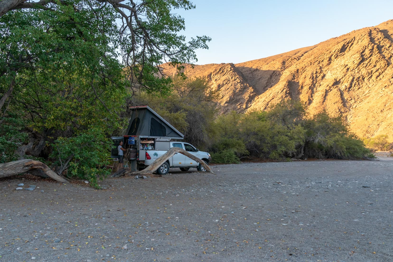
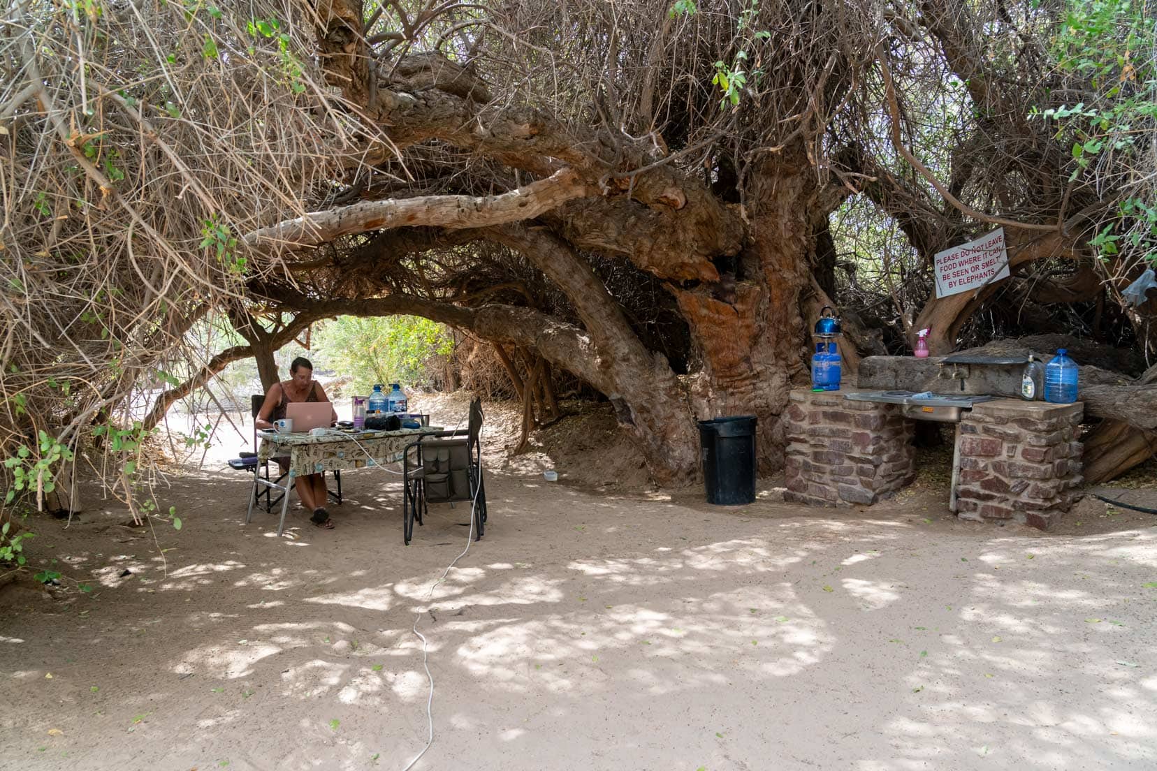
The campsite, Brandberg White Lady Lodge, was the logical start of this adventure. It’s located at the eastern section of the Huab River, close to Mt Brandberg. Our campsite was right by the dry Huab riverbed.
Once we knew we were off on this adventure, we broke the plan down into four parts – covering each of the four riverbeds we knew that the Desert Elephants might be seen in:
- Drive the Huab River to the west, pick up the Desolation Valley 4WD trail, and head north to the Ugab River.
- Drive the Ugab River to the east.
- Drive Hoanib River to the west.
- Drive Hoarisib River to the east.
It’s worth a mention. Even though the Uniab River (which lies between the Huab and Hoanib Rivers) is known for its desert elephants, we chose not to drive it. Why? Two reasons.
- The Tracks4Africa map showed that a locked gate blocked the only access going north (at the junction of road C39).
- If we added the Uniab River drive to our route, then the east-west ‘S’ pattern we were driving meant we’d arrive at the Hoarisib River at the village of Puros, the halfway point of the river. We’d then need to drive the Hoarisib to the west, then double back to Puros. Something we didn’t really want to do.
So, in light of the above, we dropped Uniab from our plan.
Logging Our Route
We log our journey in real time using the Polar Steps app. The app uses the GPS position on your phone to plot exactly where you are.
You can check out our Polar Steps here.
It’s a great set-and-forget option, and best of all, it’s free.
The Thrill of Driving Namibia’s Dry Riverbeds
Exploring Namibia’s dry riverbeds, each with its unique charm, was an exhilarating part of our journey.
From the elephant-rich Ugab River to the challenging terrain of the Hoarisib, we navigated soft sands, encountered diverse wildlife, and faced unexpected obstacles.
This adventure was a blend of off-road thrill and natural wonder, offering us unforgettable moments amidst the wild beauty of Namibia.
Refer to the interactive map above to find points of interest discussed at each dry riverbed.
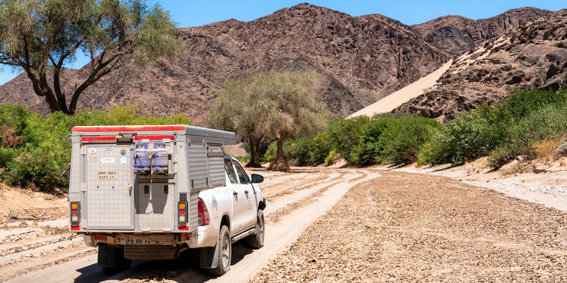
Driving the Ugab River
Before departing Brandberg White Lady Lodge campsite, I asked reception if the Huab River was driveable to the Rhino Camp or if it still had water pockets, making it impassable. I only received a shrug of the shoulders and no reply.
So, I needed to find this out for myself.
I set all the tyre pressures to 1.7 bar for soft sand driving. As it turned out, it was a good choice of pressure, and we didn’t experience any bogging issues on the Ugab.
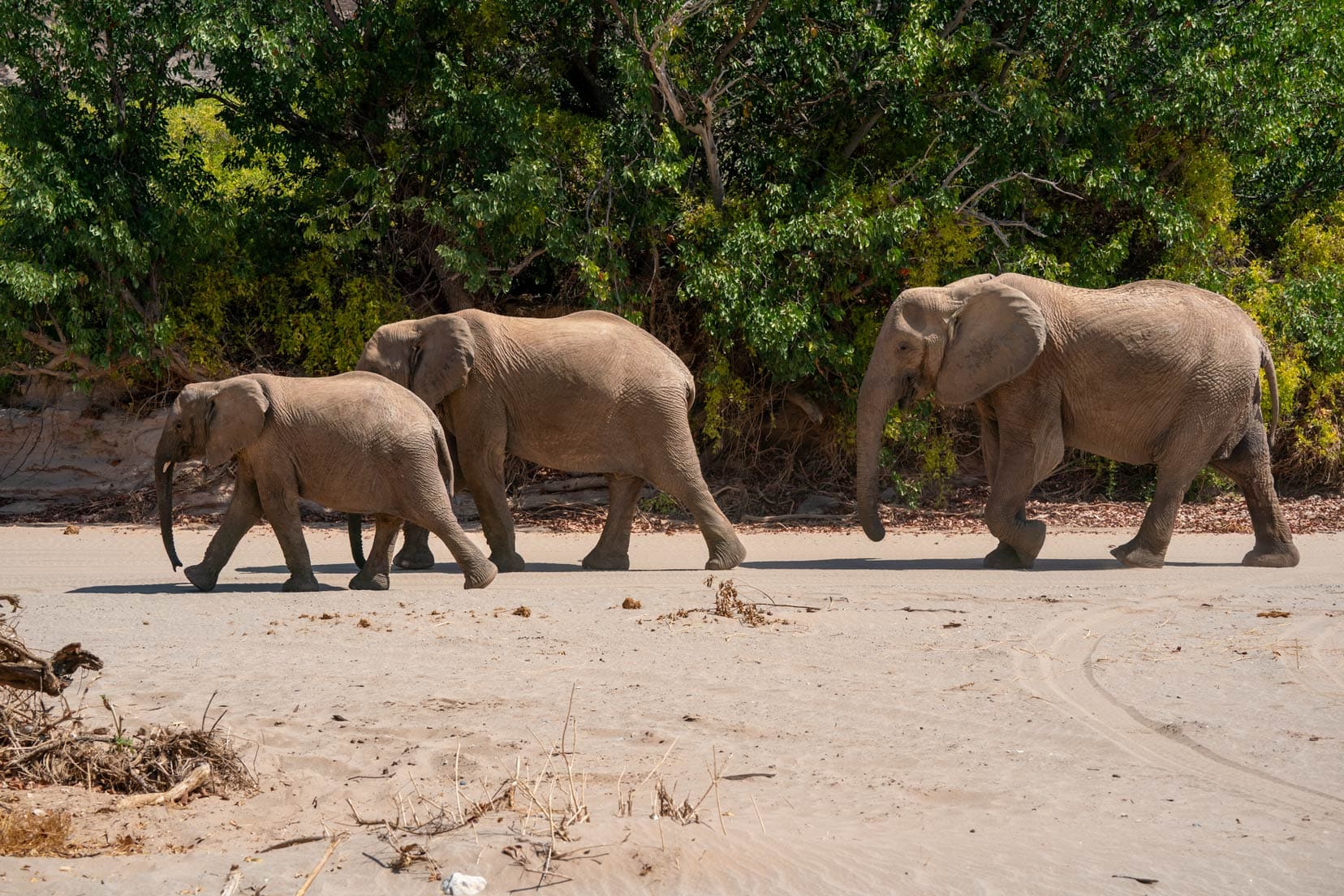
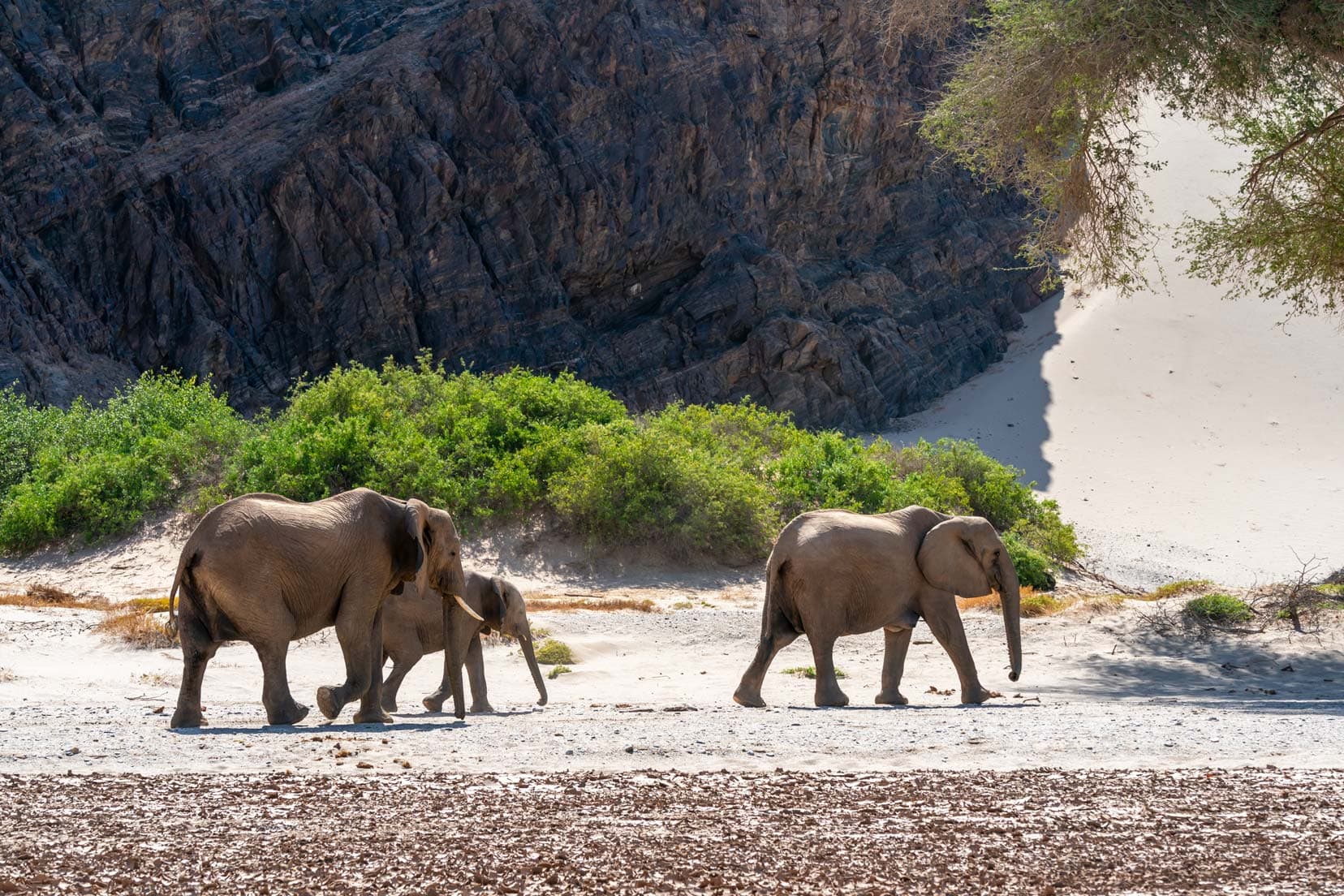
Starting the Ugab River drive early in the morning, it wasn’t long before we had our first sighting. A lone male elephant feeding off the green riverbank vegetation. Within a few kilometres, we had another fantastic up-close sighting of a breeding herd of four female elephants and a bull.
Continuing along the Ugab, we veered north to take a look at the old Tantalite mine workings. It was not particularly interesting, so we followed our original route back south and onto the Ugab River.
The riverbed had well-defined compacted tracks in the soft, fine riverbed sand. Following these definitely helped to avoid any bogging. The river reeds thickened considerably as we drove west, partially enclosing the track with large sections of pooled water.
Thinking the track might open up, we continued, but eventually, it was obvious we needed to turn around. This location coincided with that marked as swamp/mud on the Tracks4Africa app.
We backtracked to the east, turned south, and took the shortest route (as shown in Tracks4Africa) south-west to the D2342 and north-west to the abandoned Brandberg West mine entrance.
Access to the mine is up a curvy, steep hill. I thought I could do it in 4WD High, so I didn’t get much of a run-up and had to stop partway up to engage 4WD Low. I was worried about stopping on the slope, but everything turned out okay.
The road levelled out at the top of the hill, and I re-engaged 4WD High.
It looked like a typical mine site: mounds of mined rock, a few rusting bits of equipment, and a pretty rocky track.
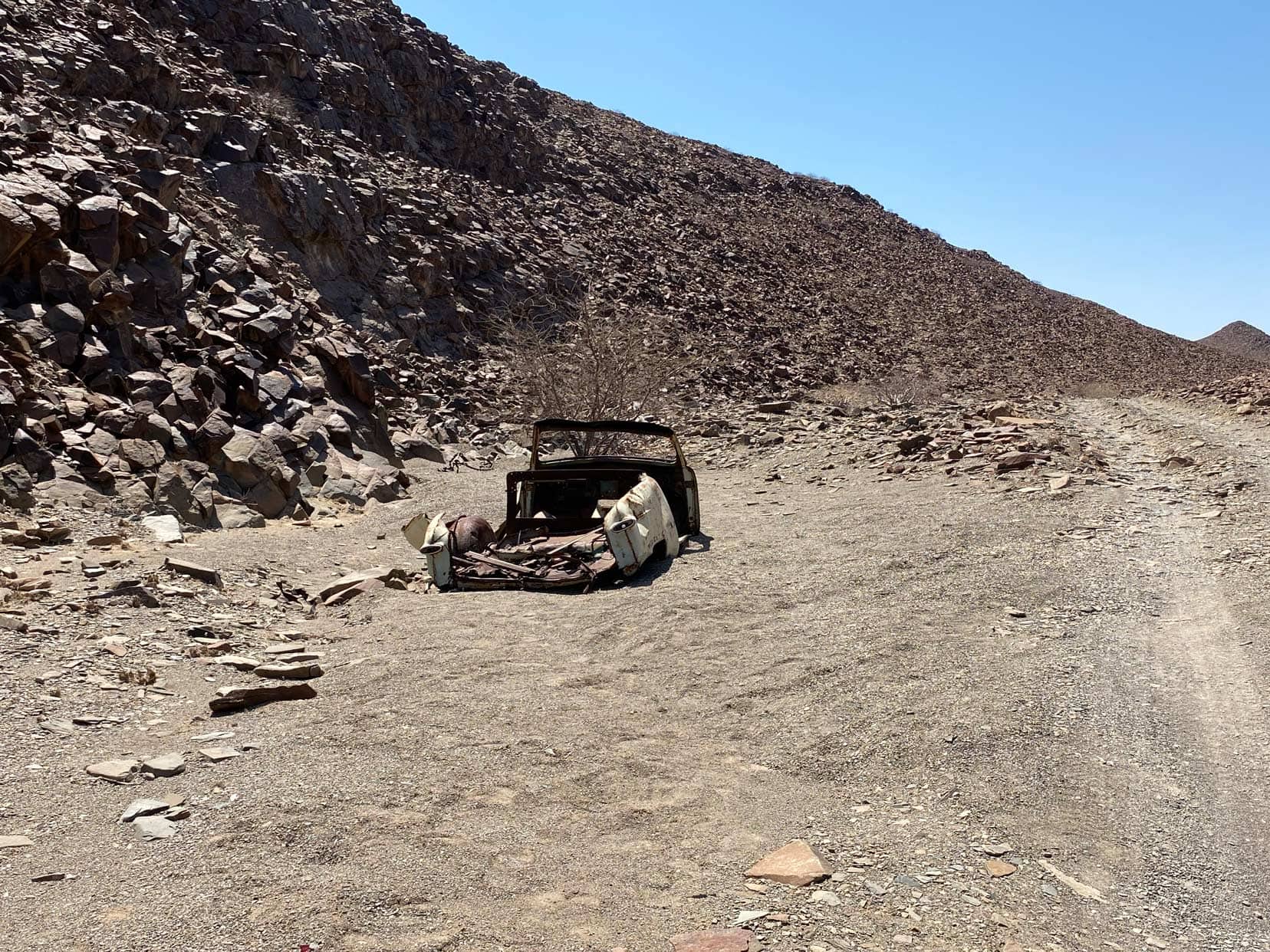
One point of interest marked on the Tracks4Africa app is a car wreck. You can’t miss it as it’s right by the road.
We re-joined the Ugab River to the west of the Doros Crater 4WD trail intersection and drove it east to see where the start of the wet areas of the river began. The position did actually coincide with that marked as swamp/mud on the Tracks4Africa app.
We drove back and set up camp not far away.
Although the Divorce Pass lay a few kilometres north, we didn’t drive this pass. I did see a video of the drive, and the trail didn’t look too technically challenging, but I’d like to hear from others.
Driving west took us through the Ugab’s Save the Rhino Trust Camp and the start of the Desolation Valley 4WD trail leading to the Huab River.
The camp has about 8 camping spots and a drop toilet with showers that sometimes have cold water. When we were there, we saw just one camper. The couple were headed to Twylfontein via the Divorce Pass. One recent reviewer on ioverlander described the Pass as absolute hell!
Video – Ugab River plus the Desolation Valley 4WD Trail
Desolation Valley 4WD-Trail (trail between Ugab and Huab rivers)
The first uphill section at the start of the Desolation Valley 4WD Trail was the most challenging part of the drive. The trail consisted of many sharp rocks that protruded at various angles and a few short, steep climbs.
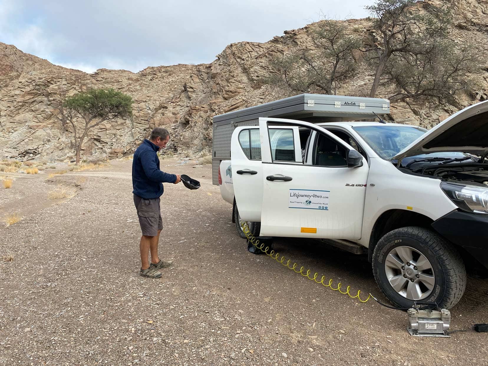
I set my tyre pressures to 2.3 bar but still sustained some sidewall damage on one of my tyres. 4×4 low range was engaged at times. The initial part of the trail climbs to a summit, and the terrain is flat from here.
Interesting points along the way are:
- Welwitschia plants — a living fossil only found in this geographical area.
- Damaraland viewpoint
- Rock formations and stone dwellings near the Gai-As fountain.
Interestingly, a notebook implanted in one wall of the stone dwellings is where travellers have added their names (we did, too).
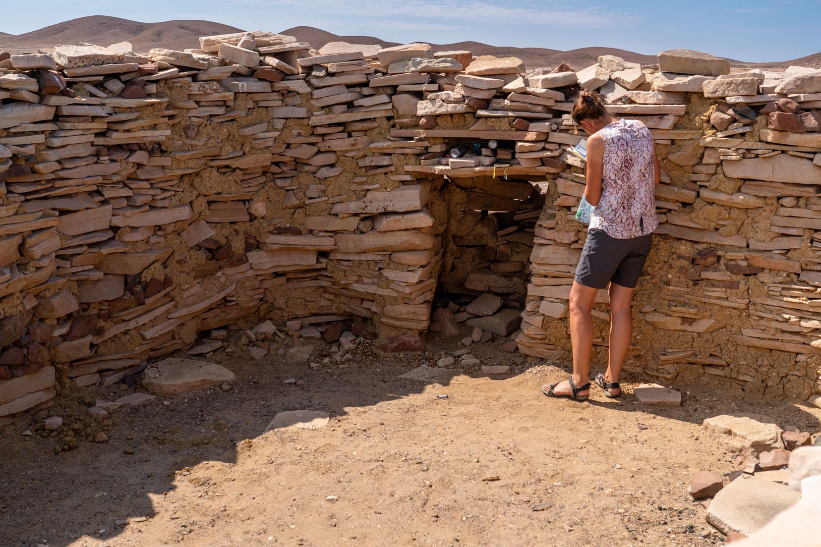
There is also a small stash of food, cigarettes and even a beer for that passing traveller truly in need. Close by is a small water soak that would surely help sustain the wildlife.
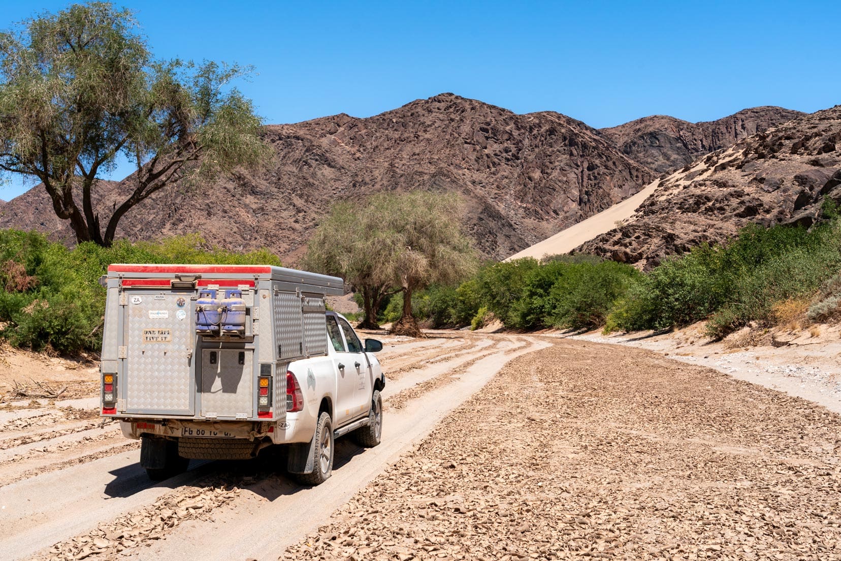
Driving the Huab River
The Desolation Valley 4WD trail ended at the western end of the Huab River.
I deflated our tyres to 1.7 bar, and we picked our way over the eroded river banks to cross to the north side of the river in the hope of following it upstream. However, we couldn’t find a way to drive down into the Huab riverbed.
We had some great green and lush Desolation Valley views, though.
Using our Tracks4Africa map, we backtracked 5 kilometres to choose another track going northeast to rejoin the Huab River.
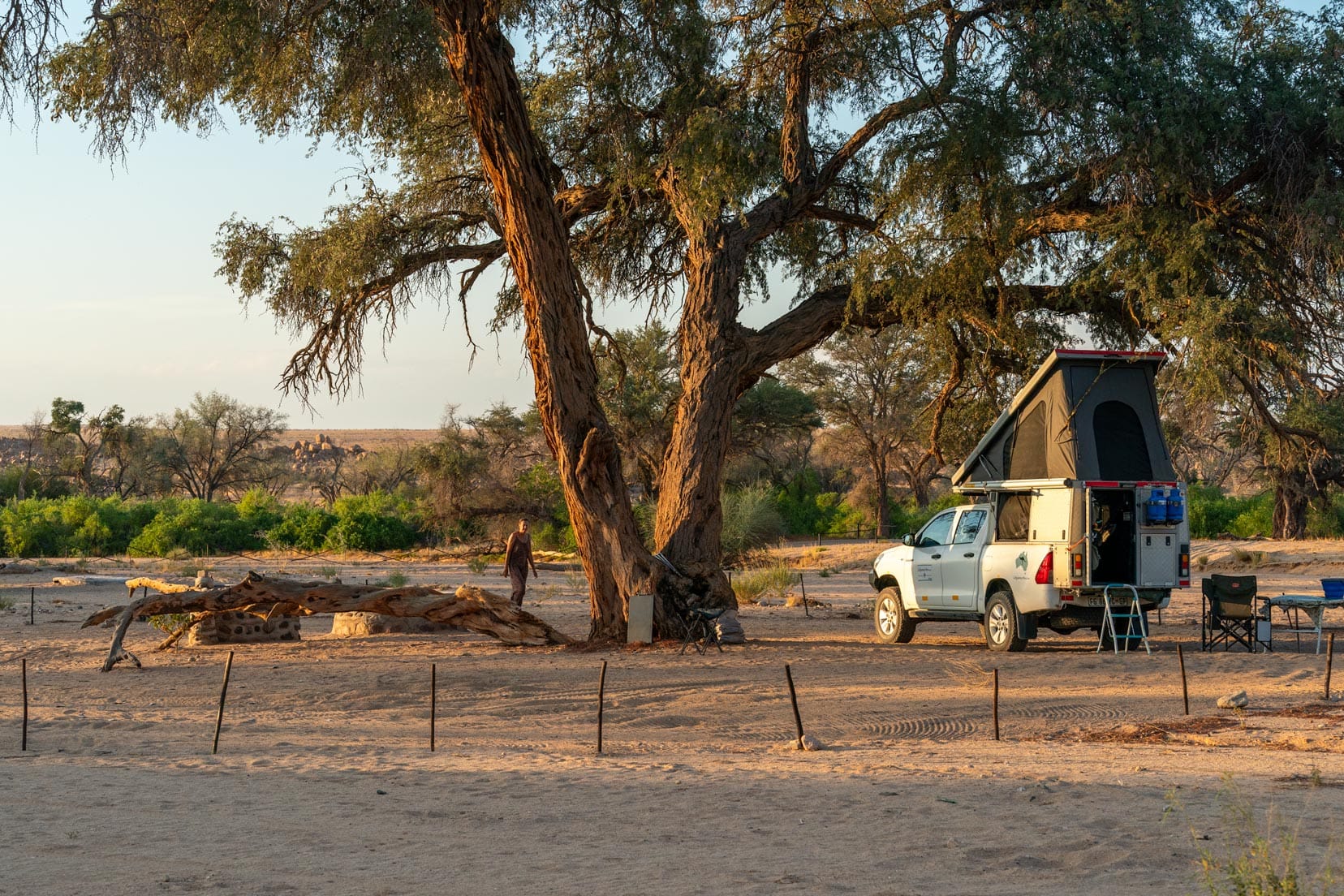
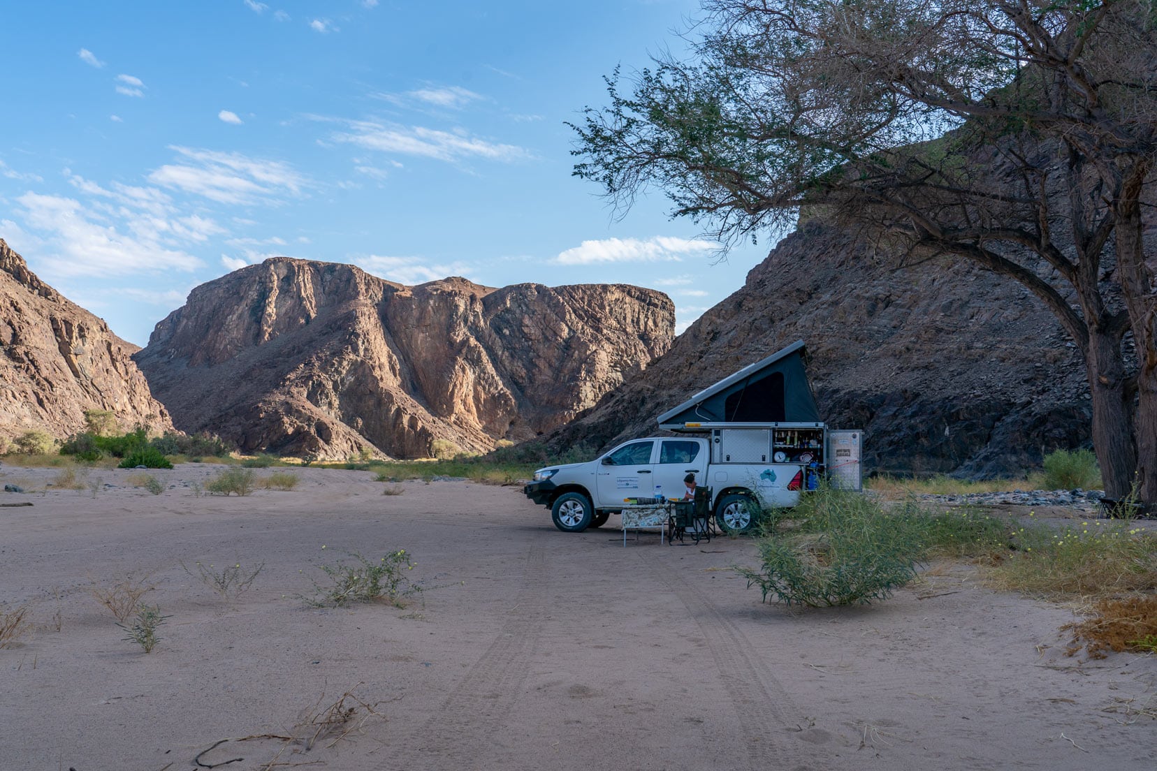
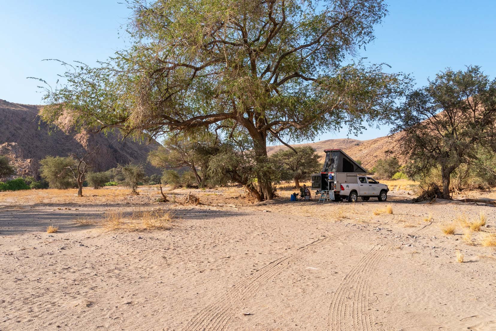
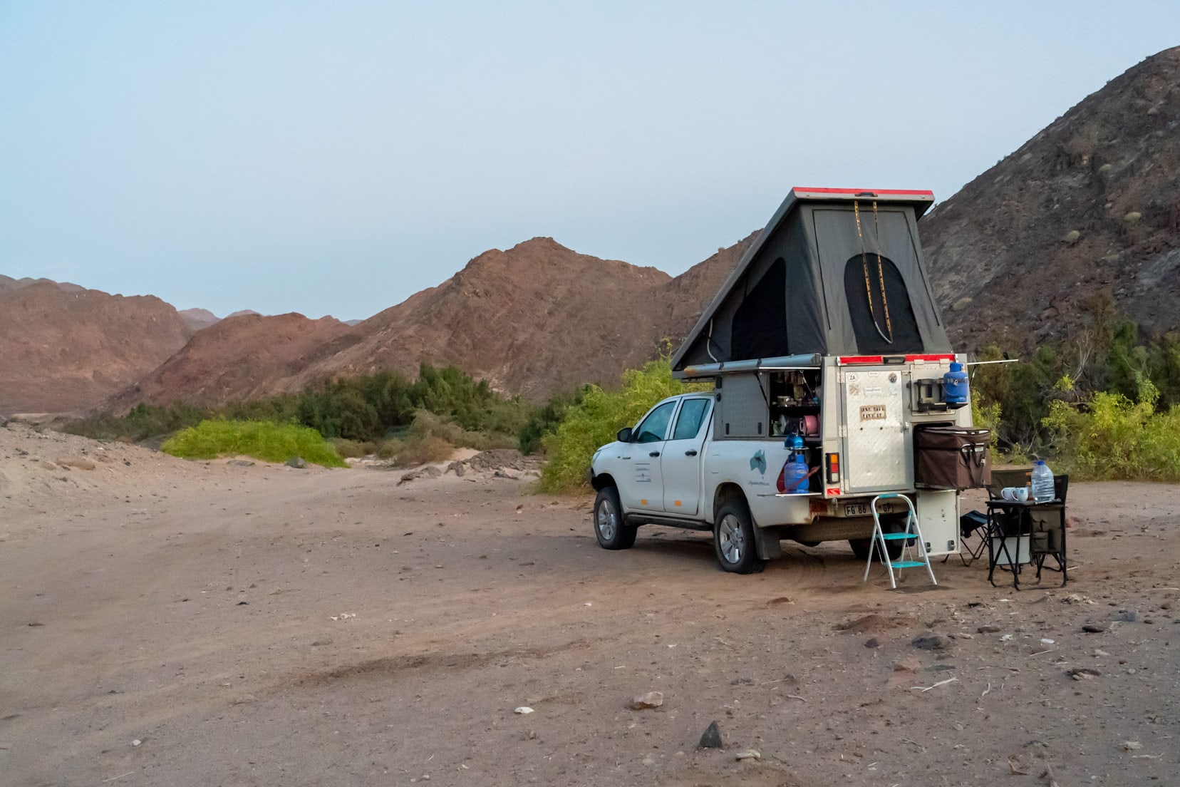
Descending the wide, dry riverbed, we drove a short way to find a recommended wild camp location, which was really lovely.
We had the spot to ourselves, which made it even more special.
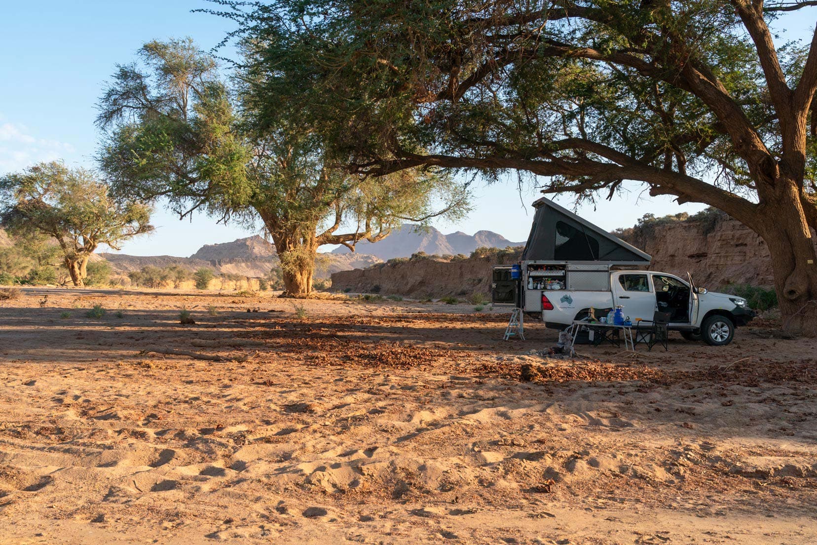
There was more wildlife here than in the Ugab dry riverbed. We saw springbok, black-backed jackal, ostrich, oryx and giraffe.
We noticed that the desert elephants stayed out of the Ugab dry riverbed, preferring to keep to the bushes of the elevated riverbanks. We saw only a few elephants here.
We passed a few private 4WD vehicles and quite a few game-drive vehicles, which sort of spoiled it after the solitude of the Ugab River.

We turned north at the De Riet area, looking to escape the unexpected game-drive traffic.
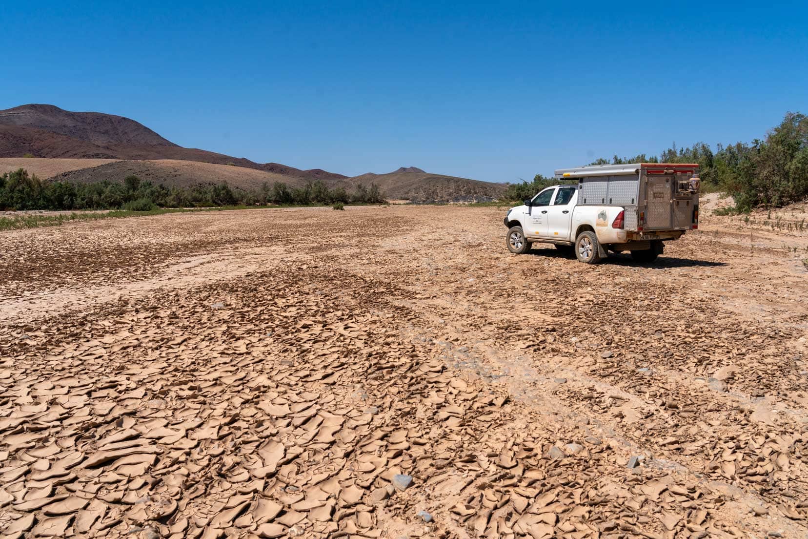
Seeking some shade to set up camp, I drove to the edge of the riverbed and got myself bogged. The sand was super fine and powdery.
After a lot of digging, dropping tyre pressures to 1 bar and using the rubber recovery tracks, I got our Hilux out of trouble. It took a couple of attempts, but we finally breathed a sigh of relief and I learnt to be particularly careful around the edges of the riverbank.
Video – Huab River
We couldn’t find a shady place to camp, so we crossed the M126/C39 and camped on the upper Huab River 4WD trail.
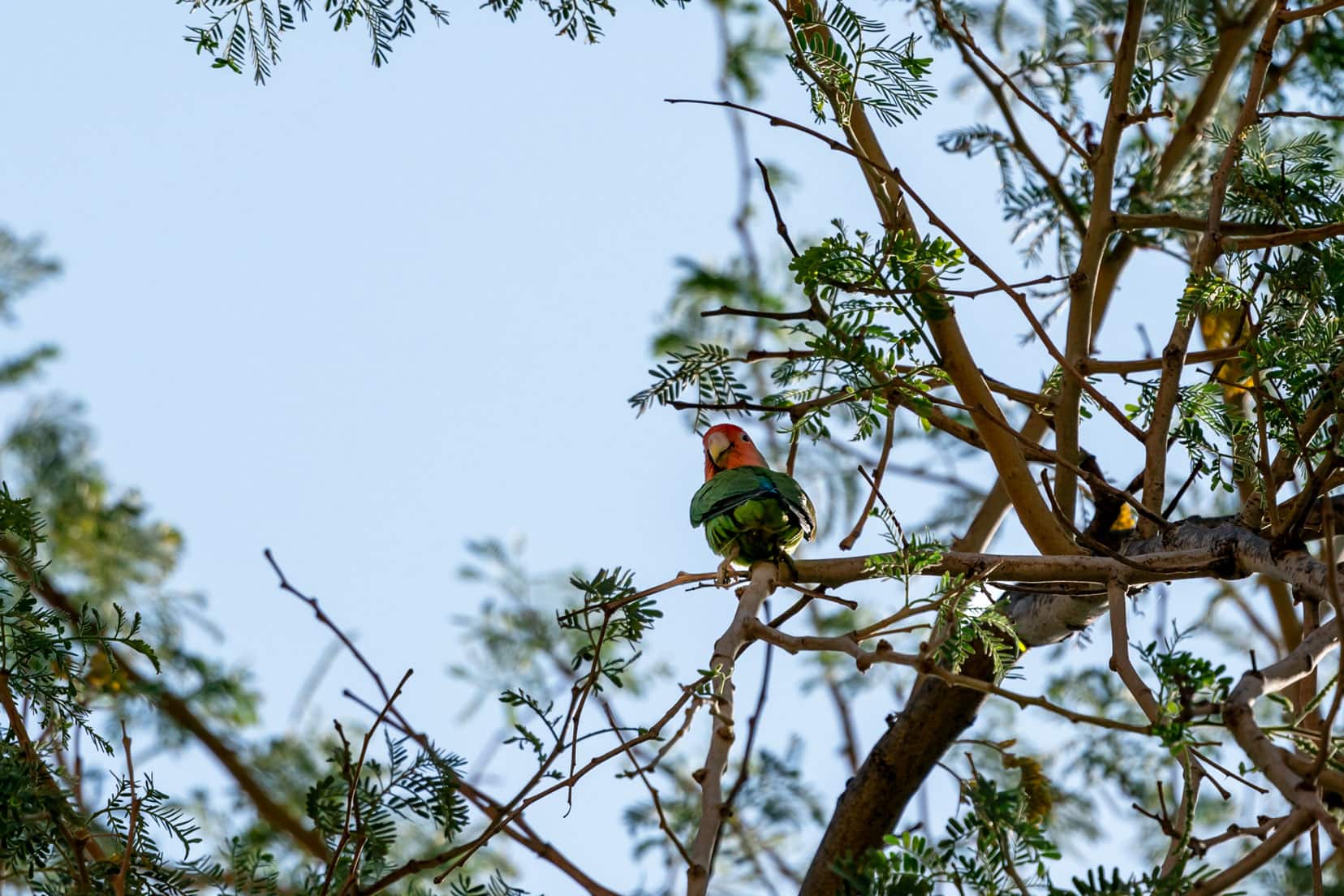
It was quiet, and I kept myself busy trying to photograph the lightning-fast Rosy-faced Lovebird (sometimes called the Peach-faced Lovebird).
If you are interested in learning more about photography, check out our article on how to make the most of your camera on a road trip.
The next day, in need of a good shower, we drove north, following elephant tracks on the road for many kilometres, but unfortunately, there were no sightings.
We overnighted at the Palmwag campsite (Gondwana Collection).
Driving the Hoanib River
Departing Palmwag, we topped up on water and fuel at Sesfontein and continued west to turn off the D3707 into some really boggy, soft sand.
On the Tracks4Africa map, this area is marked with ‘powder dust’, and it sure is.
I had pre-empted this by lowering all tyre pressures down to 1.5 Bar. After successfully negotiating this boggy section, the track conditions improved, and we soon reached a permit gate attended by two officers in uniform.
To enter, we paid cash N100 per person plus N100 for the vehicle per day. All up N600 for our two days in Hoanib.
We were asked our intention and replied that we were camping and looking for desert elephants. We were then informed of the rules:
- Remain a good distance (at least a few hundred metres) from any waterhole,
- Stay in our vehicle when elephants are about and
- Give them space.
We were provided with a map of the riverbed and waved off.
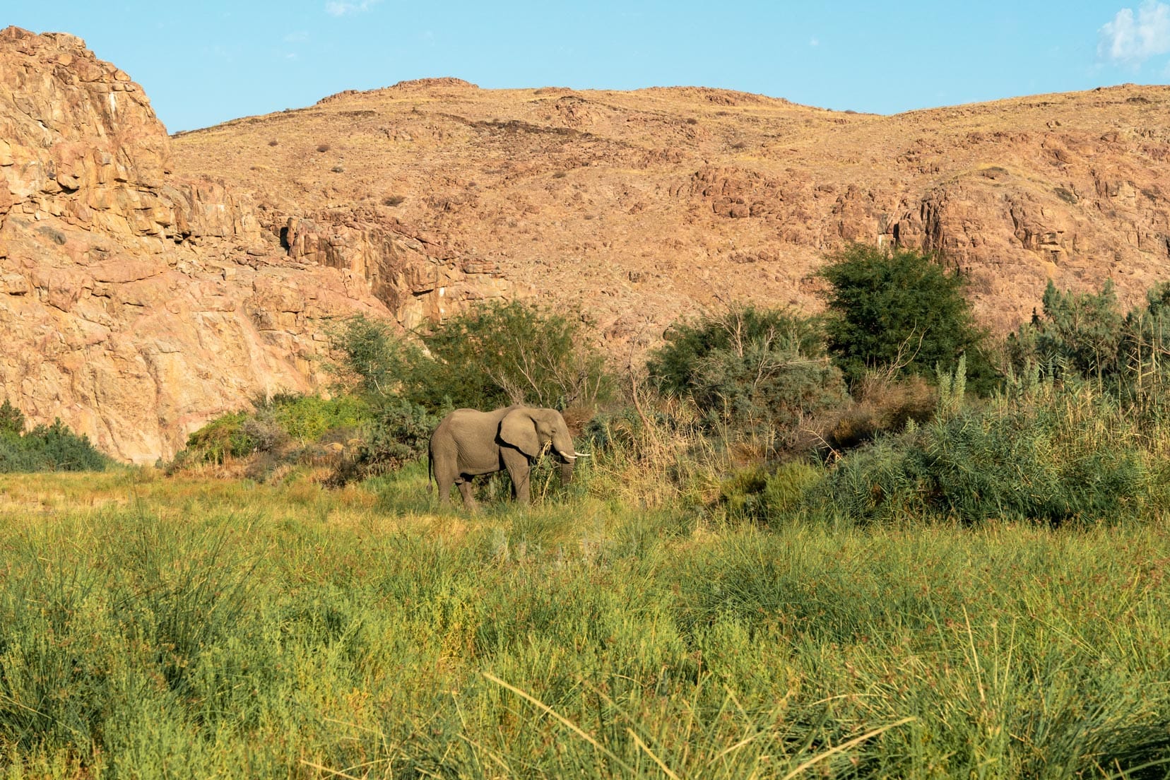
The Hoanib River provided us with the best desert elephant sightings of the four rivers (check out the Hoanib video below).
This may have been because the riverbeds in some parts are quite narrow, bringing the elephants into closer proximity. It made for some fantastic encounters.
The gate attendant mentioned a waterhole south of the Mudorib Camp that many elephants frequented. We headed south but abandoned this route after 2 hours of driving.
We had not seen any elephant spoor on this route and decided to overnight there before backtracking the next day.
Backtracking to the dry Hoanib riverbed, we spotted elephants feeding at several locations and even lying down. This was the first time we’d seen elephants lying down, and at first, we thought they might be dead.
They were only napping, though; we soon became accustomed to seeing them lie down.
We had never seen this on our previous safari drives throughout Botswana or South Africa for the months we spent in Klaserie Nature Reserve and Kruger National Park.
A troop of baboons also made an appearance at the Mudorib waterhole.
Video – Hoanib River
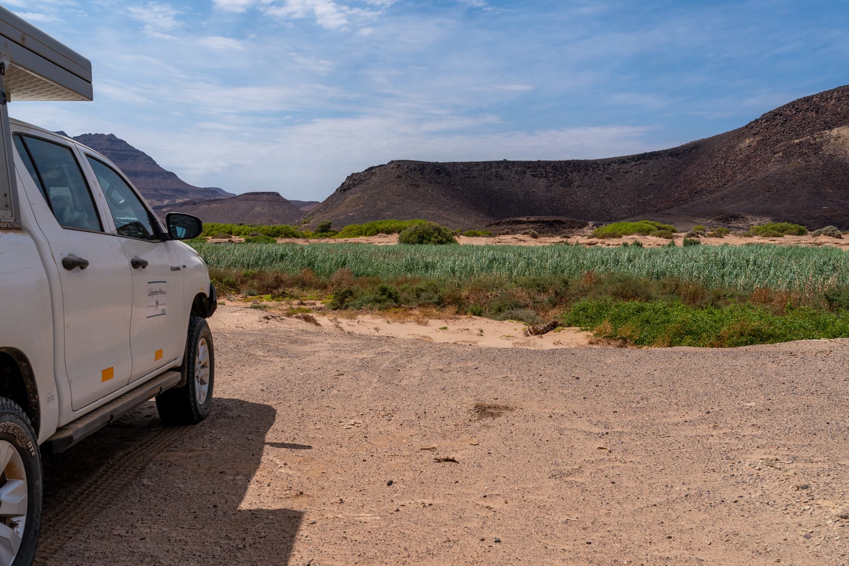
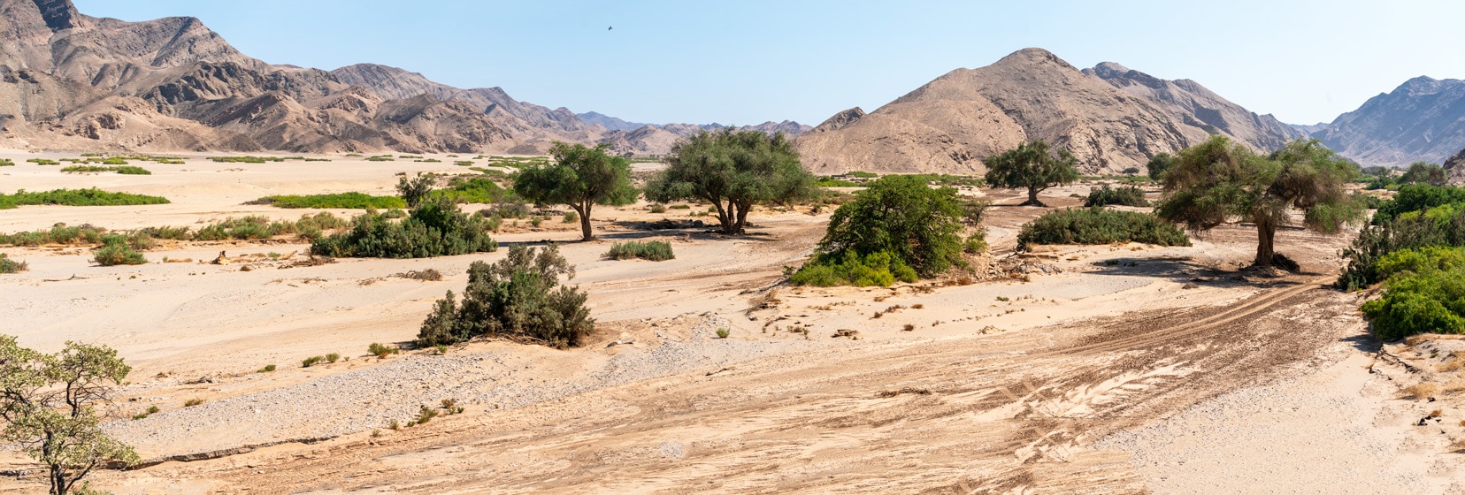
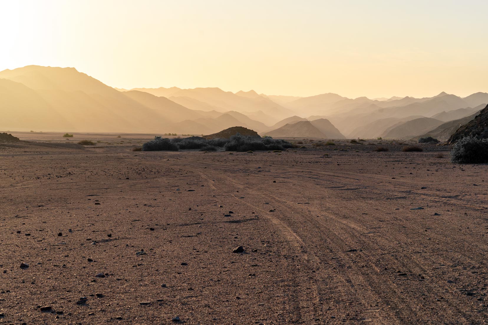
Further west, the Hoanib riverbed opens out into a wide area known as Amspoort Gorge.
It’s a beautiful location dotted with large trees that have withstood the ravages of floods and drought. There were quite a few giraffes around keeping a watchful eye on us.
At Amspoort Gorge, we turned north towards the Hoarisib River.
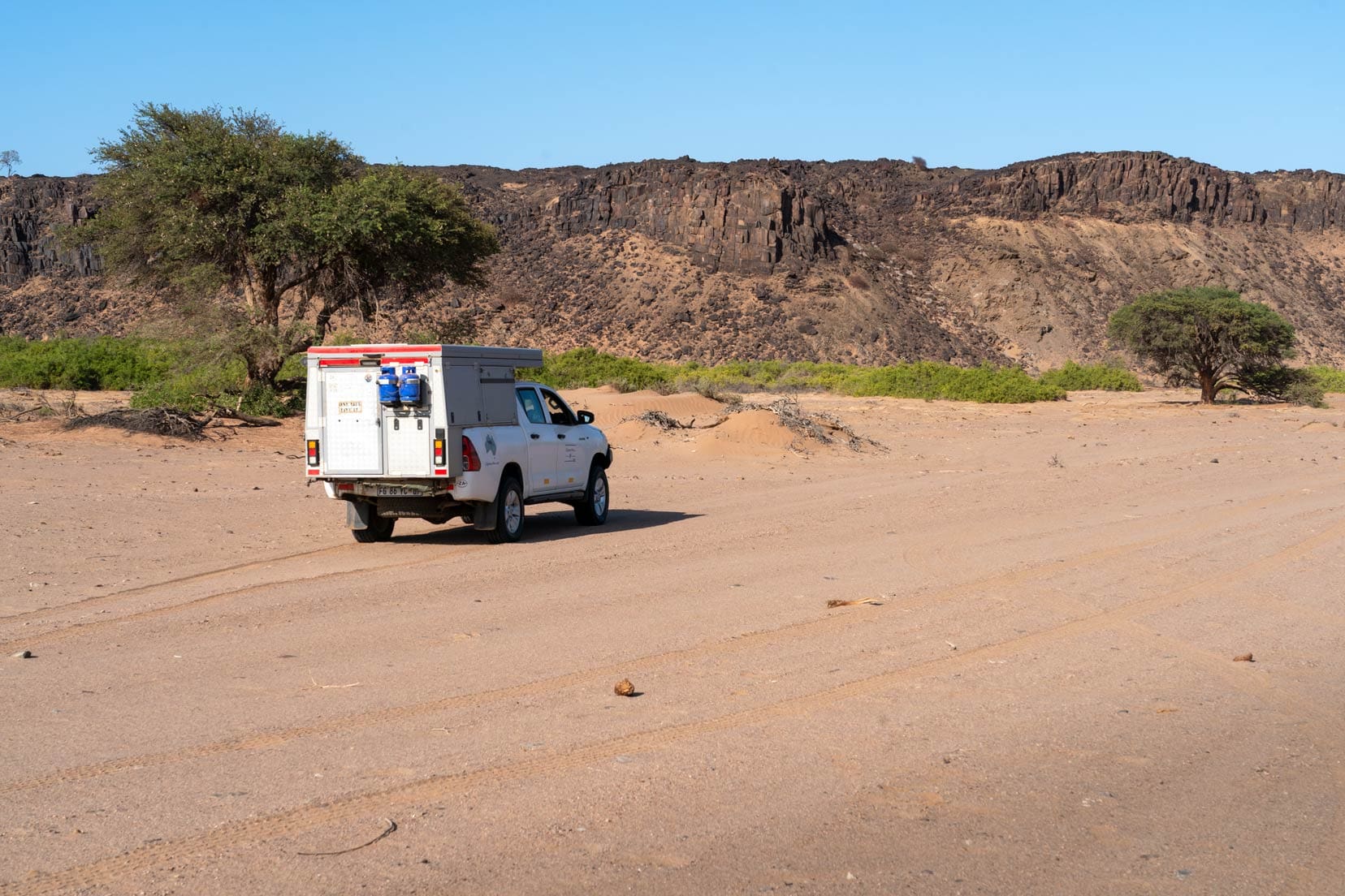
Driving the Hoarisib River
The drive between Hoanib and Hoarisib Rivers was filled with hours of unrelenting corrugations and rather bland scenery. However, a beautiful sunset over the mountains was the perfect welcome to the western end of the Hoarisib River.
Our intention was to camp on the Hoarisib River, but there was still water in the river. Not so deep, but silty and thick mud.
It looked ominous.
Therefore, we didn’t attempt to cross it and backtracked to proceed east on another track. Reaching the Hoarisib, we found that the water was even deeper.
We stopped and set up camp but back from the river reeds to avoid sharing real estate with about a million bugs.
Later, we asked a guide in Puros about our decision not to cross the muddy river. He said that he and other locals had been called out many times to take nearly a day to dig out bogged vehicles from the river.
So, our decision was the right one!
He left with some words of advice stating that if there was any water in evidence, then simply don’t drive it. That’s good enough advice for me.
So, we did not manage to drive the east-west section of the Hoarisib River but took the trail just to the south towards Puros. We could only drive the north-south part of the Hoarisib River.
After crossing a wide, dry riverbed, we entered Puros and continued north to the beautifully presented Puros Community Campsite.
This is an experience you shouldn’t miss.
The amenities here are actually built into the existing trees and bushes, creating a ‘cubby-house’ effect.
It was one of the best campsites we have had the pleasure to visit in Namibia, apart from our favourite campsite in Namibia, on the Okavango River, at Ndhovu Safari Lodge. But as a community campsite this was Puros was special.
It was right alongside the Hoarisib riverbed, making for quick access to start the river drive.
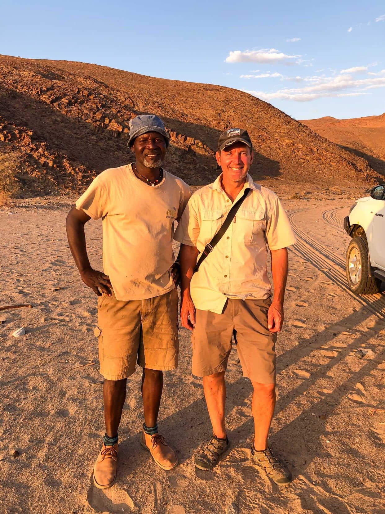
Of the four riverbeds we drove, Hoarisib was to be the most challenging. The guide cautioned us to be careful. The moist river sand that lay just below the crusty top could be boggy, and he advised following previous car tracks to avoid problems.
I was all ears.
If you decide not to drive the Hoarisib River, you can hire a guide and vehicle at the nearby Puros Bush Lodge. The guide (‘Kavosina’ as seen above) advised us to avoid crossing the river when water was evident.
So, with the guide’s advice still ringing in my ears, we left the Puros Community Campsite, and in a matter of minutes, we were following car tracks in the river sand going north. The going was very boggy, and the sand had a dark look to it, indicating it still had some moisture in it.
After a few kilometres, we found that we were making our own tracks as no vehicle had ventured that far north.
We found the Hoarisib riverbed to be quite wide, with vegetation only seen on either of the river banks. As we were driving mostly in the middle of the river, this distance made sighting elephants quite difficult.
Video – Hoarisib River
After a few hours, with no elephant spoor seen, we turned around and followed our own tracks back towards Puros. With the daytime temperatures starting to climb, the sand became hot, increasing tyre pressures and our chance of getting bogged.
Twice, I stopped to reduce tyre pressure by 0.2 bar at a time.
The Tracks4Africa app gives a selection of route options when driving the Hoarisib riverbed. Sometimes, we started on the ‘Main Offroad’ route but found this to be more treacherous than the ‘Offroad’ route and even impassable at times. Maybe because this track was used more often?
We opted for the ‘Offroad’ route most of the time. Of course, the track situation will likely change when the river floods again.
In hindsight, driving the riverbanks would have been a better option for elephant sightings as this is where the vegetation is. However, we still saw giraffes and ostriches in the Hoarisib River system and had an enlightening visit to the Himba Cultural Village at Puros.
We would overnight in Puros and then continue towards Etosha National Park National Park.

Dry Riverbed Route Navigation
We used the Tracks4Africa hard copy map alongside the Tracks4Africa app. We’ve found that the app is our go-to resource for route planning. The app includes a lot more information than the hard copy map.
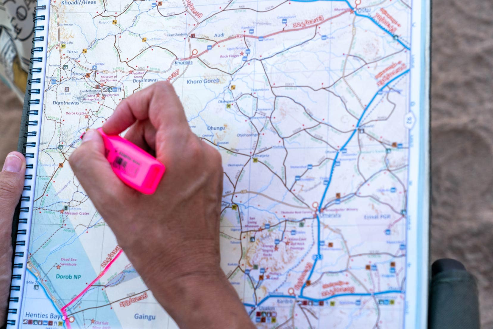
For example, when we reached the western end of the Hoarisib River and saw it was not dry, we needed an alternate route.
The Tracks4Africa app indicated a detour to the south of the river, which we took. The hard copy map did not show this. Hence, our preference for the use of the app as a primary means of route navigation. It was an essential tool for us during the drive of Namibia’s dry riverbeds.
What I’d Do Differently
Looking back on our journey, I would do a few things differently:
- Choose to drive in the winter months. We did our drive in April. It was a last-minute decision, and we were lucky the rivers were dry. This was only because summer rains were poor that year. Winter months in Namibia are not normally associated with rainfall. Also, April’s midday sun was blistering hot, so attempting the trip in the cooler months would be a lot more comfortable.
- Drive the Uniab River. It’s the one river we missed, and I still wonder what the experience of driving that would be like.
- Extend the duration of our 10-day trip to allow more time to see the desert lions. To be able to hear a lion roar in the riverbed canyons would be phenomenal.
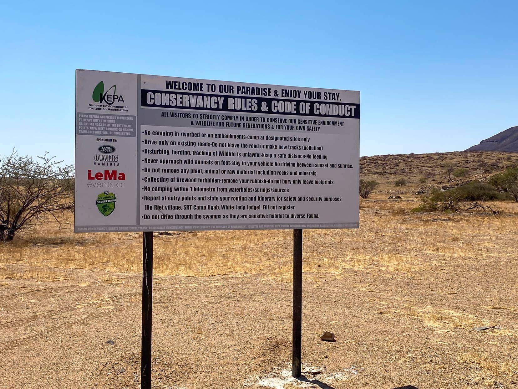
- Read Signs at the Time! Huab Dry Riverbed – we read this sign when we went through our photos, so we hadn’t realised we had broken the rules! We had read plenty of other accounts about others camping in the riverbeds and had spoken to guards at certain entry points for the other riverbeds about our plans, and none told us that we weren’t to camp.
Trip Planning: Key Considerations
Consider these during your dry riverbed trip preparations:
- Tyre Pressure: Driving dry sandy riverbeds requires reduced tyre pressures to avoid getting bogged. Be mindful that tyre pressures will also rise as the air temperature rises, which may require deflation as the trip progresses.
- Water and Food: Stock up on plenty of water and food to remain off-grid as long as possible to fully immerse yourself in nature and enjoy the experience.
- Rainy Season: If driving in the rainy season (December to April), be mindful of the water in the riverbed and the risk of flash flooding.
- Respect Wildlife: Respect the elephants by keeping a good distance from them when in your vehicle, as this will avoid stressing them. Note that where you see elephants close to us in our videos – they came towards us when we were parked. We always parked at a distance.
- Check Conditions: Always ask locals what the current river driving conditions are.
- Emergency Communication: Consider having satellite communications in case of an emergency, as there is no network signal in the riverbeds. We have a Garmin Mini Satelite Communicator.
- Follow Tracks: Driving on the tracks of other vehicles decreases the risk of bogging a vehicle in the soft, fine river sand.
Driving Namibia’s Dry Riverbeds to Encounter Desert Elephants … That’s A Wrap
Our 4×4 journey through Namibia’s riverbeds was more than just a drive; it was an exploration of Namibia’s untamed spirit.
The intimate encounters with desert elephants, the challenges of navigating uncharted terrains, and the beauty of the landscapes were phenomenal.
So, if you’re ready for the adventure of a lifetime, start planning your own 4×4 journey through Namibia. Trust us, it’s an experience you won’t forget.
Check out all our posts on Namibia here for more trip inspiration.
Pin and Save for Later
Planning Your Travels?
These are the travel resources we recommend and use when planning our trips.
- 🚘 Car Hire: We use DiscoverCars.com
- Motorhome/Campervan Rental: We highly recommend the Motorhome Republic
- 🪪 Order your International Driver’s Licence online here
- 🛏 Book Accommodation: We use Booking.com to find accommodation that suits our budget
- 🐶 Pet Sitting/Pet Sitters: Check Out TrustedHousesitters here (Use our Discount code: LIFEJOURNEY25 for 25% off. )
- Activities and Experiences: Get Your Guide and Viator
- Travel Insurance: Safetywing or World Nomads
- 🥾 Travel Gear and Accessories: Check out our top picks here — Lifejourney4two page on Amazon
For a more thorough list, visit our Travel Resources page here.
Hi Lars and Shelley,
Reading your post has brought back so many happy memories of our trip to Namibia in 2021 and our visit to Brandwag White lady and the Palmwag Concession. We were very fortunate to spend a f time with the Desert Elephants around Brandwag.
We are off on a trip through Zambia and then back home to SA through Botswana in August and September this year. Then we will start planning for another trip to Namibia in 2027. Thanks for sharing your tips on the dry river beds. Harry and Sally.
Hi Harry and Sally, so please we could reignite what sounds like beautiful memories from your Namibia trip in 2021. Have a fabulous trip in Zambia and Botswana later this year and happy planning for 2027! Thanks for taking the time to leave a comment and happy travels and adventures 🙂
Shelley and Lars
Hi Lars,
I have watched your Video re Namibia’s dry river beds and read your write up about it. I am particularly interested in the section Rhino Ugab camp to Desolation valley (Desolation valley 4×4 track). We will be doing this section in May this year (2024). The first section leaving Rhino Ugab camp is the section I am interested in. We are 2 vehicles a Hilux and Fortuner, both are towing a Bush Lapa Boskriek. My main concern are the sharp rocks. I would appreciate your comment on this section. Thank you.
Kind regards,
Ben
Hi Ben,
This ascent at the start of the Desolation Valley 4×4 trail is the challenging part. There is a distinct track to follow, however in a few places (maybe half a dozen spots) you’ll have no choice but to drive over sharp rocks as the tight width of the trail, lined by larger rocks on the sides, does not allow you to choose another option. This is where I incurred some tyre sidewall damage on one tyre even though I had my tyre pressures higher (around 2.3 bar) after driving in the sand. Maybe slightly higher tyre pressures would have helped.
This initial climb did not have particularly tight turns so manoeuvrability was not a problem. A few times I still got out of the car to check the driving line I was going to take over the rocks and then engaged 4×4 Low and let the car pick its way over until I was through, then went back to 4×4 High. I didn’t have to reverse and re-attempt any of this initial part of the climb.
Choosing the right tyre pressures, driving line and using 4×4 Low over the rocky parts should get you through. One last point, I travel with two spare tyres.
Hope that helps and feel free to ask anything else. I’d be real interested to hear how it all goes for you.
Enjoy, it’s a great part of the world to disappear in,
Lars