
Tucked away from the usual tourist trails, the Bondhusvatnet Hike offers a memorable experience with minimal effort. Unlike many of Norway’s beautiful hikes, this one gives up all her rewards without too much of a fight.
Having reached the town of Odda, a stop during our Stavanger to Bergen road trip, the serene, mirror-like surface of Sørfjord, a branch of the majestic Hardangerfjord, captivated us with its reflective beauty.
Having lived in Norway over the years with our base in Skudeneshavn, it was a fantastic location from which to springboard our adventures. We’ve really enjoyed Norway to its fullest through its different seasons, soaking up its history at Avaldsnes, admiring the stave churches, walking the pretty streets of Stavanger and the unforgettable dances of the Northern Lights.
In this article, we share our experience hiking Bondhusvatnet and further, departing from the carpark up to the moraine with photos of the scenery, terrain and a video compilation.
⛰️ Bondhusvatnet Hike in a Nutshell
- 🥾 Hiking Level: 🟩 Easy
- ⛰️ Elevation Gain: 150m
- 📏 Distance: Route 1 is the Bondhusvatnet Hike, which is a 4.6 km return from the carpark to Bondhusvatnet. To extend this for a longer trek, Route 2 passes around the lake to the moraine, totalling 8.6km return.
- ⏰ Time: 2 hours for route 1; Total 4 hours for route 2.
- 👣 Route Type: Out and Back (Route 1 is wheelchair and stroller-friendly)
- 📍Location: Folgefonna National Park, Hardangerfjord, Mauranger, Hordaland County
- 😎 Season: Year round
- 🚗 Parking Fee: NOK 100 per day for the Bondhusdalen parking area
- 🚶🏽♂️➡️Essentials to Bring: Sturdy hiking boots and versatile, layered clothing suitable for variable weather conditions.
- 🚻 Facilities: Toilets at the carpark
- ↪️ Drive: From Jondal ferry terminal, Årsnes ferry terminal or road Fv551 near Odda.
- ? Reason to Visit: To enjoy the stunning landscapes.
- ✋ Rules: Bondhusvatnet is a source of drinking water. Camping must be a minimum distance of 50 meters from the water; bathing in the water is prohibited. Dogs are to be kept on a leash at all times due to grazing animals.
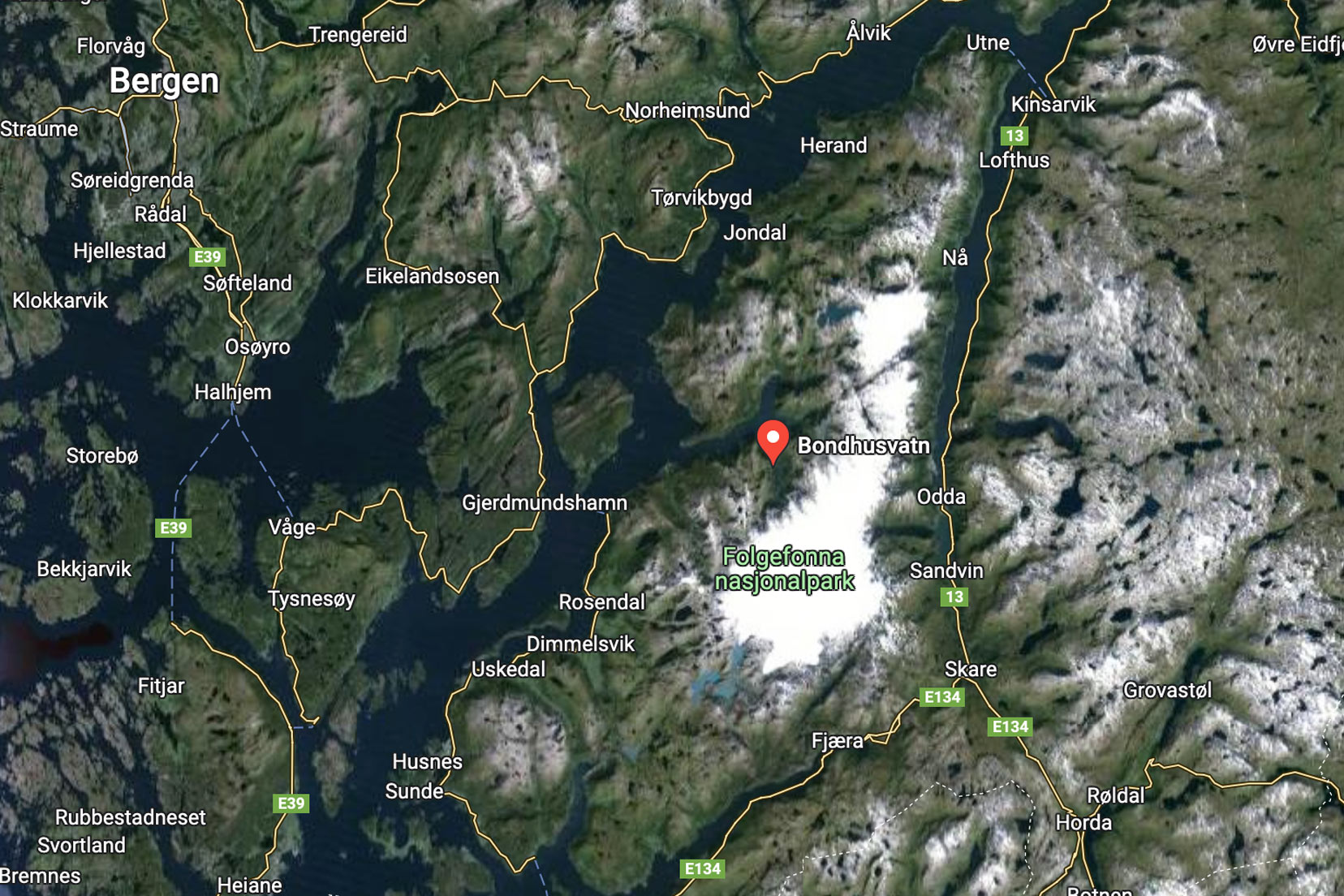
Map: Bondhusvatnet Hike Details

FREE TRAVEL PLANNER
Grab our Free 23 Page Travel Planner and get emails of all our latest posts by signing up here.
Video: Bondhusvatnet Hike
History of the Bondhusvatnet Trail
In the late 19th century, ice from Bondhusbreen was rowed across Bondhusvatnet and transported by horse and cart using the walking trail to a wharf in Sundal. From here, it was shipped to local destinations and was used to keep food chilled.
The trouble was that much of the ice would melt. Without any effective means to prevent this, the operation was abandoned.
HM Queen Sonja of Norway opened Folgefonna National Park on 14 May 2005.
Our Experience of Hiking Bondhusvatnet
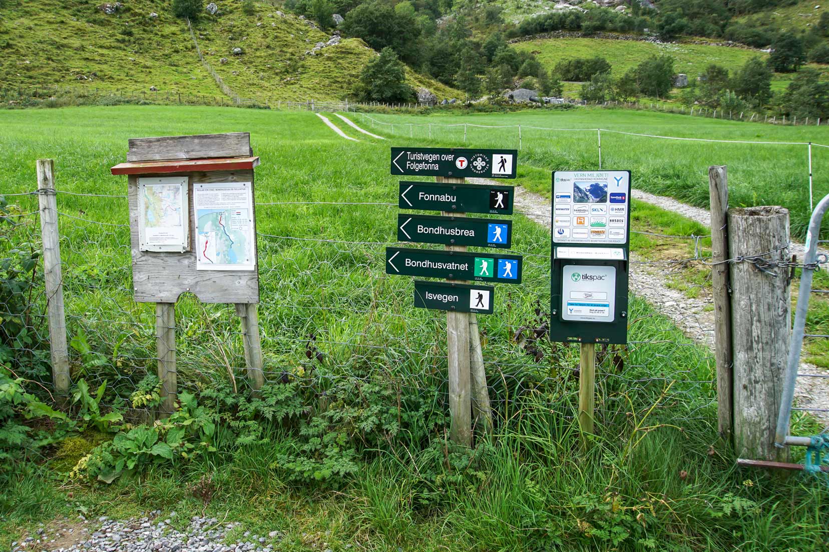
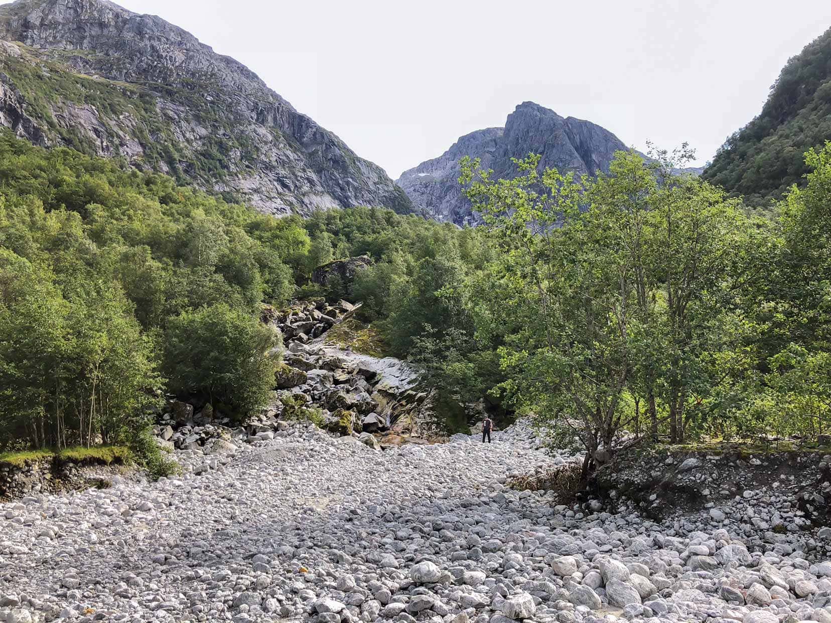
Bondhusdalen Parking to Bondhusvatnet
Arriving at the large Bondhusdalen parking area, we paid the parking fee and began the walk past the toilet area on a slightly inclining gravel path. The path ran beside the bubbling Bondhuselva River where the trees fought for space near the rocky shores.
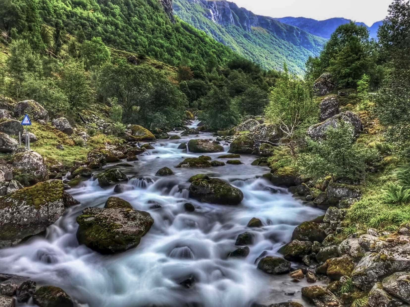
The welcoming pine scent was heavy in the air. The picturesque surroundings of Bondhusdalen Valley already showed signs of great things to come.
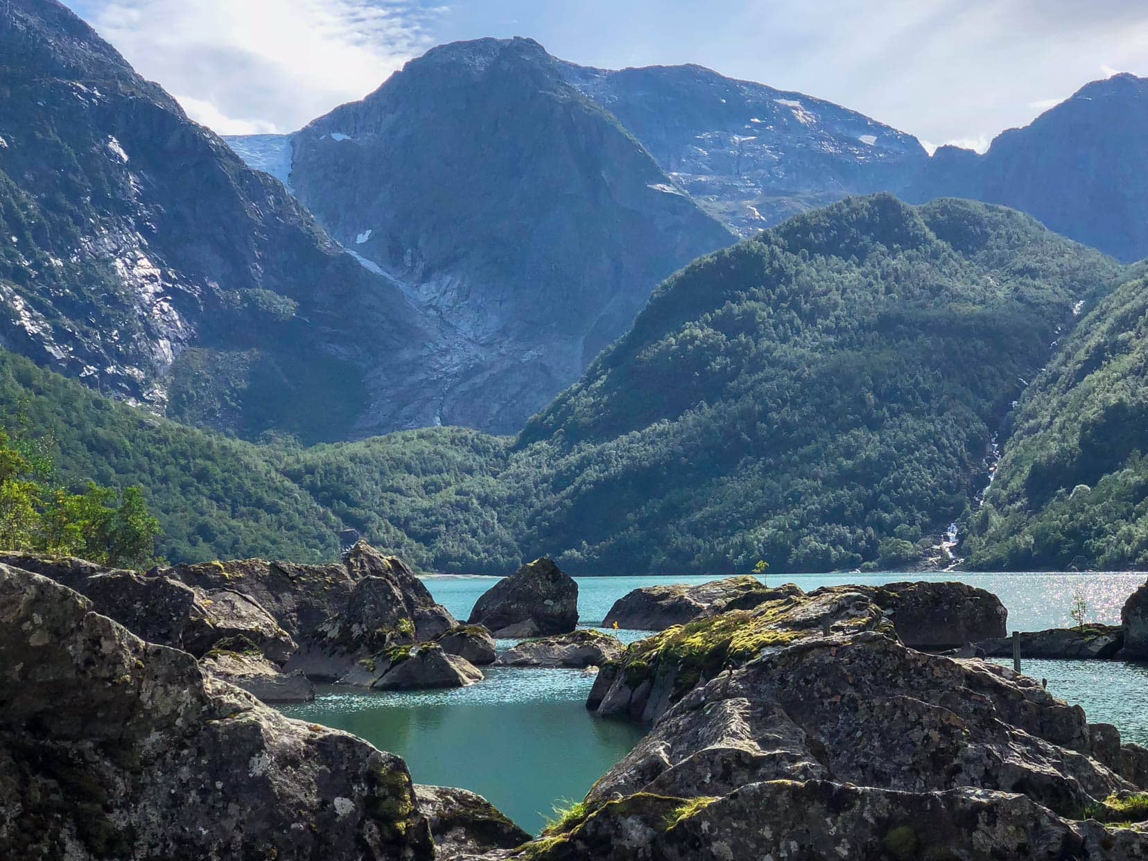
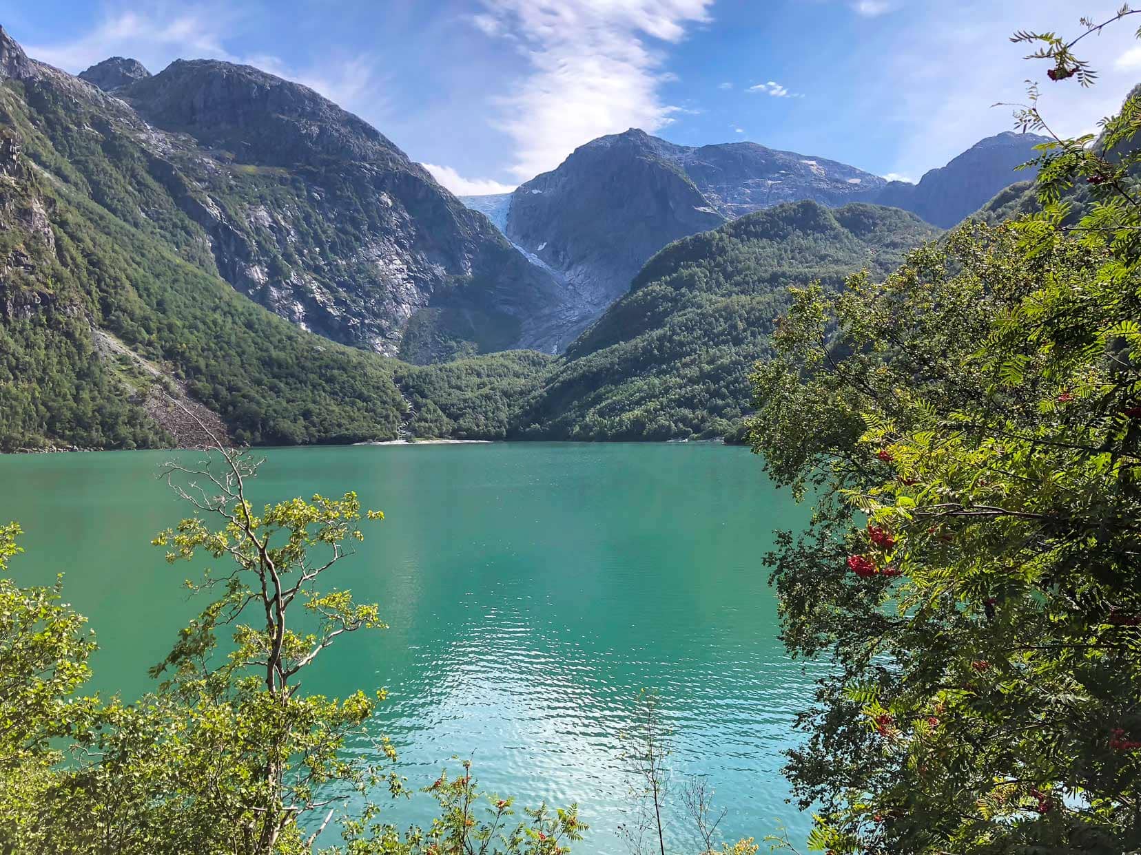
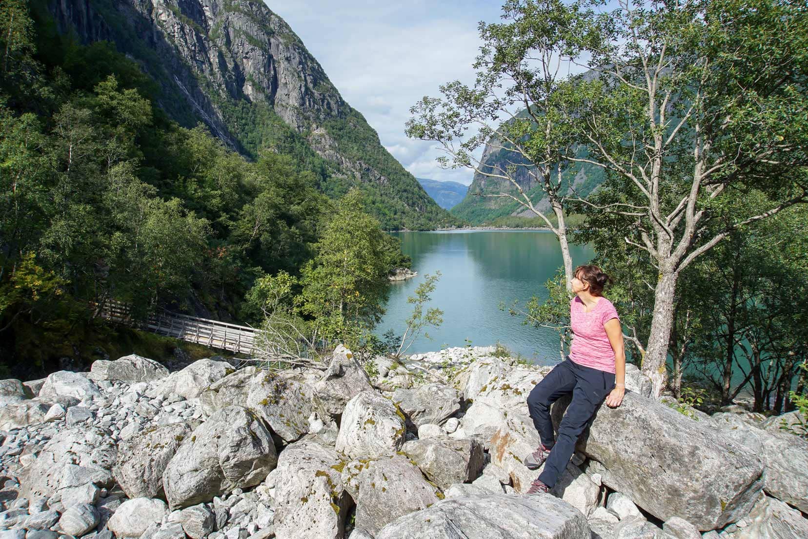
Within the hour, we had reached the closest point of Bondhusvatnet. The view from the shoreline was magnificent with the smooth aqualine waters interrupted with jagged rocks that sat close to the shoreline.
This route coincides with Route 1 marked on the map.
From here, look across Bondhusvatnet and follow the line of the canyon between the mountains to catch the merest view of the receding Bondhusbreen glacier. This is the best spot for glacier views unless you choose to hike up the moraine to the glacier’s edge however, that does not feature in this hike.
🚘 If you are looking to hire a car then we recommend DiscoverCars.
- They are winners of the World’s Best Car Rental Booking Website
- They have a Price Match Guarantee.
- 4.5 Rating on Trustpilot
- Free Cancellation
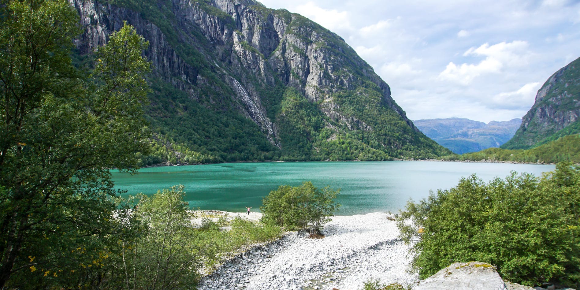
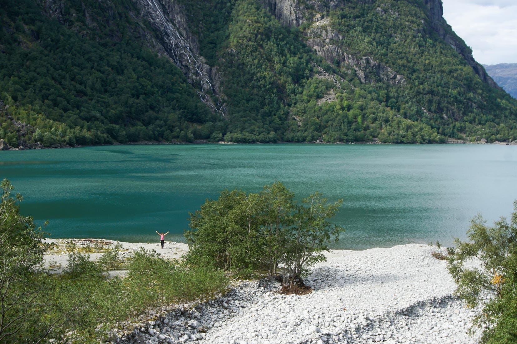
Hike to Bondhusvatnet Shoreline
With our hearts set on reaching the white beach on the far shoreline, we followed a trail that hugged the shoreline. As shown on route 2 on the map.
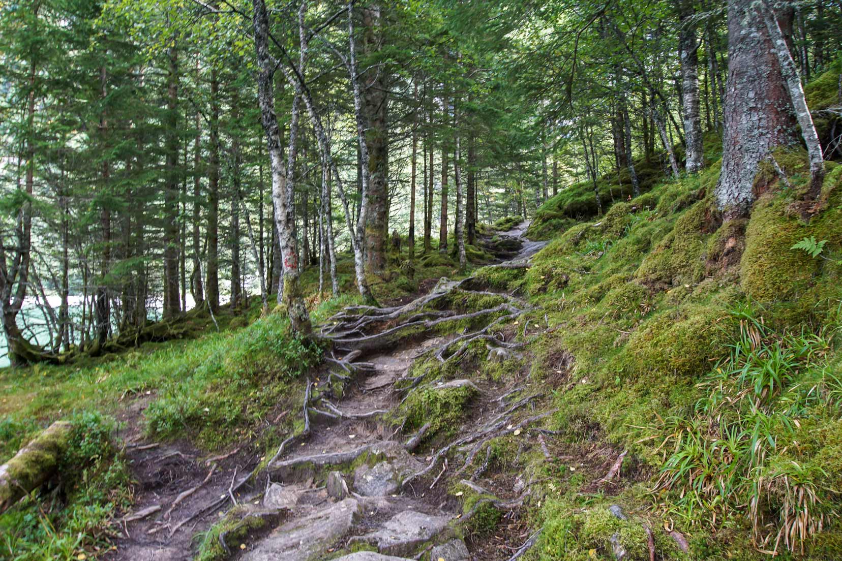
We passed a few rock picnic tables offering great scenic spots for a picnic. The trail is clear and easy going with great views of the mountains and lake between the trees.
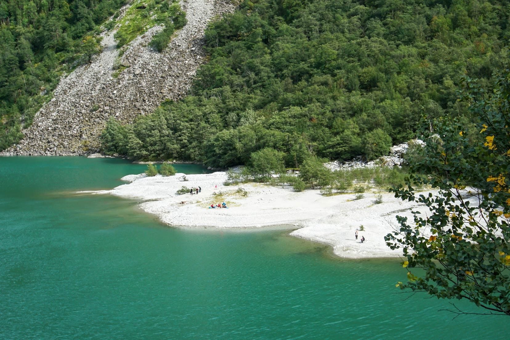
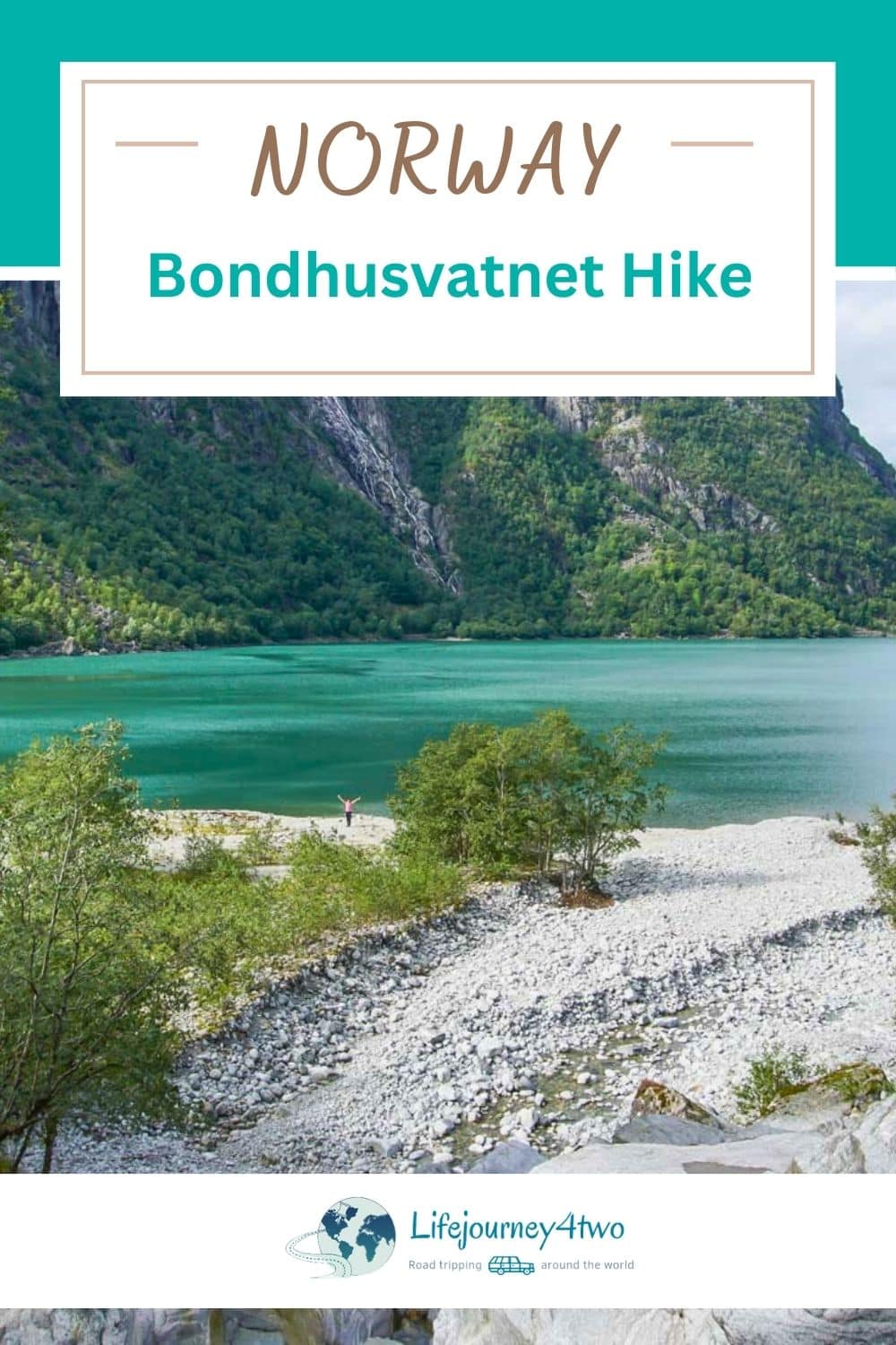
A few hundred metres from the white beach, we get our first proper views of it. The trail becomes a little tricky, requiring careful footwork to pick your way over the wet stones.
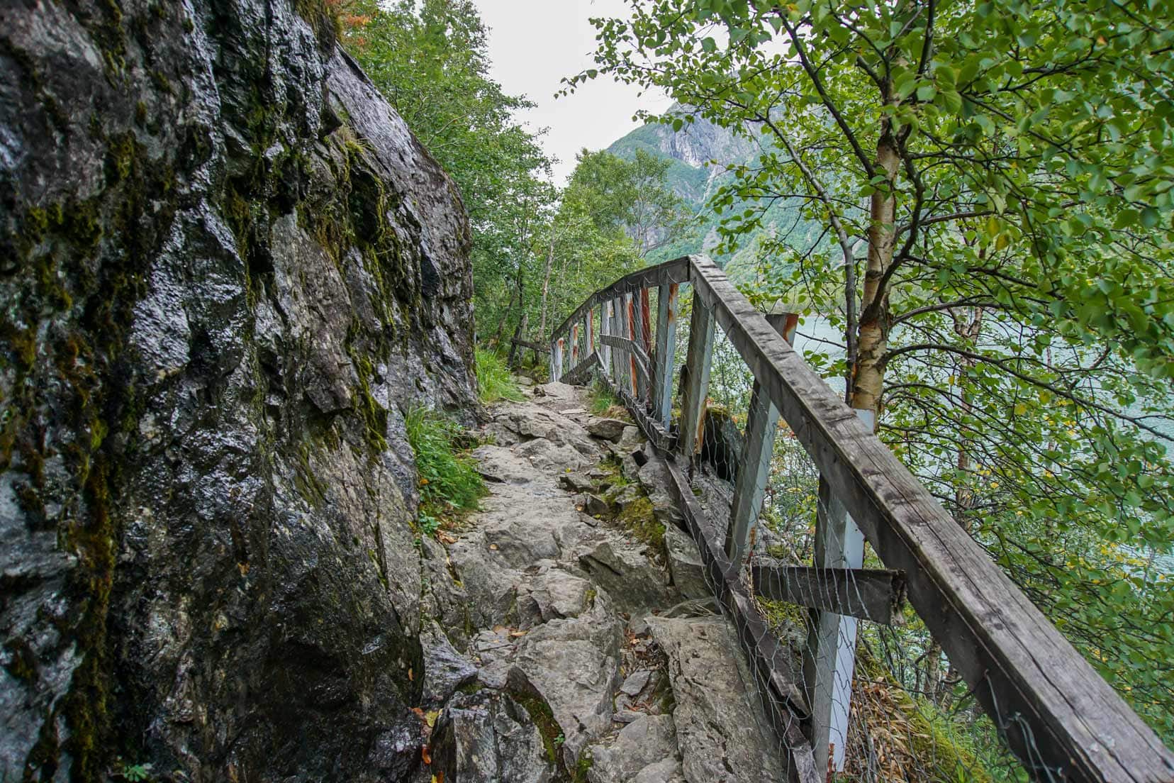
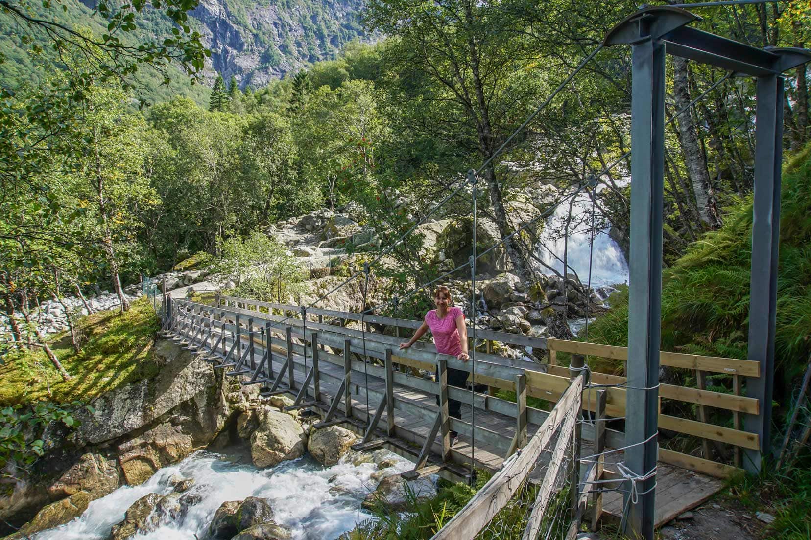
Wooden railings provide extra support to help you over the rocky path. We cross a wooden bridge over the lively Bondhusvatnet waterfall and stop to grab photos.
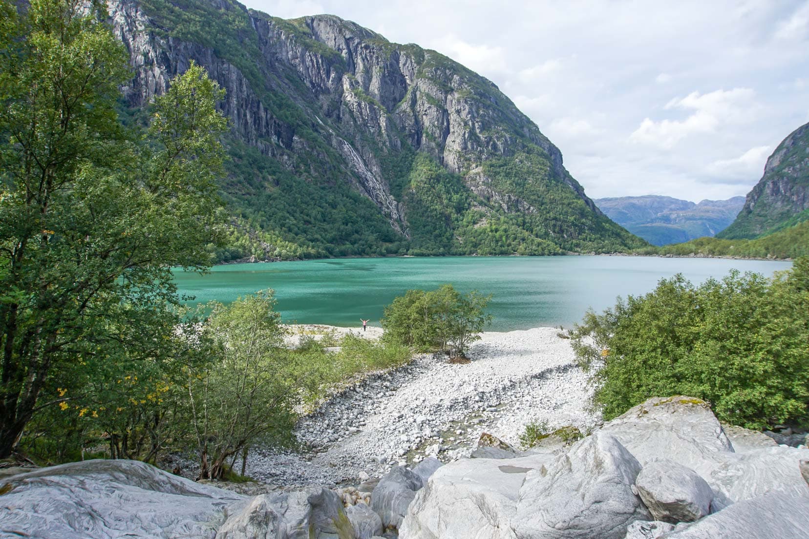
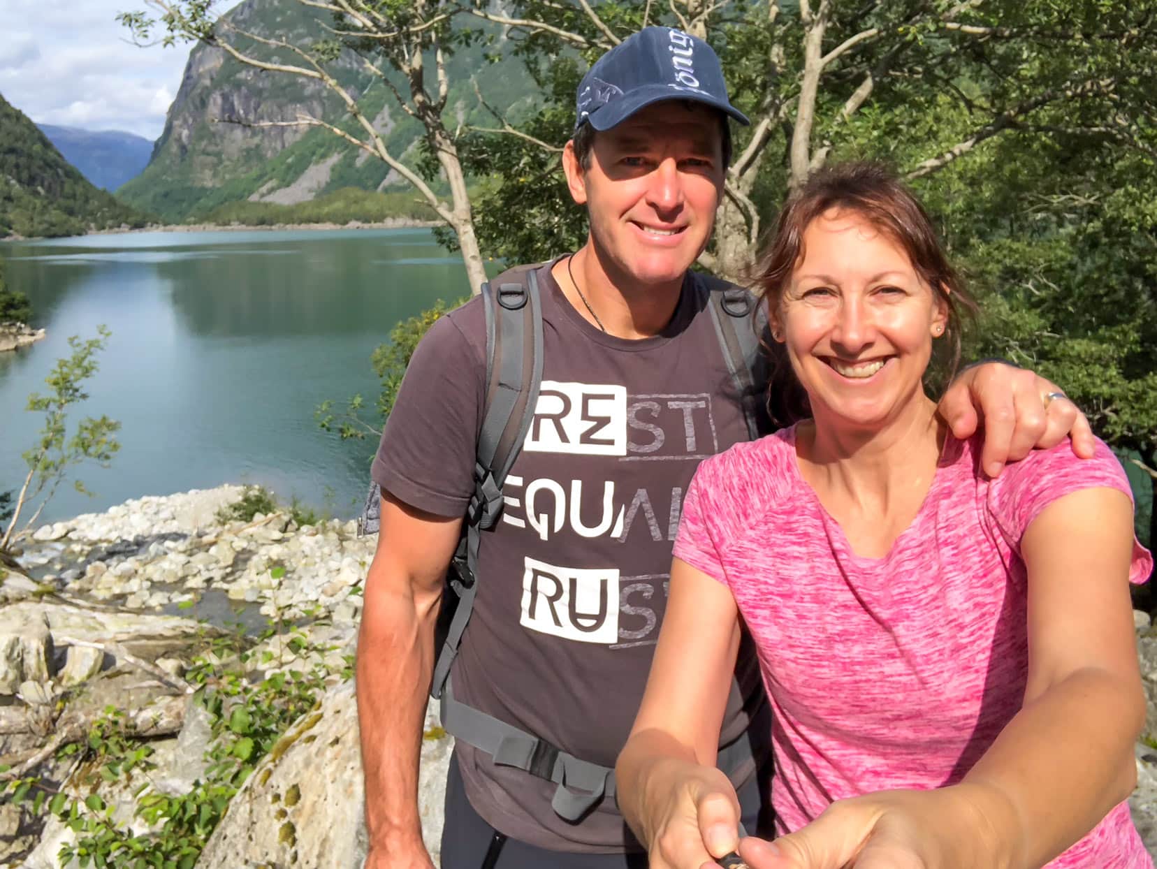
Beach and Moraine: Turn-Around Point of the Lake Bondusvatnet Hike
On the other side of the bridge, again, more careful negotiation over rocks and tree roots before we can walk down onto the white-pebbly beach.
From here, you enjoy the views then retrace your steps back to the carpark. Otherwise, you might want to boulder hop up the moraine for more scenic views.
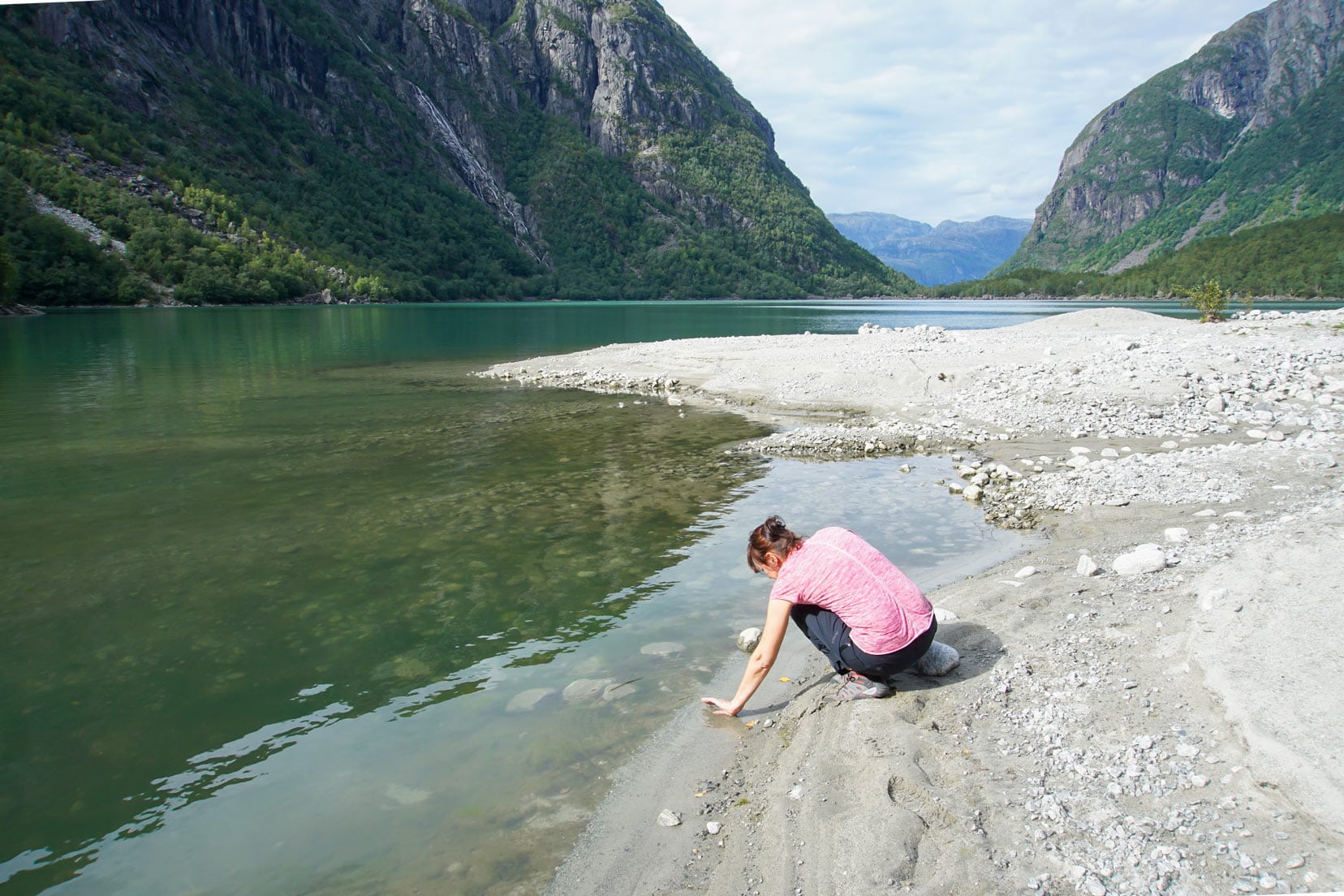
The day wasn’t without mishap though.
My better half, Shelley, was distracted and slipped on the beach rocks, coming down hard on her hand.
She immediately put the cold glacial lake waters to good use, soaking the sprain. It worked. It put the smile back on the dial with no lingering after effects.
Bondhusvatnet Hike … That’s a Wrap
I hope our Bondhusvatnet hike shows why this trek is a hidden treasure in Hardanger. We loved every minute of our time spent here.
Easy to access and suitable for all skill levels, it’s perfect for anyone looking to unplug from the fast-paced world and enjoy some serenity amidst beautiful scenery. We wholeheartedly recommend this hike for kids, families and people of all ages.
Remember when you visit, to enjoy the natural beauty responsibly and help preserve it for future adventurers.
Enjoy this wonderful hike.
Do you plan to visit this beautiful glacier lake? Have you hiked Bondhusvatnet before? We’d love to hear about any of your hiking experiences. Leave us a comment below.
🇳🇴 More Information for Your Trip to Norway
NORWEGIAN FJORDS AND HIKES: Begin your adventure with our comprehensive guides to Norway’s best hikes. Discover the breathtaking views from Ryten in Lofoten, the thrill of Kjeragbolten, or the iconic Pulpit Rock. Each guide offers essential tips and stunning locations to explore.
LOFOTEN ISLANDS: Plan an unforgettable road trip through the Lofoten Islands with our Lofoten Road Trip Guide. Learn about each must-visit spot and how to make the most of your journey in this picturesque region.
CITY EXPLORATIONS: Discover the urban charms of Norway by visiting its beautiful cities. Whether you’re strolling through Trondheim or exploring Bergen, start with our guides to Trondheim to Bodø and the vibrant city life in Stavanger.
EXTENSIVE ITINERARIES: If you are beginning to plan your journey, take a look at our Two-Week Norway Itinerary for diverse ways to experience the country, from the fjords to the northern lights.
To fully explore what Norway has to offer, visit our comprehensive Norway Travel Guide.
Planning Your Travels?
These are the travel resources we recommend and use when planning our trips.
- 🚘 Car Hire: We use DiscoverCars.com
- Motorhome/Campervan Rental: We highly recommend the Motorhome Republic
- 🪪 Order your International Driver’s Licence online here
- 🛏 Book Accommodation: We use Booking.com to find accommodation that suits our budget
- 🐶 Pet Sitting/Pet Sitters: Check Out TrustedHousesitters here (Use our Discount code: LIFEJOURNEY25 for 25% off. )
- Activities and Experiences: Get Your Guide and Viator
- Travel Insurance: Safetywing or World Nomads
- 🥾 Travel Gear and Accessories: Check out our top picks here — Lifejourney4two page on Amazon
For a more thorough list, visit our Travel Resources page here.